Balcurvie Muir

Downs, Moorland in Fife

Scotland

Balcurvie Muir

Polytunnels, Woodbank The soft fruit season has come round again and of course it was cold and wet.
Polytunnels, Woodbank Credit: Richard Webb

Balcurvie Muir is a vast expanse of downs and moorland located in the county of Fife, Scotland. Covering an area of approximately 400 hectares, the muir is situated to the east of the town of Leven and borders the quaint village of Drumeldrie to the south.

The muir is characterized by its undulating landscape, with gentle slopes and rolling hills that offer stunning panoramic views of the surrounding countryside. The terrain is primarily comprised of open grassland, heath, and patches of scattered woodland. These diverse habitats provide a rich and varied ecosystem, supporting a wide range of flora and fauna.

Balcurvie Muir is known for its diverse bird population, with several species making it their home throughout the year. Visitors may spot kestrels, lapwings, and curlews soaring above, while skylarks can be heard singing their melodious tunes. The muir also serves as an important breeding ground for ground-nesting birds, such as meadow pipits and stonechats.

The muir is a haven for nature enthusiasts and outdoor adventurers alike. There are several well-maintained footpaths that crisscross the landscape, providing ample opportunities for walking, hiking, and birdwatching. The peaceful and tranquil surroundings make it an ideal spot for picnicking and enjoying the natural beauty of the Scottish countryside.

Balcurvie Muir is not only a sanctuary for wildlife but also holds historical significance. It is believed to have been utilized by ancient settlers as a burial site, with several Bronze Age burial mounds scattered across the muir. These ancient monuments serve as a reminder of the area's rich heritage and provide a glimpse into its past.

Overall, Balcurvie Muir is a breathtaking natural landscape that offers visitors a chance to immerse themselves in the beauty and tranquility of the Scottish countryside while exploring its diverse flora, fauna, and historical landmarks.

If you have any feedback on the listing, please let us know in the comments section below.

Balcurvie Muir Images

Images are sourced within 2km of 56.198111/-3.069263 or Grid Reference NO3301. Thanks to Geograph Open Source API. All images are credited.

Polytunnels, Woodbank The soft fruit season has come round again and of course it was cold and wet.
Polytunnels, Woodbank
The soft fruit season has come round again and of course it was cold and wet.
Arable land near Windygates Looking over cereals towards Cameron Hospital.
Arable land near Windygates
Looking over cereals towards Cameron Hospital.
Methilhill Sign on the way into Methilhill.
Methilhill
Sign on the way into Methilhill.
Balfour Mains The farm buildings appear to have been abandoned since <a href="https://www.geograph.org.uk/photo/406497">NT3299 : Cattle</a> was taken.
Balfour Mains
The farm buildings appear to have been abandoned since NT3299 : Cattle was taken.
Abandoned farm Derelict buildings at Balfour Mains Farm.
Abandoned farm
Derelict buildings at Balfour Mains Farm.
Ripening wheat An arable field near Balfour Mains farm with Largo Law in the distance.
Ripening wheat
An arable field near Balfour Mains farm with Largo Law in the distance.
Little Lun Farm
Little Lun Farm
Cameron Hospital One of the wards at Cameron Hospital
Cameron Hospital
One of the wards at Cameron Hospital
Farmland Looking eastwards towards Windygates
Farmland
Looking eastwards towards Windygates
Cattle At Balfour Mains.
Cattle
At Balfour Mains.
Spot the railway! The Methil Power Station branch ceased to be used regularly during the 1990s when the power station was effectively closed and put on a care and maintenance basis.  A trial train was run to Cameron Bridge (Windygates) a few years ago in the hope of distillery traffic but a contract failed to materialise.  More recently the line has been disconnected from the national network, though the track has remained in place.  Here, alongside a spur of Wemyss Wood near Grantsfield, about a mile west of Windygates, Nature is successfully doing her best to hide the rails and sleepers.
Spot the railway!
The Methil Power Station branch ceased to be used regularly during the 1990s when the power station was effectively closed and put on a care and maintenance basis. A trial train was run to Cameron Bridge (Windygates) a few years ago in the hope of distillery traffic but a contract failed to materialise. More recently the line has been disconnected from the national network, though the track has remained in place. Here, alongside a spur of Wemyss Wood near Grantsfield, about a mile west of Windygates, Nature is successfully doing her best to hide the rails and sleepers.
Fully clothed and nearly naked Evergreen and deciduous trees in the grounds of Cameron Hospital.
Fully clothed and nearly naked
Evergreen and deciduous trees in the grounds of Cameron Hospital.
The admin block Main office building at Cameron hosp

ital.
The admin block
Main office building at Cameron hosp ital.
Haig House Known also as Cameron House or Cameron Bridge House this house was built in 1849 by the Haig family, owners of nearby Cameron Bridge Distillery. It was the home of Field Marshal Earl Haig, who was born in 1861. The moulded panel above the front door is dated 1911 and worded 'INFECTIOUS DISEASES HOSPITAL'. When the first four wards of Cameron Hospital were built, Haig house was retained as administrative premises but replaced in 1940 by a new administration building and is now used as nurses' accommodation.
Haig House
Known also as Cameron House or Cameron Bridge House this house was built in 1849 by the Haig family, owners of nearby Cameron Bridge Distillery. It was the home of Field Marshal Earl Haig, who was born in 1861. The moulded panel above the front door is dated 1911 and worded 'INFECTIOUS DISEASES HOSPITAL'. When the first four wards of Cameron Hospital were built, Haig house was retained as administrative premises but replaced in 1940 by a new administration building and is now used as nurses' accommodation.
Hangovers in waiting Silos at Cameron Bridge distillery, best known for its grain whisky but which also produces Gordon's London Dry Gin, Smirnoff Vodka and sundry other alcoholic beverages.
Hangovers in waiting
Silos at Cameron Bridge distillery, best known for its grain whisky but which also produces Gordon's London Dry Gin, Smirnoff Vodka and sundry other alcoholic beverages.
Looking down Kennoway road to Windygates Cross This is the A916, a busy link between Kirkcaldy and Cupar.
Looking down Kennoway road to Windygates Cross
This is the A916, a busy link between Kirkcaldy and Cupar.
Cameron Bridge Distillery This Diageo distillery is the birthplace of Cameron Brig pure grain whisky, and it is also where Gordons Gin, Smirnoff Vodka and other 'exotic' spirits are distilled
Cameron Bridge Distillery
This Diageo distillery is the birthplace of Cameron Brig pure grain whisky, and it is also where Gordons Gin, Smirnoff Vodka and other 'exotic' spirits are distilled
Hill Road, Kennoway
Hill Road, Kennoway
Show me another place!

Balcurvie Muir is located at Grid Ref: NO3301 (Lat: 56.198111, Lng: -3.069263)

Unitary Authority: Fife

Police Authority: Fife

What 3 Words

///giving.reef.socket. Near Windygates, Fife

Nearby Locations

Balcurvie Muir

Related Wikis

Balcurvie

Balcurvie is a Scottish rural hamlet located within the Windygates district of Levenmouth in Fife. People from Balcurvie include Sir Robert Blyth Greig...

Windygates

Windygates is a small village and surrounding district in central Fife, Scotland. The district encompasses the following villages, farms and estates; Wellsgreen...

Kennoway

Kennoway is a village in Fife, Scotland, near the larger population centres in the area of Leven and Methil. It had an estimated population of 4,570 in...

Cameron Bridge

Cameron Bridge is a village in the conurbation of Levenmouth in Fife, Scotland. It is near to the village of Windygates and 2 miles (3 kilometres) west...

Cameron Bridge railway station

Cameron Bridge railway station served the village of Cameron Bridge, Fife, Scotland from 1854 to the 1990s on the Fife Coast Railway. The line and station...
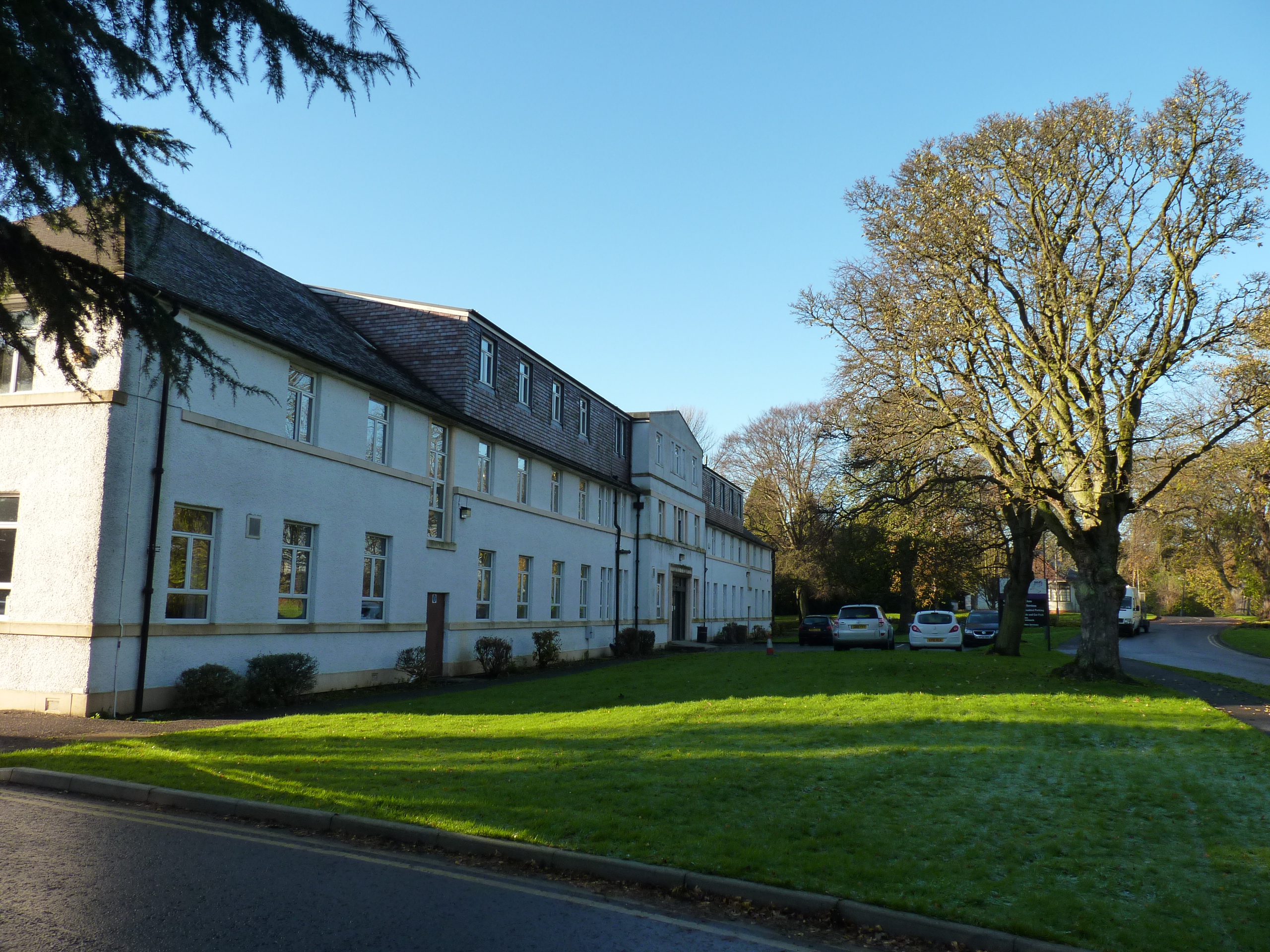
Cameron Hospital

Cameron Hospital is a health facility in Cameron Road, Windygates, Fife, Scotland. It is managed by NHS Fife. The original building, known as Haig House...
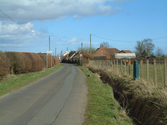
Baintown

Baintown is a hamlet located in Fife, a council area of Scotland, UK.

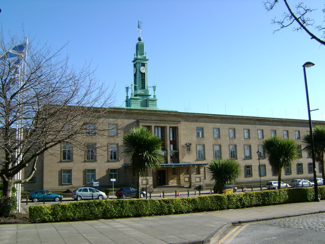
Kirkcaldy (district)

Kirkcaldy (Scottish Gaelic: Dùn Phàrlain, Scots: Dunfaurlin) was a local government district in the Fife region of Scotland from 1975 to 1996. The district...

Nearby Amenities

Located within 500m of 56.198111,-3.069263
Power: tower
Lat/Long: 56.2000039/-3.0744142
Power: tower
Lat/Long: 56.1967692/-3.0746129
Power: tower
Lat/Long: 56.2022291/-3.0693817
Power: tower
Lat/Long: 56.2017023/-3.0654076
Generator Method: wind_turbine
Generator Source: wind
Power: generator
Lat/Long: 56.2005412/-3.0637069
Power: pole
Lat/Long: 56.198973/-3.0638124
Power: pole
Lat/Long: 56.1984303/-3.0640859
Power: pole
Lat/Long: 56.1979033/-3.0643484
Power: pole
Lat/Long: 56.1972158/-3.0640049
Power: pole
Lat/Long: 56.1965221/-3.0636768
Power: pole
Lat/Long: 56.1957456/-3.0633115
Power: pole
Lat/Long: 56.1957055/-3.0627406
Power: pole
Lat/Long: 56.1958345/-3.0646174
Power: pole
Lat/Long: 56.1959124/-3.0659037
Power: pole
Lat/Long: 56.1959976/-3.0672205
Power: pole
Lat/Long: 56.196084/-3.0685002
Power: pole
Lat/Long: 56.1953477/-3.0690427
Power: pole
Lat/Long: 56.1947927/-3.0694517
Power: pole
Lat/Long: 56.1940308/-3.0696442
The data included in this document is from www.openstreetmap.org. The data is made available under ODbL.

Have you been to Balcurvie Muir?

Leave your review of Balcurvie Muir below (or comments, questions and feedback).