Brik Rigg Park

Downs, Moorland in Lancashire South Lakeland

England

Brik Rigg Park

View from Black Crag with fog over Windermere distant
View from Black Crag with fog over Windermere distant Credit: Anthony Parkes

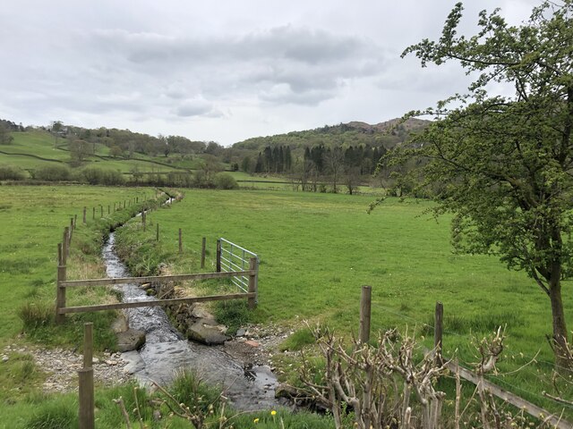
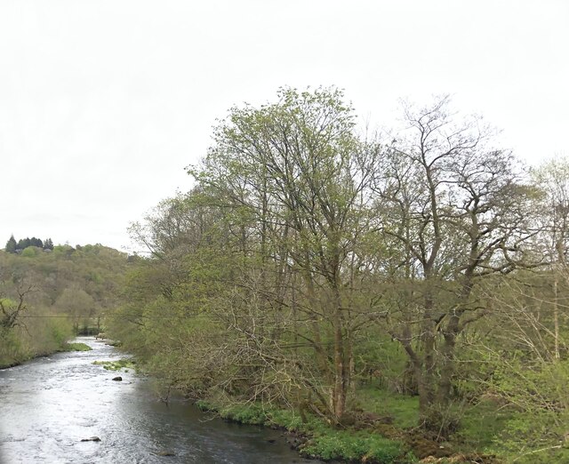
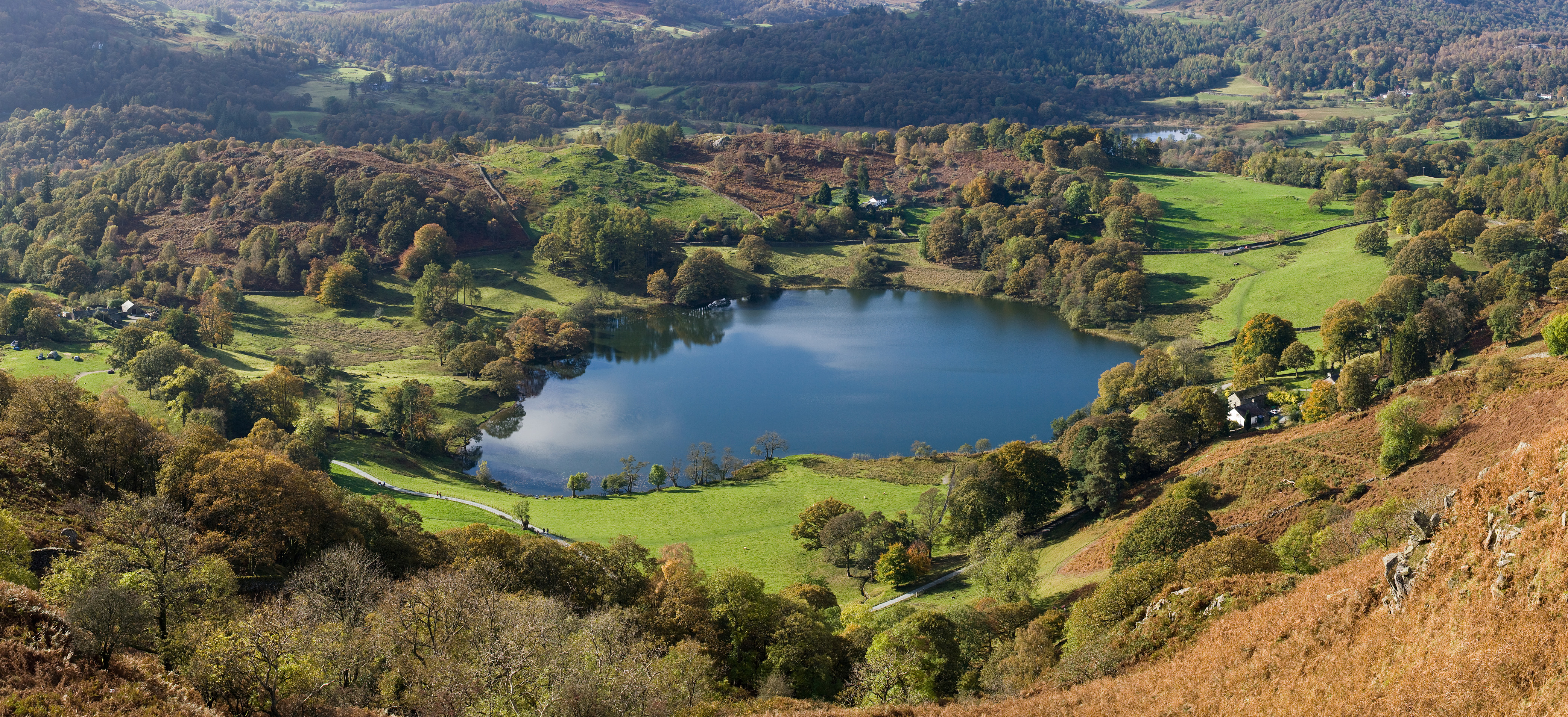
Brik Rigg Park is a picturesque natural reserve located in Lancashire, England. Stretching across an expansive area, this park showcases a diverse landscape characterized by rolling downs and vast moorland. It is a popular destination for nature enthusiasts and offers a range of activities to cater to different interests.

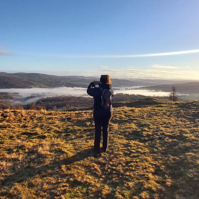
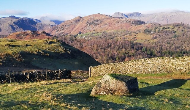
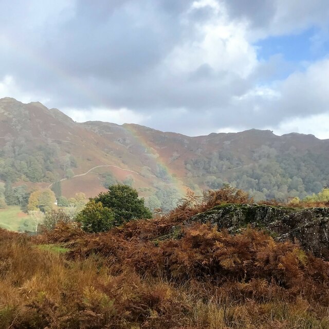
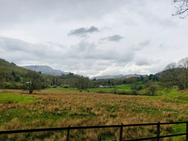
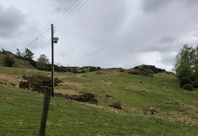
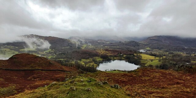
The downs of Brik Rigg Park are characterized by gently sloping hills covered in lush green grasslands. These downs provide a stunning panoramic view of the surrounding countryside, with its undulating terrain and scattered woodlands. The area is home to a variety of flora and fauna, including heather, gorse, and wildflowers, making it a haven for wildlife.

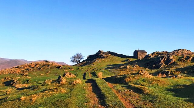
The moorland of Brik Rigg Park is a captivating sight, with its vast expanse of open space and rugged terrain. Moorland vegetation, such as heather and cotton grass, dominates the landscape, creating a unique and picturesque setting. The park's moorland is also known for its diverse bird population, including species like curlews, lapwings, and merlins.

Visitors to Brik Rigg Park can explore the area through a network of walking trails and footpaths. These trails offer breathtaking views and the opportunity to immerse oneself in the park's natural beauty. Additionally, there are designated picnic areas and camping spots for those looking to spend more time in the park.

Overall, Brik Rigg Park in Lancashire is a captivating destination for nature lovers, offering a mix of downs and moorland landscapes. Its diverse flora and fauna, coupled with its scenic beauty, make it an ideal place to enjoy outdoor activities or simply appreciate the wonders of nature.

If you have any feedback on the listing, please let us know in the comments section below.

Brik Rigg Park Images

Images are sourced within 2km of 54.422256/-3.0228191 or Grid Reference NY3303. Thanks to Geograph Open Source API. All images are credited.

View from Black Crag with fog over Windermere distant
Photographer on Black Crag
Black Crag Trig Point
Track to The Hog House Holiday Rental Cabin
Track to The Hog House
Holiday Rental Cabin
Large Boulder near the gateway to Hollin Bank
Shadows at Hollin Bank
Low Oxen Fell
Low Oxen Fell
Colwith Force Viewed from Atkinson’s Coppice, the left bank of the River Brathay here at Colwith Force was the county boundary between Lancashire (to the south) and Westmorland until Local Government Reorganisation in 1974.
The Colwith Force Alternative Route of The Cumbria Way passes beside the falls.
Colwith Force
Viewed from Atkinson’s Coppice, the left bank of the River Brathay here at Colwith Force was the county boundary between Lancashire (to the south) and Westmorland until Local Government Reorganisation in 1974. The Colwith Force Alternative Route of The Cumbria Way passes beside the falls.
Rainbow and Loughrigg Fell - from Crag Head
View to Skelwith Fold Flood plain of the River Brathay to the fore
View to Skelwith Fold
Flood plain of the River Brathay to the fore
River Brathay valley There is a large area of flood plain to the north of the river between Skelwith Bridge and Clappersgate
River Brathay valley
There is a large area of flood plain to the north of the river between Skelwith Bridge and Clappersgate
Marshy field near the River Brathay
Spring draining across the meadow to the River Brathay
River Brathay at Skelwith Bridge
Footpath to Tarn Hows From the A593 near Skelwith Bridge
Footpath to Tarn Hows
From the A593 near Skelwith Bridge
Loughrigg Tarn
Loughrigg Tarn
Trig point on Black Fell The triangulation column occupies the top of a rock plinth which is not quite the highest point of the hill; that's a short way beyond the wall and easily reached using a ladder stile, the top of which can be seen.
Peaks of the Fairfield Horseshoe lie in the distance.
Trig point on Black Fell
The triangulation column occupies the top of a rock plinth which is not quite the highest point of the hill; that's a short way beyond the wall and easily reached using a ladder stile, the top of which can be seen. Peaks of the Fairfield Horseshoe lie in the distance.
View north from trig point on Black Fell Black Fell is a minor hill among the Southern Fells of the Lake District. The view is from the hill's trig point set upon a rock outcrop which was regarded by Alfred Wainwright as the summit. Currently however in the opinion of those who assess such things, the highest point lies just beyond the wall, where it's one metre higher.
View north from trig point on Black Fell
Black Fell is a minor hill among the Southern Fells of the Lake District. The view is from the hill's trig point set upon a rock outcrop which was regarded by Alfred Wainwright as the summit. Currently however in the opinion of those who assess such things, the highest point lies just beyond the wall, where it's one metre higher.
Show me another place!

Brik Rigg Park is located at Grid Ref: NY3303 (Lat: 54.422256, Lng: -3.0228191)

Administrative County: Cumbria

District: South Lakeland

Police Authority: Cumbria

What 3 Words

///varieties.rephrase.housework. Near Ambleside, Cumbria

Related Wikis

Elter Water

Elter Water is a small lake in the Lake District in North West England, half a mile southeast of the village of the same name. It has a length of 0.62...

Skelwith Bridge

Skelwith Bridge is a small village in the southern area of the Lake District in Cumbria, England. Historically, Skelwith Bridge is part of Westmorland...

Skelwith

Skelwith is a civil parish in South Lakeland, Cumbria, England, which includes the village of Skelwith Bridge. In the 2001 census the parish had a population...

Loughrigg Tarn

Loughrigg Tarn () is a small, natural lake in the Lake District, Cumbria, England. It is situated north of Windermere, just north of the village of Skelwith...

Nearby Amenities

Located within 500m of 54.422256,-3.0228191
Barrier: stile
Lat/Long: 54.4195054/-3.0273864
Barrier: kissing_gate
Bicycle: no
Foot: yes
Horse: no
Motor Vehicle: no
Lat/Long: 54.4226331/-3.0176565
Barrier: stile
Lat/Long: 54.4193625/-3.0280401
Barrier: kissing_gate
Lat/Long: 54.4196082/-3.0206725
Skelwith Force
Canoe Description: Grade 5 but disproportionately dangerous
Rapids: 5
Waterway: waterfall
Whitewater: hazard
Lat/Long: 54.4219593/-3.0164542
Scar Coppice
Place: locality
Lat/Long: 54.4205223/-3.0282769
Ice Cream
Outdoor Seating: yes
Lat/Long: 54.4198933/-3.02613
Hiking: yes
Information: guidepost
Source: GPS Survey
Tourism: information
Lat/Long: 54.420553/-3.0252716
Barrier: stile
Material: wood
Step Count: 1
Stile: stepover
Lat/Long: 54.4244337/-3.0167912
Power: pole
Lat/Long: 54.4241216/-3.0159333
Power: pole
Lat/Long: 54.4242108/-3.0160093
Power: pole
Lat/Long: 54.4202306/-3.0263347
Power: pole
Lat/Long: 54.4199767/-3.0271006
Power: pole
Lat/Long: 54.4197426/-3.0277381
Power: pole
Lat/Long: 54.4195607/-3.0283271
Power: pole
Lat/Long: 54.4196608/-3.0172647
Power: pole
Lat/Long: 54.4198837/-3.0188644
Power: pole
Lat/Long: 54.420122/-3.0205684
Power: pole
Lat/Long: 54.419902/-3.0213125
Power: pole
Lat/Long: 54.4190191/-3.024226
Power: pole
Lat/Long: 54.4186031/-3.0255833
Information: guidepost
Tourism: information
Lat/Long: 54.4197621/-3.0265769
The data included in this document is from www.openstreetmap.org. The data is made available under ODbL.

Have you been to Brik Rigg Park?

Leave your review of Brik Rigg Park below (or comments, questions and feedback).