Falkland Common

Downs, Moorland in Fife

Scotland

Falkland Common

Bridge over Maspie Burn in Maspie Den
Bridge over Maspie Burn in Maspie Den Credit: Becky Williamson

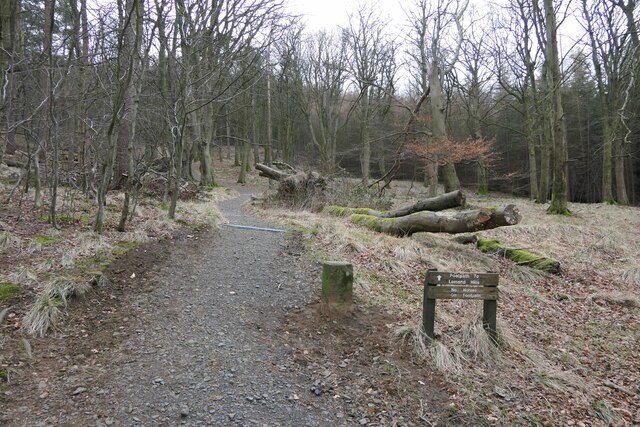
Falkland Common, located in Fife, Scotland, is a picturesque expanse of land known for its diverse landscape comprising downs, moorland, and occasional woodland. Covering an area of approximately 2,000 acres, this common is a popular destination for nature lovers, hikers, and birdwatchers.

The common is characterized by its undulating downs, which feature gently sloping hills covered in lush grasses and heather. These downs provide a stunning backdrop for leisurely walks and picnics, offering panoramic views of the surrounding countryside. In the summer months, the downs transform into a colorful tapestry with an array of wildflowers in full bloom.

The moorland, on the other hand, presents a more rugged and wild terrain. It is characterized by peat bogs, heathland, and scattered patches of gorse. Moorland birds, such as curlews, lapwings, and red grouse, can often be spotted here, making it a haven for birdwatchers. Additionally, the moorland is home to various species of mammals, including red deer and mountain hares.

Falkland Common also boasts pockets of woodland, which provide a welcome respite from the open expanses. These woodlands are dominated by native species such as oak, birch, and rowan, and they provide a habitat for a range of bird species, small mammals, and insects.

Overall, Falkland Common offers a tranquil and diverse natural environment, providing visitors with the opportunity to explore and appreciate the beauty of Fife's countryside. Whether you are seeking a peaceful stroll, birdwatching adventure, or simply a place to connect with nature, Falkland Common is a must-visit destination.

If you have any feedback on the listing, please let us know in the comments section below.

Falkland Common Images

Images are sourced within 2km of 56.255695/-3.1978364 or Grid Reference NO2507. Thanks to Geograph Open Source API. All images are credited.

Bridge over Maspie Burn in Maspie Den
Falkland
Falkland
Newton of Lathrisk Newton of Lathrisk viewed from the B936 to the west.
Newton of Lathrisk
Newton of Lathrisk viewed from the B936 to the west.
Looking north-west to Myreside Myreside viewed from the B936 to the south-east.
Looking north-west to Myreside
Myreside viewed from the B936 to the south-east.
Northern gates at Falkland Palace Northern entrance to Falkland Palace on the A912.
Northern gates at Falkland Palace
Northern entrance to Falkland Palace on the A912.
Falklandwood Farm Cottages Falklandwood Farm Cottages on the eastern side of the B936.
Falklandwood Farm Cottages
Falklandwood Farm Cottages on the eastern side of the B936.
B936 heading for Falkland The almost straight B936 between Dunshalt and Falkland, heading southwards to the latter, with the Lomond Hills in the distance.
B936 heading for Falkland
The almost straight B936 between Dunshalt and Falkland, heading southwards to the latter, with the Lomond Hills in the distance.
Falkland Parish Church
Minor road to East Lomond carpark
A921 towards Falkland
Parking area, Falkland Estate
Rivet benchmark on stone, Douk Plantation, Falkland
Sign and Stone in Allan Wood, Falkland There is an Ordnance Survey rivet benchmark on the stone.
Sign and Stone in Allan Wood, Falkland
There is an Ordnance Survey rivet benchmark on the stone.
Toll House, Newton of Falkland, B936 At the junction between the B936 and Holm Road, the "Old Toll House" in Newton of Falkland.

Category C listed Building Scottish Nᴼ. LB8770 <span class="nowrap"><a title="http://portal.historicenvironment.scot/designation/LB8770" rel="nofollow ugc noopener" href="http://portal.historicenvironment.scot/designation/LB8770">Link</a><img style="margin-left:2px;" alt="External link" title="External link - shift click to open in new window" src="https://s1.geograph.org.uk/img/external.png" width="10" height="10"/></span>

Milestone Society National ID: FF.FAL
Toll House, Newton of Falkland, B936
At the junction between the B936 and Holm Road, the "Old Toll House" in Newton of Falkland. Category C listed Building Scottish Nᴼ. LB8770 LinkExternal link Milestone Society National ID: FF.FAL
Looking north from East Lomond In the left foreground, some 1200 metres away is the A-listed House of Falkland (LB8763 <span class="nowrap"><a title="https://portal.historicenvironment.scot/designation/LB8763" rel="nofollow ugc noopener" href="https://portal.historicenvironment.scot/designation/LB8763">Link</a><img style="margin-left:2px;" alt="External link" title="External link - shift click to open in new window" src="https://s1.geograph.org.uk/img/external.png" width="10" height="10"/></span> ) and to the right, the stable block (B-listed LB8764 <span class="nowrap"><a title="https://portal.historicenvironment.scot/designation/LB8764" rel="nofollow ugc noopener" href="https://portal.historicenvironment.scot/designation/LB8764">Link</a><img style="margin-left:2px;" alt="External link" title="External link - shift click to open in new window" src="https://s1.geograph.org.uk/img/external.png" width="10" height="10"/></span> ).  In the distance, the village of Auchtermuchty can be seen.
Looking north from East Lomond
In the left foreground, some 1200 metres away is the A-listed House of Falkland (LB8763 LinkExternal link ) and to the right, the stable block (B-listed LB8764 LinkExternal link ). In the distance, the village of Auchtermuchty can be seen.
View of Falkland from East Lomond The village is some 1500 metres away from the photographer.
View of Falkland from East Lomond
The village is some 1500 metres away from the photographer.
Falkland Palace: the classic view The A=listed (LB8798 <span class="nowrap"><a title="https://portal.historicenvironment.scot/designation/LB8798" rel="nofollow ugc noopener" href="https://portal.historicenvironment.scot/designation/LB8798">Link</a><img style="margin-left:2px;" alt="External link" title="External link - shift click to open in new window" src="https://s1.geograph.org.uk/img/external.png" width="10" height="10"/></span> ) south range dates from ca. 1501 with later alterations.
Falkland Palace: the classic view
The A=listed (LB8798 LinkExternal link ) south range dates from ca. 1501 with later alterations.
Onesiphorus Tyndall Bruce statue, Falkland Surprisingly it is not listed, nor does it have a Canmore listing.
Onesiphorus Tyndall Bruce statue, Falkland
Surprisingly it is not listed, nor does it have a Canmore listing.
Show me another place!

Falkland Common is located at Grid Ref: NO2507 (Lat: 56.255695, Lng: -3.1978364)

Unitary Authority: Fife

Police Authority: Fife

What 3 Words

///extent.makes.trading. Near Falkland, Fife

Related Wikis

Falkland Palace Royal Tennis Club

The Falkland Palace Royal Tennis Club (also previously called the Falkland Palace Real Tennis Club) organizes play at the real tennis court in the gardens...
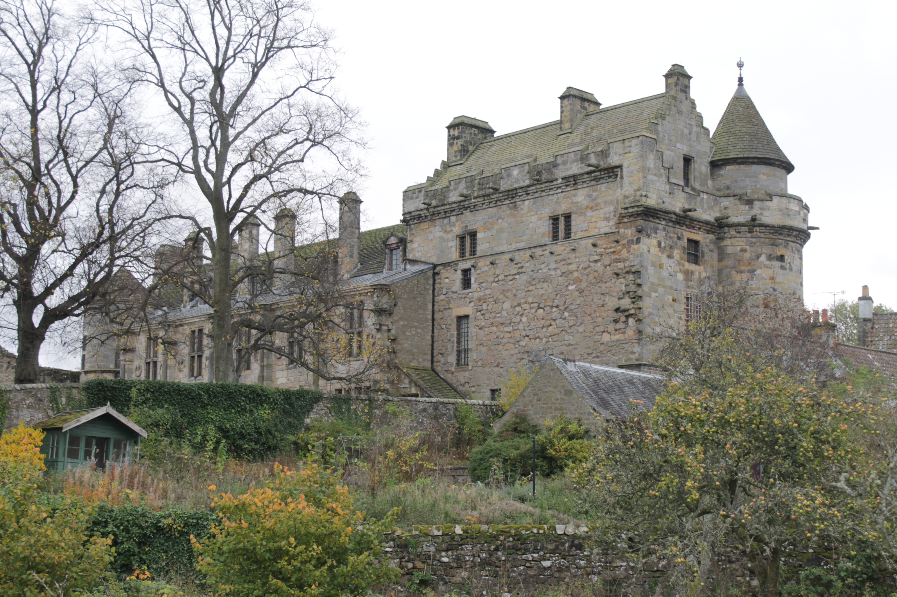
Falkland Palace

Falkland Palace, in Falkland, Fife, Scotland, is a royal palace of the Scottish Kings. It was one of the favourite places of Mary, Queen of Scots, who...
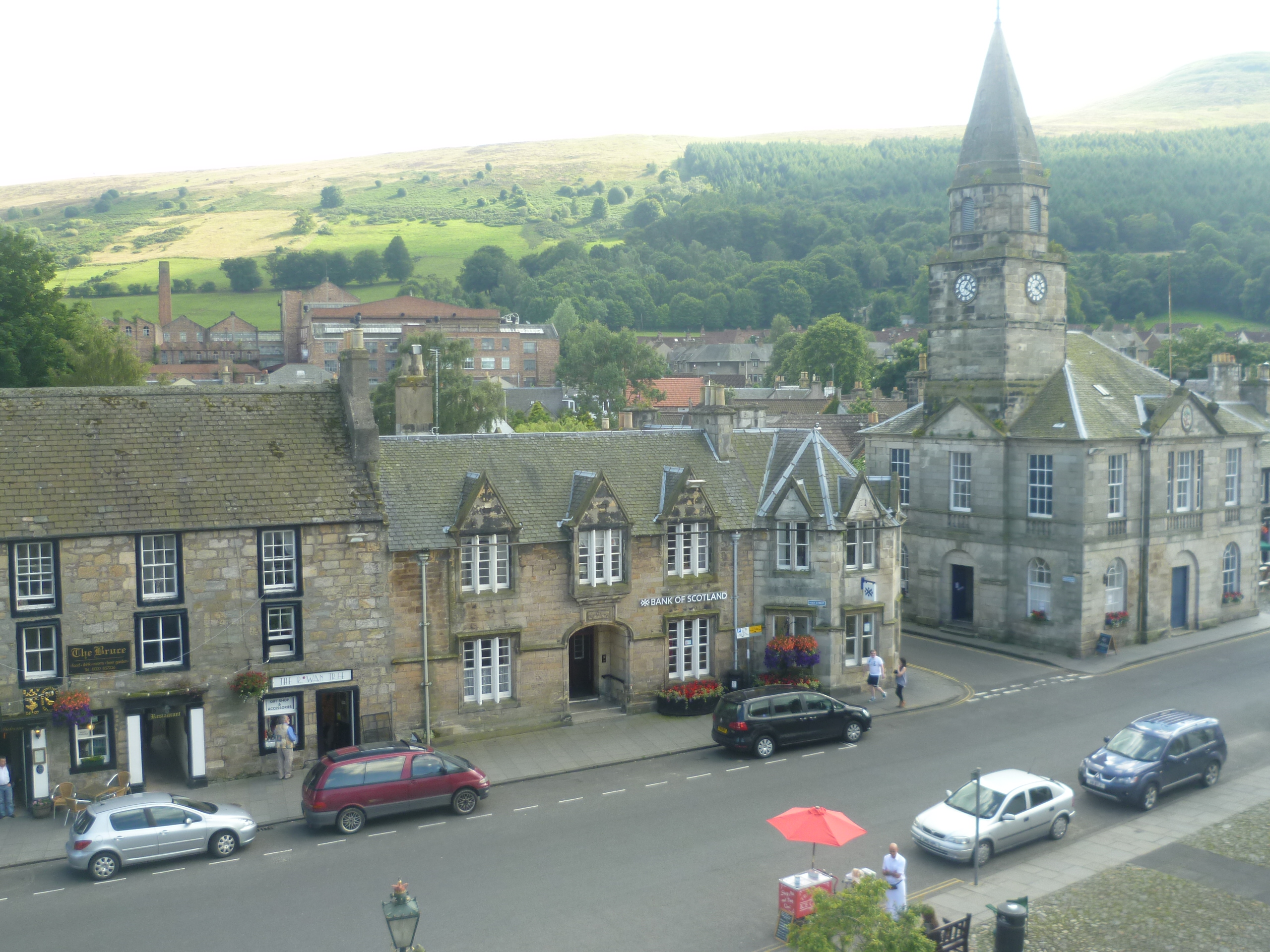
Falkland, Fife

Falkland (Scottish Gaelic: Fàclann), previously in the Lands of Kilgour (c. 1200), is a village, parish and former royal burgh in Fife, Scotland, at the...

Fife

Fife ( FYFE, Scottish English: [fɐi̯f]; Scottish Gaelic: Fìobha, IPA: [fiːvə]; Scots: Fife) is a council area, historic county, registration county and...

Nearby Amenities

Located within 500m of 56.255695,-3.1978364
Mini Roundabout
Direction: clockwise
Lat/Long: 56.2519011/-3.2012834
Post Box
Brand: Royal Mail
Brand Wikidata: Q638098
Brand Wikipedia: en:Royal Mail
Collection Times: Mo-Fr 09:00; Sa 07:00
Operator: Royal Mail
Operator Wikidata: Q638098
Post Box Mounting: stone_wall
Post Box Type: wall
Ref: KY15 314D
Royal Cypher: scottish_crown
Lat/Long: 56.2520308/-3.2013541
Bus Stop
Lomond Crescent
Bus: yes
Public Transport: platform
Shelter: yes
Lat/Long: 56.2519931/-3.1997103
Bus Stop
Lat/Long: 56.2519897/-3.2009189
Ncn Milepost: mills
Sustrans Ref: MP932
Lat/Long: 56.2520053/-3.2012352
Barrier: kissing_gate
Bicycle: yes
Foot: yes
Motor Vehicle: no
Source: survey
Lat/Long: 56.2539344/-3.1952122
Barrier: kissing_gate
Bicycle: yes
Foot: yes
Motor Vehicle: no
Source: survey
Lat/Long: 56.2543772/-3.2000089
Bench
Lat/Long: 56.2540955/-3.2027353
Give Way
Direction: forward
Lat/Long: 56.2535628/-3.2049177
Give Way
Direction: backward
Lat/Long: 56.2527044/-3.2032203
Give Way
Direction: forward
Lat/Long: 56.2520948/-3.1993317
Crossing
Crossing: traffic_signals
Lat/Long: 56.2520294/-3.2014743
Bus Stop
Primary School
Bus: yes
Public Transport: platform
Lat/Long: 56.2521588/-3.2015379
Power: pole
Lat/Long: 56.2552909/-3.1951134
Power: pole
Lat/Long: 56.2551587/-3.1942176
Power: pole
Lat/Long: 56.2550445/-3.1935058
Power: pole
Lat/Long: 56.2549412/-3.1926749
Power: pole
Lat/Long: 56.2545433/-3.1940618
Power: pole
Lat/Long: 56.2539171/-3.1947996
Power: pole
Lat/Long: 56.2533029/-3.1946893
Power: pole
Lat/Long: 56.252714/-3.1945854
Power: pole
Lat/Long: 56.2521178/-3.1944751
Power: pole
Lat/Long: 56.2536984/-3.1937178
Power: pole
Lat/Long: 56.2534472/-3.1926511
Power: pole
Lat/Long: 56.2532813/-3.1917251
Power: pole
Lat/Long: 56.2537068/-3.1906
The data included in this document is from www.openstreetmap.org. The data is made available under ODbL.

Have you been to Falkland Common?

Leave your review of Falkland Common below (or comments, questions and feedback).