Rosthwaite Fell

Downs, Moorland in Cumberland Allerdale

England

Rosthwaite Fell

Blackmoss Pot Langstrath Beck, in spate, passes through a narrow cleft in a band of rocks.
Blackmoss Pot Credit: Ian Taylor

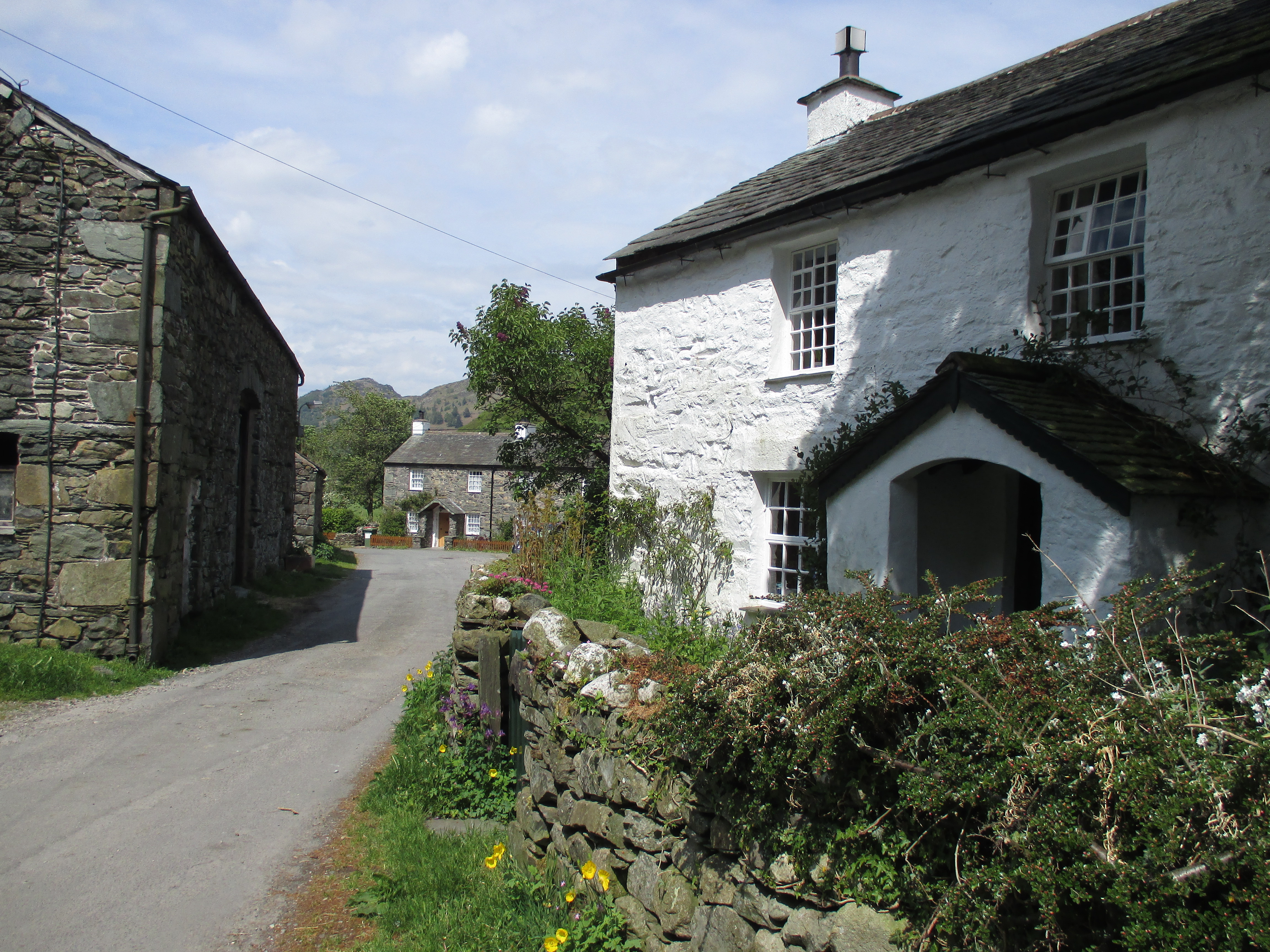
Rosthwaite Fell is a picturesque area located in Cumberland, England, known for its stunning natural beauty and diverse landscape. Situated in the heart of the Lake District National Park, this area is a haven for outdoor enthusiasts and nature lovers alike.

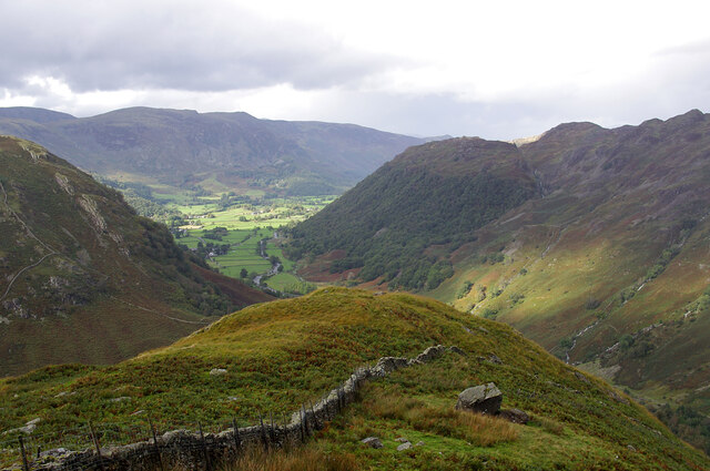
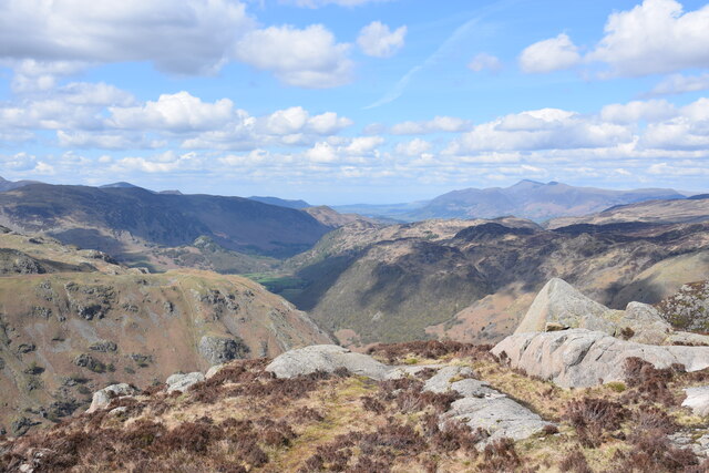
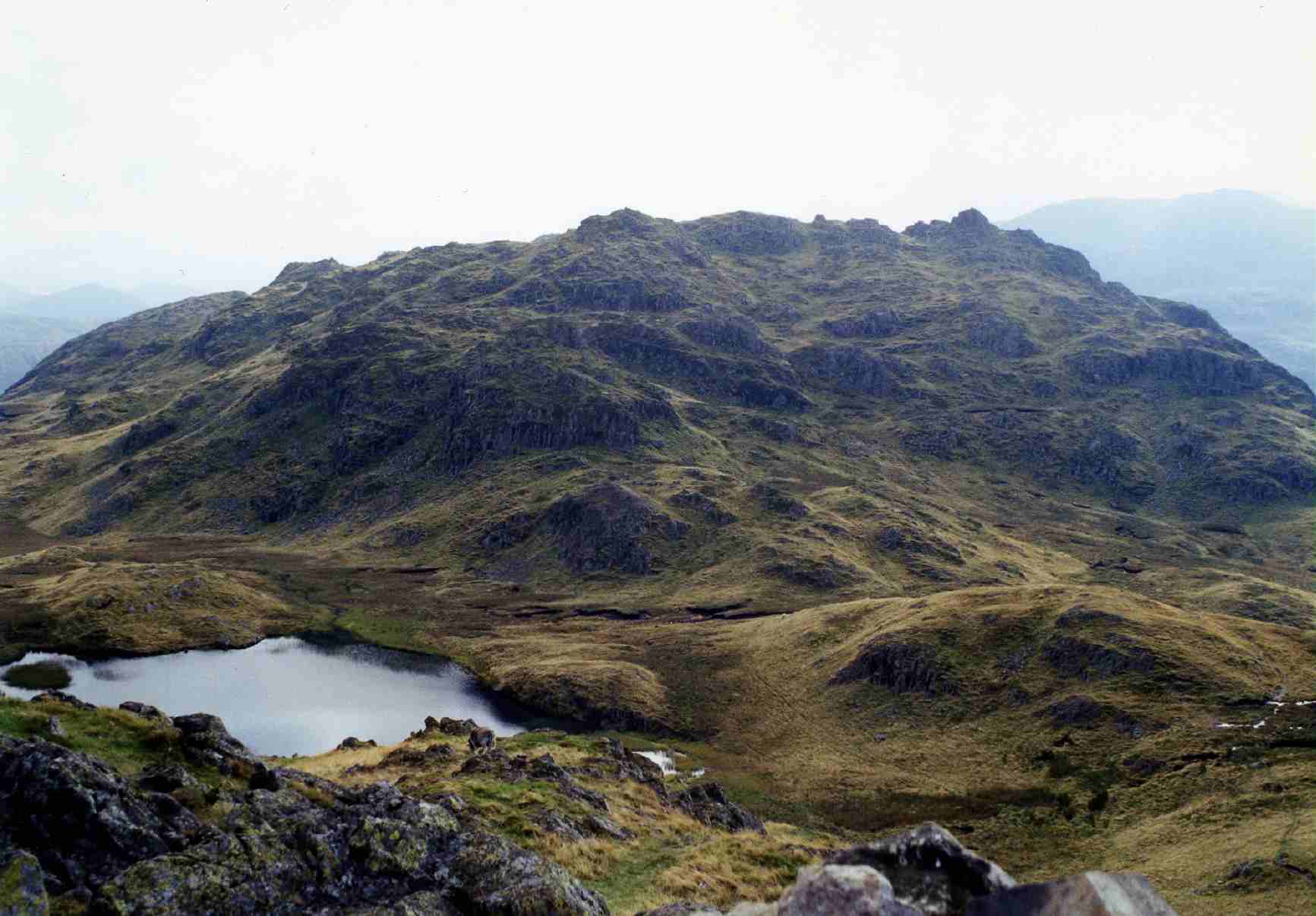
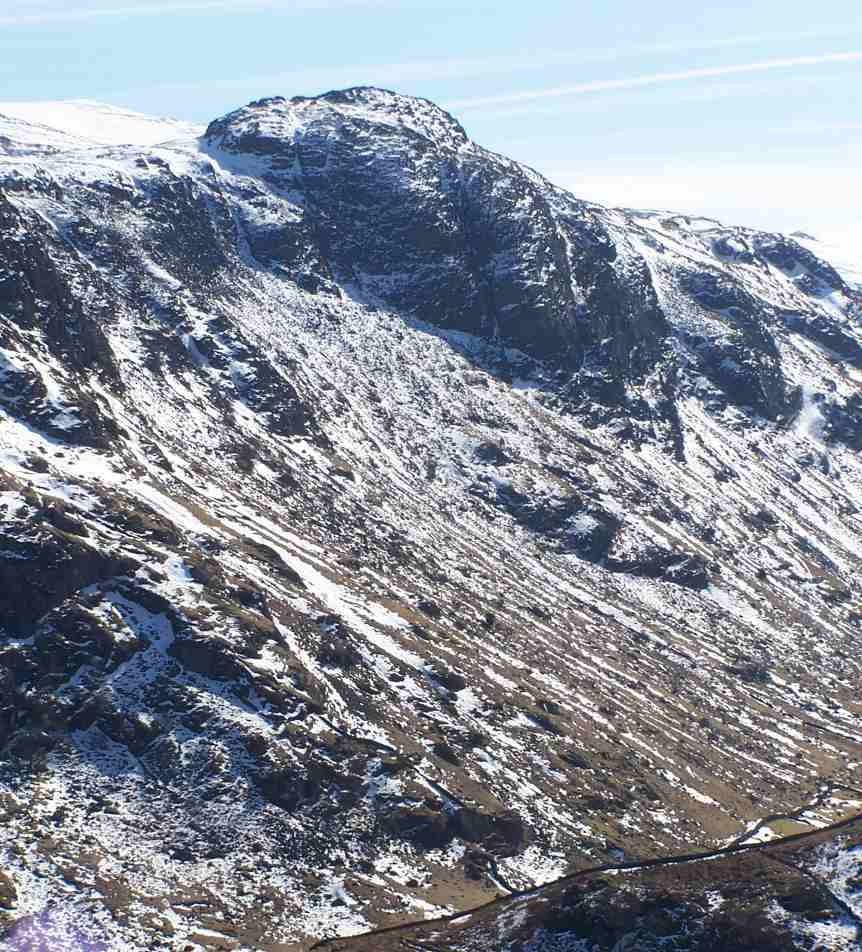
The fell is characterized by its rolling hills, expansive moorlands, and breathtaking views of the surrounding countryside. The landscape is dotted with numerous crags and rocky outcrops, adding a rugged and wild charm to the area. The terrain is predominantly covered in grasses, heather, and scattered patches of woodland, creating a varied and vibrant ecosystem.

The fell is home to a rich and diverse wildlife population. Visitors can spot a wide range of bird species, including buzzards, peregrine falcons, and ravens soaring overhead. The moorlands are also home to various mammals such as red deer, roe deer, and the elusive mountain hare.

The area offers numerous walking and hiking trails, allowing visitors to explore its beauty at their own pace. One popular route is the ascent to Glaramara, the highest point on the fell, offering panoramic views of the surrounding countryside and the nearby Borrowdale Valley.

Rosthwaite Fell is a place of tranquility and natural wonder, attracting visitors from all over the world. Its unique blend of stunning landscapes, diverse wildlife, and outdoor activities make it an ideal destination for those seeking a true British countryside experience.

If you have any feedback on the listing, please let us know in the comments section below.

Rosthwaite Fell Images

Images are sourced within 2km of 54.497166/-3.1460218 or Grid Reference NY2511. Thanks to Geograph Open Source API. All images are credited.

Blackmoss Pot Langstrath Beck, in spate, passes through a narrow cleft in a band of rocks.
Blackmoss Pot
Langstrath Beck, in spate, passes through a narrow cleft in a band of rocks.
Stonethwaite Beck In spate, downstream of the confluence of Langstrath Beck and Greenup Gill. Eagle Crag is in the background.
Stonethwaite Beck
In spate, downstream of the confluence of Langstrath Beck and Greenup Gill. Eagle Crag is in the background.
Bleak How Looking down Borrowdale from the shoulder below Eagle and Heron Crags.
Bleak How
Looking down Borrowdale from the shoulder below Eagle and Heron Crags.
On Sergeant's Crag Looking across Langstrath to White Crag. Fleetwith Pike (left) and Dale Head (centre) are prominent in the background.
On Sergeant's Crag
Looking across Langstrath to White Crag. Fleetwith Pike (left) and Dale Head (centre) are prominent in the background.
On Sergeant's Crag Looking north east across Langstrath towards Borrowdale and beyond.
On Sergeant's Crag
Looking north east across Langstrath towards Borrowdale and beyond.
Path above Old Mill Cottage On the path from Strands Bridge to Glaramara.
Path above Old Mill Cottage
On the path from Strands Bridge to Glaramara.
Approaching The Combe On the path from Strands Bridge to Glaramara. Ahead is the intake wall and gate into The Combe. On the skyline ahead is Raven Crag and to the left, through the branches of the hawthorn, the pinnacle of Combe Head can be seen.
Approaching The Combe
On the path from Strands Bridge to Glaramara. Ahead is the intake wall and gate into The Combe. On the skyline ahead is Raven Crag and to the left, through the branches of the hawthorn, the pinnacle of Combe Head can be seen.
In The Combe A bunch of Herdwicks are sizing up their visitors.
In The Combe
A bunch of Herdwicks are sizing up their visitors.
Raven Crag Heading for Glaramara, but the summit ahead is Combe Head - Glaramara cannot be seen yet.
Raven Crag
Heading for Glaramara, but the summit ahead is Combe Head - Glaramara cannot be seen yet.
Glaramara Having walked the path from Strands Bridge, the objective of the summit is a short distance (and a bit of a scramble) ahead.
Glaramara
Having walked the path from Strands Bridge, the objective of the summit is a short distance (and a bit of a scramble) ahead.
Cairn on Glaramara A quirky cairn on the summit with a view along Borrowdale, and Skiddaw and Blencathra on the skyline.
Cairn on Glaramara
A quirky cairn on the summit with a view along Borrowdale, and Skiddaw and Blencathra on the skyline.
Eagle Crag fell in front before we began to head up the steep slopes This is an image of Eagle Crag just as we were about to head up the steep slopes. A joy of a walk but certainly needed to take our time and take in the scenery as we made our way up too. Was lucky with the weather, for more on the fell and our walk to the top, check out the link below:

<span class="nowrap"><a title="https://truefreedomseekers.com/eagle-crag-and-sergeants-crag-walk/" rel="nofollow ugc noopener" href="https://truefreedomseekers.com/eagle-crag-and-sergeants-crag-walk/">Link</a><img style="margin-left:2px;" alt="External link" title="External link - shift click to open in new window" src="https://s1.geograph.org.uk/img/external.png" width="10" height="10"/></span>
Eagle Crag fell in front before we began to head up the steep slopes
This is an image of Eagle Crag just as we were about to head up the steep slopes. A joy of a walk but certainly needed to take our time and take in the scenery as we made our way up too. Was lucky with the weather, for more on the fell and our walk to the top, check out the link below: LinkExternal link
Route of Cumbria Way near to Stonethwaite Stonethwaite is a small settlement on the west side of Stonethwaite Beck; it's bypassed by the Cumbria Way which is on the other side of the stream.
Route of Cumbria Way near to Stonethwaite
Stonethwaite is a small settlement on the west side of Stonethwaite Beck; it's bypassed by the Cumbria Way which is on the other side of the stream.
Lone tree in The Combe The Combe is the upper valley of Combe Gill in Borrowdale. The tree is just beyond the groove of Rottenstone Gill.
Raven Crag is the cliff at the valley head.
Lone tree in The Combe
The Combe is the upper valley of Combe Gill in Borrowdale. The tree is just beyond the groove of Rottenstone Gill. Raven Crag is the cliff at the valley head.
Signs at Stonethwaite Bridge Choice of three bridleways on the Cumbria Way at Stonethwaite.
Signs at Stonethwaite Bridge
Choice of three bridleways on the Cumbria Way at Stonethwaite.
Evening sunlight on Eagle Crag The path through the gate can be used as an alternative to The Cumbria Way long distance trail, which follows the valley on the opposite side of Stonethwaite Beck.
Evening sunlight on Eagle Crag
The path through the gate can be used as an alternative to The Cumbria Way long distance trail, which follows the valley on the opposite side of Stonethwaite Beck.
Stonethwaite Beck From the campsite in Stonethwaite. Stonethwaite Fell beyond the beck.
Stonethwaite Beck
From the campsite in Stonethwaite. Stonethwaite Fell beyond the beck.
Stonethwaite Beck From the campsite in Stonethwaite
Stonethwaite Beck
From the campsite in Stonethwaite
Show me another place!

Rosthwaite Fell is located at Grid Ref: NY2511 (Lat: 54.497166, Lng: -3.1460218)

Administrative County: Cumbria

District: Allerdale

Police Authority: Cumbria

What 3 Words

///shortcuts.producers.arrow. Near Keswick, Cumbria

Related Wikis

Rosthwaite Fell

Rosthwaite Fell is a fell in the English Lake District. It is situated some 12 kilometres (7+1⁄2 miles) due south of Keswick and 2 kilometres (1+1⁄4 miles...

Stonethwaite

Stonethwaite is a small village in the Lake District in the English county of Cumbria, historically part of Cumberland, it is situated in the valley of...

Lake District

The Lake District, also known as the Lakes or Lakeland, is a mountainous region and national park in North West England. It is primarily famous for its...

Sergeant's Crag

Sergeant's Crag is a fell in the English Lake District. It is an intermediate height on the ridge between the Langstrath and Greenup valleys in the Central...

Nearby Amenities

Located within 500m of 54.497166,-3.1460218
Source: npe
Lat/Long: 54.5004453/-3.1470736
Source: npe
Lat/Long: 54.5003986/-3.1464882
Source: npe
Lat/Long: 54.5001443/-3.1460545
Source: npe
Lat/Long: 54.4997558/-3.1459719
Source: npe
Lat/Long: 54.4994368/-3.1467173
Source: npe
Lat/Long: 54.4997097/-3.1470152
Source: npe
Lat/Long: 54.5002417/-3.1473672
Rosthwaite Cam
Ele: 612
Natural: peak
Source: npe
Lat/Long: 54.4961945/-3.1504651
Cop Knott
Place: locality
Lat/Long: 54.497047/-3.1402163
Stickle Brow
Place: locality
Lat/Long: 54.4961089/-3.1432673
Great Hollow
Place: locality
Lat/Long: 54.4952244/-3.1488942
The data included in this document is from www.openstreetmap.org. The data is made available under ODbL.

Have you been to Rosthwaite Fell?

Leave your review of Rosthwaite Fell below (or comments, questions and feedback).