Colyford Common
Downs, Moorland in Devon East Devon
England
Colyford Common

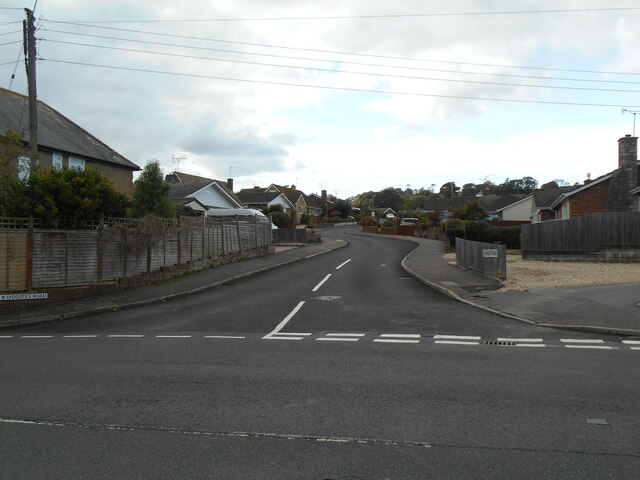
Colyford Common is a picturesque area located in the county of Devon, England. It is situated near the village of Colyford, nestled between the coastal town of Seaton and the historic town of Colyton. Covering an expansive area of downs and moorland, Colyford Common is a haven for nature enthusiasts and offers breathtaking views of the surrounding countryside.
The common is characterized by its rolling hills, heathlands, and open grasslands, creating a diverse and vibrant ecosystem. This varied habitat supports a rich array of flora and fauna, including wildflowers such as heather, gorse, and orchids, along with numerous bird species like skylarks, meadow pipits, and stonechats. The common is also home to rabbits, foxes, and occasional sightings of deer.
Colyford Common is a popular destination for outdoor activities, particularly walking and hiking. It boasts several well-maintained footpaths and trails, allowing visitors to explore its natural beauty at their own pace. The area is also renowned for its tranquility, providing a peaceful retreat for those seeking solace in nature.
In addition to its natural wonders, Colyford Common holds historical significance. The common is known for its ancient earthwork remains, including the remnants of a Roman fort. These archaeological features provide a glimpse into the area's past, adding an extra layer of intrigue for history enthusiasts.
Overall, Colyford Common presents a captivating blend of natural beauty, biodiversity, and historical charm. Whether it's a leisurely stroll through the meadows or an adventurous hike up the hills, this idyllic location offers something for everyone to enjoy.
If you have any feedback on the listing, please let us know in the comments section below.
Colyford Common Images
Images are sourced within 2km of 50.724182/-3.0622113 or Grid Reference SY2592. Thanks to Geograph Open Source API. All images are credited.


Colyford Common is located at Grid Ref: SY2592 (Lat: 50.724182, Lng: -3.0622113)
Administrative County: Devon
District: East Devon
Police Authority: Devon and Cornwall
What 3 Words
///apparatus.conjured.violinist. Near Colyton, Devon
Nearby Locations
Related Wikis

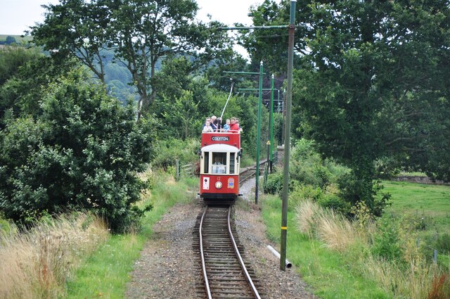
Seaton Tramway
The Seaton Tramway is a 2 ft 9 in (838 mm) narrow gauge electric tramway in the East Devon district of South West England. The 3-mile (4.8 km) route runs...

Colyford
Colyford is a village and civil parish in the East Devon district, in the county of Devon, England. It is situated midway between Lyme Regis and Sidmouth...
St Michael's Church, Colyford
St Michael's Church is a Church of England church in Colyford, Devon, England. Built in 1888–89, St Michael's has been Grade II listed since 1984. Today...

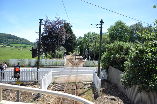
Colyford railway station
Colyford railway station, and its successor the Colyford tram stop, serve the village of Colyford in Devon, England. It was open as a railway station,...
Nearby Amenities
Located within 500m of 50.724182,-3.0622113Have you been to Colyford Common?
Leave your review of Colyford Common below (or comments, questions and feedback).