Scudamore Common

Downs, Moorland in Herefordshire

England

Scudamore Common

By Lower House, Cusop Looking from the footpath that drops down from the Offa's Dyke path into Cusop Dingle.
By Lower House, Cusop Credit: Mike Parker

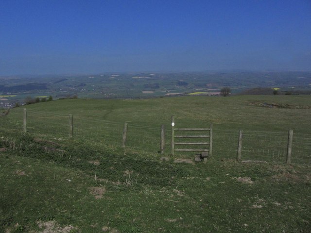
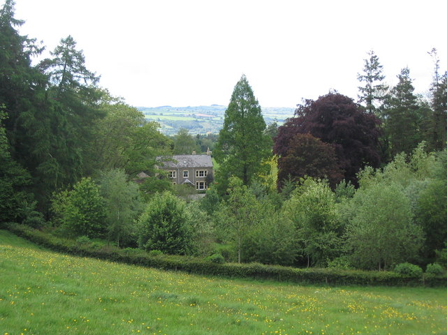
Scudamore Common is a picturesque area located in Herefordshire, England. Spread across a vast expanse of downs and moorland, it is a haven for nature enthusiasts and those seeking tranquility in the great outdoors. The common is situated in the western part of the county, close to the border with Wales, and covers an area of approximately 500 acres.

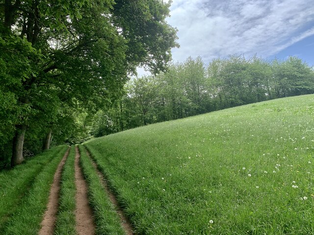
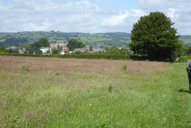
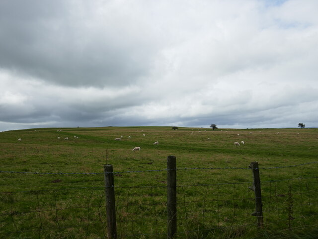
The landscape of Scudamore Common is characterized by rolling hills, open grasslands, and heather-covered moorlands, which provide a diverse habitat for a wide variety of plant and animal species. The common is predominantly composed of limestone and boasts a rich and fertile soil, resulting in a vibrant and colorful display of wildflowers during the spring and summer months.

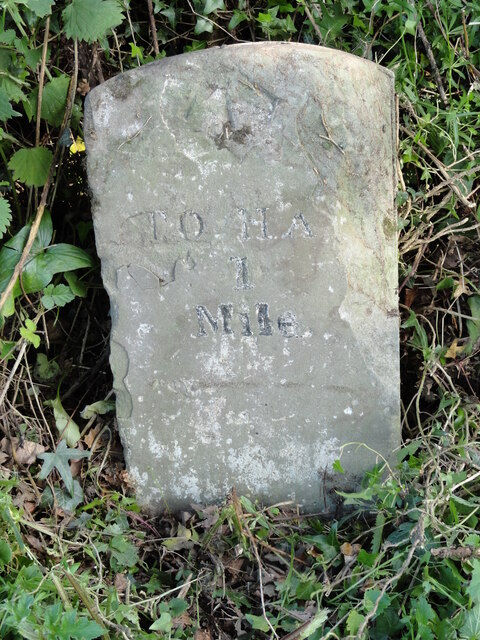
Walking trails and footpaths crisscross the common, offering visitors the opportunity to explore its natural beauty and discover its hidden gems. One of the notable features of Scudamore Common is the presence of several ancient burial mounds, known locally as barrows, which provide a glimpse into the area's rich history and cultural heritage.

The common is home to numerous bird species, including skylarks, meadow pipits, and stonechats, making it a popular destination for birdwatchers. Additionally, it is a haven for butterflies and other insects, with species such as the common blue and small pearl-bordered fritillary frequently spotted.

Scudamore Common is managed by the National Trust, ensuring its preservation and protection for future generations to enjoy. Whether one seeks a peaceful stroll, a chance to observe wildlife, or simply a moment of solitude in nature, Scudamore Common provides a serene and unspoiled retreat in the heart of Herefordshire.

If you have any feedback on the listing, please let us know in the comments section below.

Scudamore Common Images

Images are sourced within 2km of 52.073308/-3.0947122 or Grid Reference SO2542. Thanks to Geograph Open Source API. All images are credited.

By Lower House, Cusop Looking from the footpath that drops down from the Offa's Dyke path into Cusop Dingle.
By Lower House, Cusop
Looking from the footpath that drops down from the Offa's Dyke path into Cusop Dingle.
Llwybr Clawdd Offa, agos i'r Gelli Gandryll The Offa's Dyke path, three lines of red earth in the green pasture, crosses the fields south of Hay.
Llwybr Clawdd Offa, agos i'r Gelli Gandryll
The Offa's Dyke path, three lines of red earth in the green pasture, crosses the fields south of Hay.
Milestone on B4348 Hardwicke Road, near Cusop, Herefordshire An old milestone on the SE side of the B4348 Hardwicke Road near to Cusop, Herefordshire, displaying one mile to Hay on Wye. Potential benchmark too.
Milestone Society National ID: HF_HYHF01
Milestone on B4348 Hardwicke Road, near Cusop, Herefordshire
An old milestone on the SE side of the B4348 Hardwicke Road near to Cusop, Herefordshire, displaying one mile to Hay on Wye. Potential benchmark too. Milestone Society National ID: HF_HYHF01
Rooftop in Cusop Dingle Rooftop in Cusop Dingle viewed from Offa's Dyke.
Rooftop in Cusop Dingle
Rooftop in Cusop Dingle viewed from Offa's Dyke.
Cottage in Cusop Dingle Cottage in Cusop Dingle viewed from Offa's Dyke Path.
Cottage in Cusop Dingle
Cottage in Cusop Dingle viewed from Offa's Dyke Path.
Approaching Hay-on-Wye Approaching Hay-on-Wye on the Offa's Dyke Path.
Approaching Hay-on-Wye
Approaching Hay-on-Wye on the Offa's Dyke Path.
Cusop Hill
Cusop Hill
Cusop - St Mary's Church & churchyard
Footpath exiting from the eastern side of Cusop Churchyard In the churchyard to the right of this photograph and between two large ancient yew trees is the grave of William Seward the first Methodist Martyr.
Footpath exiting from the eastern side of Cusop Churchyard
In the churchyard to the right of this photograph and between two large ancient yew trees is the grave of William Seward the first Methodist Martyr.
Hill path & stile on NW shoulder of Cusop Hill An attractive hill path climbs east then southeast from Cusop Church towards Cusop Hill and provides fine views over the Wye Valley
Hill path & stile on NW shoulder of Cusop Hill
An attractive hill path climbs east then southeast from Cusop Church towards Cusop Hill and provides fine views over the Wye Valley
Millennium window at Cusop The east window of St.Mary's church, Cusop, was designed by Nicola Hopwood.
Millennium window at Cusop
The east window of St.Mary's church, Cusop, was designed by Nicola Hopwood.
A Remarkable Yew One of three Huge yew trees in the Churchyard at Cusop.
A Remarkable Yew
One of three Huge yew trees in the Churchyard at Cusop.
Hay-on-Wye, Bear Street
Hay-on-Wye, The Old Black Lion This public house is said to have 13th century origins although the present basically U-plan structure is largely 17th century. The front was brought forward in the 18th century and various modern additions have been made. It is a grade II listed building (Cadw Building ID: 7381 <span class="nowrap"><a title="http://www.britishlistedbuildings.co.uk/wa-7381-the-old-black-lion-ph-lion-street-hay#.VyZW0__mqHs" rel="nofollow ugc noopener" href="http://www.britishlistedbuildings.co.uk/wa-7381-the-old-black-lion-ph-lion-street-hay#.VyZW0__mqHs">Link</a><img style="margin-left:2px;" alt="External link" title="External link - shift click to open in new window" src="https://s1.geograph.org.uk/img/external.png" width="10" height="10"/></span>  British Listed Buildings).
Hay-on-Wye, The Old Black Lion
This public house is said to have 13th century origins although the present basically U-plan structure is largely 17th century. The front was brought forward in the 18th century and various modern additions have been made. It is a grade II listed building (Cadw Building ID: 7381 LinkExternal link British Listed Buildings).
Hay-on-Wye, Lion Street
Hay-on-Wye Conservative Club (1), 35 Lion Street, Hay-on-Wye, Powys This members club was established in 1898 and provides various facilities including a restaurant and bingo, snooker and others. Judging by its website, the club seems more of a social club than a political one but no doubt at election times its members support the party. Politically Hay-on-Wye is in the Brecon & Radnorshire constituency, which was created in 1918. In its first few years it was held by Liberals and then up to fairly recent times it passed between the Conservatives and Labour. In a byelection of 1985 it was won by the Liberals and since 1992 it has been either Conservative or Liberal Democrat. Since this photograph was taken the club's exterior has been redecorated.

<a href="https://www.geograph.org.uk/photo/5363934">SO2342 : Hay-on-Wye Conservative Club (2) - plaque, 35 Lion Street, Hay-on-Wye, Powys</a>.
Hay-on-Wye Conservative Club (1), 35 Lion Street, Hay-on-Wye, Powys
This members club was established in 1898 and provides various facilities including a restaurant and bingo, snooker and others. Judging by its website, the club seems more of a social club than a political one but no doubt at election times its members support the party. Politically Hay-on-Wye is in the Brecon & Radnorshire constituency, which was created in 1918. In its first few years it was held by Liberals and then up to fairly recent times it passed between the Conservatives and Labour. In a byelection of 1985 it was won by the Liberals and since 1992 it has been either Conservative or Liberal Democrat. Since this photograph was taken the club's exterior has been redecorated. SO2342 : Hay-on-Wye Conservative Club (2) - plaque, 35 Lion Street, Hay-on-Wye, Powys.
Hay-on-Wye Conservative Club (2) - plaque, 35 Lion Street, Hay-on-Wye, Powys The club's name is on this plaque by the front door.

<a href="https://www.geograph.org.uk/photo/5363928">SO2342 : Hay-on-Wye Conservative Club (1), 35 Lion Street, Hay-on-Wye, Powys</a>.
Hay-on-Wye Conservative Club (2) - plaque, 35 Lion Street, Hay-on-Wye, Powys
The club's name is on this plaque by the front door. SO2342 : Hay-on-Wye Conservative Club (1), 35 Lion Street, Hay-on-Wye, Powys.
Bear Street, Hay-on-Wye
Show me another place!

Scudamore Common is located at Grid Ref: SO2542 (Lat: 52.073308, Lng: -3.0947122)

Unitary Authority: County of Herefordshire

Police Authority: West Mercia

What 3 Words

///swing.event.soaps. Near Hay, Powys

Related Wikis

Cusop

Cusop is a village and civil parish in Herefordshire, England that lies at the foot of Cusop Hill next to the town of Hay-on-Wye in Wales. It is a short...

Dulas Bridge

Dulas Bridge spans Dulas Brook, a tributary of the River Wye in Hay-on-Wye, Powys, Wales.The Dulas bridge, near Hay station, was a joint counties bridge...

Hay Festival

The Hay Festival of Literature & Arts, better known as the Hay Festival (Welsh: Gŵyl Y Gelli), is an annual literature festival held in Hay-on-Wye, Powys...
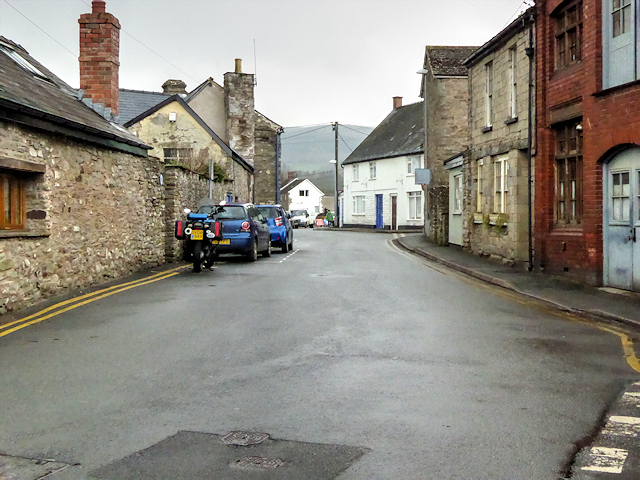
Hay-on-Wye

Hay-on-Wye (Welsh: Y Gelli Gandryll), known locally as Hay (Welsh: Y Gelli), is a market town and community in Powys, Wales, in the historic county of...

Hay-on-Wye railway station

Hay was a railway station serving the town of Hay-on-Wye in Powys, Wales, although the station was located just across the English border in Herefordshire...

Cheese Market, Hay-on-Wye

The Cheese Market in Hay-on-Wye (Welsh: Marchnad gaws Y Gelli Gandryll), formerly Hay-on-Wye Town Hall, (Welsh: Neuadd y Dref Y Gelli Gandryll), is a municipal...

Hay St Marys F.C.

Hay St Marys F.C. are a football club based in Hay-on-Wye. They currently play in the Ardal SE, the third tier of the Welsh football pyramid. The home...

Hay-on-Wye Bridge

Hay Bridge spans the River Wye at Hay-on-Wye, Powys, Wales. Preceding the rebuild, the bridge was partly of stone and partly of wood, which itself replaced...

Have you been to Scudamore Common?

Leave your review of Scudamore Common below (or comments, questions and feedback).