Archenfield

Settlement in Herefordshire

England

Archenfield

Milestone on B4348 Hardwicke Road, near Cusop, Herefordshire An old milestone on the SE side of the B4348 Hardwicke Road near to Cusop, Herefordshire, displaying one mile to Hay on Wye. Potential benchmark too.
Milestone Society National ID: HF_HYHF01
Milestone on B4348 Hardwicke Road, near Cusop, Herefordshire Credit: Roadside Relics

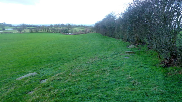
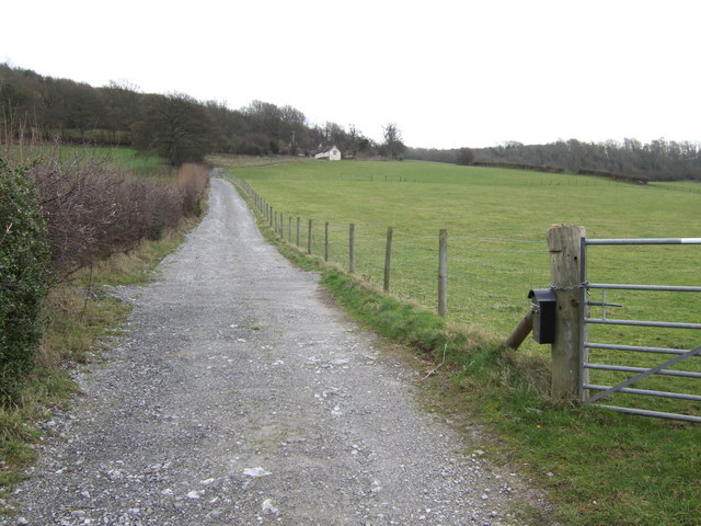
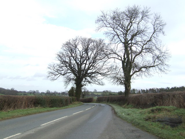
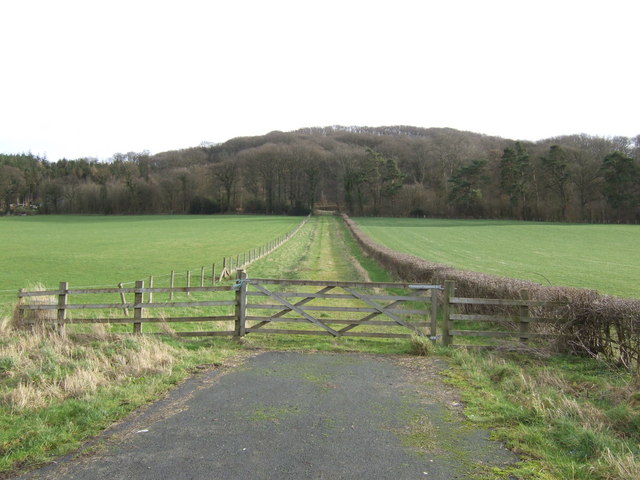
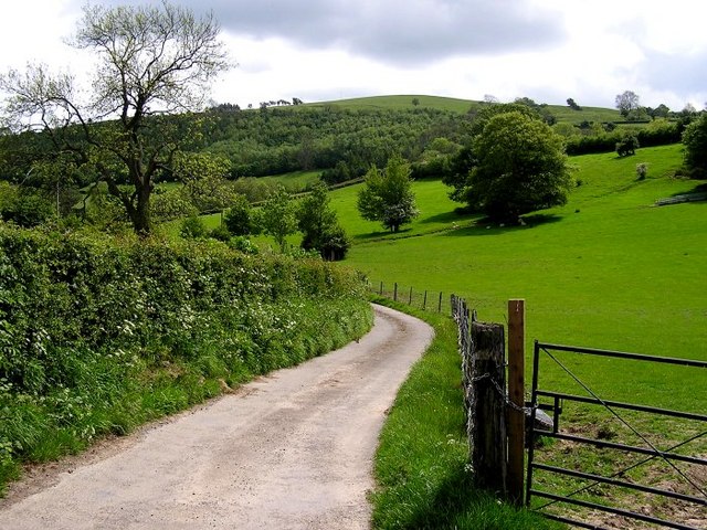
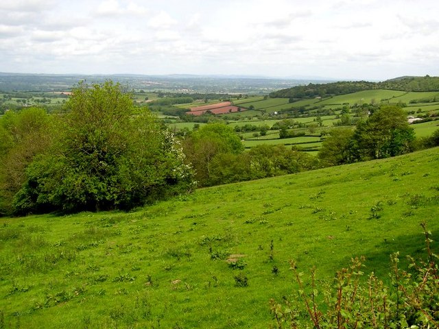
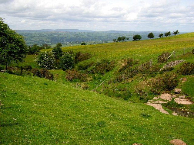
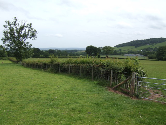
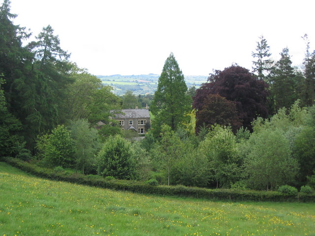
Archenfield is a historic region located in Herefordshire, England. Situated in the western part of the county, it is bordered by the River Monnow to the west and the River Wye to the south. The area encompasses a picturesque landscape, characterized by rolling hills, lush green fields, and charming villages.

The name Archenfield is derived from the Old English term "eorcanfeld," which means "field of ploughed land." This hints at its agricultural heritage, with farming being a prominent industry in the area. The fertile soil and favorable climate make it ideal for cultivating various crops, including grains, fruits, and vegetables.

The region is renowned for its rich history, dating back to the Roman era. It was strategically important due to its proximity to the Welsh border, serving as a defense point against potential invasions. Throughout the centuries, Archenfield witnessed the rise and fall of several kingdoms and witnessed numerous conflicts.

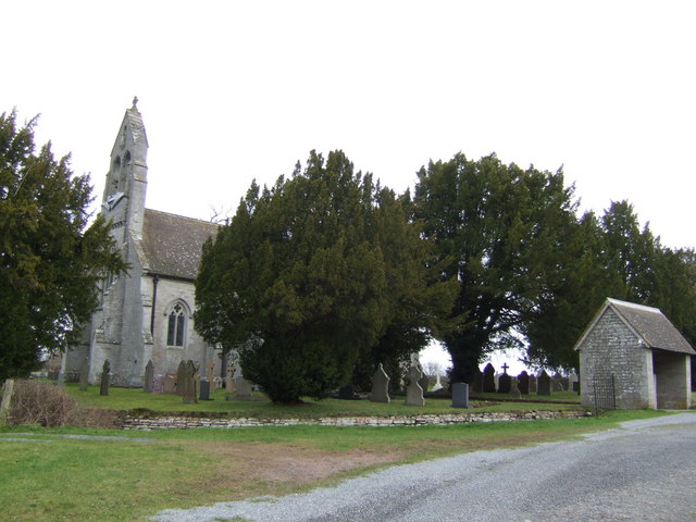
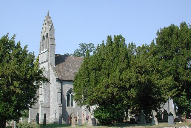
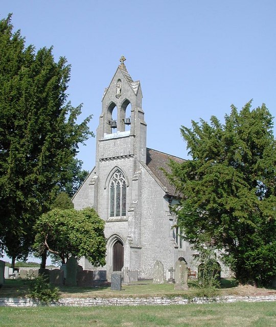
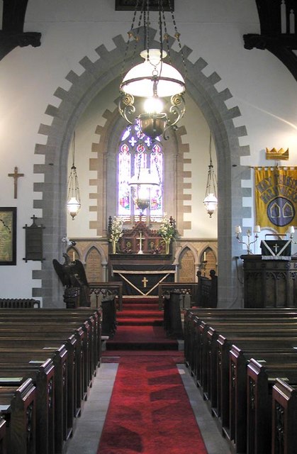
Today, Archenfield is a popular destination for nature enthusiasts and history buffs alike. The stunning countryside offers opportunities for outdoor activities such as hiking, cycling, and birdwatching. The area is also dotted with historical landmarks, including ancient churches, manor houses, and remnants of medieval fortifications.

With its idyllic scenery, cultural heritage, and vibrant community, Archenfield continues to attract visitors who seek a peaceful retreat amidst the beauty of Herefordshire.

If you have any feedback on the listing, please let us know in the comments section below.
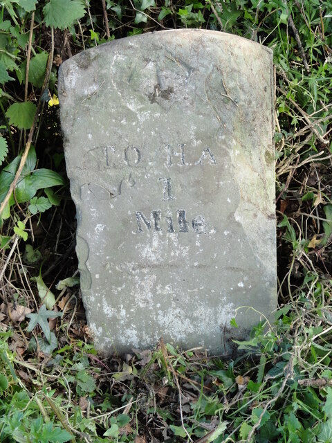
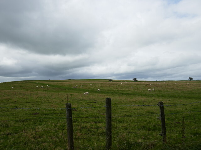
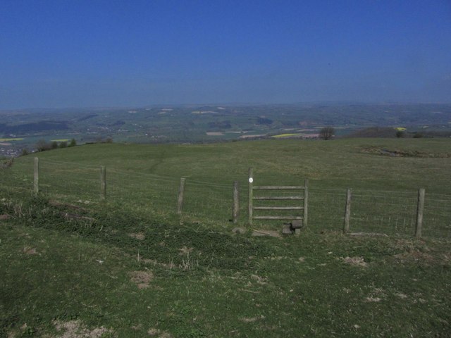
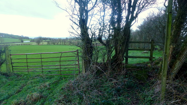
Archenfield Images

Images are sourced within 2km of 52.075842/-3.0812042 or Grid Reference SO2542. Thanks to Geograph Open Source API. All images are credited.

Milestone on B4348 Hardwicke Road, near Cusop, Herefordshire An old milestone on the SE side of the B4348 Hardwicke Road near to Cusop, Herefordshire, displaying one mile to Hay on Wye. Potential benchmark too.
Milestone Society National ID: HF_HYHF01
Milestone on B4348 Hardwicke Road, near Cusop, Herefordshire
An old milestone on the SE side of the B4348 Hardwicke Road near to Cusop, Herefordshire, displaying one mile to Hay on Wye. Potential benchmark too. Milestone Society National ID: HF_HYHF01
Cusop Hill
Cusop Hill
Hill path & stile on NW shoulder of Cusop Hill An attractive hill path climbs east then southeast from Cusop Church towards Cusop Hill and provides fine views over the Wye Valley
Hill path & stile on NW shoulder of Cusop Hill
An attractive hill path climbs east then southeast from Cusop Church towards Cusop Hill and provides fine views over the Wye Valley
Stile on Tomkyn's Lane Footpath leads north-west towards Llanerch-y-coed.
Stile on Tomkyn's Lane
Footpath leads north-west towards Llanerch-y-coed.
Footpath from Tomkyn's Lane Footpath leads north-west towards Llanerch-y-coed.
Footpath from Tomkyn's Lane
Footpath leads north-west towards Llanerch-y-coed.
Old Milestone, B4348, Rock Coppice The milestone is located 150m east of the junction with Priory Lane against the hedgerow, 15m from B stone, on the south side of the road.  Parish of Clifford (Hererfordshire District). Carved stone post, erected by the Whitney & Brewardine turnpike trust in the 19th century. 

Inscription reads:-
TO
HAY
2
MILES

Milestone Society National ID: HF_HYHF02
Old Milestone, B4348, Rock Coppice
The milestone is located 150m east of the junction with Priory Lane against the hedgerow, 15m from B stone, on the south side of the road. Parish of Clifford (Hererfordshire District). Carved stone post, erected by the Whitney & Brewardine turnpike trust in the 19th century. Inscription reads:- TO HAY 2 MILES Milestone Society National ID: HF_HYHF02
Holy Trinity church, Hardwicke Hiding behind the yews, by the B4348
Holy Trinity church, Hardwicke
Hiding behind the yews, by the B4348
Hardwicke picnic area A tiny facility at the junction of the B4348 and B4352.
Hardwicke picnic area
A tiny facility at the junction of the B4348 and B4352.
Newly-laid track Up the steep slope to the isolated cottage in the distance.
Newly-laid track
Up the steep slope to the isolated cottage in the distance.
Oaks by the B4348 Looking east towards Hereford.
Oaks by the B4348
Looking east towards Hereford.
Private track To Mouse Castle Wood, which in turn hides the remains of Mouse Castle  on the hilltop.
Private track
To Mouse Castle Wood, which in turn hides the remains of Mouse Castle on the hilltop.
Holy Trinity, Hardwicke, Herefordshire
Holy Trinity, Hardwicke, Herefordshire - East end
The Track to Penhenllan Farmland near Hay on Wye.
The Track to Penhenllan
Farmland near Hay on Wye.
Herefordshire Countryside Taken on the lower slopes of Cusop Hill.
Herefordshire Countryside
Taken on the lower slopes of Cusop Hill.
Cusop Hill Small stream near the summit of Cusop Hill.
Cusop Hill
Small stream near the summit of Cusop Hill.
Sheep pasture near Redley Farm A hamlet called Archenfield is nearby. However the region of west and south Herefordshire was also Archenfield, as explained in; <span class="nowrap"><a title="http://en.wikipedia.org/wiki/Archenfield" rel="nofollow ugc noopener" href="http://en.wikipedia.org/wiki/Archenfield">Link</a><img style="margin-left:2px;" alt="External link" title="External link - shift click to open in new window" src="https://s1.geograph.org.uk/img/external.png" width="10" height="10"/></span>
Sheep pasture near Redley Farm
A hamlet called Archenfield is nearby. However the region of west and south Herefordshire was also Archenfield, as explained in; LinkExternal link
Show me another place!

Archenfield is located at Grid Ref: SO2542 (Lat: 52.075842, Lng: -3.0812042)

Unitary Authority: County of Herefordshire

Police Authority: West Mercia

What 3 Words

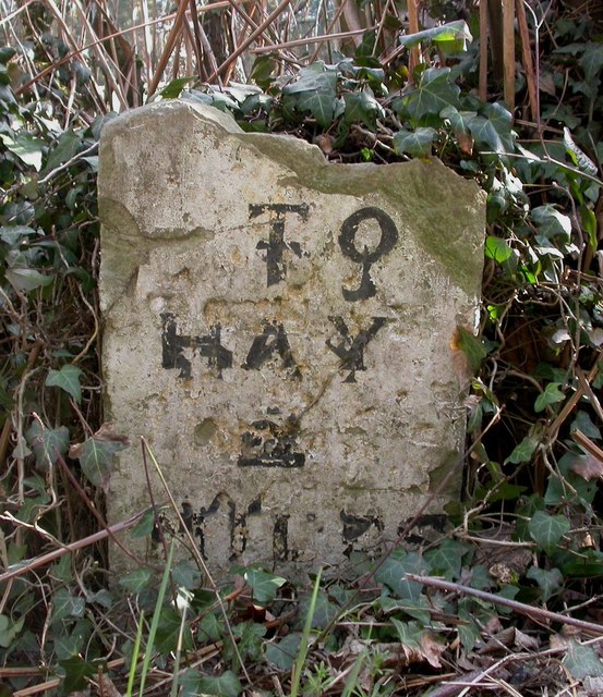
///bills.crinkled.revision. Near Clifford, Herefordshire

Related Wikis

Clifford Priory

Clifford Priory was a priory in Herefordshire, England at grid reference SO2531944576. == References ==

Cusop

Cusop is a village and civil parish in Herefordshire, England that lies at the foot of Cusop Hill next to the town of Hay-on-Wye in Wales. It is a short...

Westbrook railway station (England)

Westbrook railway station was a station to the northwest of Dorstone, Herefordshire, England. The station was opened in 1881, closed to passengers in 1941...

Greens Siding railway station

Greens Siding railway station was a station to the east of Clifford, Herefordshire, England. The station was opened in 1903, closed to passengers in 1941...

Dulas Bridge

Dulas Bridge spans Dulas Brook, a tributary of the River Wye in Hay-on-Wye, Powys, Wales.The Dulas bridge, near Hay station, was a joint counties bridge...

Hay-on-Wye railway station

Hay was a railway station serving the town of Hay-on-Wye in Powys, Wales, although the station was located just across the English border in Herefordshire...

Hay Festival

The Hay Festival of Literature & Arts, better known as the Hay Festival (Welsh: Gŵyl Y Gelli), is an annual literature festival held in Hay-on-Wye, Powys...

Hay-on-Wye

Hay-on-Wye (Welsh: Y Gelli Gandryll), known locally as Hay (Welsh: Y Gelli), is a market town and community in Powys, Wales, in the historic county of...

Nearby Amenities

Located within 500m of 52.075842,-3.0812042
Archenfield
Name Cy: Ergyng
Place: hamlet
Lat/Long: 52.0750099/-3.0772667
Building: yes
Lat/Long: 52.073856/-3.0845294
Building: yes
Lat/Long: 52.074344/-3.0794654
The data included in this document is from www.openstreetmap.org. The data is made available under ODbL.

Have you been to Archenfield?

Leave your review of Archenfield below (or comments, questions and feedback).