Badievochel

Downs, Moorland in Banffshire

Scotland

Badievochel

Rough grazing near River Livet Boggy ground grazed by sheep on the lower slopes of Carn an t-Suidhe
Rough grazing near River Livet Credit: Dorothy Carse

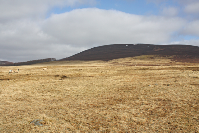
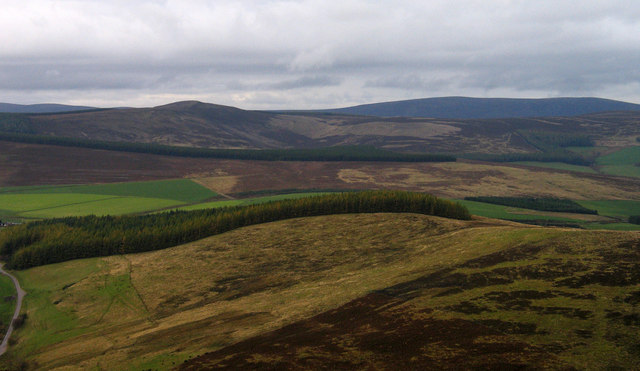
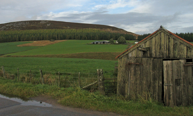
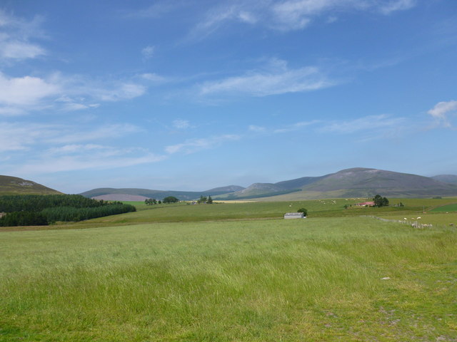
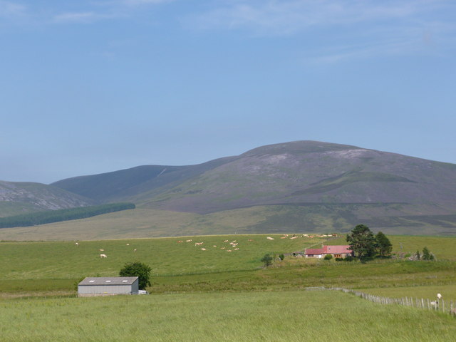
Badievochel is a picturesque region located in the county of Banffshire, situated in the northeastern part of Scotland. Known for its stunning natural landscape, the area primarily consists of downs and moorland, making it an ideal destination for nature lovers and outdoor enthusiasts.

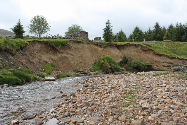
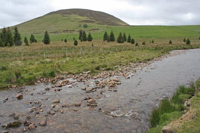
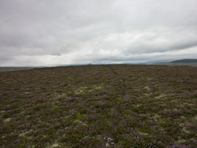
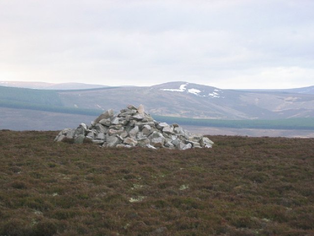
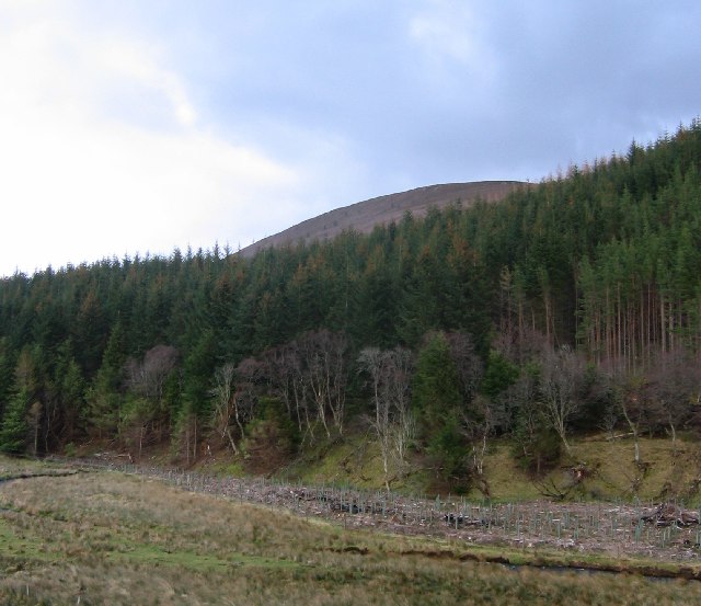
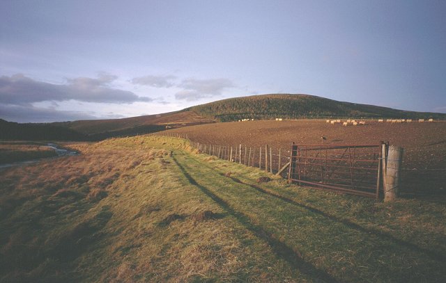
The downs of Badievochel showcase rolling hills and vast grasslands, creating a serene and tranquil atmosphere. Visitors can enjoy peaceful walks or hikes, taking in the breathtaking views of the surrounding countryside. The moorland, on the other hand, offers a more rugged and wild experience, with heather-covered hills and scattered patches of woodland.

The region is home to a diverse array of wildlife, including various bird species, such as red grouse and golden eagles. The downs and moorland provide important habitats for these creatures, making Badievochel a popular destination for birdwatching.

The area also boasts some historical significance. Ruins of ancient settlements and stone circles can be found scattered throughout the landscape, providing a glimpse into the region's rich past.

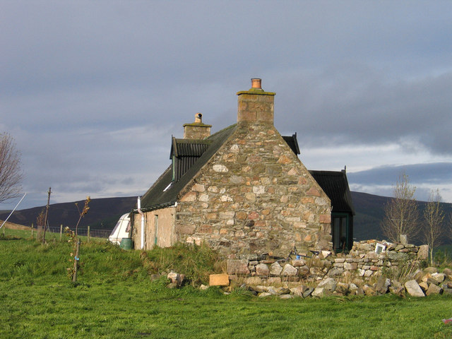
Despite its remote location, Badievochel is easily accessible by road, and there are several accommodation options available for those wishing to stay and explore the area further. Visitors can enjoy activities such as camping, hiking, wildlife spotting, and photography, immersing themselves in the natural beauty and tranquility of this enchanting part of Banffshire.

If you have any feedback on the listing, please let us know in the comments section below.

Badievochel Images

Images are sourced within 2km of 57.289527/-3.2598736 or Grid Reference NJ2422. Thanks to Geograph Open Source API. All images are credited.

Rough grazing near River Livet Boggy ground grazed by sheep on the lower slopes of Carn an t-Suidhe
Rough grazing near River Livet
Boggy ground grazed by sheep on the lower slopes of Carn an t-Suidhe
Erosion, River Livet The ruined buildings of Poolwick are about to fall in.
Erosion, River Livet
The ruined buildings of Poolwick are about to fall in.
River Livet near Glack Looking towards The Bochel.
River Livet near Glack
Looking towards The Bochel.
Badievochel Badievochel is a small cottage lying south-east of The Bochel, a modest hill, but a 'Marilyn'.
Badievochel
Badievochel is a small cottage lying south-east of The Bochel, a modest hill, but a 'Marilyn'.
West ridge of The Bochel The heather and grass slopes of the west ridge of The Bochel descend towards coniferous plantings. The conical hill left of centre is Carn Daimh and the more distant flat-topped hill to the right is Carn a’ Ghille Chearr, one of the Hills of Cromdale.
West ridge of The Bochel
The heather and grass slopes of the west ridge of The Bochel descend towards coniferous plantings. The conical hill left of centre is Carn Daimh and the more distant flat-topped hill to the right is Carn a’ Ghille Chearr, one of the Hills of Cromdale.
Shed and barns at Bochel The farm buildings at the centre of the image are those of Bochel. The hill rising beyond is called The Bochel.
Shed and barns at Bochel
The farm buildings at the centre of the image are those of Bochel. The hill rising beyond is called The Bochel.
Braes of Glenlivet Carn an t-Suidhe and Corryhabbie Hill rise above Eskemore.
Braes of Glenlivet
Carn an t-Suidhe and Corryhabbie Hill rise above Eskemore.
Eskemore and Corryhabbie Hill The corrugated iron roof of the house at Eskemore stands out in the summer greenness of the Braes of Glenlivet.  The hill in the background is Corryhabbie Hill.
Eskemore and Corryhabbie Hill
The corrugated iron roof of the house at Eskemore stands out in the summer greenness of the Braes of Glenlivet. The hill in the background is Corryhabbie Hill.
Bochel Summit Narrow path through the heather leading to the summit cairn.
Bochel Summit
Narrow path through the heather leading to the summit cairn.
The summit cairn, The Bochel The Bochel is an isolated quartzite hill in Glen Livet. View over to Carn Daimh
The summit cairn, The Bochel
The Bochel is an isolated quartzite hill in Glen Livet. View over to Carn Daimh
The Bochel A steep wee hill, The Bochel is seen here from the west, rising above the Crombie Water
The Bochel
A steep wee hill, The Bochel is seen here from the west, rising above the Crombie Water
Sheep, Glen Livet The higher farmed area of the glen, sheep feeding on root crops.
Sheep, Glen Livet
The higher farmed area of the glen, sheep feeding on root crops.
RC church, Chapeltown Parish Church of Our Lady of Perpetual Succour, in Braes of Glenlivet.
RC church, Chapeltown
Parish Church of Our Lady of Perpetual Succour, in Braes of Glenlivet.
RC Parish church, Chapeltown
The Lord's prayer In latin, as a decorative frieze inside Chapeltown's RC church.
The Lord's prayer
In latin, as a decorative frieze inside Chapeltown's RC church.
Church House, Chapeltown
Tower entrance to the church of Our Lady of Perpetual Succour in Chapeltown
Whisky trail. As it was before it became a tourist flytrap.
Whisky trail.
As it was before it became a tourist flytrap.
Show me another place!

Badievochel is located at Grid Ref: NJ2422 (Lat: 57.289527, Lng: -3.2598736)

Unitary Authority: Moray

Police Authority: North East

What 3 Words

///nutrients.dodging.thickened. Near Dufftown, Moray

Nearby Locations

Badievochel

Related Wikis

Clashnoir

Clashnoir is a settlement in Glenlivet, Moray, Scotland, 92 miles north of Edinburgh and 25 miles south of Elgin.

Braeval distillery

Braeval distillery is a distiller of Scotch whisky in Chapeltown, Banffshire, Scotland. Founded in 1973 as Braes of Glenlivet, the distillery is owned...

County of Moray

Moray; (Scottish Gaelic: Moireibh [ˈmɤɾʲəv]) or Morayshire, called Elginshire until 1919, is a historic county, registration county and lieutenancy area...

Auchnarrow

Auchnarrow (Scottish Gaelic: Achadh an Arbha) is a village in Moray, Scotland.
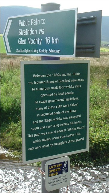
Scalan

The Scalan was once a seminary and was one of the few places in Scotland where the Roman Catholic faith was kept alive during the troubled times of the...

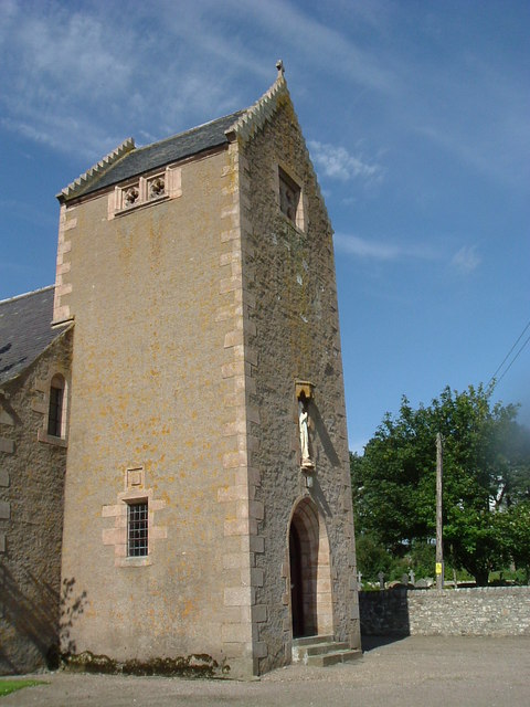
Church of The Incarnation, Tombae

The Church of The Incarnation was built between 1827 and 1829 as a Roman Catholic church, under the patronage of the Gordon family, in Banffshire, Scotland...

Tamnavulin distillery

Tamnavulin distillery is a producer of single malt Scotch whisky that was founded in 1966. The distillery is operated by Whyte & Mackay, which Philippines...

Glenlivet Estate

The Glenlivet Estate is located in Glenlivet, Scotland in the Cairngorms National Park. It measures 58,000 acres (230 km2) and is part of The Crown Estate...

Nearby Amenities

Located within 500m of 57.289527,-3.2598736
Power: pole
Lat/Long: 57.2914902/-3.253334
Power: pole
Lat/Long: 57.2915521/-3.2546481
Power: pole
Lat/Long: 57.2916237/-3.2558727
Power: pole
Lat/Long: 57.2916895/-3.2572227
Power: pole
Lat/Long: 57.2918752/-3.2587516
Power: pole
Lat/Long: 57.29203/-3.2599583
Power: pole
Lat/Long: 57.2922477/-3.2611507
Power: pole
Lat/Long: 57.2869477/-3.2597005
Power: pole
Lat/Long: 57.2874218/-3.2599261
Power: pole
Lat/Long: 57.2883662/-3.2605384
Power: pole
Lat/Long: 57.2890376/-3.2608696
Power: pole
Lat/Long: 57.2894411/-3.2608267
Power: pole
Lat/Long: 57.2899268/-3.2607461
Power: pole
Lat/Long: 57.2905401/-3.2608517
Power: pole
Lat/Long: 57.2910664/-3.2609484
Power: pole
Lat/Long: 57.2916121/-3.2610218
Power: pole
Lat/Long: 57.2928949/-3.2612385
Power: pole
Lat/Long: 57.2934995/-3.2611167
Power: pole
Lat/Long: 57.2910693/-3.2624702
Power: pole
Lat/Long: 57.290723/-3.2633958
Power: pole
Lat/Long: 57.290365/-3.2643358
Power: pole
Lat/Long: 57.2899587/-3.2653223
Power: pole
Lat/Long: 57.2895514/-3.2662747
Power: pole
Lat/Long: 57.2891479/-3.2672344
Man Made: mast
Tower Construction: lattice
Tower Type: communication
Lat/Long: 57.2875016/-3.2632449
The data included in this document is from www.openstreetmap.org. The data is made available under ODbL.

Have you been to Badievochel?

Leave your review of Badievochel below (or comments, questions and feedback).