Black Moss

Downs, Moorland in Peeblesshire

Scotland

Black Moss

New fence on Talla East Side The boundary of the Talla and Gameshope area managed by the Border Forest Trust, see <a href="https://www.geograph.org.uk/photo/7209729">NT1420 : Border Forest Trust information board at Talla Water</a>.
New fence on Talla East Side Credit: wrobison

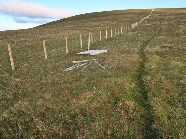
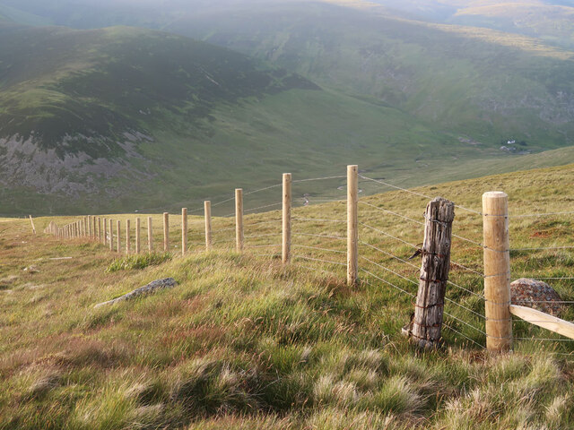
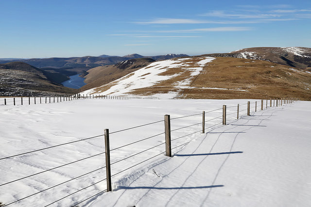
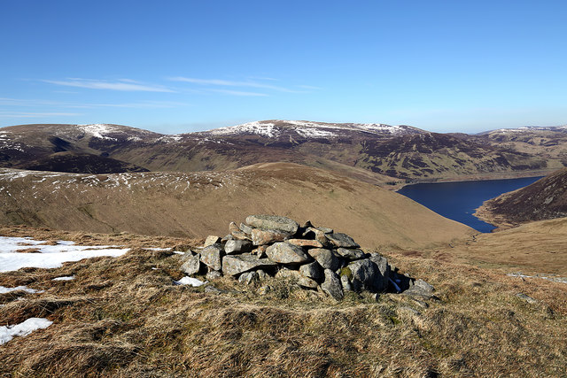
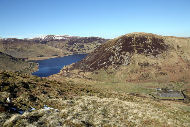
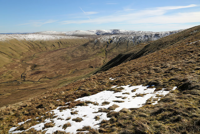
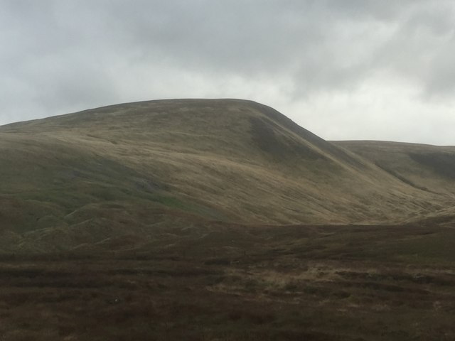
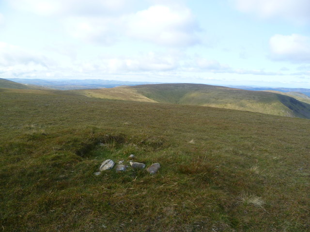
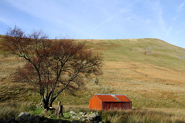
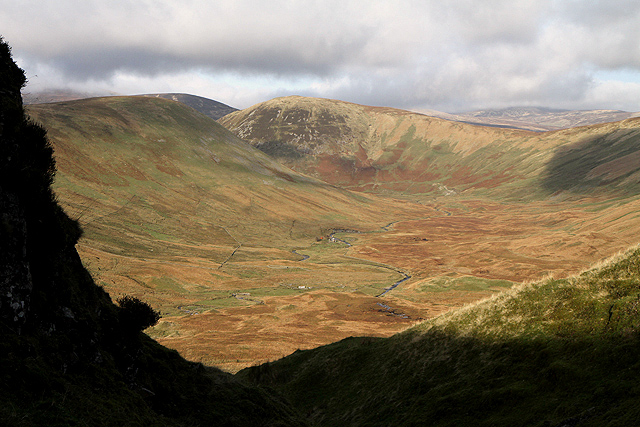
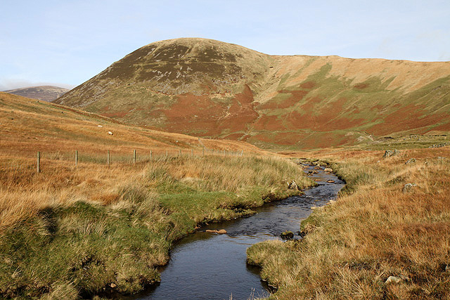
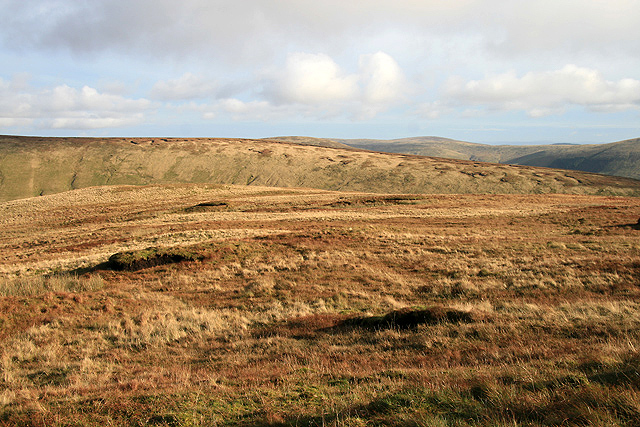
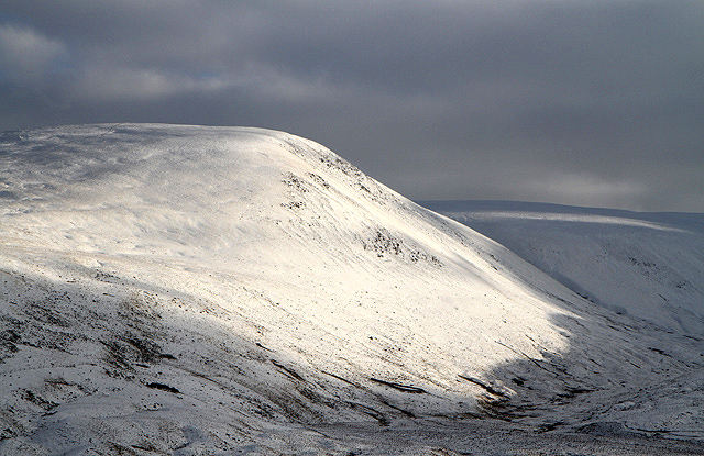
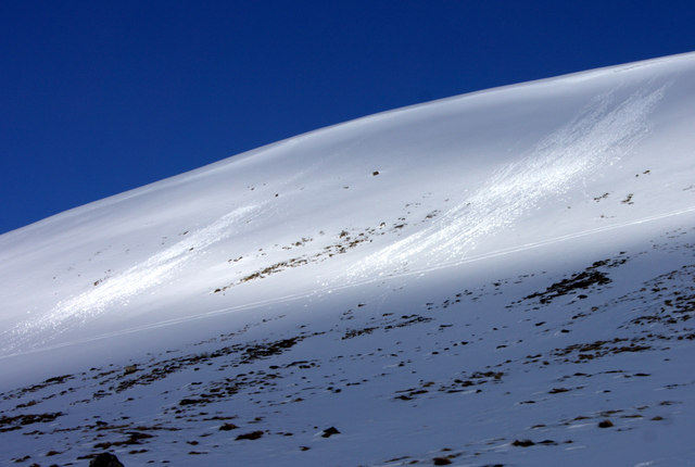
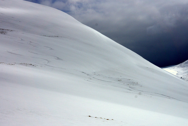
Black Moss is a vast expanse of downs and moorland located in Peeblesshire, Scotland. Covering an area of approximately 1,500 acres, it is a significant natural feature within the region. The landscape of Black Moss is characterized by its rolling hills, heather-covered moors, and patches of dense woodland.

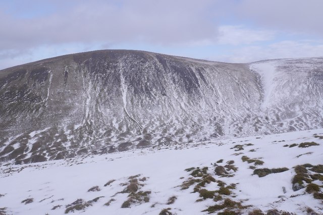
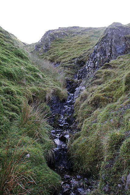
The downs of Black Moss provide breathtaking panoramic views of the surrounding countryside, with their gentle slopes and wide open spaces offering a sense of tranquility and serenity. The moorland, on the other hand, is a wilder and more rugged terrain, dotted with peat bogs and scattered with rocky outcrops.

This area is renowned for its diverse wildlife and is home to a variety of species. Birdwatchers can spot birds of prey such as kestrels, buzzards, and occasionally even peregrine falcons soaring above the moors. The heather attracts bees, butterflies, and other insects, adding vibrant colors to the landscape during the summer months.

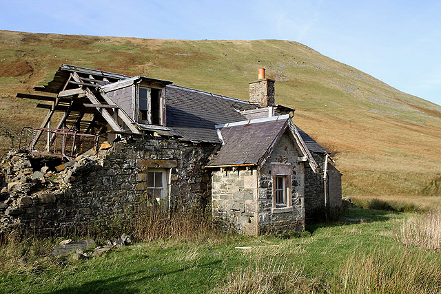
Black Moss is also rich in archaeological history, with several prehistoric sites scattered across its grounds. Ancient burial mounds, stone circles, and remnants of settlements have been discovered, providing valuable insights into the area's past.

The area is a haven for outdoor enthusiasts, offering numerous walking and hiking trails that allow visitors to explore the beauty of Black Moss. Additionally, the moorland provides an excellent location for activities such as nature photography, wildlife observation, and even picnicking.

Overall, Black Moss in Peeblesshire is a captivating natural landscape, offering a diverse range of flora, fauna, and historical intrigue that make it an ideal destination for those seeking to immerse themselves in Scotland's natural beauty.

If you have any feedback on the listing, please let us know in the comments section below.

Black Moss Images

Images are sourced within 2km of 55.462043/-3.3005942 or Grid Reference NT1719. Thanks to Geograph Open Source API. All images are credited.

New fence on Talla East Side The boundary of the Talla and Gameshope area managed by the Border Forest Trust, see <a href="https://www.geograph.org.uk/photo/7209729">NT1420 : Border Forest Trust information board at Talla Water</a>.
New fence on Talla East Side
The boundary of the Talla and Gameshope area managed by the Border Forest Trust, see NT1420 : Border Forest Trust information board at Talla Water.
New fence on Nickies Knowe Looking down the steep slopes to the Megget Water and Meggethead the white building on the right. The fence is on the boundary of the Talla and Gameshope area managed by the Border Forest Trust, see <a href="https://www.geograph.org.uk/photo/7209729">NT1420 : Border Forest Trust information board at Talla Water</a>.
New fence on Nickies Knowe
Looking down the steep slopes to the Megget Water and Meggethead the white building on the right. The fence is on the boundary of the Talla and Gameshope area managed by the Border Forest Trust, see NT1420 : Border Forest Trust information board at Talla Water.
Snow on Talla East Side This is a view towards Nickies Knowe with Talla Reservoir on the far left. There were large patches of snow on the tops on a lovely March day for hill walking.
Snow on Talla East Side
This is a view towards Nickies Knowe with Talla Reservoir on the far left. There were large patches of snow on the tops on a lovely March day for hill walking.
A cairn on Five Cairns Hill Megget Reservoir is in the right background.
A cairn on Five Cairns Hill
Megget Reservoir is in the right background.
Crumley Hill This is near the summit looking towards Megget Reservoir with Craigdilly centre right and Winterhopeburn Farm down on the far right.
Crumley Hill
This is near the summit looking towards Megget Reservoir with Craigdilly centre right and Winterhopeburn Farm down on the far right.
On the lower southeast slopes of Five Cairns Hill The view straight ahead is to Red Scar on Lochcraig Head <a href="https://www.geograph.org.uk/photo/1496701">NT1818 : Red Scar on Lochcraig Rig</a> with the Winterhope Burn down on the left.
On the lower southeast slopes of Five Cairns Hill
The view straight ahead is to Red Scar on Lochcraig Head NT1818 : Red Scar on Lochcraig Rig with the Winterhope Burn down on the left.
Nickies Knowe Steep scree slopes on the west side of the hill.
Nickies Knowe
Steep scree slopes on the west side of the hill.
Nickie's Knowe High hill country between the Moffat Glen and Tweeddale, seen from the road at Megget Stone.
Nickie's Knowe
High hill country between the Moffat Glen and Tweeddale, seen from the road at Megget Stone.
Looking towards Nickies Knowe On the flat ridge of Lochcraig Head
Looking towards Nickies Knowe
On the flat ridge of Lochcraig Head
A shed at Winter Hope This red corrugated iron shed is by the derelict cottage at Winterhopeburn. Crumley Hill is in the background.
A shed at Winter Hope
This red corrugated iron shed is by the derelict cottage at Winterhopeburn. Crumley Hill is in the background.
Winter Hope The Winterhope Burn runs through this sheltered valley into Megget Reservoir. Crumley Hill is on the left with Craigdilly in the central background. This was viewed from Red Scar on Lochcraig Rig. For a view of Red Scar from Five Cairns Hill, see <a href="https://www.geograph.org.uk/photo/1496701">NT1818 : Red Scar on Lochcraig Rig</a>.
Winter Hope
The Winterhope Burn runs through this sheltered valley into Megget Reservoir. Crumley Hill is on the left with Craigdilly in the central background. This was viewed from Red Scar on Lochcraig Rig. For a view of Red Scar from Five Cairns Hill, see NT1818 : Red Scar on Lochcraig Rig.
The derelict building at Winterhopeburn This farm cottage on the west side of the Winterhope Burn has fallen into disrepair. Crumley Hill is in the background.
The derelict building at Winterhopeburn
This farm cottage on the west side of the Winterhope Burn has fallen into disrepair. Crumley Hill is in the background.
The Winterhope Burn This is a view downstream towards Craigdilly.
The Winterhope Burn
This is a view downstream towards Craigdilly.
A small burn in Red Scar This gully is at the northeast end of Lochcraig Rig. For a view of the gully from Five Cairns Hill, see <a href="https://www.geograph.org.uk/photo/1496701">NT1818 : Red Scar on Lochcraig Rig</a>.
A small burn in Red Scar
This gully is at the northeast end of Lochcraig Rig. For a view of the gully from Five Cairns Hill, see NT1818 : Red Scar on Lochcraig Rig.
Lochcraig Rig This is at the northeast end of the ridge looking over to The Strypes.
Lochcraig Rig
This is at the northeast end of the ridge looking over to The Strypes.
Nickies Knowe from Fans Law The face of the hill on the east side of the Talla Water has been highlighted by some winter sunshine.
Nickies Knowe from Fans Law
The face of the hill on the east side of the Talla Water has been highlighted by some winter sunshine.
Avalanches set off by the warm afternoon sun. This wasn't the only evidence of significant instability in the snow and ski lines had to be chosen carefully.
Avalanches set off by the warm afternoon sun.
This wasn't the only evidence of significant instability in the snow and ski lines had to be chosen carefully.
Ski tracks off Nickies Knowe
Show me another place!

Black Moss is located at Grid Ref: NT1719 (Lat: 55.462043, Lng: -3.3005942)

Unitary Authority: The Scottish Borders

Police Authority: The Lothians and Scottish Borders

What 3 Words

///polka.grips.figs. Near Ettrick, Scottish Borders

Nearby Locations

Black Moss

Related Wikis

Megget Reservoir

Megget Reservoir is an impounding reservoir in the Megget valley in Ettrick Forest, in the Scottish Borders. The 259 hectares (640 acres) reservoir is...

Loch Skeen

Loch Skeen or Loch Skene is a loch in Dumfries and Galloway in the south of Scotland. It is located about 10 miles to the north-east of Moffat and feeds...

Megget

Megget is a former chapelry or parish containing the valley of Megget Water, now forming the westernmost part of the parish of Yarrow, Selkirkshire in...

Dob's Linn

Dob's Linn is a small steep valley in Dumfries and Galloway, just north of the A708 road between Moffat and Selkirk, in Scotland. It is part of the Grey...

Talla Water

Talla Water is a river in the Scottish Borders area of Scotland, near Tweedsmuir. It feeds the Talla Reservoir, and is a tributary of the River Tweed....

White Coomb

White Coomb is a hill in the Moffat Hills range, part of the Southern Uplands of Scotland. Its broad summit is the highest point in the range and the registration...

Craigierig

Craigierig is a village on the Megget Reservoir, in the Scottish Borders area of Scotland, in the former Selkirkshire. Places nearby include the Glengaber...

Grey Mare's Tail, Moffat Hills

Grey Mare's Tail is a 60-metre (200 ft) hanging valley waterfall near to Moffat in southern Scotland. The fall is produced by the Tail Burn flowing from...

Have you been to Black Moss?

Leave your review of Black Moss below (or comments, questions and feedback).