Cliff Field

Downs, Moorland in Devon East Devon

England

Cliff Field

The edge of Pinn Beacon Plantation The woods touch farmland here.  The boundary is a bank with a hedge, and there is a sunken path just inside the woodland.
The edge of Pinn Beacon Plantation Credit: David Smith

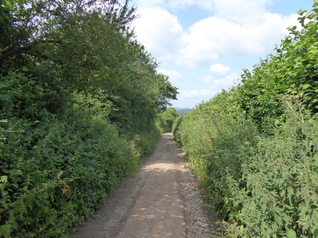
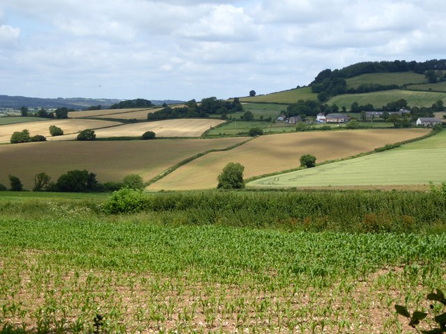
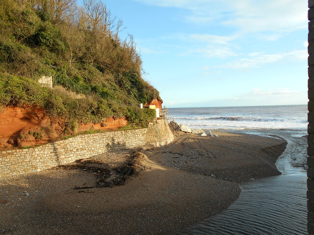
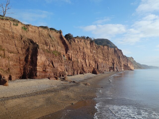
Cliff Field in Devon is a picturesque area located on the rugged coastline of the South West of England. This stunning landscape is characterized by its dramatic cliffs, rolling downs, and expansive moorland. The area is rich in natural beauty, with breathtaking views of the surrounding countryside and the sparkling waters of the English Channel.

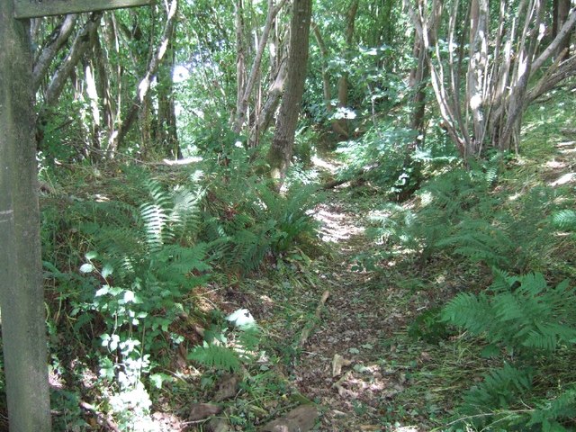
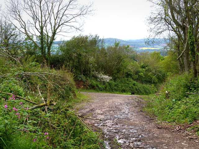
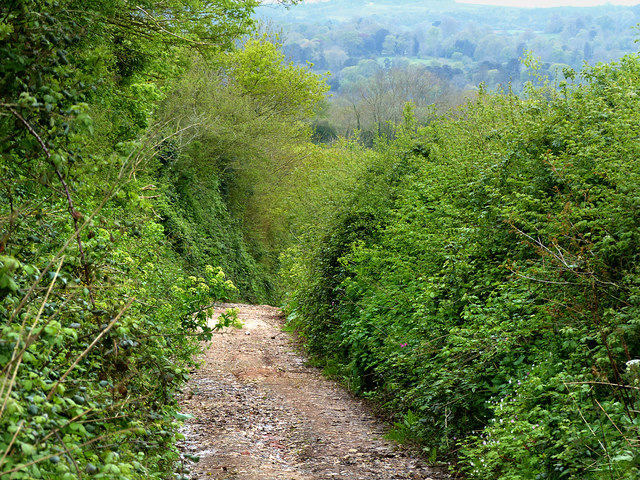
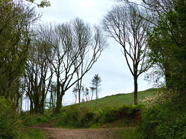
The cliffs of Cliff Field tower high above the sea, offering spectacular views of the crashing waves below. The downs are covered in lush grasses and wildflowers, providing a perfect habitat for a variety of birds and wildlife. The moorland stretches out for miles, dotted with rocky outcrops and ancient stone circles.

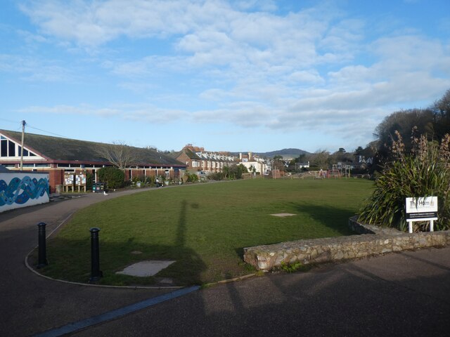
Visitors to Cliff Field can enjoy a range of outdoor activities, including hiking, birdwatching, and picnicking. The area is also popular with photographers and artists, who come to capture the stunning landscapes and dramatic seascapes.

Overall, Cliff Field in Devon is a must-visit destination for nature lovers and outdoor enthusiasts looking to explore the beauty of the South West of England.

If you have any feedback on the listing, please let us know in the comments section below.
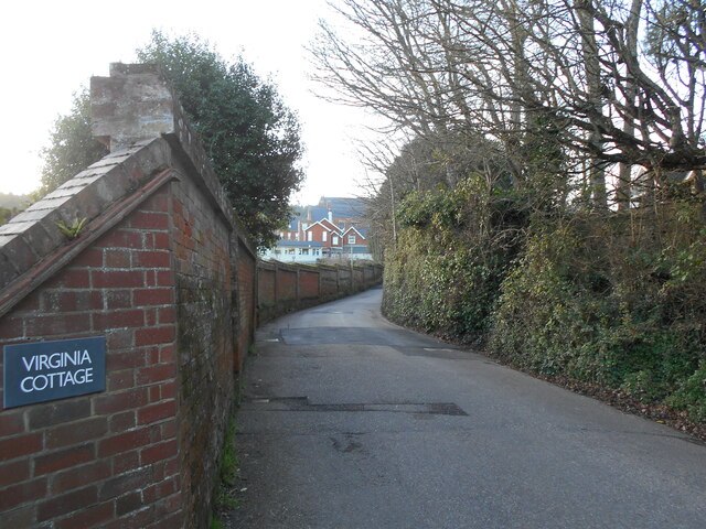
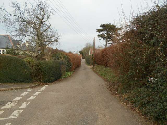
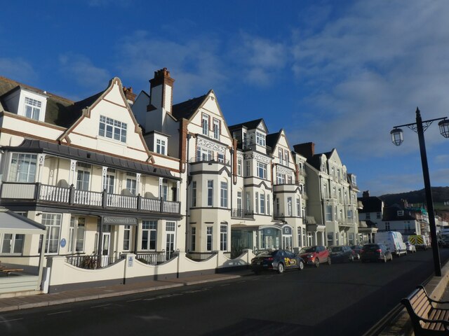
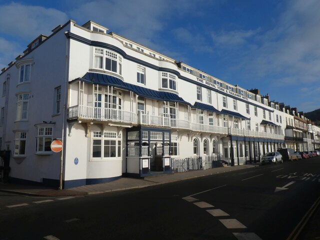
Cliff Field Images

Images are sourced within 2km of 50.675312/-3.2517315 or Grid Reference SY1186. Thanks to Geograph Open Source API. All images are credited.

The edge of Pinn Beacon Plantation The woods touch farmland here.  The boundary is a bank with a hedge, and there is a sunken path just inside the woodland.
The edge of Pinn Beacon Plantation
The woods touch farmland here. The boundary is a bank with a hedge, and there is a sunken path just inside the woodland.
Bar's Lane
Bar's Lane
Bar's Lane descending
Bar's Lane and High Peak Plantation
Bar's Lane, Otterton A farm track and public footpath to the north of the village.  On the skyline is Woodbury Common
Bar's Lane, Otterton
A farm track and public footpath to the north of the village. On the skyline is Woodbury Common
Lower Pinn Farm and valley of Otterton Brook With a field of maize in the foreground
Lower Pinn Farm and valley of Otterton Brook
With a field of maize in the foreground
Walking the dog Approaching Alma bridge from Cliff road.
An earlier footpath ran straight on. This has now fallen into the sea and the path diverted to its new course.
Walking the dog
Approaching Alma bridge from Cliff road. An earlier footpath ran straight on. This has now fallen into the sea and the path diverted to its new course.
Looking up river A view up the River Sid off the new Alma bridge.
The old bridge was replaced due to coastal erosion
Looking up river
A view up the River Sid off the new Alma bridge. The old bridge was replaced due to coastal erosion
An everchanging view The mouth of the River Sid.
the shingle banks continue to move due to either tidal or river actions.
An everchanging view
The mouth of the River Sid. the shingle banks continue to move due to either tidal or river actions.
Lawn Vista allotments Basking in the January sunshine. There are occasions when the nearby River Sid floods and these are then underwater.
The railings belong from a pre health and safety era and still retain spikes.
Note the novel way of resolving this.
Lawn Vista allotments
Basking in the January sunshine. There are occasions when the nearby River Sid floods and these are then underwater. The railings belong from a pre health and safety era and still retain spikes. Note the novel way of resolving this.
A long wall the wall originally enclosed the gardens to Sidmouth convent.
It is now a private school. Part of which can be seen in the distance.
A long wall
the wall originally enclosed the gardens to Sidmouth convent. It is now a private school. Part of which can be seen in the distance.
Alma Lane Named after a battle in the Crimean offensive.1853 - 1856.
Alma Lane
Named after a battle in the Crimean offensive.1853 - 1856.
Kingswood and Devoran Hotels, Sidmouth
Royal York and Faulkner Hotel, Sidmouth
Salcombe Hill Cliff, east of Sidmouth The same view as in <a href="https://www.geograph.org.uk/photo/6697279">SY1387 : Salcombe Hill Cliff, east of Sidmouth</a> but 13 months later.  Yet more cliff falls and erosion of the cliff
Salcombe Hill Cliff, east of Sidmouth
The same view as in SY1387 : Salcombe Hill Cliff, east of Sidmouth but 13 months later. Yet more cliff falls and erosion of the cliff
Playing field, between Sidmouth Swimming Pool and River Sid
Bare trees in The Byes, Sidmouth
Alma Bridge over River Sid, Sidmouth
Show me another place!

Cliff Field is located at Grid Ref: SY1186 (Lat: 50.675312, Lng: -3.2517315)

Administrative County: Devon

District: East Devon

Police Authority: Devon and Cornwall

What 3 Words

///update.kings.winter. Near Sidmouth, Devon

Nearby Locations

Jacob's Ladder Cliff Field

Related Wikis

Peak House, Sidmouth

Peak House in Sidmouth, Devon, is a building designed by Evelyn Hellicar. It was finished in 1904 and is entirely made of beer stone. It is a Grade II...

Kennaway House

Kennaway House is a Regency town house in Sidmouth, East Devon, which was formerly known as Fort House and Church House. It is a Grade II* listed building...

Sidmouth Museum

Sidmouth Museum is a museum in Sidmouth, Devon, England. The museum is housed in Hope Cottage, a Grade II listed building. The building was extended in...

East Devon

East Devon is a local government district in Devon, England. Its council is based in the town of Honiton, although Exmouth is the largest town. The district...

Nearby Amenities

Located within 500m of 50.675312,-3.2517315
Source: PGS
Lat/Long: 50.6733328/-3.2551817
Source: PGS
Lat/Long: 50.6739732/-3.2529123
Source: PGS
Lat/Long: 50.6743792/-3.2500897
Source: PGS
Lat/Long: 50.6744269/-3.2498106
Source: PGS
Lat/Long: 50.6745756/-3.2490433
Source: PGS
Lat/Long: 50.6747707/-3.2475834
Source: PGS
Lat/Long: 50.6747171/-3.2471931
Source: PGS
Lat/Long: 50.6753874/-3.244702
Incline: up
Lat/Long: 50.6748468/-3.257602
Toilets
Check Date: 2022-08-06
Fee: no
Wheelchair: limited
Lat/Long: 50.6758568/-3.2466958
Telephone
Booth: KX100
Check Date: 2024-04-01
Covered: booth
Note: missing handset today
Operator: BT
Operator Wikidata: Q593786
Phone: +44 1395 514887
Lat/Long: 50.6758643/-3.2465372
Post Box
Collection Times: Mo-Fr 09:00; Sa 07:00
Operator: Royal Mail
Operator Wikidata: Q638098
Post Box Mounting: brick_wall
Post Box Type: wall
Ref: EX10 72D
Royal Cypher: EIIR
Royal Cypher Wikidata: Q33102113
Lat/Long: 50.6788391/-3.2489491
Cafe
Connaught Gardens Café
Check Date: 2023-04-17
Lat/Long: 50.6752864/-3.2465027
Sidmouth Golf Club
Sport: golf
Lat/Long: 50.6782068/-3.2548066
Chit Rocks
Natural: rocks
Lat/Long: 50.6741219/-3.2450501
Post Box
Collection Times: Mo-Fr 09:00; Sa 07:00
Operator: Royal Mail
Operator Wikidata: Q638098
Post Box Type: pillar
Ref: EX10 83D
Royal Cypher: EVIIR
Royal Cypher Wikidata: Q33102324
Lat/Long: 50.6775689/-3.2466649
Turning Circle
Lat/Long: 50.677235/-3.2532262
Bench
Backrest: yes
Lat/Long: 50.6753278/-3.2521842
Barrier: bollard
Lat/Long: 50.6758928/-3.2472258
Bench
Backrest: yes
Lat/Long: 50.6754/-3.2508175
Historic: memorial
Memorial: plaque
Lat/Long: 50.6757943/-3.247077
Historic: memorial
Memorial: plaque
Lat/Long: 50.6755683/-3.2461142
Historic: memorial
Memorial: plaque
Lat/Long: 50.6753158/-3.2463326
Post Box
Collection Times: Mo-Fr 09:00; Sa 07:00
Ref: EX10 84D
Royal Cypher: GR
Royal Cypher Wikidata: Q33102273
Lat/Long: 50.6753039/-3.253176
Sidmouth Harbour Hotel
Addr City: Sidmouth
Addr Postcode: EX10 8RU
Addr Street: Manor Road
Contact Facebook: sidmouthharbourhotel
Contact Instagram: sidmouthharbourhotel
Fhrs Id: 167404
Phone: +44 1395 513252
Tourism: hotel
Website: https://www.harbourhotels.co.uk/sidmouth
Lat/Long: 50.6765554/-3.2453337
Barrier: bollard
Bollard: fixed
Lat/Long: 50.6776669/-3.2470903
Bench
Backrest: yes
Lat/Long: 50.6757506/-3.2478304
Bench
Backrest: yes
Lat/Long: 50.6749584/-3.2536724
Bench
Backrest: yes
Survey Date: 2023-03-18
Lat/Long: 50.675827/-3.2481276
Barrier: kissing_gate
Lat/Long: 50.6748963/-3.2538807
Jacobs Ladder
Historic: monument
Lat/Long: 50.6752909/-3.2468473
Direction: 100
Generator Method: photovoltaic
Generator Output Electricity: yes
Generator Solar Modules: 14
Generator Source: solar
Generator Type: solar_photovoltaic_panel
Location: roof
Power: generator
Lat/Long: 50.6761843/-3.2532299
Direction: 190
Generator Method: photovoltaic
Generator Output Electricity: yes
Generator Solar Modules: 5
Generator Source: solar
Generator Type: solar_photovoltaic_panel
Location: roof
Power: generator
Lat/Long: 50.6789259/-3.2496974
Direction: SE
Generator Method: photovoltaic
Generator Output Electricity: yes
Generator Solar Modules: 6
Generator Source: solar
Generator Type: solar_photovoltaic_panel
Location: roof
Power: generator
Lat/Long: 50.678331/-3.2499442
Direction: 195
Generator Method: photovoltaic
Generator Output Electricity: yes
Generator Solar Modules: 14
Generator Source: solar
Generator Type: solar_photovoltaic_panel
Location: roof
Power: generator
Lat/Long: 50.6775458/-3.247219
Direction: 175
Generator Method: photovoltaic
Generator Output Electricity: yes
Generator Solar Modules: 8
Generator Source: solar
Generator Type: solar_photovoltaic_panel
Location: roof
Power: generator
Lat/Long: 50.6782715/-3.2479338
Direction: 175
Generator Method: photovoltaic
Generator Output Electricity: yes
Generator Solar Modules: 6
Generator Source: solar
Generator Type: solar_photovoltaic_panel
Location: roof
Power: generator
Lat/Long: 50.6783208/-3.2479432
Barrier: chain
Lat/Long: 50.6761087/-3.2469885
Bench
Backrest: yes
Survey Date: 2023-03-18
Lat/Long: 50.6750546/-3.2538038
Bench
Backrest: yes
Survey Date: 2023-03-18
Lat/Long: 50.6754282/-3.2515484
Bench
Survey Date: 2023-03-18
Lat/Long: 50.6756993/-3.2478451
Bench
Survey Date: 2023-03-18
Lat/Long: 50.6757395/-3.2476959
Bench
Backrest: yes
Survey Date: 2023-03-18
Lat/Long: 50.6757271/-3.2477219
Bench
Backrest: yes
Survey Date: 2023-03-18
Lat/Long: 50.6742794/-3.25864
Fire Hydrant
Emergency: fire_hydrant
Fire Hydrant Type: underground
Survey Date: 2023-03-18
Lat/Long: 50.6746289/-3.2568948
Waste Basket
Survey Date: 2023-03-18
Waste: dog_excrement
Lat/Long: 50.6749324/-3.2547804
Bench
Backrest: yes
Survey Date: 2023-03-18
Lat/Long: 50.6750595/-3.2533907
Bench
Backrest: yes
Survey Date: 2023-03-18
Lat/Long: 50.6751064/-3.2532865
Bench
Backrest: yes
Survey Date: 2023-03-18
Lat/Long: 50.6751821/-3.2529006
Bench
Backrest: yes
Survey Date: 2023-03-18
Lat/Long: 50.6754275/-3.2513904
Bench
Backrest: yes
Survey Date: 2023-03-18
Lat/Long: 50.6757256/-3.2480082
Waste Basket
Survey Date: 2023-03-18
Lat/Long: 50.675455/-3.2472281
Waste Basket
Survey Date: 2023-03-18
Lat/Long: 50.6754742/-3.2472775
Bench
Backrest: yes
Survey Date: 2023-03-18
Lat/Long: 50.6751376/-3.2532431
Bench
Backrest: yes
Survey Date: 2023-03-18
Lat/Long: 50.675217/-3.2528236
Bench
Backrest: yes
Survey Date: 2023-03-18
Lat/Long: 50.6752886/-3.2524642
Bench
Backrest: yes
Survey Date: 2023-03-18
Lat/Long: 50.6753442/-3.2519823
Bench
Backrest: yes
Survey Date: 2023-03-18
Lat/Long: 50.675366/-3.2517877
Bench
Backrest: yes
Survey Date: 2023-03-18
Lat/Long: 50.6754698/-3.2511819
Life Ring
Emergency: life_ring
Survey Date: 2023-03-18
Lat/Long: 50.6754933/-3.2472935
Life Ring
Emergency: life_ring
Survey Date: 2023-03-18
Lat/Long: 50.6753018/-3.2468635
Bench
Backrest: yes
Survey Date: 2023-03-18
Lat/Long: 50.678621/-3.2486338
Bench
Backrest: yes
Survey Date: 2023-03-18
Lat/Long: 50.6752925/-3.2526432
Bench
Survey Date: 2023-03-18
Lat/Long: 50.6756247/-3.2477787
Bench
Backrest: yes
Survey Date: 2023-03-18
Lat/Long: 50.6785636/-3.2491017
Bench
Backrest: yes
Survey Date: 2023-03-18
Lat/Long: 50.6749904/-3.2535631
Waste Basket
Survey Date: 2023-03-18
Waste: dog_excrement
Lat/Long: 50.6758231/-3.2482032
Bench
Survey Date: 2023-03-18
Lat/Long: 50.6756528/-3.2478144
Bench
Survey Date: 2023-03-18
Lat/Long: 50.6755766/-3.2477105
Bench
Survey Date: 2023-03-18
Lat/Long: 50.675724/-3.2478417
Bench
Survey Date: 2023-03-18
Lat/Long: 50.6756719/-3.2478377
Bench
Survey Date: 2023-03-18
Lat/Long: 50.6756094/-3.2477474
Addr City: Sidmouth
Addr Housename: The Gazebo
Addr Street: Peak Hill Road
Lat/Long: 50.6745174/-3.25682
The data included in this document is from www.openstreetmap.org. The data is made available under ODbL.

Have you been to Cliff Field?

Leave your review of Cliff Field below (or comments, questions and feedback).