Falla Moss

Downs, Moorland in Peeblesshire

Scotland

Falla Moss

Carterhope Rig Rather wet underfoot.
Carterhope Rig Credit: Richard Webb

Falla Moss, located in Peeblesshire, Scotland, is a stunning and picturesque area known for its mesmerizing downs and moorland. Spread across a vast expanse, Falla Moss is a haven for nature lovers and outdoor enthusiasts.

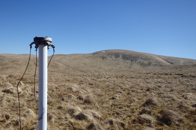
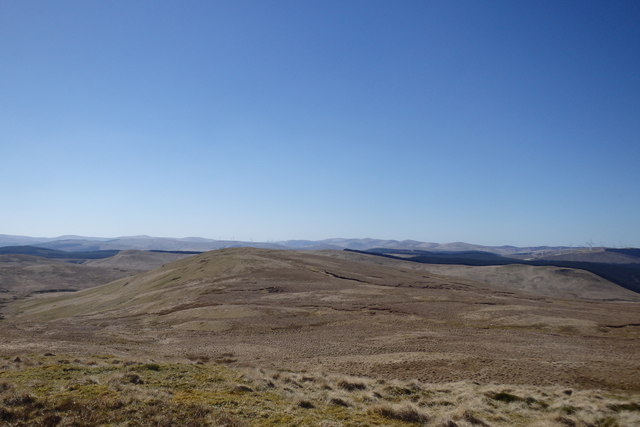
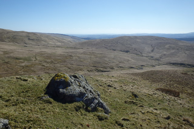
The landscape of Falla Moss is characterized by rolling downs, which are gentle slopes covered in grass and heather. These downs offer breathtaking panoramic views of the surrounding countryside, with their vibrant green hues contrasting against the ever-changing colors of the seasons. The area is also home to numerous species of wildlife, including deer, birds, and small mammals, making it a popular destination for nature photographers and birdwatchers.

The moorland in Falla Moss is equally captivating, featuring vast stretches of open land covered in heather, moss, and sparse vegetation. This unique ecosystem provides a habitat for a diverse range of plant and animal species, some of which are rare and protected. The moorland is also renowned for its tranquil atmosphere, offering visitors a peaceful and serene environment to explore.

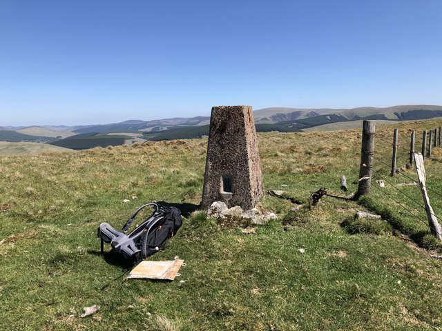
Aside from its natural beauty, Falla Moss also has a rich cultural and historical heritage. The area is dotted with archaeological sites, such as ancient burial mounds and stone circles, providing a glimpse into the lives of the people who once inhabited this land.

Whether you are seeking a tranquil retreat, an opportunity to immerse yourself in nature, or a chance to explore the history of the area, Falla Moss in Peeblesshire offers a truly remarkable experience for all who visit.

If you have any feedback on the listing, please let us know in the comments section below.

Falla Moss Images

Images are sourced within 2km of 55.434743/-3.4553298 or Grid Reference NT0816. Thanks to Geograph Open Source API. All images are credited.

Carterhope Rig Rather wet underfoot.
Carterhope Rig
Rather wet underfoot.
Macrule Hill Rough grazing around Fruid, very wet underfoot.
Macrule Hill
Rough grazing around Fruid, very wet underfoot.
Stell, Hawkshaw Burn Rough grazing near Fruid.
Stell, Hawkshaw Burn
Rough grazing near Fruid.
Hawkshaw Burn View from Carterhope Rig.
Hawkshaw Burn
View from Carterhope Rig.
Craigmaid Seen across the gathering grounds of the Hawkshaw Burn
Craigmaid
Seen across the gathering grounds of the Hawkshaw Burn
Head of the Hawkshaw Burn A quadbike track, so useful in this tussock filled wet wasteland recedes into the distance - it looks like desert, but is a bog.
Head of the Hawkshaw Burn
A quadbike track, so useful in this tussock filled wet wasteland recedes into the distance - it looks like desert, but is a bog.
Stell, Hawkshaw Burn Wet grazing which so far has dodged the Sitka and wind turbines.
Stell, Hawkshaw Burn
Wet grazing which so far has dodged the Sitka and wind turbines.
Hass of Macrule Foreground grassy ridge with the snow covered bulk of Hart Fell beyond.
Hass of Macrule
Foreground grassy ridge with the snow covered bulk of Hart Fell beyond.
Carterhope Rig Quadbike tracks make progress across the sodden tussocks easier.
Carterhope Rig
Quadbike tracks make progress across the sodden tussocks easier.
Post Under Ballaman Hill Looking towards Hart Fell. Purpose of post unknown.
Post Under Ballaman Hill
Looking towards Hart Fell. Purpose of post unknown.
On Barncorse Knowe Looking towards The Crown of Scotland
On Barncorse Knowe
Looking towards The Crown of Scotland
Descending The Crown of Scotland Above Powskein Burn
Descending The Crown of Scotland
Above Powskein Burn
Big Tussocks One of the joys of walking off piste in the Borders
Big Tussocks
One of the joys of walking off piste in the Borders
Path junction, Onweather Hill Path on the left leads up to Little Onweather Hill.
Path junction, Onweather Hill
Path on the left leads up to Little Onweather Hill.
Bridge over Cor Water Small concrete bridge carries the track over Cor Water.
Bridge over Cor Water
Small concrete bridge carries the track over Cor Water.
The summit of Craigmaid, 553m The extensive forestry seen is in the vicinity of the Fruid and Talla Reservoirs.
The summit of Craigmaid, 553m
The extensive forestry seen is in the vicinity of the Fruid and Talla Reservoirs.
Colin Craig and Cor Water The country on the right has been despoiled by sitka spruce. The open moorland on the left is, I understand, likely to be despoiled by a large wind farm.

The Cor Water in the centre is here seen looking upstream, near its headwaters. It, or one of its feeder burns, has a strong claim to be "the source of the River Tweed". But the official source near the A701 (in NT0514) has the advantage that it can be seen by tourists, and so might be a (frankly rather boring) visitor attraction.
Colin Craig and Cor Water
The country on the right has been despoiled by sitka spruce. The open moorland on the left is, I understand, likely to be despoiled by a large wind farm. The Cor Water in the centre is here seen looking upstream, near its headwaters. It, or one of its feeder burns, has a strong claim to be "the source of the River Tweed". But the official source near the A701 (in NT0514) has the advantage that it can be seen by tourists, and so might be a (frankly rather boring) visitor attraction.
On Bught Shank Taken from the edge of the forestry.
On Bught Shank
Taken from the edge of the forestry.
Show me another place!

Falla Moss is located at Grid Ref: NT0816 (Lat: 55.434743, Lng: -3.4553298)

Unitary Authority: The Scottish Borders

Police Authority: The Lothians and Scottish Borders

What 3 Words

///outboard.create.locals. Near Moffat, Dumfries & Galloway

Nearby Locations

Falla Moss Falla Moss

Related Wikis

Fruid Reservoir

Fruid is a small reservoir in the Scottish Borders area of Scotland, UK, near Menzion. It is formed by damming the Fruid Water, and supplements the contents...

Annanhead Hill

Annanhead Hill is a 478-metre (1,568 ft) summit in the Moffat Hills of Scotland. It lies on the boundary between the Scottish Borders and Dumfries and...

Devil's Beef Tub

The Devil's Beef Tub (Marquis of Annandale's Beef-Tub, Beef-Stand, MacCleran's Loup) is a deep, dramatic hollow in the hills north of the Scottish town...

Hart Fell

Hart Fell is a hill in the Moffat Hills range, part of the Southern Uplands of Scotland. It lies north of the town of Moffat on the border with the Scottish...

Have you been to Falla Moss?

Leave your review of Falla Moss below (or comments, questions and feedback).