Adelaide Gardens

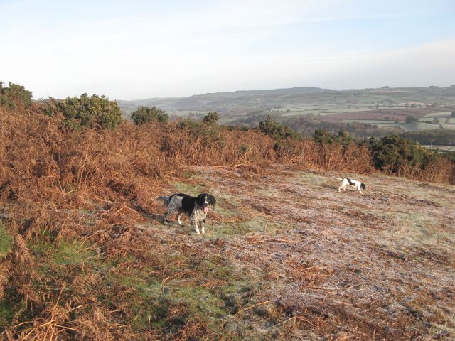
Downs, Moorland in Brecknockshire

Wales

Adelaide Gardens

Footpath to Pen-y-Crug
Footpath to Pen-y-Crug Credit: Gareth James

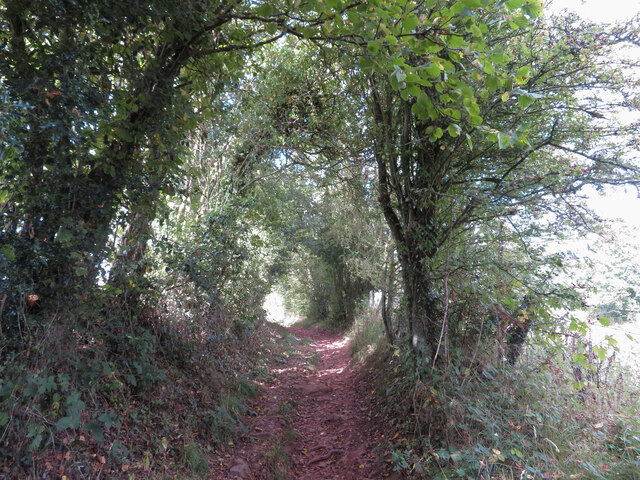
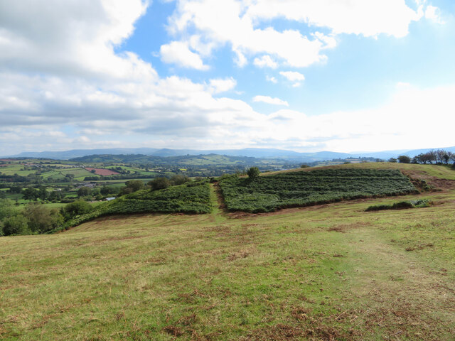
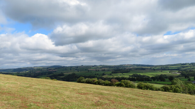
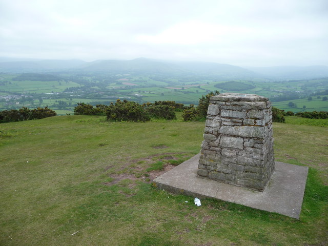
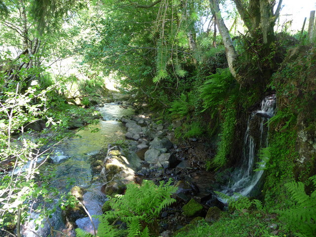
Adelaide Gardens is a picturesque green space located in the county of Brecknockshire, situated within the Downs and Moorland region of the United Kingdom. Spanning over a vast area, the gardens offer an enchanting escape for nature enthusiasts and visitors seeking tranquility amidst breathtaking landscapes.

The gardens boast a diverse range of flora and fauna, with an abundance of colorful flowers, towering trees, and well-maintained lawns. The carefully curated flower beds showcase a variety of species, including roses, daisies, and lavender, providing a delightful visual feast for visitors throughout the seasons.

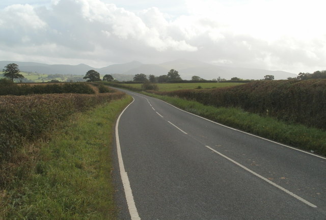
A network of winding paths and walkways meanders through the gardens, inviting visitors to explore and discover hidden gems along the way. These paths lead to secluded benches, perfect for relaxation and contemplation while enjoying the fresh air and stunning views.

Adelaide Gardens is also home to a charming pond, where ducks and other aquatic wildlife can be observed. The peaceful atmosphere around the pond offers a sense of serenity, making it an ideal spot for picnics or simply unwinding amidst nature's beauty.

The gardens are well-maintained by a dedicated team of gardeners, ensuring that the grounds remain in pristine condition year-round. Additionally, regular events and exhibitions take place within Adelaide Gardens, showcasing local artists and musicians, further enhancing the cultural experience for visitors.

With its idyllic setting, diverse flora, and tranquil ambiance, Adelaide Gardens in Brecknockshire is a must-visit destination for nature lovers and those seeking a peaceful retreat in the heart of the Downs and Moorland region.

If you have any feedback on the listing, please let us know in the comments section below.

Adelaide Gardens Images

Images are sourced within 2km of 51.946128/-3.4032327 or Grid Reference SO0328. Thanks to Geograph Open Source API. All images are credited.

Footpath to Pen-y-Crug
View south-east from Pen-y-crug
View north-east from Pen-y-crug
Trig point on Pen-y-crug
The summit trig point of Pen-y-crug near Brecon On a clearer day this spot commands excellent views of the Beacons and is an excellent alternative place to walk to admire the mountains. An Iron Age hillfort was established on the summit and the multivallate ditches and ramparts are well preserved. Ferns obstruct the site in high summer.
The summit trig point of Pen-y-crug near Brecon
On a clearer day this spot commands excellent views of the Beacons and is an excellent alternative place to walk to admire the mountains. An Iron Age hillfort was established on the summit and the multivallate ditches and ramparts are well preserved. Ferns obstruct the site in high summer.
B4520 heads south towards Brecon The northern boundary of Brecon <a title="https://www.geograph.org.uk/photo/3403408" href="https://www.geograph.org.uk/photo/3403408">Link</a> is about 600 metres ahead.
B4520 heads south towards Brecon
The northern boundary of Brecon Link is about 600 metres ahead.
sheep grazing near summit of Pen-y-crug Pen-y-crug is a modest hill, (but a HuMP - a hill with at least 100m. prominence), north-west of Brecon. The sheep are feeding on rough grazing land with gorse bushes nearby and close to the earth ramparts of an Iron Age fort. The distant wooded hill is Moel Fenni Fach, where there's another hill fort though that one is obscured by tree cover.
sheep grazing near summit of Pen-y-crug
Pen-y-crug is a modest hill, (but a HuMP - a hill with at least 100m. prominence), north-west of Brecon. The sheep are feeding on rough grazing land with gorse bushes nearby and close to the earth ramparts of an Iron Age fort. The distant wooded hill is Moel Fenni Fach, where there's another hill fort though that one is obscured by tree cover.
Hill slopes below Pen-y-crug The slopes lie south-east of Pen-y-crug, a modest hill rising to 331m, close to Brecon.
Hill slopes below Pen-y-crug
The slopes lie south-east of Pen-y-crug, a modest hill rising to 331m, close to Brecon.
Pen y Crug Cerddwyr yn anelu at Ben y Crug, bryngaer o'r Oes Haearn.

Walkers heading towards Pen y Crug, an Iron Age Hillfort (trans. hilltop).
Pen y Crug
Cerddwyr yn anelu at Ben y Crug, bryngaer o'r Oes Haearn. Walkers heading towards Pen y Crug, an Iron Age Hillfort (trans. hilltop).
Pen-y-crug trig point The triangulation pillar on Pen-y-crug has been augmented with new stonework and some patriotic symbols. The image was captured quite early on the first frosty morning of the year, with sublime views of the Fforest Fawr. There is a very strong resonance in this district between the siting of hill forts and their subsequent use for triangulation points by the Ordnance Survey.
Pen-y-crug trig point
The triangulation pillar on Pen-y-crug has been augmented with new stonework and some patriotic symbols. The image was captured quite early on the first frosty morning of the year, with sublime views of the Fforest Fawr. There is a very strong resonance in this district between the siting of hill forts and their subsequent use for triangulation points by the Ordnance Survey.
Bracken clearance A previous submission mentioned a problem with bracken, so it is good to see an effort being made to curtail this menace, or at least to collect and remove the dried foliage. My Geograph assistants certainly appreciate the work that has been done.
Bracken clearance
A previous submission mentioned a problem with bracken, so it is good to see an effort being made to curtail this menace, or at least to collect and remove the dried foliage. My Geograph assistants certainly appreciate the work that has been done.
Trig point, Pen-y-crug  Trig point, complete with Welsh dragon, on the summit of Pen-y-crug, 331m above sea level.
Trig point, Pen-y-crug
Trig point, complete with Welsh dragon, on the summit of Pen-y-crug, 331m above sea level.
Drifted snow beside a lane This lane is a bridleway just to the north of Brecon.  Last week's heavy snowfall is still very evident here with snow lying where it was blown and drifted.
Drifted snow beside a lane
This lane is a bridleway just to the north of Brecon. Last week's heavy snowfall is still very evident here with snow lying where it was blown and drifted.
Edge of farm land The path approaches a stile permitting access to the Access Land surrounding Pen-y-crug.
Edge of farm land
The path approaches a stile permitting access to the Access Land surrounding Pen-y-crug.
Path descending Pen-y-crug Looking south-east along the line of the Crug Villa path.
Path descending Pen-y-crug
Looking south-east along the line of the Crug Villa path.
View south from Pen-y-crug trig Wide-angle shot showing the peaks of the Beacons to the right and Brecon town in the valley left.
Being an outlier, Pen-y-crug is renowned locally for providing some of the best views of the Brecon Beacons and Black Mountains.
View south from Pen-y-crug trig
Wide-angle shot showing the peaks of the Beacons to the right and Brecon town in the valley left. Being an outlier, Pen-y-crug is renowned locally for providing some of the best views of the Brecon Beacons and Black Mountains.
Hillfort ramparts, Pen-y-crug On the south side of the hill, looking west.
Hillfort ramparts, Pen-y-crug
On the south side of the hill, looking west.
View west from Pen-y-crug Being an outlier, Pen-y-crug is renowned locally for providing some of the best views of the Brecon Beacons and Black Mountains.
Looking over the part-wooded Y Gaer hill fort in the middle distance, to Fan Brycheiniog over 20km distant, in SN8221.
View west from Pen-y-crug
Being an outlier, Pen-y-crug is renowned locally for providing some of the best views of the Brecon Beacons and Black Mountains. Looking over the part-wooded Y Gaer hill fort in the middle distance, to Fan Brycheiniog over 20km distant, in SN8221.
Show me another place!

Adelaide Gardens is located at Grid Ref: SO0328 (Lat: 51.946128, Lng: -3.4032327)

Unitary Authority: Powys

Police Authority: Dyfed Powys

What 3 Words

///joggers.blurs.swerving. Near Brecon, Powys

Related Wikis

St David's Church, Llanfaes

St. David's Church (or Llanfaes Church; Llandewi yn y Maes [St. David's in the Field]) is located in Brecon, Powys, Mid Wales.St. David's Church was reckoned...

Newton House (Brecon, Powys)

Newton house near Brecon in Powys is an important Grade I listed 16th Century house which retains much of its original features including a screen, plasterwork...

Afon Tarell

The Afon Tarell is a river in Powys, Wales, which rises to the west of the Brecon Beacons in Brecon Beacons National Park and flows north, then north-east...

Christ College, Brecon

Christ College, Brecon, is a co-educational, boarding and day independent school, located in the cathedral and market town of Brecon in mid-Wales. It currently...

Nearby Amenities

Located within 500m of 51.946128,-3.4032327
Traffic Calming: yes
Lat/Long: 51.9472562/-3.3988698
Traffic Calming: ramp
Lat/Long: 51.9459312/-3.4062053
Traffic Signals
Lat/Long: 51.945416/-3.4071356
Traffic Calming: ramp
Lat/Long: 51.9460555/-3.4061254
Traffic Signals
Lat/Long: 51.9468409/-3.3963667
Traffic Calming: choker
Lat/Long: 51.9464629/-3.4053319
Post Box
Operator: Royal Mail
Operator Wikidata: Q638098
Lat/Long: 51.9448409/-3.405316
Waste Basket
Lat/Long: 51.9463472/-3.3981712
Bus Stop
Bench: no
Bus: yes
Public Transport: platform
Shelter: no
Tactile Paving: no
Lat/Long: 51.9440473/-3.4070319
Waste Basket
Lat/Long: 51.9447752/-3.4044849
Bench
Backrest: yes
Colour: brown
Material: wood
Seats: 2
Lat/Long: 51.946369/-3.3980936
Barrier: bollard
Bicycle: permissive
Foot: yes
Lat/Long: 51.9467562/-3.399343
Pub
The Drovers Arms
Wheelchair: no
Wikidata: Q29486035
Lat/Long: 51.9449774/-3.4040297
Power: pole
Lat/Long: 51.9421005/-3.4051425
Power: pole
Lat/Long: 51.9425602/-3.4069628
Cafe
Llanfaes Dairy
Addr City: Brecon
Addr Country: GB
Addr Housenumber: 19
Addr Postcode: LD3 8AH
Addr Street: Bridge Street
Fhrs Id: 298409
Wheelchair: limited
Lat/Long: 51.9469579/-3.3962631
Bus Stop
Llanfaes, St David's Church
Bus: yes
Naptan AtcoCode: 5610AWE90331
Naptan NaptanCode: powpgtm
Public Transport: platform
Lat/Long: 51.9451999/-3.401795
Traffic Calming: yes
Lat/Long: 51.946703/-3.3986282
Location Transition: yes
Power: pole
Lat/Long: 51.9423072/-3.4019932
Power: pole
Lat/Long: 51.9417847/-3.4034818
Direction: SSE
Generator Method: photovoltaic
Generator Output Electricity: yes
Generator Solar Modules: 16
Generator Source: solar
Generator Type: solar_photovoltaic_panel
Location: roof
Power: generator
Lat/Long: 51.9474185/-3.4006489
Direction: WSW
Generator Method: photovoltaic
Generator Output Electricity: yes
Generator Solar Modules: 12
Generator Source: solar
Generator Type: solar_photovoltaic_panel
Location: roof
Power: generator
Lat/Long: 51.9458183/-3.4038358
Direction: SW
Generator Method: photovoltaic
Generator Output Electricity: yes
Generator Solar Modules: 20
Generator Source: solar
Generator Type: solar_photovoltaic_panel
Location: roof
Power: generator
Lat/Long: 51.9437001/-3.4093688
Direction: SW
Generator Method: photovoltaic
Generator Output Electricity: yes
Generator Solar Modules: 20
Generator Source: solar
Generator Type: solar_photovoltaic_panel
Location: roof
Power: generator
Lat/Long: 51.9437662/-3.4092347
Direction: SW
Generator Method: photovoltaic
Generator Output Electricity: yes
Generator Solar Modules: 15
Generator Source: solar
Generator Type: solar_photovoltaic_panel
Location: roof
Power: generator
Lat/Long: 51.9437253/-3.4093205
Direction: SW
Generator Method: photovoltaic
Generator Output Electricity: yes
Generator Solar Modules: 10
Generator Source: solar
Generator Type: solar_photovoltaic_panel
Location: roof
Power: generator
Lat/Long: 51.9437439/-3.4092803
Direction: 235
Generator Method: photovoltaic
Generator Output Electricity: yes
Generator Solar Modules: 32
Generator Source: solar
Generator Type: solar_photovoltaic_panel
Location: roof
Power: generator
Lat/Long: 51.9431108/-3.4081174
Direction: 190
Generator Method: photovoltaic
Generator Output Electricity: yes
Generator Solar Modules: 8
Generator Source: solar
Generator Type: solar_photovoltaic_panel
Location: roof
Power: generator
Lat/Long: 51.9450216/-3.4056285
Direction: 215
Generator Method: photovoltaic
Generator Output Electricity: yes
Generator Solar Modules: 6
Generator Source: solar
Generator Type: solar_photovoltaic_panel
Location: roof
Power: generator
Lat/Long: 51.9438008/-3.4060483
Silver Street Brecon
Brand: National Grid
Brand Wikidata: Q1465461
Operator: National Grid Electricity Distribution Plc
Operator Old: Western Power Distribution
Operator Wikidata: Q7988183
Owner: National Grid Electricity Distribution (South Wales) Plc
Owner Wikidata: Q114397937
Power: substation
Ref: 614721
Voltage: 11000
Lat/Long: 51.9471245/-3.396855
Masons Row
Brand: National Grid
Brand Wikidata: Q1465461
Operator: National Grid Electricity Distribution Plc
Operator Old: Western Power Distribution
Operator Wikidata: Q7988183
Owner: National Grid Electricity Distribution (South Wales) Plc
Owner Wikidata: Q114397937
Power: substation
Ref: 614716
Voltage: 11000
Lat/Long: 51.9481031/-3.3995634
Llanfaes
Place: suburb
Lat/Long: 51.9455683/-3.4010204
Bus Stop
Llanfaes, St David's Church
Bus: yes
Naptan AtcoCode: 5610AWE90330
Naptan NaptanCode: powpgtj
Public Transport: platform
Lat/Long: 51.9453611/-3.4011926
The data included in this document is from www.openstreetmap.org. The data is made available under ODbL.

Have you been to Adelaide Gardens?

Leave your review of Adelaide Gardens below (or comments, questions and feedback).