Cobbinshaw Moss
Downs, Moorland in Midlothian
Scotland
Cobbinshaw Moss
![South Cobbinshaw Seen from North Cobbinshaw, looking across the reservoir from near the start of the causeway. The reservoir is the source of water for the Union Canal [Edinburgh-Falkirk], entering at Linn's Mill via the Bog Burn, Murieston Water, Linhouse water and the River Almond.](https://s3.geograph.org.uk/geophotos/02/81/09/2810967_459de6cf.jpg)
Cobbinshaw Moss is a vast expanse of wetland located in Midlothian, Scotland. Covering an area of approximately 250 hectares, it is a designated Site of Special Scientific Interest (SSSI) due to its rich biodiversity and unique ecological importance.
The moss is primarily composed of peat, which has accumulated over thousands of years, creating a distinctive landscape. It is surrounded by gently rolling hills and is located near the Pentland Hills Regional Park, adding to its scenic beauty.
The site is home to a diverse range of plant and animal species. Sphagnum moss dominates the area, forming thick carpets that retain water, creating a unique habitat for rare plants such as bog rosemary, cotton grass, and sundew. These plants have adapted to the acidic and waterlogged conditions of the moss.
Cobbinshaw Moss also supports a variety of bird species, including curlews, lapwings, and snipe, which nest in the wet grassland areas. The site is an important breeding ground for these birds, and their presence adds to the ecological significance of the moss.
Visitors to Cobbinshaw Moss can enjoy its natural beauty through a network of footpaths and boardwalks. These allow visitors to explore the moss while minimizing disturbance to the delicate ecosystem. The moss is a popular spot for nature enthusiasts, birdwatchers, and photographers, who come to appreciate the tranquility and unique wildlife that can be found here.
If you have any feedback on the listing, please let us know in the comments section below.
Cobbinshaw Moss Images
Images are sourced within 2km of 55.792889/-3.5389689 or Grid Reference NT0356. Thanks to Geograph Open Source API. All images are credited.


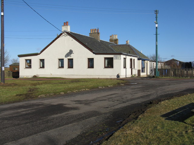


![The road to Tarbrax A modified turning off the A70 [Lang Wang] which, after another turn, will lead to Tarbrax, a small isolated village left over from the oil-shale mining era of the 19C.](https://s1.geograph.org.uk/geophotos/02/81/10/2811029_1f02a850.jpg)
![Tarbrax Village Hall sign On the Lanark Road [A70, Lang Whang] at the turning off to Tarbrax and, in the other direction, where the path across the Pentland Hills to West Linton and Dolphinton via the Covenanter's Grave, leaves the road.](https://s1.geograph.org.uk/geophotos/02/81/10/2811057_053f07e7.jpg)

![The A70 [Lang Whang] near Tarbrax.](https://s3.geograph.org.uk/geophotos/02/81/10/2811067_a03d41e4.jpg)


Cobbinshaw Moss is located at Grid Ref: NT0356 (Lat: 55.792889, Lng: -3.5389689)
Unitary Authority: West Lothian
Police Authority: The Lothians and Scottish Borders
What 3 Words
///sudden.suiting.prospers. Near West Calder, West Lothian
Nearby Locations
Related Wikis
Tarbrax
Tarbrax (Scottish Gaelic: "An Tòrr Breac" - meaning "the speckled tor") is a small village in the Parish of Carnwath, South Lanarkshire, Scotland. It...

Cobbinshaw Reservoir
Cobbinshaw Reservoir is a reservoir in West Lothian, Scotland. It is situated near the Pentland Hills, 5 km south of West Calder. The 310-acre (1.3 km2...

Cobbinshaw
Cobbinshaw is a small hamlet in West Lothian, Scotland. It is at the end of a dead end road from nearby Woolfords. Cobbinshaw is at 1,000 feet (300 m...
Cobbinshaw railway station
Cobbinshaw railway station was on the Caledonian Railway Edinburgh to Carstairs line sited near a village called Woolfords in South Lanarkshire. The freight...
Have you been to Cobbinshaw Moss?
Leave your review of Cobbinshaw Moss below (or comments, questions and feedback).