Haile

Settlement in Cumberland Copeland

England

Haile

Farm track to Moor House Farm Farm track bounded by hedgerows
Farm track to Moor House Farm Credit: P Gaskell

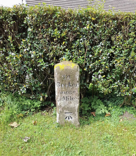
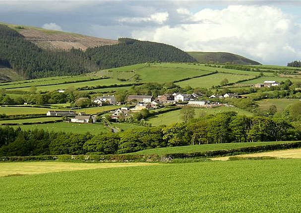
Haile is a small village located in the county of Cumberland in Northwest England. Situated approximately 8 miles southwest of the city of Carlisle, Haile falls within the civil parish of Beckermet. With a population of around 400 residents, it is a close-knit community surrounded by picturesque countryside.

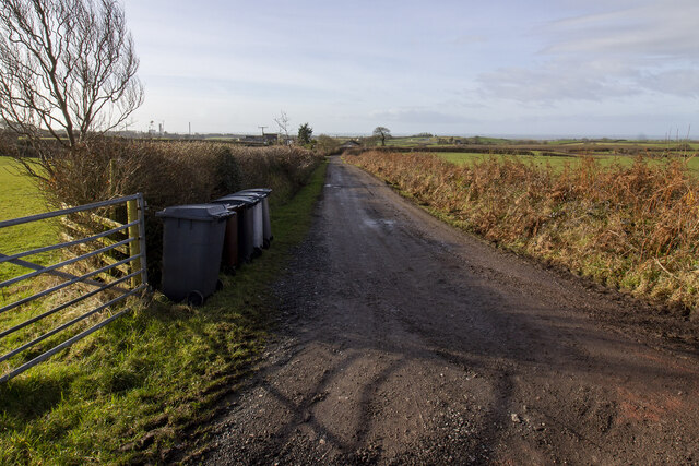
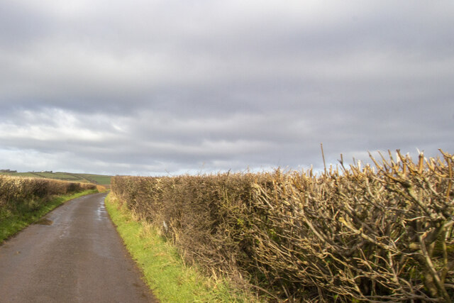
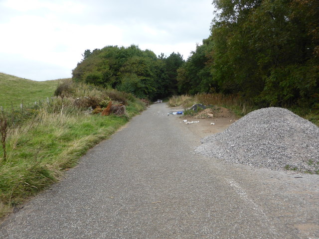
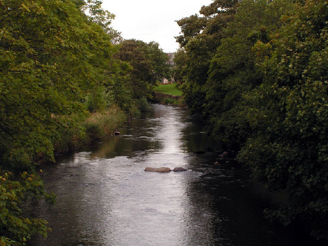
Historically, Haile has strong roots in agriculture, with farming playing a significant role in the village's economy. The landscape is characterized by rolling hills, meandering streams, and lush green fields, providing a beautiful backdrop for residents and visitors alike.

The village boasts a charming mix of traditional stone-built houses and more modern dwellings, creating a distinct architectural blend. Haile is also home to the St. Giles Church, a Grade I listed building dating back to the 12th century. This historic place of worship adds to the village's cultural and historical significance.

Although relatively small, Haile offers a range of amenities to cater to its residents' needs. These include a village hall, a primary school, and a local pub, providing a central hub for socializing and community events.

The surrounding area offers numerous opportunities for outdoor activities, such as hiking, cycling, and fishing, making Haile an attractive destination for nature lovers and outdoor enthusiasts. Additionally, the nearby Lake District National Park, with its stunning landscapes and recreational facilities, is within easy reach.

Overall, Haile is a peaceful and picturesque village, offering a close community spirit and a tranquil rural setting.

If you have any feedback on the listing, please let us know in the comments section below.

Haile Images

Images are sourced within 2km of 54.46464/-3.493063 or Grid Reference NY0308. Thanks to Geograph Open Source API. All images are credited.

Farm track to Moor House Farm Farm track bounded by hedgerows
Farm track to Moor House Farm
Farm track bounded by hedgerows
Road at Sheepfields Farm Road at Sheepfields Farm bounded by hedgerows
Road at Sheepfields Farm
Road at Sheepfields Farm bounded by hedgerows
Farmstead in Haile village Vernacular farm building and farmhouse
Farmstead in Haile village
Vernacular farm building and farmhouse
Field next to Carletonmoor Woods Gateway entering field next to Carletonmoor Woods
Field next to Carletonmoor Woods
Gateway entering field next to Carletonmoor Woods
Road approaching Scurgill Approaching Scurgill from Carletonmoor Woods
Road approaching Scurgill
Approaching Scurgill from Carletonmoor Woods
Old Milestone by Hardgates Road, south of Haile Carved stone post by the UC road, in parish of HAILE (COPELAND District), Hardgates Road, by "Langdale", on grass verge at T-junction, on West side of road. Egremont stone, erected by the Egremont to Salthouse turnpike trust in the 19th century. 

Inscription reads:-
: To / Calder / Bridge / 2 Miles : : TO / Becker / mont / ½ Mile : 
Carved benchmark on lower right face.

Grade II Listed. List Entry Number: 1063738 <span class="nowrap"><a title="https://historicengland.org.uk/listing/the-list/list-entry/1063738" rel="nofollow ugc noopener" href="https://historicengland.org.uk/listing/the-list/list-entry/1063738">Link</a><img style="margin-left:2px;" alt="External link" title="External link - shift click to open in new window" src="https://s1.geograph.org.uk/img/external.png" width="10" height="10"/></span>

Milestone Society National ID: CU_CBBM02.
Old Milestone by Hardgates Road, south of Haile
Carved stone post by the UC road, in parish of HAILE (COPELAND District), Hardgates Road, by "Langdale", on grass verge at T-junction, on West side of road. Egremont stone, erected by the Egremont to Salthouse turnpike trust in the 19th century. Inscription reads:- : To / Calder / Bridge / 2 Miles : : TO / Becker / mont / ½ Mile : Carved benchmark on lower right face. Grade II Listed. List Entry Number: 1063738 LinkExternal link Milestone Society National ID: CU_CBBM02.
Road to Grange Brow Road to Grange Brow with hedgerows
Road to Grange Brow
Road to Grange Brow with hedgerows
Farmstead at Grange Farmstead at Grange with vernacular and modern farm buildings
Farmstead at Grange
Farmstead at Grange with vernacular and modern farm buildings
Barn conversion, Oxenriggs Farm
The old road is now a dumping ground
Silage store on the old road near Beckermet The old road is now a public footpath.
Silage store on the old road near Beckermet
The old road is now a public footpath.
Castle Earthworks This is private farmland and it's not possible to get closer to the prominent castle site.
Castle Earthworks
This is private farmland and it's not possible to get closer to the prominent castle site.
Ordnance Survey Cut Mark This OS cut mark can be found on the roadside building at Town End Farm. It marks a point 78.367m above mean sea level.
Ordnance Survey Cut Mark
This OS cut mark can be found on the roadside building at Town End Farm. It marks a point 78.367m above mean sea level.
Milestone - Calder Bridge 2 The OS cut mark on the stone marks a point 82.320m above mean sea level.
Milestone - Calder Bridge 2
The OS cut mark on the stone marks a point 82.320m above mean sea level.
Old Milestone by Hardgates Road, south of Haile Carved stone post by the UC road, in parish of HAILE (COPELAND District), Hardgates Road, by "Langdale", on grass verge at T-junction, on West side of road. Egremont stone, erected by the Egremont to Salthouse turnpike trust in the 19th century. 

Inscription reads:-
: To / Calder / Bridge / 2 Miles : : TO / Becker / mont / ½ Mile : 
Carved benchmark on lower right face.

Grade II Listed. List Entry Number: 1063738
<span class="nowrap"><a title="https://historicengland.org.uk/listing/the-list/list-entry/1063738" rel="nofollow ugc noopener" href="https://historicengland.org.uk/listing/the-list/list-entry/1063738">Link</a><img style="margin-left:2px;" alt="External link" title="External link - shift click to open in new window" src="https://s1.geograph.org.uk/img/external.png" width="10" height="10"/></span>

Milestone Society National ID: CU_CBBM02.
Old Milestone by Hardgates Road, south of Haile
Carved stone post by the UC road, in parish of HAILE (COPELAND District), Hardgates Road, by "Langdale", on grass verge at T-junction, on West side of road. Egremont stone, erected by the Egremont to Salthouse turnpike trust in the 19th century. Inscription reads:- : To / Calder / Bridge / 2 Miles : : TO / Becker / mont / ½ Mile : Carved benchmark on lower right face. Grade II Listed. List Entry Number: 1063738 LinkExternal link Milestone Society National ID: CU_CBBM02.
Old Milestone in Haile Carved stone post by the UC road, in parish of HAILE (COPELAND District), Beck Brow, Haile village, T-junction against wall, on East side of road. Egremont stone, erected by the Egremont to Salthouse turnpike trust in the 19th century. 

Inscription reads:-
: To / Ennerdale / Bridge / 2 Miles : : To / Egremont / (?) Miles :   

Grade II Listed. List Entry Number: 1336075
<span class="nowrap"><a title="https://historicengland.org.uk/listing/the-list/list-entry/1336075" rel="nofollow ugc noopener" href="https://historicengland.org.uk/listing/the-list/list-entry/1336075">Link</a><img style="margin-left:2px;" alt="External link" title="External link - shift click to open in new window" src="https://s1.geograph.org.uk/img/external.png" width="10" height="10"/></span>

Milestone Society National ID: CU_CBEG.
Old Milestone in Haile
Carved stone post by the UC road, in parish of HAILE (COPELAND District), Beck Brow, Haile village, T-junction against wall, on East side of road. Egremont stone, erected by the Egremont to Salthouse turnpike trust in the 19th century. Inscription reads:- : To / Ennerdale / Bridge / 2 Miles : : To / Egremont / (?) Miles : Grade II Listed. List Entry Number: 1336075 LinkExternal link Milestone Society National ID: CU_CBEG.
Field entrance off the A595, Blackbeck
A595, Blackbeck Towards Egremont.
A595, Blackbeck
Towards Egremont.
Show me another place!

Haile is located at Grid Ref: NY0308 (Lat: 54.46464, Lng: -3.493063)

Administrative County: Cumbria

District: Copeland

Police Authority: Cumbria

What 3 Words

///embarks.dummy.skyrocket. Near Egremont, Cumbria

Nearby Locations

Haile Church Hill Wood

Related Wikis

Haile, Cumbria

Haile is a small village and civil parish in Copeland district, in the county of Cumbria, England. It had a population of 617 at the 2011 Census.Nearby...
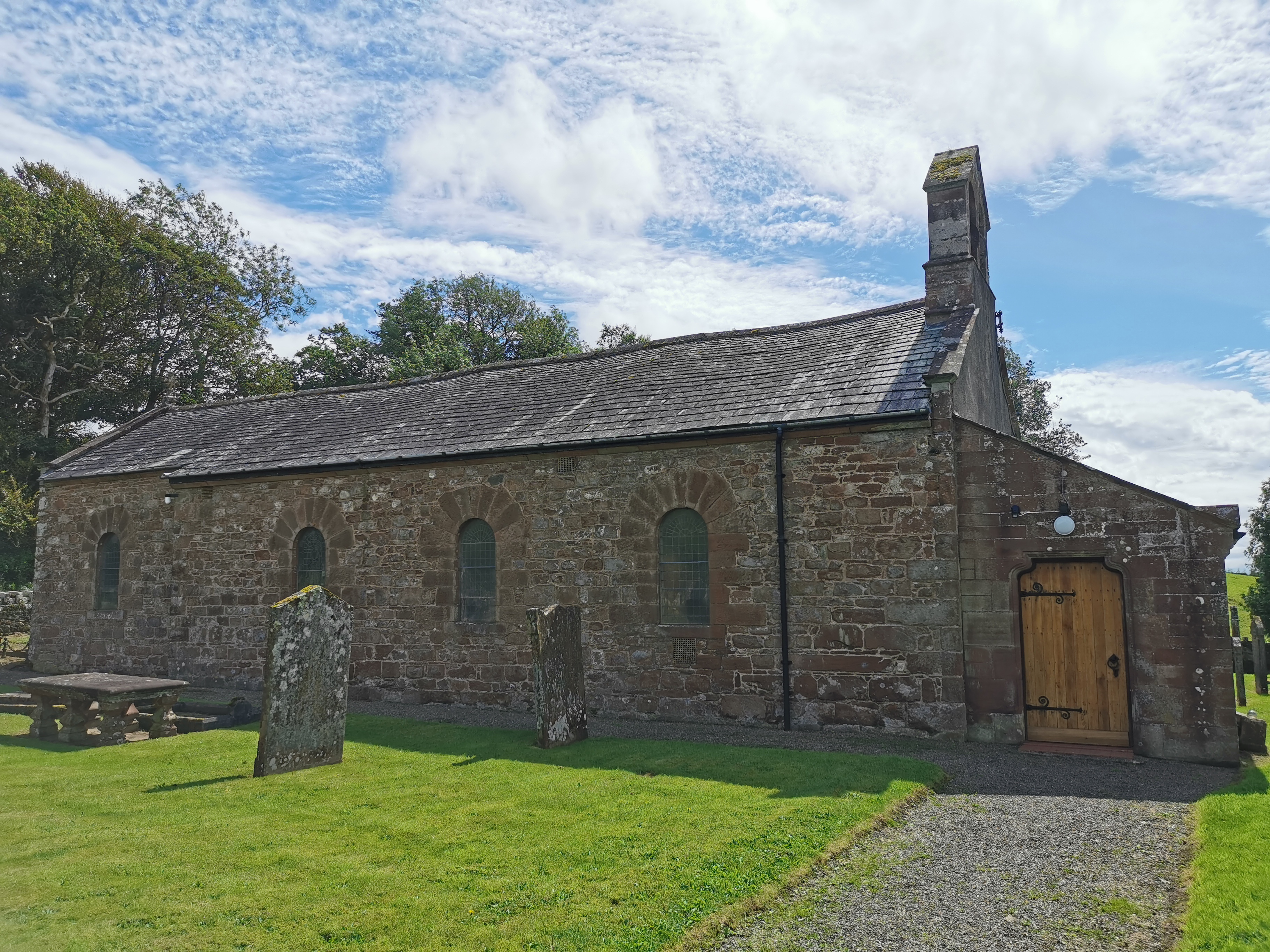
Haile Parish Church

Haile Parish Church is near Haile, Cumbria, England. It is an active Anglican parish church in the deanery of Calder, and the diocese of Carlisle. Its...

Beckermet Mines railway station

Beckermet Mines railway station was situated at Pit No.1 of the mine of the same name. It was used by workmen's trains which travelled along a branch which...

Blackbeck

Blackbeck is a small village in Cumbria, England. It is northeast of Beckermet and Sellafield, along the A595 road. It contains the Blackbeck Inn and Brow...

Thornhill, Cumbria

Thornhill is a village in the county of Cumbria, England, south of Whitehaven and north of Seascale, close to St. Bees, and only a few miles from the Irish...

Wilton, Cumbria

Wilton is a hamlet in the Copeland district, in the county of Cumbria, England. It is near the small town of Egremont. In 1870-72 it had a population of...

St Thomas Cross Platform railway station

St Thomas Cross Platform was a railway station used by workmen's trains on the Moor Row to Sellafield line on what is now the southeastern, Cringlethwaite...

St John, Beckermet

St John, Beckermet, is in Beckermet, Cumbria, England. It is an Anglican parish church in the deanery of Calder, and the diocese of Carlisle. Its benefice...

Nearby Amenities

Located within 500m of 54.46464,-3.493063
Haile
Place: village
Source: npe
Wikidata: Q2731867
Wikipedia: en:Haile, Cumbria
Lat/Long: 54.4634926/-3.4928266
Turning Circle
Lat/Long: 54.4637869/-3.4933441
Post Box
Ref: CA22 58
Lat/Long: 54.4635281/-3.4922471
Power: pole
Lat/Long: 54.4648232/-3.4955144
Power: pole
Lat/Long: 54.4641886/-3.4948647
Power: pole
Lat/Long: 54.4633856/-3.4940205
Power: pole
Lat/Long: 54.4629083/-3.4952343
Power: pole
Lat/Long: 54.4622947/-3.4967568
Power: pole
Lat/Long: 54.4617907/-3.4980583
Power: pole
Lat/Long: 54.4651289/-3.492094
Power: pole
Lat/Long: 54.4657778/-3.491772
Power: pole
Lat/Long: 54.4664257/-3.4913661
Power: pole
Lat/Long: 54.4672585/-3.4907868
Power: pole
Lat/Long: 54.4681766/-3.4901789
Power: pole
Lat/Long: 54.4675763/-3.4918348
Power: pole
Lat/Long: 54.4688477/-3.4937594
The data included in this document is from www.openstreetmap.org. The data is made available under ODbL.

Have you been to Haile?

Leave your review of Haile below (or comments, questions and feedback).