Haigh Moor

Settlement in Yorkshire

England

Haigh Moor

St Michael's East Ardsley: lych gate The lych gate is close to, but distinct from the main churchyard entrance.
St Michael's East Ardsley: lych gate Credit: Stephen Craven

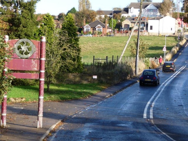
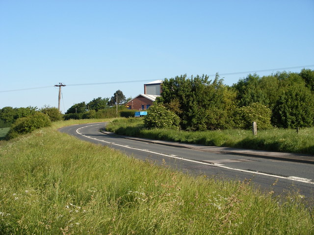
Haigh Moor is a picturesque area located in Yorkshire, England. Situated in the southern part of the county, it covers an extensive stretch of land encompassing rolling hills, dense woodlands, and open fields. The moor is known for its natural beauty and is a popular destination for outdoor enthusiasts and nature lovers.

At an elevation of approximately 250 meters, Haigh Moor offers stunning panoramic views of the surrounding countryside and nearby villages. The landscape is largely unspoiled and provides a peaceful retreat away from the hustle and bustle of urban life. The moor is home to a diverse range of flora and fauna, including heather, bilberry, and various bird species.

Visitors to Haigh Moor can enjoy a range of activities such as hiking, birdwatching, and picnicking. There are numerous trails and footpaths that crisscross the moor, allowing visitors to explore its natural wonders at their own pace. The area is also a popular spot for dog walkers, providing ample space for pets to roam and play.

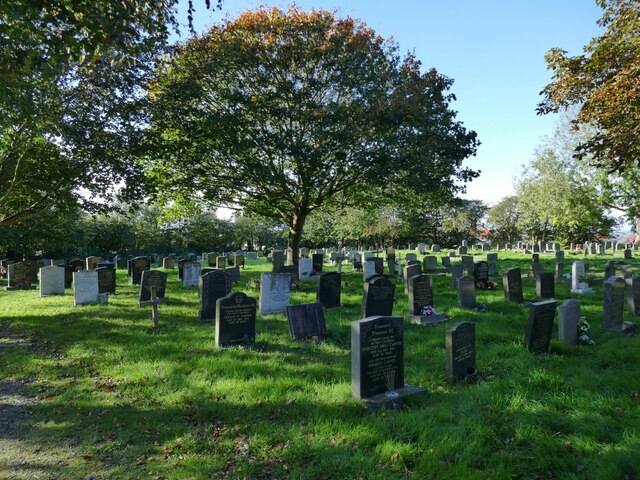
In addition to its natural attractions, Haigh Moor has historical significance. The remains of ancient settlements and burial sites have been discovered in the area, indicating human habitation dating back thousands of years. This adds an element of intrigue and fascination for those interested in the region's rich history.

Overall, Haigh Moor offers a tranquil and scenic setting for outdoor enthusiasts and those seeking a peaceful retreat in the heart of Yorkshire. Its natural beauty, diverse wildlife, and historical significance make it a must-visit destination for both locals and tourists alike.

If you have any feedback on the listing, please let us know in the comments section below.

Haigh Moor Images

Images are sourced within 2km of 53.716227/-1.569631 or Grid Reference SE2824. Thanks to Geograph Open Source API. All images are credited.

St Michael's East Ardsley: lych gate The lych gate is close to, but distinct from the main churchyard entrance.
St Michael's East Ardsley: lych gate
The lych gate is close to, but distinct from the main churchyard entrance.
St Michael's East Ardsley: war memorial The memorial is in the churchyard to the south of the church buildings. It is inscribed on all four sides with the names of the fallen of World War I, ordered by the year of death.
St Michael's East Ardsley: war memorial
The memorial is in the churchyard to the south of the church buildings. It is inscribed on all four sides with the names of the fallen of World War I, ordered by the year of death.
St Michael's East Ardsley: south side The tower is a prominent local landmark and contains a peal of eight bells and a clock by Potts of Leeds.
St Michael's East Ardsley: south side
The tower is a prominent local landmark and contains a peal of eight bells and a clock by Potts of Leeds.
St Michael's East Ardsley: south door An unusual feature for a 19th century church is this Norman doorway, retained from the earlier building on the site. It is seen here through the outer security gate of the porch.
St Michael's East Ardsley: south door
An unusual feature for a 19th century church is this Norman doorway, retained from the earlier building on the site. It is seen here through the outer security gate of the porch.
St Michael's East Ardsley: benchmark Cut into the south-west corner of the tower, with a bolt, and still looking clean-cut. See <a href="https://www.geograph.org.uk/photo/3339789">SE3025 : Benchmark on St Michael's Church</a> for a closer view. None of the older maps avaialble online seem to show it, but bench-marks.org.uk gives a value of 141.01m.
St Michael's East Ardsley: benchmark
Cut into the south-west corner of the tower, with a bolt, and still looking clean-cut. See SE3025 : Benchmark on St Michael's Church for a closer view. None of the older maps avaialble online seem to show it, but bench-marks.org.uk gives a value of 141.01m.
St Michael's East Ardsley: churchyard The churchyard is still open for burials.
St Michael's East Ardsley: churchyard
The churchyard is still open for burials.
St Michael's East Ardsley: churchyard extension The serried ranks of polished granite memorials make this look very much like a Council (secular) cemetery, but as far as I can tell it is an extension to the churchyard, just that a different style of memorial is permitted here.
St Michael's East Ardsley: churchyard extension
The serried ranks of polished granite memorials make this look very much like a Council (secular) cemetery, but as far as I can tell it is an extension to the churchyard, just that a different style of memorial is permitted here.
St Michael's East Ardsley: churchyard entrance The metal gate bears the name of the church.
St Michael's East Ardsley: churchyard entrance
The metal gate bears the name of the church.
Manhole cover, Church Lane, East Ardsley A 'no-rok' circular cover by Lees of Gomersal.
Manhole cover, Church Lane, East Ardsley
A 'no-rok' circular cover by Lees of Gomersal.
Green space, Church Lane, East Ardsley The housing beyond is relatively modern (at least compared with the 19th century church and hall).
Green space, Church Lane, East Ardsley
The housing beyond is relatively modern (at least compared with the 19th century church and hall).
St Michael's church hall, Church Lane, East Ardsley The right hand side is the original Sunday School of 1837, and on the left the 'Jubilee Wing' of 1897.
St Michael's church hall, Church Lane, East Ardsley
The right hand side is the original Sunday School of 1837, and on the left the 'Jubilee Wing' of 1897.
St Michael's church hall, Church Lane, East Ardsley (detail) Above the door are dates of construction (1837) and extension (1897). See <a href="https://www.geograph.org.uk/photo/7626300">SE3025 : St Michael's church hall, Church Lane, East Ardsley</a> for context.
St Michael's church hall, Church Lane, East Ardsley (detail)
Above the door are dates of construction (1837) and extension (1897). See SE3025 : St Michael's church hall, Church Lane, East Ardsley for context.
Blossom Cottage, Bradford Road, East Ardsley The building is end-on to the road and comprises at least two dwellings. The road is the main A650 between Bradford and Wakefield, which is still busy despite most through traffic taking the M62.
Blossom Cottage, Bradford Road, East Ardsley
The building is end-on to the road and comprises at least two dwellings. The road is the main A650 between Bradford and Wakefield, which is still busy despite most through traffic taking the M62.
Esso filling station, Bradford Road, East Ardsley With a Tesco Express as part of the offering.
Esso filling station, Bradford Road, East Ardsley
With a Tesco Express as part of the offering.
Derelict sheds, East Ardsley (1) These buildings have lost most of their cladding. There was fencing along the site boundary with dangerous structure warnings.
Derelict sheds, East Ardsley (1)
These buildings have lost most of their cladding. There was fencing along the site boundary with dangerous structure warnings.
Derelict sheds, East Ardsley (2) These buildings have lost most of their cladding. There was fencing along the site boundary with dangerous structure warnings.
Derelict sheds, East Ardsley (2)
These buildings have lost most of their cladding. There was fencing along the site boundary with dangerous structure warnings.
Field west of Pilden Lane With a horse box on the far side.
Field west of Pilden Lane
With a horse box on the far side.
Stile in the woods On the Leeds Country Way.
Stile in the woods
On the Leeds Country Way.
Show me another place!

Haigh Moor is located at Grid Ref: SE2824 (Lat: 53.716227, Lng: -1.569631)

Division: West Riding

Unitary Authority: Leeds

Police Authority: West Yorkshire

What 3 Words

///pints.likes.dent. Near Morley, West Yorkshire

Related Wikis

Beggarington Hill

Beggarington Hill is a hamlet in the county of West Yorkshire, England, in the City of Leeds and at the border of Kirklees. Historically, it was part of...

Woodkirk

Woodkirk is an ancient village between Leeds and Dewsbury, West Yorkshire, England. The parish church is a grade II listed building. It is traditionally...

Woodkirk Priory

Woodkirk Priory was a cell of Augustinian Canons in West Yorkshire, England. William, second earl of Warenne (d. 1138), had granted the land for its foundation...

Jaw Hill

Jaw Hill is a hill in the City of Leeds district of West Yorkshire, England. It is near Kirkhamgate in the City of Wakefield district. == History == A...

Nearby Amenities

Located within 500m of 53.716227,-1.569631
Traffic Calming: table
Lat/Long: 53.7145608/-1.5755721
Traffic Calming: table
Lat/Long: 53.7133663/-1.5730683
Turning Circle
Lat/Long: 53.7163043/-1.5747658
Turning Circle
Lat/Long: 53.7156784/-1.5755686
Bus Stop
Commonside
Bench: no
Bin: no
Lit: no
Local Ref: 45016096
Naptan AtcoCode: 450016096
Naptan Bearing: SE
Naptan CommonName: Commonside
Naptan Crossing: Haigh Moor Road
Naptan Indicator: Stop 45016096
Naptan PlusbusZoneRef: LEEDS
Naptan ShortCommonName: Haigh Moor Road
Naptan Street: Batley Road
Naptan Verified: yes
Ref: 45016096
Shelter: no
Source: naptan_import
Tactile Paving: no
Lat/Long: 53.7131484/-1.572509
Bus Stop
Commonside West Ardsley
Local Ref: 45016095
Naptan AtcoCode: 450016095
Naptan Bearing: N
Naptan CommonName: Commonside West Ardsley
Naptan Crossing: Batley Road
Naptan Indicator: Stop 45016095
Naptan Landmark: Church
Naptan PlusbusZoneRef: LEEDS
Naptan ShortCommonName: Batley Road
Naptan Street: Haigh Moor Road
Naptan Verified: yes
Ref: 45016095
Source: naptan_import
Lat/Long: 53.7137621/-1.5728249
Barrier: stile
Material: stone
Stile: stepover
Lat/Long: 53.7133185/-1.5730579
Post Box
Operator: Royal Mail
Post Box Type: lamp
Ref: WF3 232
Royal Cypher: EIIR
Royal Cypher Wikidata: Q33102113
Lat/Long: 53.7169249/-1.5712299
Power: substation
Lat/Long: 53.7177931/-1.5735173
West Ardsley
Place: suburb
Wikidata: Q7984320
Wikipedia: en:West Ardsley
Lat/Long: 53.717965/-1.5726504
Batley Road
Naptan AtcoCode: 450015847
Naptan Bearing: NW
Naptan BusStopType: CUS
Naptan CommonName: Batley Road
Naptan Landmark: Unknown
Naptan ShortCommonName: Batley Road
Naptan Street: Batley Road
Naptan Verified: no
Source: naptan_import
Lat/Long: 53.7120916/-1.570612
Bus Stop
Haigh Moor Road
Local Ref: 45016091
Naptan AtcoCode: 450016091
Naptan Bearing: SW
Naptan CommonName: Haigh Moor Road
Naptan Crossing: Twixt The Nook & Holly Court
Naptan Indicator: Stop 45016091
Naptan Landmark: Boyle Farm
Naptan PlusbusZoneRef: LEEDS
Naptan ShortCommonName: Boyle Hall Farm
Naptan Street: Haigh Moor Road
Naptan Verified: yes
Ref: 45016091
Shelter: no
Source: naptan_import
Lat/Long: 53.7190405/-1.5698656
Bus Stop
Haigh Moor Road Holly Court
Local Ref: 45016092
Naptan AtcoCode: 450016092
Naptan Bearing: S
Naptan CommonName: Haigh Moor Road Holly Court
Naptan Crossing: Holly Court
Naptan Indicator: Stop 45016092
Naptan PlusbusZoneRef: LEEDS
Naptan ShortCommonName: Holly Court
Naptan Street: Haigh Moor Road
Naptan Verified: yes
Ref: 45016092
Shelter: no
Source: naptan_import
Lat/Long: 53.7171712/-1.5709391
Bus Stop
Haigh Moor Road Redhill Drive
Local Ref: 45016093
Naptan AtcoCode: 450016093
Naptan Bearing: S
Naptan CommonName: Haigh Moor Road Redhill Drive
Naptan Crossing: Redhill Drive
Naptan Indicator: Stop 45016093
Naptan PlusbusZoneRef: LEEDS
Naptan ShortCommonName: Redhill Drive
Naptan Street: Haigh Moor Road
Naptan Verified: yes
Ref: 45016093
Source: naptan_import
Lat/Long: 53.7150538/-1.5720213
Bus Stop
Haigh Moor Road Redhill Drive
Local Ref: 45016094
Naptan AtcoCode: 450016094
Naptan Bearing: N
Naptan CommonName: Haigh Moor Road Redhill Drive
Naptan Crossing: Redhill Drive
Naptan Indicator: Stop 45016094
Naptan PlusbusZoneRef: LEEDS
Naptan ShortCommonName: Redhill Drive
Naptan Street: Haigh Moor Road
Naptan Verified: yes
Source: naptan_import
Lat/Long: 53.7150185/-1.5721883
Bus Stop
Batley Road Haigh Moor Road
Bench: yes
Bin: no
Check Date Shelter: 2024-03-15
Local Ref: 45016097
Naptan AtcoCode: 450016097
Naptan Bearing: NW
Naptan CommonName: Batley Road Haigh Moor Road
Naptan Crossing: Haigh Moor Road
Naptan Indicator: Stop 45016097
Naptan PlusbusZoneRef: LEEDS
Naptan ShortCommonName: Haigh Moor Road
Naptan Street: Batley Road
Naptan Verified: yes
Ref: 45016097
Shelter: yes
Source: naptan_import
Tactile Paving: no
Lat/Long: 53.713516/-1.5735173
Bus Stop
Batley Road
Check Date Shelter: 2024-03-29
Local Ref: 45016098
Naptan AtcoCode: 450016098
Naptan Bearing: NW
Naptan CommonName: Batley Road
Naptan Crossing: Woollin Avenue
Naptan Indicator: Stop 45016098
Naptan PlusbusZoneRef: LEEDS
Naptan ShortCommonName: Woollin Avenue
Naptan Street: Batley Road
Naptan Verified: yes
Ref: 45016098
Shelter: yes
Source: naptan_import
Lat/Long: 53.7147719/-1.5761607
Bus Stop
Batley Road
Local Ref: 45016309
Naptan AtcoCode: 450016309
Naptan Bearing: SE
Naptan CommonName: Batley Road
Naptan Crossing: Nr-At Haigh Moor Road (Kirkhamgate Side)
Naptan Indicator: Stop 45016309
Naptan Landmark: Haigh Hall Farm
Naptan PlusbusZoneRef: LEEDS
Naptan ShortCommonName: Haigh Hall Farm
Naptan Street: Batley Road
Naptan Verified: no
Source: naptan_import
Lat/Long: 53.7121721/-1.5705051
Haigh Moor Road West Ardsley
Local Ref: 45050378
Naptan AtcoCode: 450050378
Naptan Bearing: NE
Naptan BusStopType: CUS
Naptan CommonName: Haigh Moor Road West Ardsley
Naptan Indicator: Stop 45050378
Naptan PlusbusZoneRef: LEEDS
Naptan ShortCommonName: Boyle Hall Farm
Naptan Street: Haigh Moor Road
Naptan Verified: no
Source: naptan_import
Lat/Long: 53.7191002/-1.5699647
Haigh Moor Road Holly Court
Local Ref: 45050379
Naptan AtcoCode: 450050379
Naptan Bearing: N
Naptan BusStopType: CUS
Naptan CommonName: Haigh Moor Road Holly Court
Naptan Indicator: Stop 45050379
Naptan PlusbusZoneRef: LEEDS
Naptan ShortCommonName: Haigh Moor Avenue
Naptan Street: Haigh Moor Road
Naptan Verified: no
Source: naptan_import
Lat/Long: 53.7171897/-1.5710753
Batley Road Woollin Avenue
Local Ref: 45050380
Naptan AtcoCode: 450050380
Naptan Bearing: SE
Naptan BusStopType: CUS
Naptan CommonName: Batley Road Woollin Avenue
Naptan Indicator: Stop 45050380
Naptan PlusbusZoneRef: LEEDS
Naptan ShortCommonName: Woollin Avenue
Naptan Street: Batley Road
Naptan Verified: no
Source: naptan_import
Lat/Long: 53.7148524/-1.5760539
Kindergarten
Kaleidoscope Day Nurseries
Addr City: Wakefield
Addr Housename: West Ardsley Community Centre
Addr Postcode: WF3 1HD
Addr Street: Batley Road
Addr Suburb: West Ardsley
Fhrs Id: 321535
Lat/Long: 53.7157109/-1.5768217
Waste Basket
Ref UK Leedscc Bin: 1200
Lat/Long: 53.719505/-1.568499
Waste Basket
Ref UK Leedscc Bin: 1201
Lat/Long: 53.716742/-1.571301
Waste Basket
Ref UK Leedscc Bin: 1202
Lat/Long: 53.713763/-1.57269
Barrier: stile
Lat/Long: 53.714023/-1.5715882
The data included in this document is from www.openstreetmap.org. The data is made available under ODbL.

Have you been to Haigh Moor?

Leave your review of Haigh Moor below (or comments, questions and feedback).