Beer Moors
Downs, Moorland in Somerset Somerset West and Taunton
England
Beer Moors

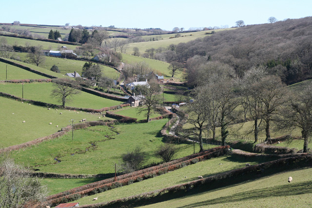
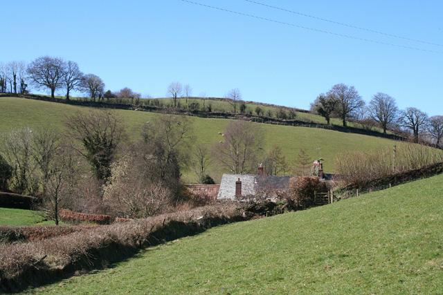
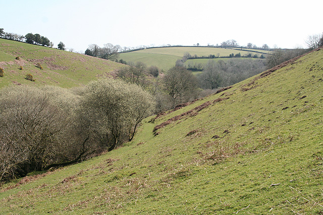
Beer Moors is a stunning natural landscape located in Somerset, England. Spread across a vast area, it encompasses both downs and moorland, offering visitors a diverse and panoramic view of the countryside. The moors are situated near the village of Beer, which is nestled within the Quantock Hills Area of Outstanding Natural Beauty.
The moorland section of Beer Moors is characterized by its open and undulating terrain, covered in heather and gorse. This creates a vibrant and colorful landscape, particularly during the summer months when the moors come alive with the purples and yellows of blooming wildflowers. The area is also home to various species of birds, including skylarks and stonechats, providing a haven for birdwatchers and nature enthusiasts.
As you move towards the downs, the landscape changes to rolling hills covered in rich grasses and scattered with ancient burial mounds and historical sites. The downs offer breathtaking views of the surrounding countryside, including the nearby coast and the Bristol Channel.
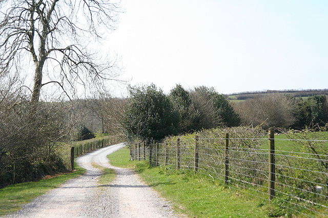
Beer Moors attracts a range of outdoor enthusiasts, from hikers and walkers to horse riders and mountain bikers. There are numerous footpaths and trails crisscrossing the area, allowing visitors to explore the moors and enjoy the peaceful and tranquil surroundings.
Overall, Beer Moors is a captivating natural area, offering a mix of moorland and downs, picturesque views, and a diverse range of flora and fauna. It is a perfect destination for those seeking a peaceful retreat or an adventure in the heart of nature.
If you have any feedback on the listing, please let us know in the comments section below.
Beer Moors Images
Images are sourced within 2km of 51.024302/-3.5934334 or Grid Reference SS8826. Thanks to Geograph Open Source API. All images are credited.


Beer Moors is located at Grid Ref: SS8826 (Lat: 51.024302, Lng: -3.5934334)
Administrative County: Somerset
District: Somerset West and Taunton
Police Authority: Avon and Somerset
What 3 Words
///surviving.aced.easygoing. Near Dulverton, Somerset
Nearby Locations
Related Wikis

Briggins Moor
Briggins Moor is a 15.3 hectare biological Site of Special Scientific Interest in Somerset, notified in 1994. The site is south of Dulverton and close...

East Anstey
East Anstey is a village and civil parish in the North Devon district of Devon, England. The parish is located in an area which has been designated as...

Oldways End
Oldways End is a hamlet in the civil parish of East Anstey in the North Devon district of Devon, England. Its nearest town is Tiverton, which lies approximately...

Combe, Dulverton
Combe is a historic estate in Somerset, England, situated between the town of Dulverton and the village of Brushford. == Descent == === Taunton Priory... ===

Oldberry Castle
Oldberry Castle (sometimes called Oldbury Castle) is an Iron Age hill fort north west of Dulverton, Somerset, England. It lies approximately 0.5 miles...

Northmoor, Dulverton
Northmoor is an historic estate in the parish of Dulverton in Somerset, England. The Victorian mansion house known as Northmoor House is set amongst steep...

Barle Bridge
Barle Bridge is a five span stone arch bridge over the River Barle in Dulverton within the English county of Somerset, which is medieval in origin. It...

Mounsey Castle
Mounsey Castle is an Iron Age irregular triangular earthwork of 1.75 hectares (4.3 acres) north west of Dulverton, Somerset, England. It has been scheduled...
Related Videos

Where to relax in Dulverton ? Anstey Mills cottage, UK 2022
Anstey_Mills_cottage #udeshperera #silent_travel_movies #travel #traveling #travelvlog #holiday #holidaytour #holidaystory ...
Nearby Amenities
Located within 500m of 51.024302,-3.5934334Have you been to Beer Moors?
Leave your review of Beer Moors below (or comments, questions and feedback).