Bye Common

Downs, Moorland in Somerset Somerset West and Taunton

England

Bye Common

On Winsford Hill
On Winsford Hill Credit: David Martin

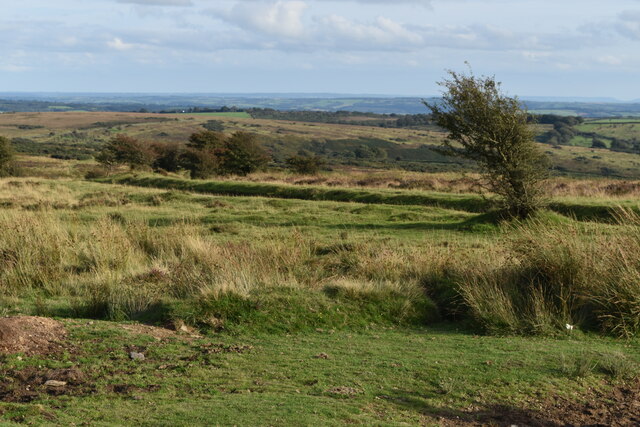
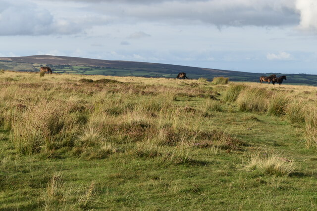
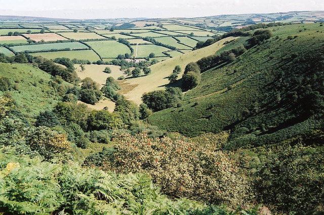
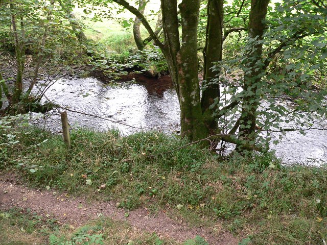
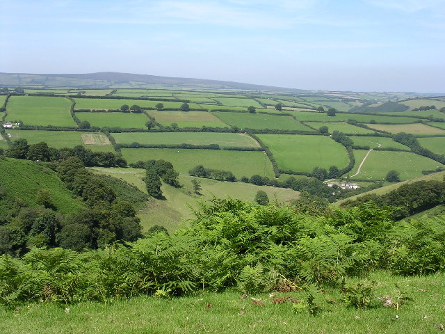
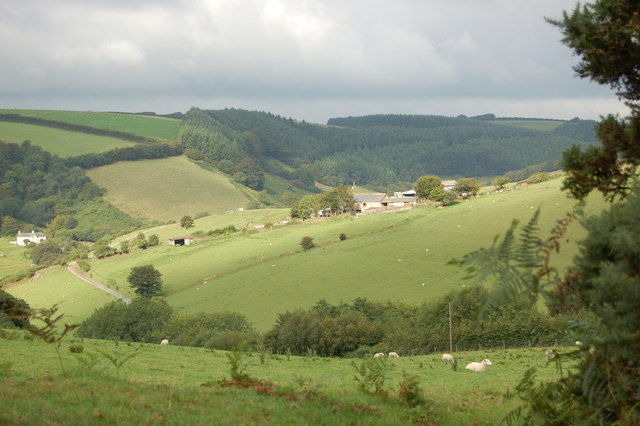
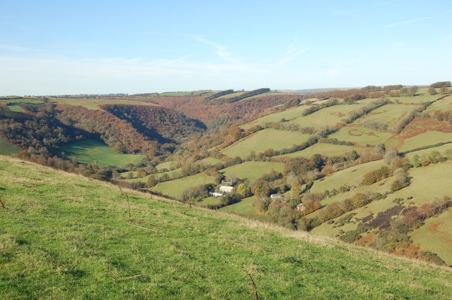
Bye Common is a picturesque area located in Somerset, England. It is situated between the Downs and the Moorland, offering a unique and diverse landscape for visitors to explore. The common is known for its stunning natural beauty, with rolling hills, meadows, and woodlands.

The Downs portion of Bye Common features vast open spaces with gently sloping hills, providing breathtaking panoramic views of the surrounding countryside. It is a popular spot for outdoor activities such as hiking, picnicking, and birdwatching. The area is home to a variety of wildlife, including rabbits, foxes, and numerous species of birds.

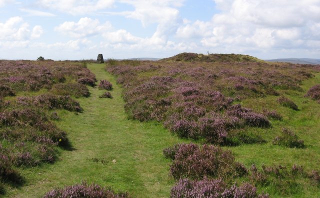
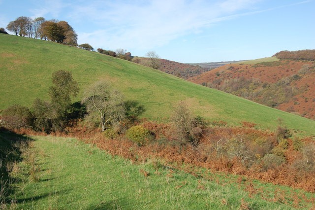
On the other hand, the Moorland section of Bye Common offers a more rugged terrain, with heather-covered hills and peat bogs. This area is perfect for those seeking a more challenging hiking experience or for nature enthusiasts interested in exploring unique ecosystems.

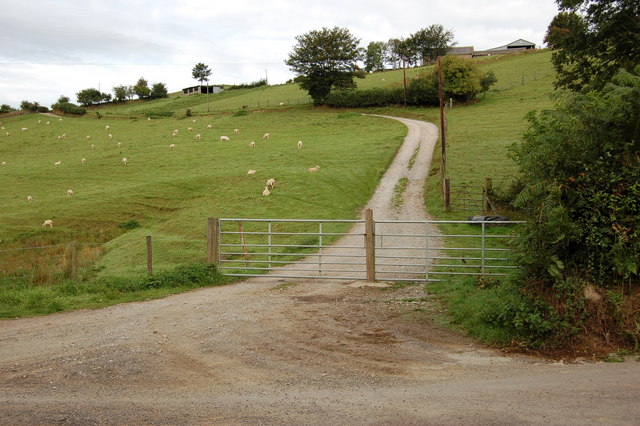
Bye Common is well-maintained and has a network of walking trails, allowing visitors to easily navigate through the different landscapes. There are also designated picnic areas and benches, providing opportunities for relaxation and enjoying the beautiful surroundings.

The common is easily accessible, with nearby parking facilities and public transportation options. It is a popular destination for locals and tourists alike, offering a tranquil escape from the hustle and bustle of everyday life.

In summary, Bye Common in Somerset is a stunning natural area that encompasses both the Downs and Moorland landscapes. With its diverse terrain, wildlife, and recreational activities, it is a must-visit location for nature lovers and outdoor enthusiasts.

If you have any feedback on the listing, please let us know in the comments section below.

Bye Common Images

Images are sourced within 2km of 51.112284/-3.5950012 or Grid Reference SS8835. Thanks to Geograph Open Source API. All images are credited.

On Winsford Hill
On Winsford Hill
Near the summit of Winsford Hill
Winsford : Ash Lane Looking along Ash Lane.
Winsford : Ash Lane
Looking along Ash Lane.
Winsford : Ash Lane Ash Lane heads down into Winsford.
Winsford : Ash Lane
Ash Lane heads down into Winsford.
Winsford: the Punchbowl from Winsford Hill Looking north-north-east to Withycombe Farm
Winsford: the Punchbowl from Winsford Hill
Looking north-north-east to Withycombe Farm
River Exe at Nethercote Taken on south side of the river.
River Exe at Nethercote
Taken on south side of the river.
Trig Point, Winsford Hill Trig Point & one of the Wambarrows
Trig Point, Winsford Hill
Trig Point & one of the Wambarrows
Punchbowl from Winsford Hill
Torre Farm surrounded by fields of sheep. Taken from the start of Ison Lane bridleway
Torre Farm surrounded by fields of sheep.
Taken from the start of Ison Lane bridleway
Track up to Torre Farm from Oldrey Lane The track swings to the left then in a large semicircle round the contour of the hill to finish at the farm buildings near the top right.
Track up to Torre Farm from Oldrey Lane
The track swings to the left then in a large semicircle round the contour of the hill to finish at the farm buildings near the top right.
Bridleway through newly planted woodland. Although the slopes were cleared for planting, a wide selection of new hardwood trees (oak, ash, sycamore, birch, and rowan) is in fierce competition with the local bracken.
Bridleway through newly planted woodland.
Although the slopes were cleared for planting, a wide selection of new hardwood trees (oak, ash, sycamore, birch, and rowan) is in fierce competition with the local bracken.
Bridge over River Exe at Larcombe Foot. This Bridge (in need of repair) now provides access to 2 bridleways 1 footpath and a private road. The photograph was taken from a spot which could have been a ford.
Bridge over River Exe at Larcombe Foot.
This Bridge (in need of repair) now provides access to 2 bridleways 1 footpath and a private road. The photograph was taken from a spot which could have been a ford.
"Bridleway"  to Larcome Foot The notice from Exmoor National Park Authority basically explains that this RUPP (Road Used as a Public Path) has now been downgraded to a Bridleway. Motorised vehicles other than the landowner’s are no longer allowed to use it.
"Bridleway" to Larcome Foot
The notice from Exmoor National Park Authority basically explains that this RUPP (Road Used as a Public Path) has now been downgraded to a Bridleway. Motorised vehicles other than the landowner’s are no longer allowed to use it.
The Corner on Staddon Hill Road. This road is the only public access for this grid square
The Corner on Staddon Hill Road.
This road is the only public access for this grid square
Old Beech Hedge near Staddon Hill There are many wonderful example of old beech hedges on Exmoor, which have been left to the wind, rain, sun and the sheep.
Old Beech Hedge near Staddon Hill
There are many wonderful example of old beech hedges on Exmoor, which have been left to the wind, rain, sun and the sheep.
Crossing the Exe near West Nethercote The river can get quite deep at during the winter months.
Crossing the Exe near West Nethercote
The river can get quite deep at during the winter months.
Bridleway heading down to Neathercote The circular green markings on the hill are quite curious.
Bridleway heading down to Neathercote
The circular green markings on the hill are quite curious.
The River Exe valley from Bye Common looking N.W. The group of cottages are West and East Nethercote
The River Exe valley from Bye Common looking N.W.
The group of cottages are West and East Nethercote
Show me another place!

Bye Common is located at Grid Ref: SS8835 (Lat: 51.112284, Lng: -3.5950012)

Administrative County: Somerset

District: Somerset West and Taunton

Police Authority: Avon and Somerset

What 3 Words

///daily.panoramic.intend. Near Dulverton, Somerset

Related Wikis

Exmoor

Exmoor is loosely defined as an area of hilly open moorland in west Somerset and north Devon in South West England. It is named after the River Exe, the...

South Exmoor SSSI

South Exmoor (grid reference SS880340) is a 3132.7 hectare (7742.3 acre) biological Site of Special Scientific Interest in Devon and Somerset, England...

Garratts Wood

Garratts Wood is a woodland in Somerset, England, near the village of Winsford. It covers a total area of 1.11 hectares (2.74 acres). It is owned and managed...

Caratacus Stone

The Caratacus Stone, sometimes known as the Caractacus Stone, is an inscribed stone on Exmoor in Somerset, England. It is thought to date from the 6th...

Winsford, Somerset

Winsford is a village and civil parish in Somerset, England, located about 5 miles (8 km) north-west of Dulverton. It is within the borders of the Exmoor...

Road Castle

Road Castle is an Iron Age bank and ditch in the West Somerset district of Somerset, England. The hill fort is situated approximately 2 miles (3.2 km)...

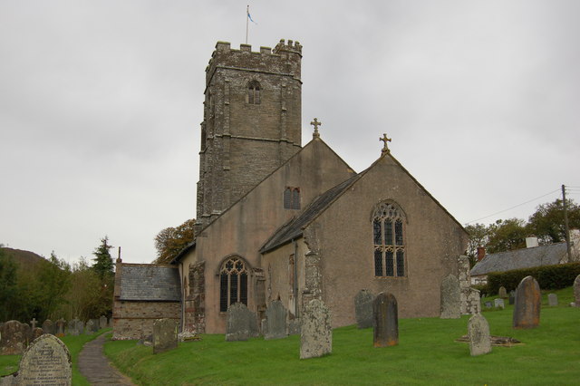
Church of St Mary Magdelene, Exford

The Anglican Church of St Mary Magdelene in Exford, Somerset, England was built in the 15th century. It is a Grade II* listed building. == History == Nothing...

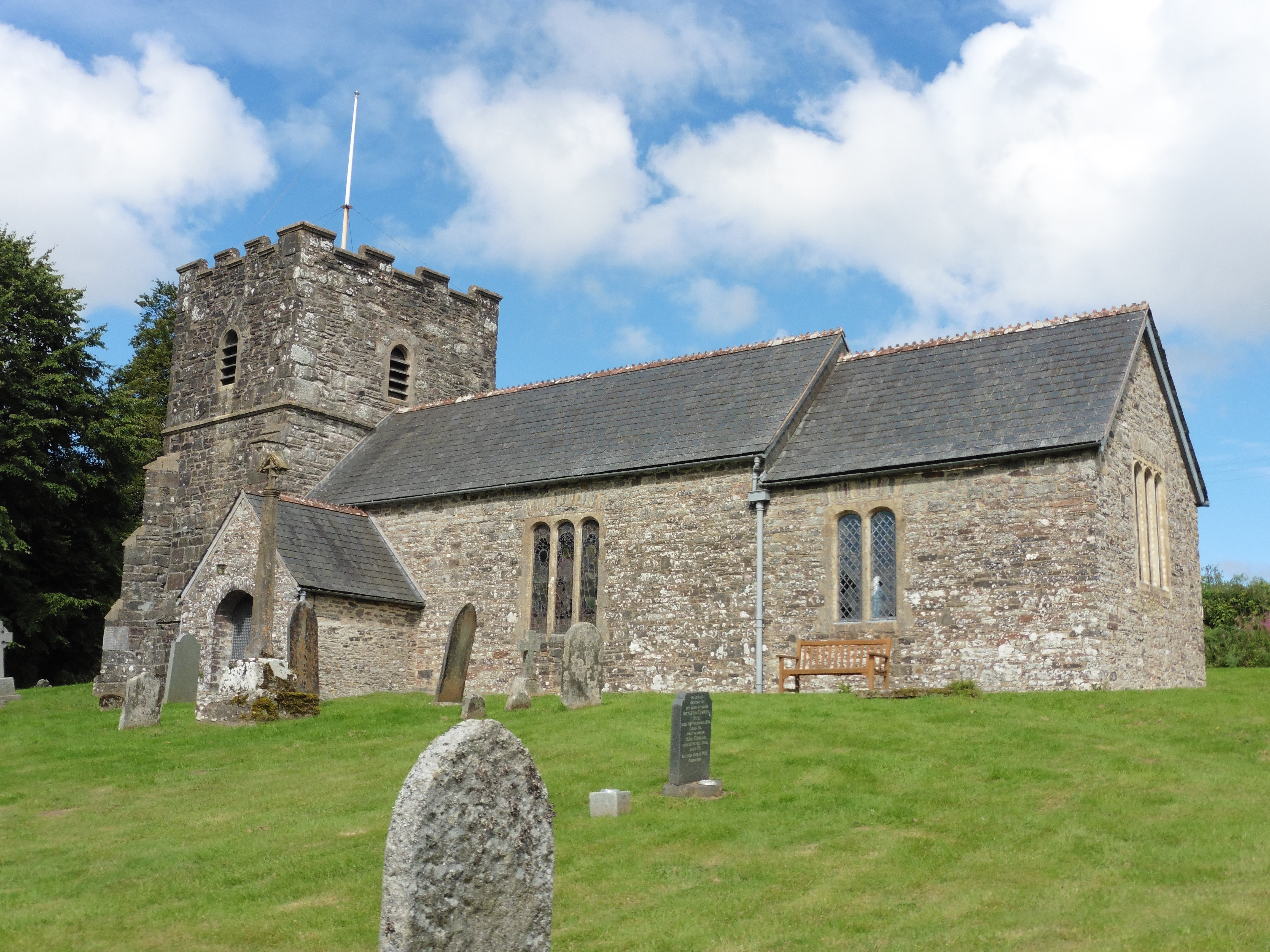
Church of St Andrew, Withypool

The Anglican Church of St Andrew in Withypool, Somerset, England was built in late medieval period. It is a Grade II* listed building. == History == The...

Nearby Amenities

Located within 500m of 51.112284,-3.5950012
The data included in this document is from www.openstreetmap.org. The data is made available under ODbL.

Have you been to Bye Common?

Leave your review of Bye Common below (or comments, questions and feedback).