Poole Coppice

Wood, Forest in Somerset Somerset West and Taunton

England

Poole Coppice

Brushford: Knowle Farm
Brushford: Knowle Farm Credit: Martin Bodman

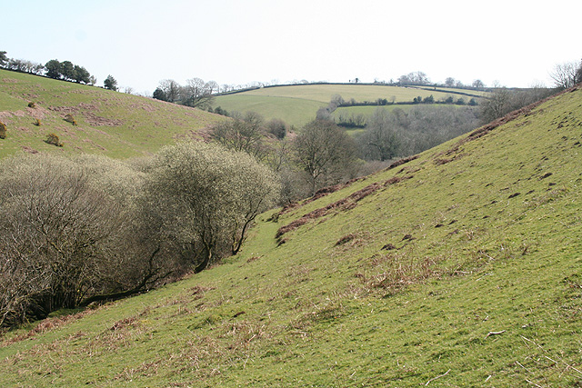
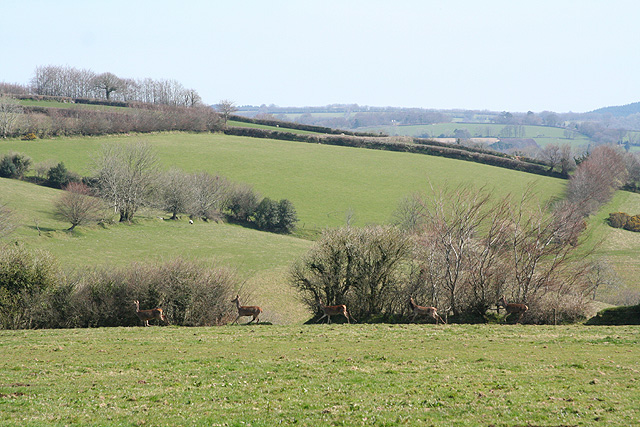
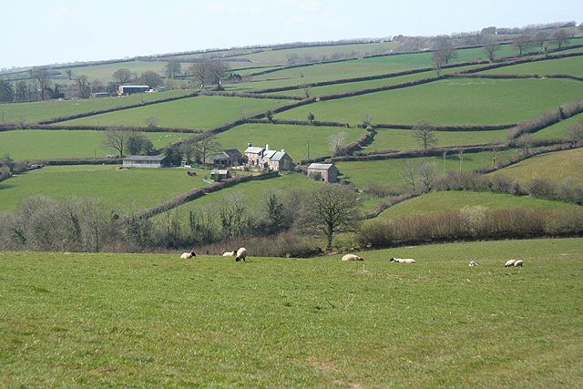
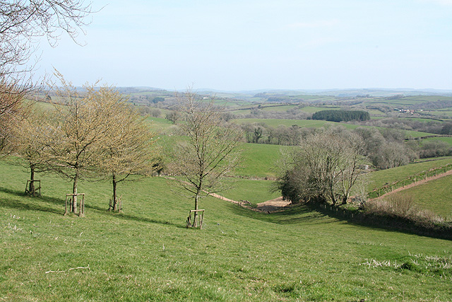
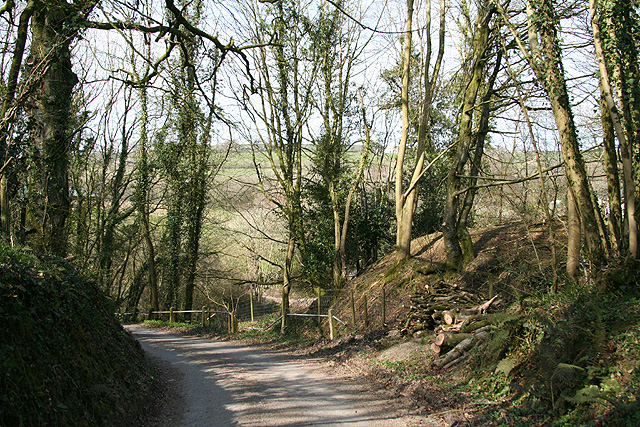
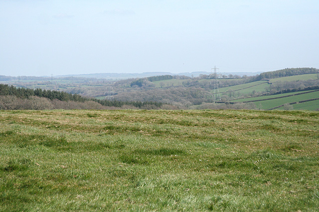
Located in Somerset, Poole Coppice is a picturesque wood that covers an area of approximately 50 hectares. It is a popular destination for nature enthusiasts, hikers, and those seeking tranquility in the midst of nature. The wood is nestled within the rolling landscape of Somerset, surrounded by lush green fields and gentle hills.

Poole Coppice is predominantly composed of deciduous trees, including oak, ash, beech, and birch, which create a dense and vibrant canopy during the summer months. The forest floor is covered with a diverse array of flora, including bluebells, wild garlic, and wood anemones, providing a colorful and fragrant display during springtime.

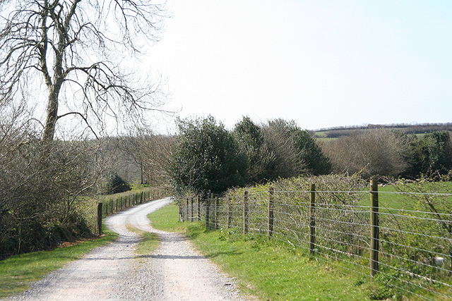
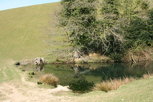
The wood is crisscrossed by a network of well-maintained footpaths, allowing visitors to explore its beauty at their leisure. These paths lead to a variety of interesting features, such as a babbling brook, a small pond, and a few ancient trees that have stood for centuries. These ancient trees, with their gnarled and twisted trunks, lend an air of mystery and enchantment to the woodland.

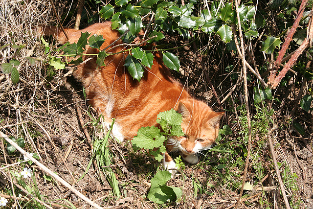
Birdwatchers are particularly drawn to Poole Coppice, as it is home to a diverse range of avian species. Visitors may spot woodpeckers, owls, warblers, and finches, among others. The peaceful ambiance of the wood also attracts various mammals, including foxes, badgers, and squirrels.

Overall, Poole Coppice offers a tranquil retreat for nature lovers, with its beautiful woodland, diverse flora and fauna, and serene atmosphere. Whether it be for a leisurely stroll, a birdwatching expedition, or simply to escape the hustle and bustle of everyday life, this enchanting wood in Somerset is a perfect destination.

If you have any feedback on the listing, please let us know in the comments section below.

Poole Coppice Images

Images are sourced within 2km of 51.024858/-3.5848968 or Grid Reference SS8826. Thanks to Geograph Open Source API. All images are credited.

Brushford: Knowle Farm
Looking North From West Knowle
Brushford: Venn Looking north from the lane between West Knowle and Hawkwell Cross
Brushford: Venn
Looking north from the lane between West Knowle and Hawkwell Cross
Brushford: Bere A farm in remote country between East Anstey and Dulverton, seen from its entrance gate. The track leading to the farm and on to Broomball Cross is also a public bridleway. Looking north west
Brushford: Bere
A farm in remote country between East Anstey and Dulverton, seen from its entrance gate. The track leading to the farm and on to Broomball Cross is also a public bridleway. Looking north west
Brushford: between Nightcott and Upcott Looking south from the Brushford – Nightcott lane
Brushford: between Nightcott and Upcott
Looking south from the Brushford – Nightcott lane
Brushford: by Trackford Moor On the access road to Lower Sowerhill. Looking south west
Brushford: by Trackford Moor
On the access road to Lower Sowerhill. Looking south west
Dulverton: footbridge over stream On the public footpath between Dulverton and Waddicombe, looking east
Dulverton: footbridge over stream
On the public footpath between Dulverton and Waddicombe, looking east
Dulverton: below Chilcott Looking east in the direction of Lower Chilcott Wood, in a hidden valley, with pussy willow by a stream
Dulverton: below Chilcott
Looking east in the direction of Lower Chilcott Wood, in a hidden valley, with pussy willow by a stream
Dulverton: by Lower Chilcott A cat enjoying Easter sunshine
Dulverton: by Lower Chilcott
A cat enjoying Easter sunshine
Dulverton: Higher Chilcott Farm Home of Pine Lodge Riding Holidays. Looking north east. See <span class="nowrap"><a title="http://www.pinelodge.countryside-inter.net/introductionframe.htm" rel="nofollow ugc noopener" href="http://www.pinelodge.countryside-inter.net/introductionframe.htm">Link</a><img style="margin-left:2px;" alt="External link" title="External link - shift click to open in new window" src="https://s1.geograph.org.uk/img/external.png" width="10" height="10"/></span>
Dulverton: Higher Chilcott Farm
Home of Pine Lodge Riding Holidays. Looking north east. See LinkExternal link
Dulverton: track to Cawkett Looking south west
Dulverton: track to Cawkett
Looking south west
Dulverton: five hinds Near Chilcott Cross, looking east
Dulverton: five hinds
Near Chilcott Cross, looking east
Dulverton: pond By the footpath from Dulverton to Waddicombe, and clearly man made, with a dam height of 12 feet or more. Looking west
Dulverton: pond
By the footpath from Dulverton to Waddicombe, and clearly man made, with a dam height of 12 feet or more. Looking west
East Anstey: East Liscombe A farmhouse with self-catering holiday cottages rated 4-star by the English Tourism Council. The barn on the right retains an old threshing machine which was powered by horses in a round house attached to the building. Looking west-north-west. See also <span class="nowrap"><a title="http://www.ansteymillscottagedevon.co.uk" rel="nofollow ugc noopener" href="http://www.ansteymillscottagedevon.co.uk">Link</a><img style="margin-left:2px;" alt="External link" title="External link - shift click to open in new window" src="https://s1.geograph.org.uk/img/external.png" width="10" height="10"/></span>
East Anstey: East Liscombe
A farmhouse with self-catering holiday cottages rated 4-star by the English Tourism Council. The barn on the right retains an old threshing machine which was powered by horses in a round house attached to the building. Looking west-north-west. See also LinkExternal link
East Anstey: towards West Liscombe
Dulverton: near Ridlers By the bridleway to Bere and Knowle. Looking east-south-east over a west Somerset landscape
Dulverton: near Ridlers
By the bridleway to Bere and Knowle. Looking east-south-east over a west Somerset landscape
Dulverton: lane near Anstey Farm Looking north-north-west
Dulverton: lane near Anstey Farm
Looking north-north-west
Brushford: by Higher Allshire Farm Looking towards South Moor and the valley of the Den Brook. The pasture in the foreground has recently been rolled
Brushford: by Higher Allshire Farm
Looking towards South Moor and the valley of the Den Brook. The pasture in the foreground has recently been rolled
Show me another place!

Poole Coppice is located at Grid Ref: SS8826 (Lat: 51.024858, Lng: -3.5848968)

Administrative County: Somerset

District: Somerset West and Taunton

Police Authority: Avon and Somerset

What 3 Words

///outs.abundance.importers. Near Dulverton, Somerset

Related Wikis

Briggins Moor

Briggins Moor is a 15.3 hectare biological Site of Special Scientific Interest in Somerset, notified in 1994. The site is south of Dulverton and close...

Combe, Dulverton

Combe is a historic estate in Somerset, England, situated between the town of Dulverton and the village of Brushford. == Descent == === Taunton Priory... ===

East Anstey

East Anstey is a village and civil parish in the North Devon district of Devon, England. The parish is located in an area which has been designated as...

Oldways End

Oldways End is a hamlet in the civil parish of East Anstey in the North Devon district of Devon, England. Its nearest town is Tiverton, which lies approximately...

Nearby Amenities

Located within 500m of 51.024858,-3.5848968
Barrier: cattle_grid
Lat/Long: 51.0272035/-3.5840535
Generator Method: photovoltaic
Generator Output Electricity: yes
Generator Source: solar
Generator Type: solar_photovoltaic_panel
Location: roof
Power: generator
Lat/Long: 51.0211629/-3.5834795
Generator Method: photovoltaic
Generator Output Electricity: yes
Generator Source: solar
Generator Type: solar_photovoltaic_panel
Location: roof
Power: generator
Lat/Long: 51.0213882/-3.5848501
Post Box
Collection Times: Mo-Fr 09:00; Sa 07:00
Drive Through: no
Operator: Royal Mail
Operator Wikidata: Q638098
Post Box Type: wall
Ref: TA22 42D
Royal Cypher: VR
Lat/Long: 51.0210909/-3.5833317
The data included in this document is from www.openstreetmap.org. The data is made available under ODbL.

Have you been to Poole Coppice?

Leave your review of Poole Coppice below (or comments, questions and feedback).