Bessiewalla Moor

Downs, Moorland in Dumfriesshire

Scotland

Bessiewalla Moor

Coldside Road
Coldside Road Credit: Steven Brown

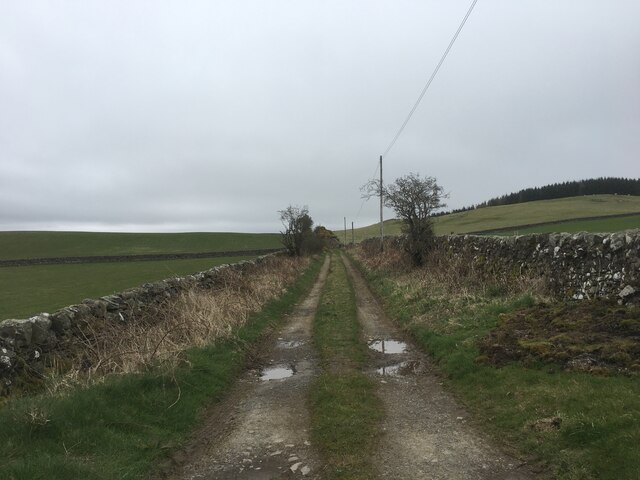
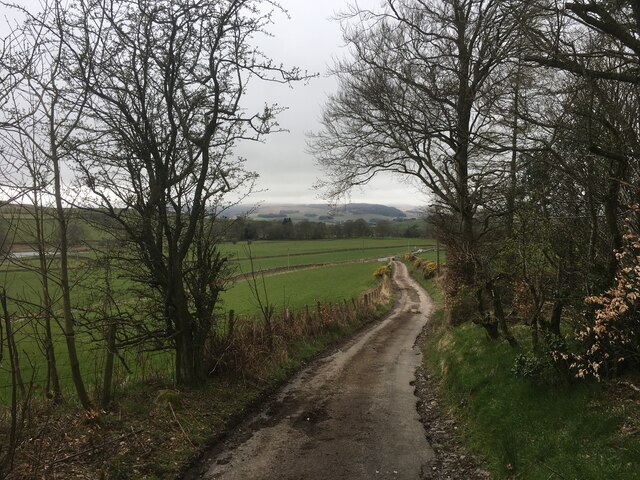
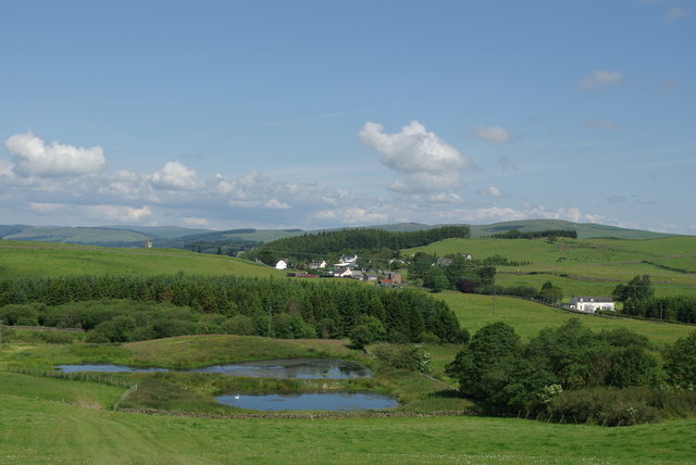
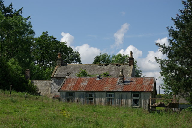
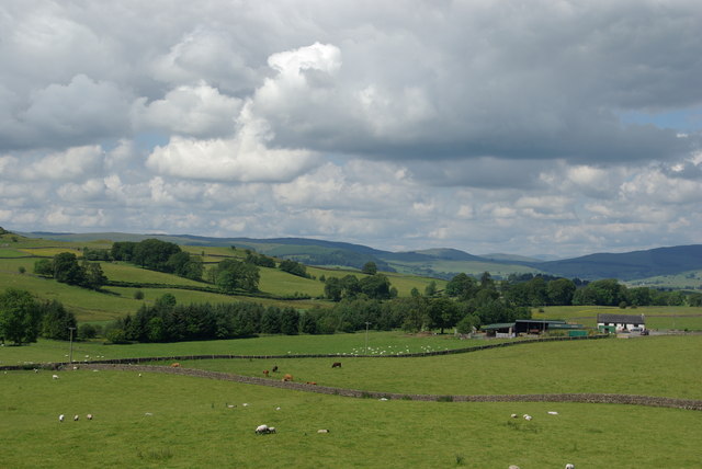
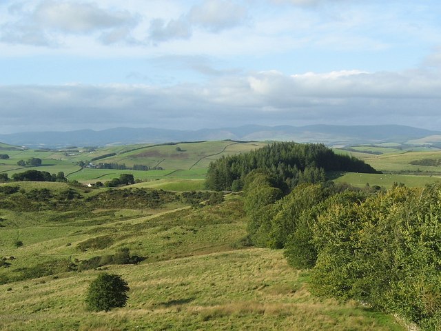
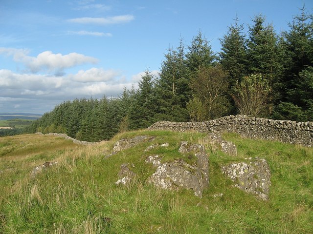
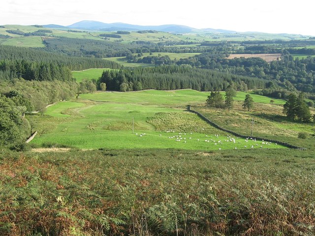
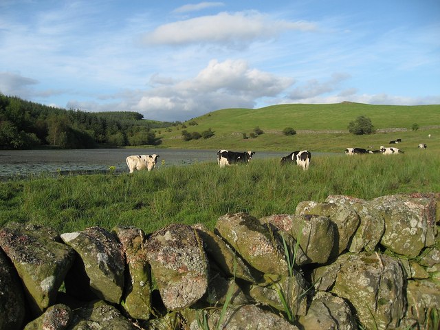
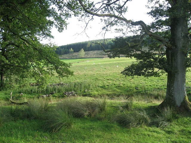
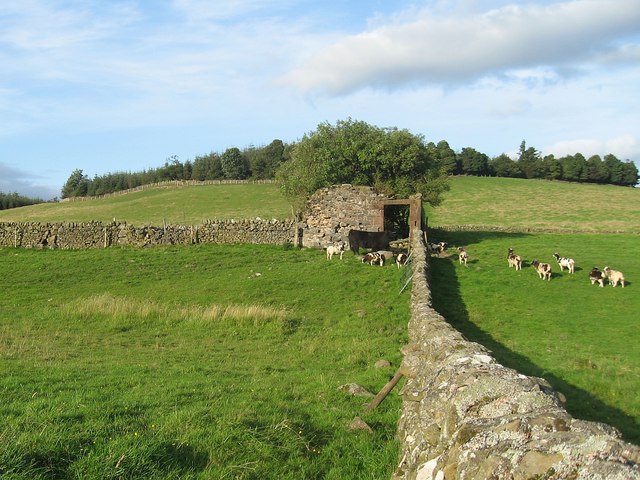
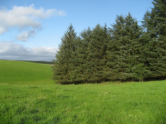
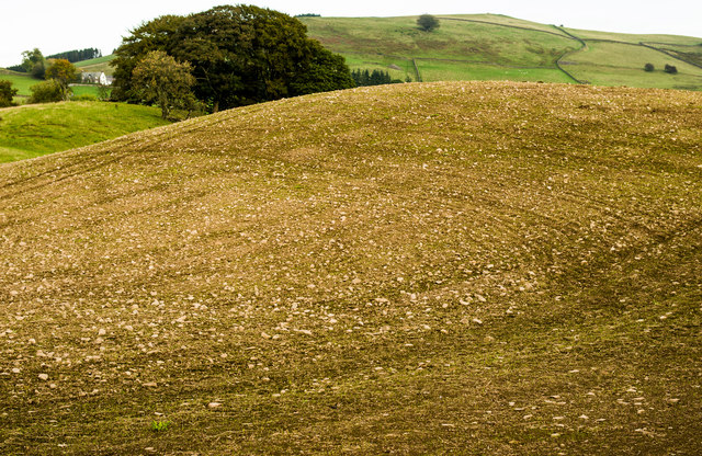
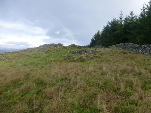
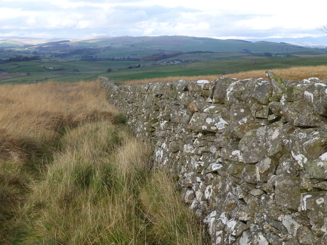
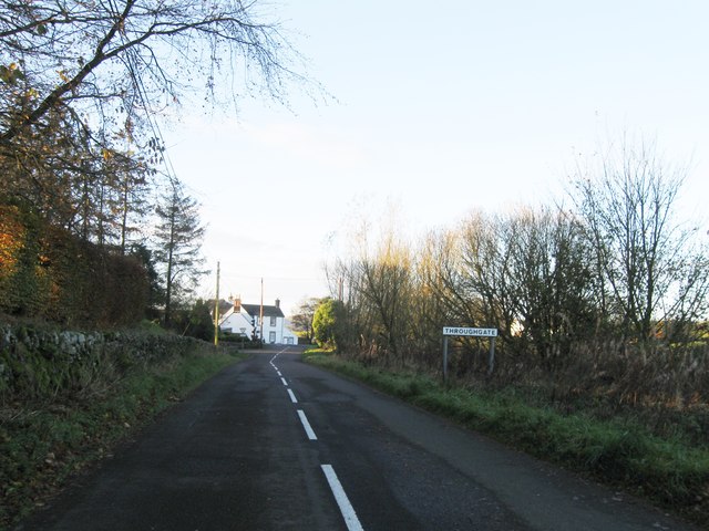
Bessiewalla Moor, located in Dumfriesshire, Scotland, is a vast expanse of open moorland characterized by rolling hills, heather-covered slopes, and scattered patches of woodland. The moorland is situated in the southern uplands of Scotland, near the border with England. It covers an area of approximately 5,000 acres and is known for its rugged beauty and remote location.

The moorland is home to a variety of wildlife, including red deer, grouse, and other bird species. Visitors to Bessiewalla Moor can enjoy hiking, birdwatching, and photography opportunities in this unspoiled natural setting. The moorland is also popular with outdoor enthusiasts for activities such as mountain biking and horse riding.

Bessiewalla Moor is a peaceful and tranquil place, offering visitors a chance to escape the hustle and bustle of everyday life and immerse themselves in the natural beauty of the Scottish countryside. The moorland is a designated Site of Special Scientific Interest (SSSI) due to its unique flora and fauna, making it an important conservation area. Overall, Bessiewalla Moor is a stunning and wild landscape that showcases the beauty of the Scottish countryside.

If you have any feedback on the listing, please let us know in the comments section below.

Bessiewalla Moor Images

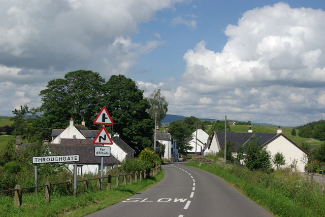
Images are sourced within 2km of 55.124994/-3.7599455 or Grid Reference NX8782. Thanks to Geograph Open Source API. All images are credited.

Coldside Road
Coldside Road
Coldside Road
Coldside Road
Old Moss-Side, Dunscore
Fields & ponds west of Mansegate View towards the village of Dunscore
Fields & ponds west of Mansegate
View towards the village of Dunscore
Lower Linburn
Lower Linburn
Throughgate
Throughgate
Upper Linburn
Upper Linburn
Forest edge The edge of Townhead Wood on the North side of Killyleoch Hill.
Forest edge
The edge of Townhead Wood on the North side of Killyleoch Hill.
Killyleoch Hill The forest boundary at the top of Killyleoch Hill.
Killyleoch Hill
The forest boundary at the top of Killyleoch Hill.
Sheep above Morrington
Cattle by Loweberry Loch
Field near Berryland Sheep grazing in a field near Berryland.
Field near Berryland
Sheep grazing in a field near Berryland.
Guarded ruin This ruin was guarded by a black cow and a herd of goats.
Guarded ruin
This ruin was guarded by a black cow and a herd of goats.
Forest edge The boundary between the forest and well tended pasture.
Forest edge
The boundary between the forest and well tended pasture.
Below Crawston Hill
Below Crawston Hill
Killyleoch Hill Climbed with Phil Coper and Chris Watson. The ascent is fairly easy with no tree or access problems. The 1:25000 map is useful as it shows the track starting at NX881801, which is not marked on the Landranger map. This track avoids the farms, houses, notices and quarry which may impede other approaches, and there is room to park at the track entrance. Follow the track to NX877811, turn left through a gate, over the burn and through a broad gap in the trees, then follow the western edge of the trees all the way to the summit, which is a large rock a few metres away from the tree line. There are four walls to cross on the way, all of which have reasonable crossing places near the edge of the trees. The first wall has a fence in the corner, after which there is some rough bracken and vegetation but nothing too bad but better when it's dry or in winter.
Name: Killyleoch Hill
Hill number: 1799
Height: 239.7m / 786ft
Area: 27C: The Glenkens to Annandale
Class: Ma,2
Grid ref: NX 87859 82034
Summit feature: large rock
Drop: 151.6m
Col: 88.1m  NX 8725 8621
Killyleoch Hill
Climbed with Phil Coper and Chris Watson. The ascent is fairly easy with no tree or access problems. The 1:25000 map is useful as it shows the track starting at NX881801, which is not marked on the Landranger map. This track avoids the farms, houses, notices and quarry which may impede other approaches, and there is room to park at the track entrance. Follow the track to NX877811, turn left through a gate, over the burn and through a broad gap in the trees, then follow the western edge of the trees all the way to the summit, which is a large rock a few metres away from the tree line. There are four walls to cross on the way, all of which have reasonable crossing places near the edge of the trees. The first wall has a fence in the corner, after which there is some rough bracken and vegetation but nothing too bad but better when it's dry or in winter. Name: Killyleoch Hill Hill number: 1799 Height: 239.7m / 786ft Area: 27C: The Glenkens to Annandale Class: Ma,2 Grid ref: NX 87859 82034 Summit feature: large rock Drop: 151.6m Col: 88.1m NX 8725 8621
Dry Stone Wall This is the third of four dry stone walls that you need to cross to bag Killyleoch Hill.
Dry Stone Wall
This is the third of four dry stone walls that you need to cross to bag Killyleoch Hill.
Entrance to Throughgate
Show me another place!

Bessiewalla Moor is located at Grid Ref: NX8782 (Lat: 55.124994, Lng: -3.7599455)

Unitary Authority: Dumfries and Galloway

Police Authority: Dumfries and Galloway

What 3 Words

///grants.endings.calibrate. Near Dumfries, Dumfries & Galloway

Related Wikis

Stepford railway station

Stepford (NX864815) was one of the minor request stop stations on the Cairn Valley Light Railway branch from Dumfries. It served a very rural area in...

Nithsdale

Nithsdale (Srath Nid in Scottish Gaelic), also known as Strathnith, Stranith or Stranit, is the strath or dale of the River Nith in southern Scotland....

Dunscore

Dunscore (['dʌnskər] / 'DUN-skur', less commonly ['dunskɔ:r] / 'DUN-score') is a small village which lies 9 miles (14 km) northwest of Dumfries on the...

Newtonairds railway station

Newtonairds (NX877801) was one of the principal stations on the now closed Cairn Valley Light Railway branch from Dumfries. It served a very rural area...

Have you been to Bessiewalla Moor?

Leave your review of Bessiewalla Moor below (or comments, questions and feedback).