Pester Moors

Downs, Moorland in Somerset Somerset West and Taunton

England

Pester Moors

Brushford: Knowle Farm
Brushford: Knowle Farm Credit: Martin Bodman

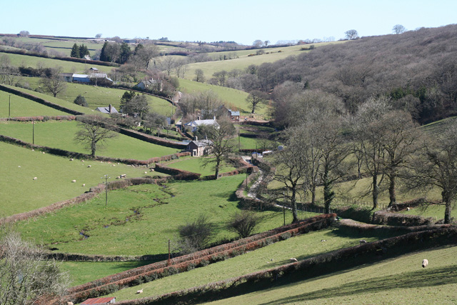
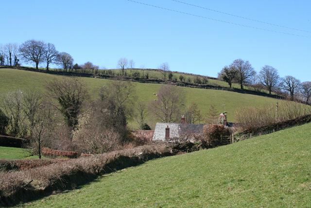
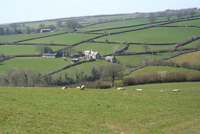
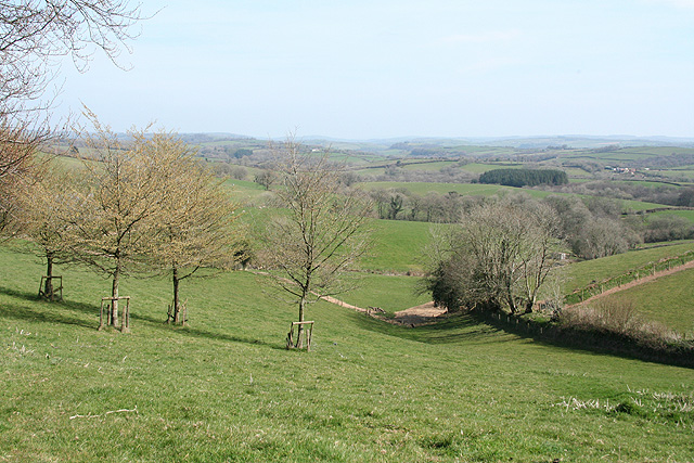
Pester Moors is a beautiful area located in Somerset, England. It is known for its diverse and picturesque landscape, consisting of downs and moorland. The area is characterized by rolling hills, open grasslands, and heathland, creating a stunning natural scenery.

The downs in Pester Moors are vast stretches of undulating land covered in grass. They provide breathtaking views of the surrounding countryside and are home to a variety of plant and animal species. Visitors can enjoy long walks or hikes along the downs, immersing themselves in the serene and peaceful atmosphere.

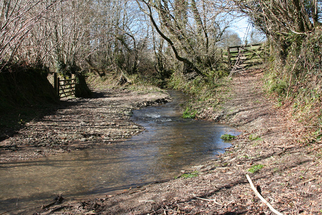
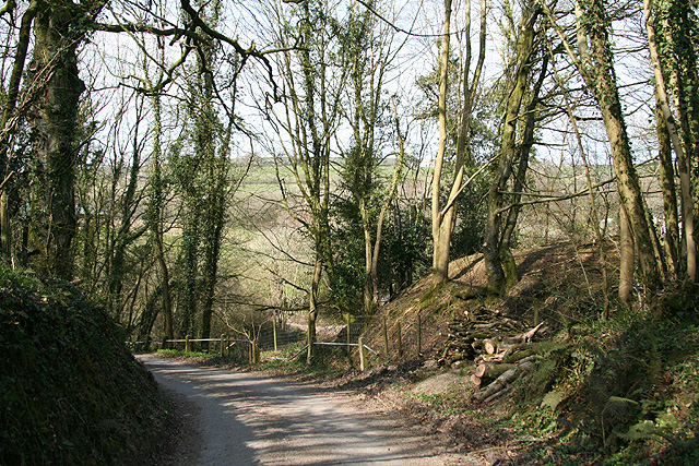
The moorland in Pester Moors is another significant feature of the area. It is characterized by heather and gorse-covered expanses, interspersed with marshes and bogs. This unique habitat supports a wide range of wildlife, including birds, reptiles, and small mammals. The moorland is a haven for nature enthusiasts and bird watchers, offering the opportunity to spot rare and endangered species.

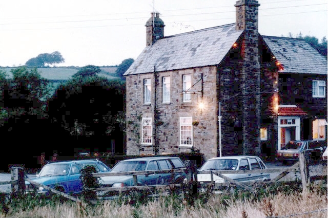
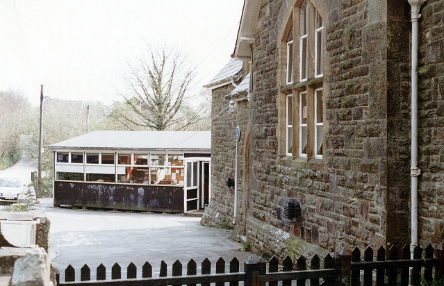
In addition to its natural beauty, Pester Moors also has a rich cultural heritage. The area is dotted with ancient archaeological sites, including burial mounds and standing stones, providing fascinating insights into its past. The nearby villages are also worth exploring, with their charming cottages and historic buildings.

Overall, Pester Moors is a haven for nature lovers and those seeking tranquility. Its diverse landscape, rich wildlife, and cultural heritage make it a truly unique and captivating destination in Somerset, England.

If you have any feedback on the listing, please let us know in the comments section below.

Pester Moors Images

Images are sourced within 2km of 51.023266/-3.6014257 or Grid Reference SS8726. Thanks to Geograph Open Source API. All images are credited.

Brushford: Knowle Farm
Looking North From West Knowle
Brushford: Venn Looking north from the lane between West Knowle and Hawkwell Cross
Brushford: Venn
Looking north from the lane between West Knowle and Hawkwell Cross
East Anstey: Waddicombe Looking north east from the start of a bridleway to Badlake Farm. There is some evidence for a medieval watermill at Waddicombe
East Anstey: Waddicombe
Looking north east from the start of a bridleway to Badlake Farm. There is some evidence for a medieval watermill at Waddicombe
East Anstey: approaching Oak Farm Looking west-south-west on a bridleway from Waddicombe to Dunsley
East Anstey: approaching Oak Farm
Looking west-south-west on a bridleway from Waddicombe to Dunsley
East Anstey: ford on bridleway Looking west-south-west on bridleway from Waddicombe to Dunsley
East Anstey: ford on bridleway
Looking west-south-west on bridleway from Waddicombe to Dunsley
Brushford: Bere A farm in remote country between East Anstey and Dulverton, seen from its entrance gate. The track leading to the farm and on to Broomball Cross is also a public bridleway. Looking north west
Brushford: Bere
A farm in remote country between East Anstey and Dulverton, seen from its entrance gate. The track leading to the farm and on to Broomball Cross is also a public bridleway. Looking north west
East Anstey - The Froude Arms Now closed and a private residence.
East Anstey - The Froude Arms
Now closed and a private residence.
East Anstey School A cold morning!
East Anstey School
A cold morning!
Houses at East Anstey
Brushford: overhead power line A transmission line on Hawtree Moors. Looking south east
Brushford: overhead power line
A transmission line on Hawtree Moors. Looking south east
Brushford: Oldways End A hamlet near the B3227 and on the road to East Anstey. Also on the Somerset – Devon border. Looking east-south-east
Brushford: Oldways End
A hamlet near the B3227 and on the road to East Anstey. Also on the Somerset – Devon border. Looking east-south-east
Dulverton: cottages at Oldways End The Dulverton and Brushford parish boundaries meet here as does the Somerset – Devon border. Looking north west
Dulverton: cottages at Oldways End
The Dulverton and Brushford parish boundaries meet here as does the Somerset – Devon border. Looking north west
East Anstey: East Liscombe A farmhouse with self-catering holiday cottages rated 4-star by the English Tourism Council. The barn on the right retains an old threshing machine which was powered by horses in a round house attached to the building. Looking west-north-west. See also <span class="nowrap"><a title="http://www.ansteymillscottagedevon.co.uk" rel="nofollow ugc noopener" href="http://www.ansteymillscottagedevon.co.uk">Link</a><img style="margin-left:2px;" alt="External link" title="External link - shift click to open in new window" src="https://s1.geograph.org.uk/img/external.png" width="10" height="10"/></span>
East Anstey: East Liscombe
A farmhouse with self-catering holiday cottages rated 4-star by the English Tourism Council. The barn on the right retains an old threshing machine which was powered by horses in a round house attached to the building. Looking west-north-west. See also LinkExternal link
East Anstey: West Liscombe Looking south west by the path from Dulverton to Waddicombe
East Anstey: West Liscombe
Looking south west by the path from Dulverton to Waddicombe
East Anstey: towards West Liscombe
Dulverton: near Ridlers By the bridleway to Bere and Knowle. Looking east-south-east over a west Somerset landscape
Dulverton: near Ridlers
By the bridleway to Bere and Knowle. Looking east-south-east over a west Somerset landscape
Dulverton: lane near Anstey Farm Looking north-north-west
Dulverton: lane near Anstey Farm
Looking north-north-west
Show me another place!

Pester Moors is located at Grid Ref: SS8726 (Lat: 51.023266, Lng: -3.6014257)

Administrative County: Somerset

District: Somerset West and Taunton

Police Authority: Avon and Somerset

What 3 Words

///lakeside.miles.teaching. Near Dulverton, Somerset

Nearby Locations

Pester Moors

Related Wikis

Oldways End

Oldways End is a hamlet in the civil parish of East Anstey in the North Devon district of Devon, England. Its nearest town is Tiverton, which lies approximately...

East Anstey

East Anstey is a village and civil parish in the North Devon district of Devon, England. The parish is located in an area which has been designated as...

Briggins Moor

Briggins Moor is a 15.3 hectare biological Site of Special Scientific Interest in Somerset, notified in 1994. The site is south of Dulverton and close...

West Anstey

West Anstey is a village and civil parish on the River Yeo, about 5 miles west of Dulverton, in the North Devon district, in the county of Devon, England...

Mounsey Castle

Mounsey Castle is an Iron Age irregular triangular earthwork of 1.75 hectares (4.3 acres) north west of Dulverton, Somerset, England. It has been scheduled...

Combe, Dulverton

Combe is a historic estate in Somerset, England, situated between the town of Dulverton and the village of Brushford. == Descent == === Taunton Priory... ===

Northmoor, Dulverton

Northmoor is an historic estate in the parish of Dulverton in Somerset, England. The Victorian mansion house known as Northmoor House is set amongst steep...

Brewer's Castle

Brewer's Castle is a defended Iron Age settlement in the West Somerset district of Somerset, England. The hill fort is situated approximately 2 miles...

Nearby Amenities

Located within 500m of 51.023266,-3.6014257
Power: pole
Lat/Long: 51.0199152/-3.604736
Power: pole
Lat/Long: 51.0199393/-3.6026842
Power: pole
Lat/Long: 51.0199601/-3.6007309
Power: pole
Lat/Long: 51.019982/-3.5987864
Power: pole
Lat/Long: 51.0200029/-3.5966706
The data included in this document is from www.openstreetmap.org. The data is made available under ODbL.

Have you been to Pester Moors?

Leave your review of Pester Moors below (or comments, questions and feedback).