Lonemore

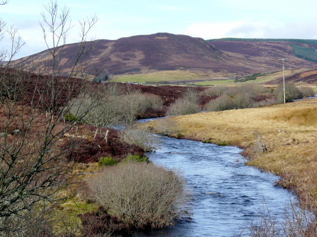
Downs, Moorland in Sutherland

Scotland

Lonemore

A9, northbound The A9 is a strategic link between the Highlands of Scotland and the Central Belt. It runs 279 miles from junction 5 of the M9 at Polmont to Scrabster. Originally it ran from Edinburgh.
<span class="nowrap"><a title="https://www.sabre-roads.org.uk/wiki/index.php?title=A9" rel="nofollow ugc noopener" href="https://www.sabre-roads.org.uk/wiki/index.php?title=A9">Link</a><img style="margin-left:2px;" alt="External link" title="External link - shift click to open in new window" src="https://s1.geograph.org.uk/img/external.png" width="10" height="10"/></span>
A9, northbound Credit: N Chadwick

Lonemore is a small village located in the county of Sutherland, in the Scottish Highlands. It is situated in a remote area known for its picturesque downs and moorland landscapes. The village is nestled among rolling hills and surrounded by vast open spaces, providing a peaceful and serene atmosphere for its residents.

With a population of around 150 people, Lonemore offers a close-knit community where residents enjoy a quiet and laid-back lifestyle. The village is primarily residential, with a few local businesses catering to the needs of the community. The nearest town, Golspie, is approximately 8 miles away, providing additional amenities and services.

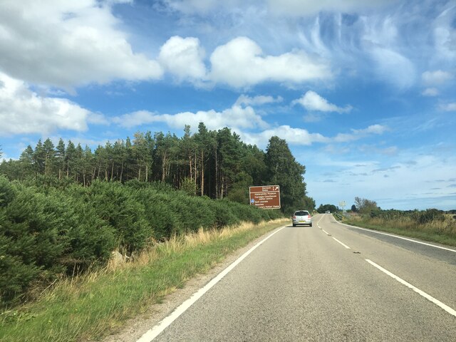
The natural surroundings of Lonemore are a major draw for visitors and outdoor enthusiasts. The downs and moorland offer ample opportunities for hiking, birdwatching, and other outdoor activities. The area is also known for its diverse wildlife, including various bird species, red deer, and Highland cattle.

Lonemore benefits from its proximity to the North Coast 500, a popular scenic driving route that attracts tourists from around the world. This location provides an economic boost to the area, as visitors often stop in the village to admire the stunning landscapes and explore the local attractions.

Overall, Lonemore in Sutherland is a charming village that offers a tranquil setting amidst the natural beauty of the Scottish Highlands. Its close community, stunning surroundings, and access to outdoor activities make it an ideal destination for nature lovers and those seeking a peaceful getaway.

If you have any feedback on the listing, please let us know in the comments section below.

Lonemore Images

Images are sourced within 2km of 57.867195/-4.0806466 or Grid Reference NH7688. Thanks to Geograph Open Source API. All images are credited.

A9, northbound The A9 is a strategic link between the Highlands of Scotland and the Central Belt. It runs 279 miles from junction 5 of the M9 at Polmont to Scrabster. Originally it ran from Edinburgh.
<span class="nowrap"><a title="https://www.sabre-roads.org.uk/wiki/index.php?title=A9" rel="nofollow ugc noopener" href="https://www.sabre-roads.org.uk/wiki/index.php?title=A9">Link</a><img style="margin-left:2px;" alt="External link" title="External link - shift click to open in new window" src="https://s1.geograph.org.uk/img/external.png" width="10" height="10"/></span>
A9, northbound
The A9 is a strategic link between the Highlands of Scotland and the Central Belt. It runs 279 miles from junction 5 of the M9 at Polmont to Scrabster. Originally it ran from Edinburgh. LinkExternal link
Signage to Dornoch - A9 northbound
Silage fields near Evelix
Bottom road to Dornoch
Entrance to Cyderhall Farm
Jetsam-decorated garden, Lonemore
Garden decorations, Lonemore
Decorated roadside garden, Lonemore
Small bridge A small bridge over River Evelix
Small bridge
A small bridge over River Evelix
River Evelix River Evelix taken from the bridge
River Evelix
River Evelix taken from the bridge
Cyderhall Farm Cyderhall Farm buildings
Cyderhall Farm
Cyderhall Farm buildings
Field boundary and Estuary The edge of the fields with the Dornoch Firth beyond
Field boundary and Estuary
The edge of the fields with the Dornoch Firth beyond
Lonemore Farm The farm dwellings at Lonemore
Lonemore Farm
The farm dwellings at Lonemore
Cyderhall Cottage The front and a part of the lovely garden at Cyderhall Cottage
Cyderhall Cottage
The front and a part of the lovely garden at Cyderhall Cottage
Eaglefield Farm Fields and logging results next to Eaglefield Farm
Eaglefield Farm
Fields and logging results next to Eaglefield Farm
Post Box A post box at the entrance to Eaglefield Farm
Post Box
A post box at the entrance to Eaglefield Farm
The last hole? The last water hazard at least on the driving range
The last hole?
The last water hazard at least on the driving range
Natural Play Area in Camore Woods
Show me another place!

Lonemore is located at Grid Ref: NH7688 (Lat: 57.867195, Lng: -4.0806466)

Unitary Authority: Highland

Police Authority: Highlands and Islands

What 3 Words

///desiring.tidying.unusable. Near Dornoch, Highland

Nearby Locations

Lonemore Lonemore

Related Wikis

Lonemore, Sutherland

Lonemore (Scottish Gaelic: An Lòn Mòr) is a village on the north shore of the Dornoch Firth in Sutherland, Scottish Highlands and is in the Scottish council...

Camore

Camore (Scottish Gaelic: An Cadha Mòr) is a small hamlet, located 0.5 mile directly southeast of Evelix, and 1.5 miles west of Dornoch, in south east Sutherland...

River Evelix

The River Evelix (Scottish Gaelic: Èibhleag) is a river in Sutherland, Scotland. It draws water from some 30 square miles (78 km2) of rugged moorland...

Evelix

Evelix or Evelick (Scottish Gaelic: Èibhleag) is a village near Dornoch in south east Sutherland, Scotland. The River Evelix runs through it. Evelix is...

Nearby Amenities

Located within 500m of 57.867195,-4.0806466
Created By: almien_coastlines
Source: PGS
Lat/Long: 57.864082/-4.086728
Created By: almien_coastlines
Source: PGS
Lat/Long: 57.864087/-4.086248
Created By: almien_coastlines
Source: PGS
Lat/Long: 57.864217/-4.086013
Created By: almien_coastlines
Source: PGS
Lat/Long: 57.864347/-4.085776
Created By: almien_coastlines
Source: PGS
Lat/Long: 57.864355/-4.084815
Created By: almien_coastlines
Source: PGS
Lat/Long: 57.864359/-4.084335
Created By: almien_coastlines
Source: PGS
Lat/Long: 57.864489/-4.084099
Created By: almien_coastlines
Source: PGS
Lat/Long: 57.864619/-4.083862
Created By: almien_coastlines
Source: PGS
Lat/Long: 57.864749/-4.083627
Created By: almien_coastlines
Source: PGS
Lat/Long: 57.864879/-4.08339
Created By: almien_coastlines
Source: PGS
Lat/Long: 57.864883/-4.08291
Created By: almien_coastlines
Source: PGS
Lat/Long: 57.864887/-4.082429
Created By: almien_coastlines
Source: PGS
Lat/Long: 57.865018/-4.082194
Created By: almien_coastlines
Source: PGS
Lat/Long: 57.865147/-4.081957
Created By: almien_coastlines
Source: PGS
Lat/Long: 57.865151/-4.081476
Created By: almien_coastlines
Source: PGS
Lat/Long: 57.865155/-4.080996
Created By: almien_coastlines
Source: PGS
Lat/Long: 57.865286/-4.080761
Created By: almien_coastlines
Source: PGS
Lat/Long: 57.865415/-4.080524
Created By: almien_coastlines
Source: PGS
Lat/Long: 57.865684/-4.07909
Created By: almien_coastlines
Source: PGS
Lat/Long: 57.865828/-4.077173
Created By: almien_coastlines
Source: PGS
Lat/Long: 57.86634/-4.077188
Created By: almien_coastlines
Source: PGS
Lat/Long: 57.866476/-4.076232
Created By: almien_coastlines
Source: PGS
Lat/Long: 57.866744/-4.074798
Created By: almien_coastlines
Source: PGS
Lat/Long: 57.866748/-4.074318
Created By: almien_coastlines
Source: PGS
Lat/Long: 57.866752/-4.073838
Created By: almien_coastlines
Source: PGS
Lat/Long: 57.867016/-4.072885
Created By: almien_coastlines
Source: PGS
Lat/Long: 57.86702/-4.072405
Ele: 9.15
Note Ele: 30 ft
Source Ele: OS7
Lat/Long: 57.870631/-4.0772233
Lonemore
Name Gd: An Lòn Mòr
Place: hamlet
Lat/Long: 57.8691839/-4.0812226
The data included in this document is from www.openstreetmap.org. The data is made available under ODbL.

Have you been to Lonemore?

Leave your review of Lonemore below (or comments, questions and feedback).