Lonemore

Settlement in Sutherland

Scotland

Lonemore

A9, northbound The A9 is a strategic link between the Highlands of Scotland and the Central Belt. It runs 279 miles from junction 5 of the M9 at Polmont to Scrabster. Originally it ran from Edinburgh.
<span class="nowrap"><a title="https://www.sabre-roads.org.uk/wiki/index.php?title=A9" rel="nofollow ugc noopener" href="https://www.sabre-roads.org.uk/wiki/index.php?title=A9">Link</a><img style="margin-left:2px;" alt="External link" title="External link - shift click to open in new window" src="https://s1.geograph.org.uk/img/external.png" width="10" height="10"/></span>
A9, northbound Credit: N Chadwick

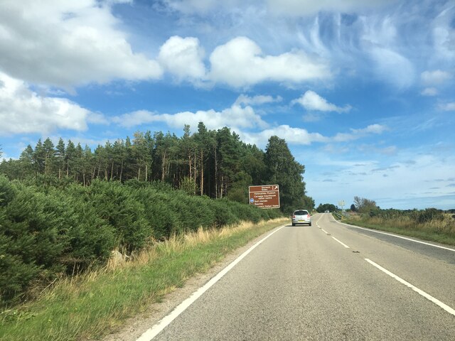
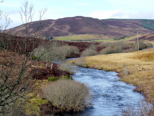
Lonemore is a small village located in the county of Sutherland, in the northern part of Scotland. It is situated on the eastern shore of Loch Shin, one of the largest freshwater lochs in the country. The village is nestled amidst stunning natural landscapes, with rolling hills and dense forests surrounding it.

Despite its remote location, Lonemore has a rich history dating back centuries. The village was primarily a farming community, with agriculture playing a significant role in the local economy. However, in recent years, tourism has also become an important industry in the area, attracting visitors who seek to explore the untouched beauty of the Scottish Highlands.

Lonemore offers a peaceful and tranquil atmosphere, making it an ideal destination for those looking to escape the hustle and bustle of city life. Visitors can indulge in various outdoor activities, including hiking, fishing, and wildlife spotting. The nearby Shin Falls, a breathtaking waterfall on the River Shin, is a popular attraction for nature enthusiasts.

In terms of amenities, Lonemore has a few small shops and cafes, providing basic necessities for both residents and tourists. However, for more significant amenities and services, the nearby town of Lairg is only a short drive away.

Overall, Lonemore is a hidden gem in the Scottish Highlands, offering a serene and picturesque setting for those seeking a peaceful retreat amidst nature's beauty.

If you have any feedback on the listing, please let us know in the comments section below.
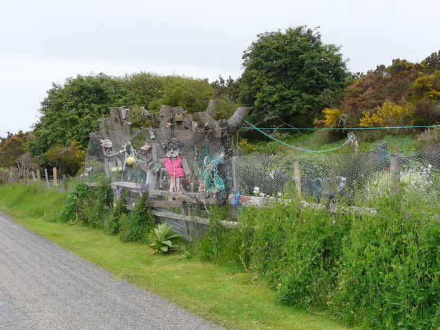
Lonemore Images

Images are sourced within 2km of 57.869241/-4.081727 or Grid Reference NH7688. Thanks to Geograph Open Source API. All images are credited.

A9, northbound The A9 is a strategic link between the Highlands of Scotland and the Central Belt. It runs 279 miles from junction 5 of the M9 at Polmont to Scrabster. Originally it ran from Edinburgh.
<span class="nowrap"><a title="https://www.sabre-roads.org.uk/wiki/index.php?title=A9" rel="nofollow ugc noopener" href="https://www.sabre-roads.org.uk/wiki/index.php?title=A9">Link</a><img style="margin-left:2px;" alt="External link" title="External link - shift click to open in new window" src="https://s1.geograph.org.uk/img/external.png" width="10" height="10"/></span>
A9, northbound
The A9 is a strategic link between the Highlands of Scotland and the Central Belt. It runs 279 miles from junction 5 of the M9 at Polmont to Scrabster. Originally it ran from Edinburgh. LinkExternal link
A9, Evelix Bridge The A9 is a strategic link between the Highlands of Scotland and the Central Belt. Running for 273 miles, it is the longest road in Scotland and the fifth-longest A-road in the United Kingdom. Historically it was the main road between Edinburgh and John o' Groats but its importance has been eclipsed somewhat in the south by the A90 across the Forth Road Bridge and the M90 motorway, which now links Edinburgh more directly with Perth, and the M9, which is now the main road between Edinburgh and Bridge of Allan.
A9, Evelix Bridge
The A9 is a strategic link between the Highlands of Scotland and the Central Belt. Running for 273 miles, it is the longest road in Scotland and the fifth-longest A-road in the United Kingdom. Historically it was the main road between Edinburgh and John o' Groats but its importance has been eclipsed somewhat in the south by the A90 across the Forth Road Bridge and the M90 motorway, which now links Edinburgh more directly with Perth, and the M9, which is now the main road between Edinburgh and Bridge of Allan.
Path to Loch-an-treel
Signage to Dornoch - A9 northbound
Postbox at Evelix IV25 277. Royal Mail list this box as 'Evelix'.
Postbox at Evelix
IV25 277. Royal Mail list this box as 'Evelix'.
Silage fields near Evelix
Evelix Bridge
Evelix Bridge
Old Milestone by the A9, north of Evelix Bridge, Dornoch Parish By the A9, in parish of Dornoch (Sutherland District), just South of the A949 junction, and North of Evelix Bridge, behind safety barrier.

Surveyed

Milestone Society National ID: HI_BBWK11.
Old Milestone by the A9, north of Evelix Bridge, Dornoch Parish
By the A9, in parish of Dornoch (Sutherland District), just South of the A949 junction, and North of Evelix Bridge, behind safety barrier. Surveyed Milestone Society National ID: HI_BBWK11.
Footpath from Camore to Lonemore, Sutherland The surface of the path has been recently relaid.  The vegetation on the verges should recover shortly.
Footpath from Camore to Lonemore, Sutherland
The surface of the path has been recently relaid. The vegetation on the verges should recover shortly.
Evelix: postbox № IV25 277 A Victorian postbox set into a pillar by the driveway to Evelix House. Its last collection times are 4:30pm on weekdays and 11:45am on Saturdays.
Evelix: postbox № IV25 277
A Victorian postbox set into a pillar by the driveway to Evelix House. Its last collection times are 4:30pm on weekdays and 11:45am on Saturdays.
Camore Wood Esker The long heathery ridge is an esker of sand and gravel, laid down by meltwater at the end of the last Ice Age.
Camore Wood Esker
The long heathery ridge is an esker of sand and gravel, laid down by meltwater at the end of the last Ice Age.
Bottom road to Dornoch
Entrance to Cyderhall Farm
Jetsam-decorated garden, Lonemore
Garden decorations, Lonemore
Decorated roadside garden, Lonemore
Small bridge A small bridge over River Evelix
Small bridge
A small bridge over River Evelix
River Evelix River Evelix taken from the bridge
River Evelix
River Evelix taken from the bridge
Show me another place!

Lonemore is located at Grid Ref: NH7688 (Lat: 57.869241, Lng: -4.081727)

Unitary Authority: Highland

Police Authority: Highlands and Islands

What 3 Words

///frizz.commuted.mural. Near Dornoch, Highland

Nearby Locations

Lonemore Lonemore

Related Wikis

Lonemore, Sutherland

Lonemore (Scottish Gaelic: An Lòn Mòr) is a village on the north shore of the Dornoch Firth in Sutherland, Scottish Highlands and is in the Scottish council...

Camore

Camore (Scottish Gaelic: An Cadha Mòr) is a small hamlet, located 0.5 mile directly southeast of Evelix, and 1.5 miles west of Dornoch, in south east Sutherland...

Evelix

Evelix or Evelick (Scottish Gaelic: Èibhleag) is a village near Dornoch in south east Sutherland, Scotland. The River Evelix runs through it. Evelix is...

River Evelix

The River Evelix (Scottish Gaelic: Èibhleag) is a river in Sutherland, Scotland. It draws water from some 30 square miles (78 km2) of rugged moorland...

Nearby Amenities

Located within 500m of 57.869241,-4.081727
Created By: almien_coastlines
Source: PGS
Lat/Long: 57.864879/-4.08339
Created By: almien_coastlines
Source: PGS
Lat/Long: 57.864883/-4.08291
Created By: almien_coastlines
Source: PGS
Lat/Long: 57.864887/-4.082429
Created By: almien_coastlines
Source: PGS
Lat/Long: 57.865018/-4.082194
Created By: almien_coastlines
Source: PGS
Lat/Long: 57.865147/-4.081957
Created By: almien_coastlines
Source: PGS
Lat/Long: 57.865151/-4.081476
Created By: almien_coastlines
Source: PGS
Lat/Long: 57.865155/-4.080996
Created By: almien_coastlines
Source: PGS
Lat/Long: 57.865286/-4.080761
Created By: almien_coastlines
Source: PGS
Lat/Long: 57.865415/-4.080524
Created By: almien_coastlines
Source: PGS
Lat/Long: 57.865684/-4.07909
Created By: almien_coastlines
Source: PGS
Lat/Long: 57.865828/-4.077173
Created By: almien_coastlines
Source: PGS
Lat/Long: 57.86634/-4.077188
Created By: almien_coastlines
Source: PGS
Lat/Long: 57.866476/-4.076232
Created By: almien_coastlines
Source: PGS
Lat/Long: 57.866744/-4.074798
Ele: 9.15
Note Ele: 30 ft
Source Ele: OS7
Lat/Long: 57.870631/-4.0772233
Eaglefield
Place: isolated_dwelling
Lat/Long: 57.8712239/-4.0748645
Lonemore
Name Gd: An Lòn Mòr
Place: hamlet
Lat/Long: 57.8691839/-4.0812226
The data included in this document is from www.openstreetmap.org. The data is made available under ODbL.

Have you been to Lonemore?

Leave your review of Lonemore below (or comments, questions and feedback).