Challacombe Down

Downs, Moorland in Devon Teignbridge

England

Challacombe Down

Birch Tor Granite jointed and weathered rocks on the moorland above Bennett's Cross.
<span class="nowrap"><a title="www.dartmoor.gov.uk" rel="nofollow ugc noopener" href="http://www.dartmoor.gov.uk">Link</a><img style="margin-left:2px;" alt="External link" title="External link - shift click to open in new window" src="https://s1.geograph.org.uk/img/external.png" width="10" height="10"/></span>
Birch Tor Credit: Colin Smith

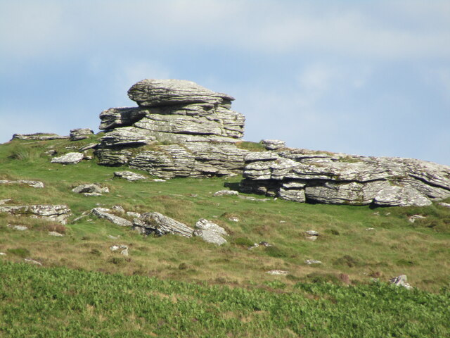
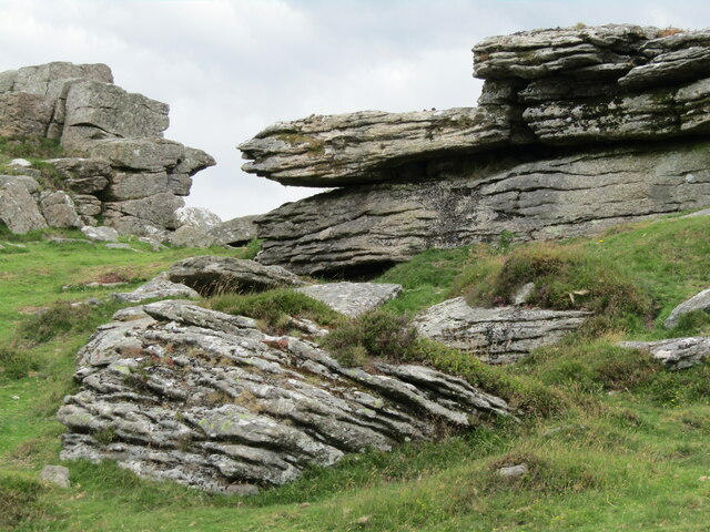
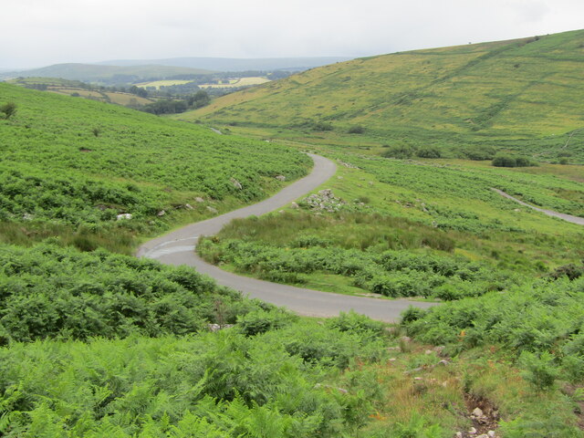
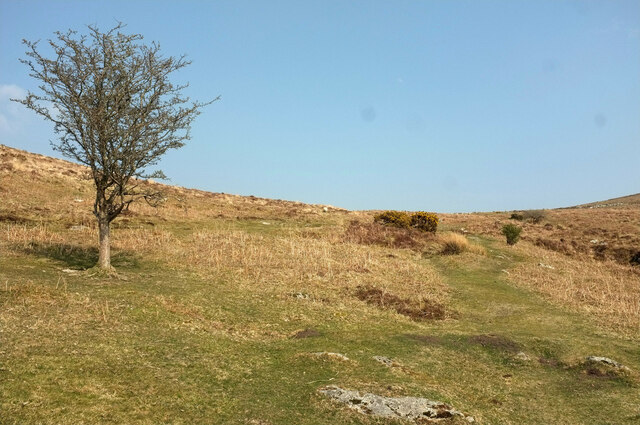
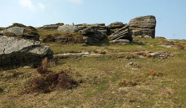
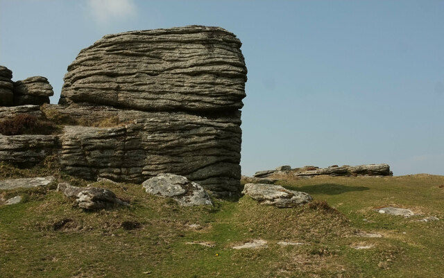
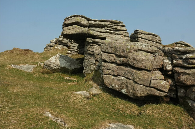
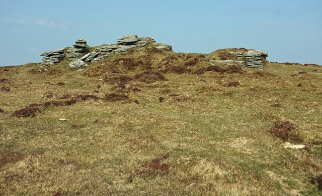
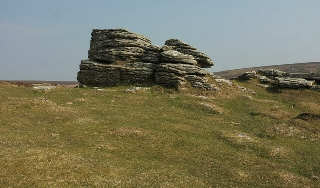
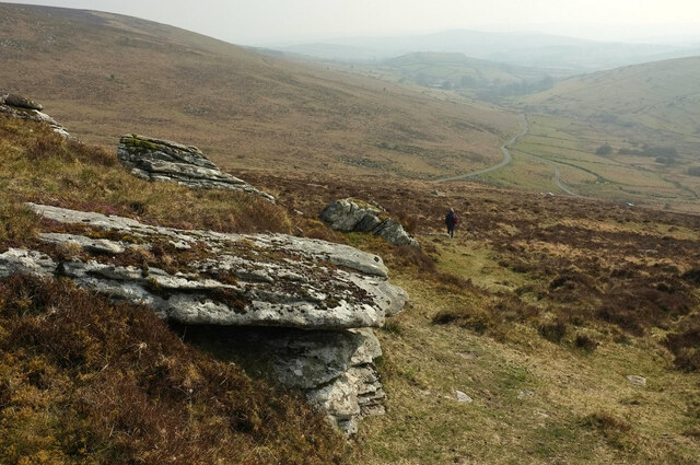
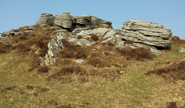
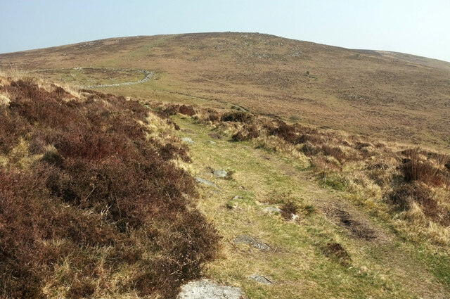
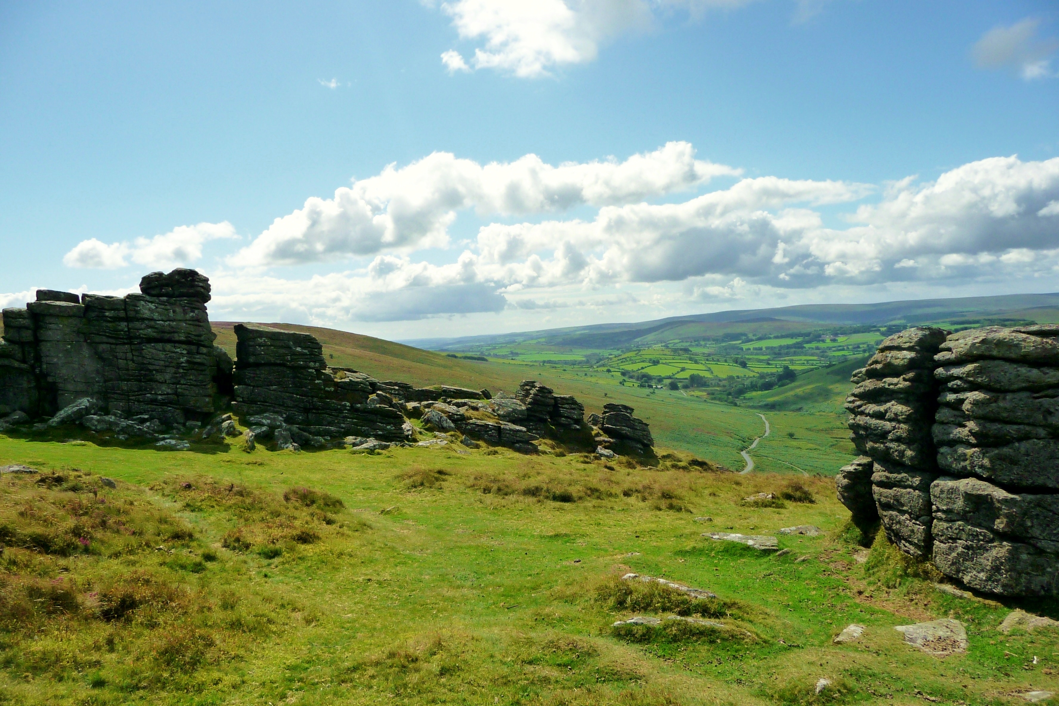
Challacombe Down is a picturesque area located in the county of Devon, England. Situated on the northern edge of Dartmoor National Park, it is known for its stunning natural beauty and rich biodiversity. The area is characterized by rolling hills, open grasslands, and scenic moorland, attracting nature enthusiasts and hikers alike.

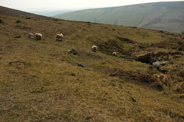
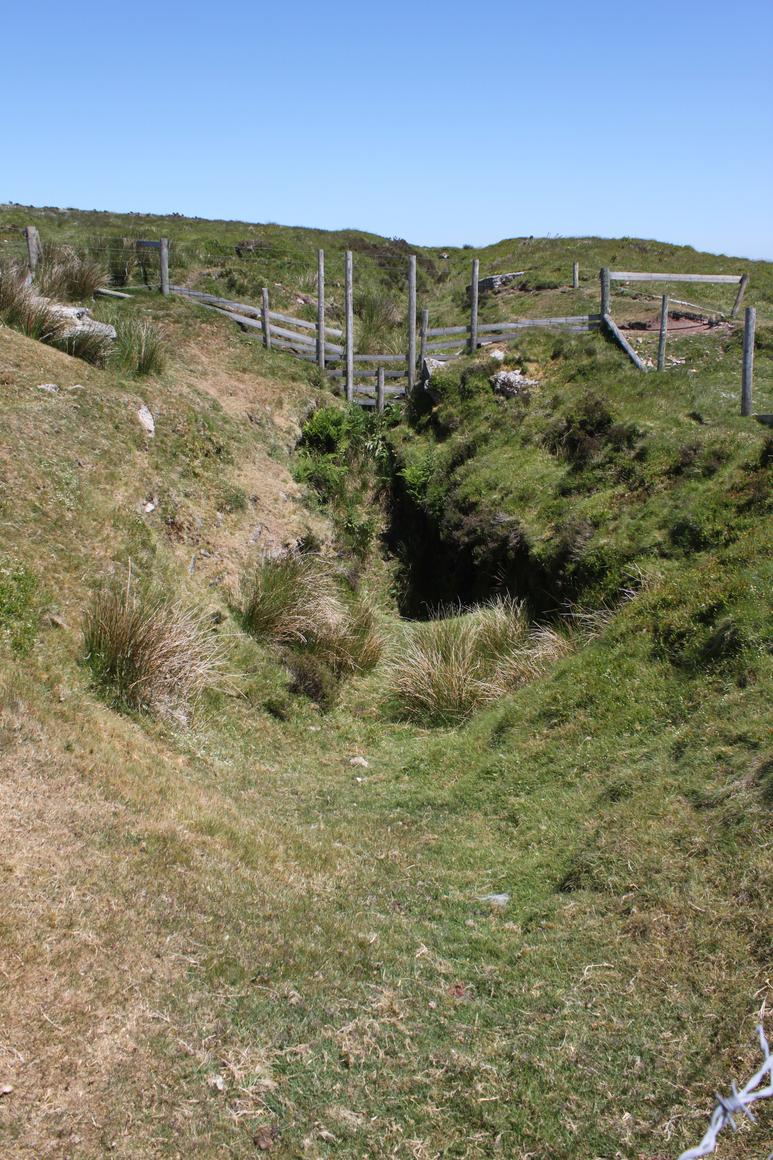
Covering an expanse of approximately 4 square miles, Challacombe Down boasts a diverse range of flora and fauna. The mix of acidic heathland, wet bog, and woodlands provides a unique habitat for various species. Visitors can spot a wide array of wildlife, including Dartmoor ponies, red deer, and numerous bird species such as the skylark and stonechat.

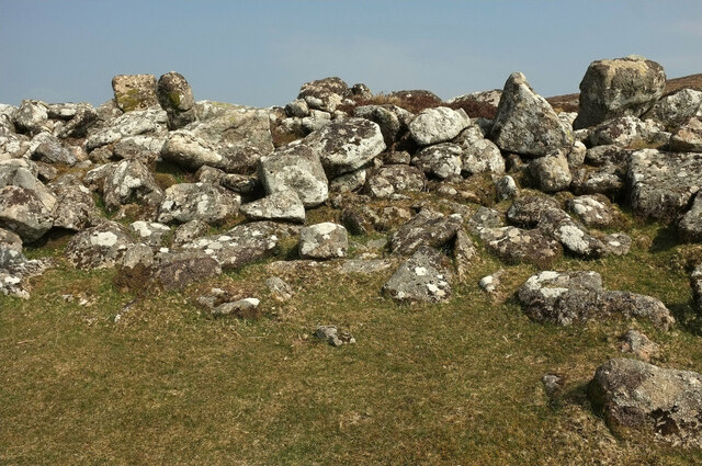
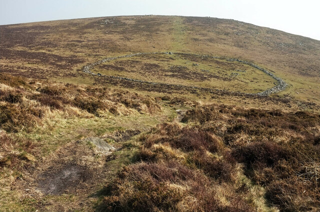
The down is also home to several archaeological sites, reflecting its ancient history. Evidence of Bronze Age settlements, stone circles, and burial mounds can be found scattered across the landscape, offering a glimpse into the area's past.

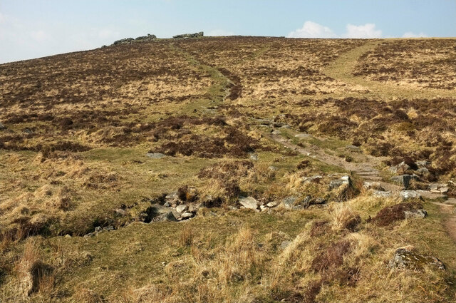
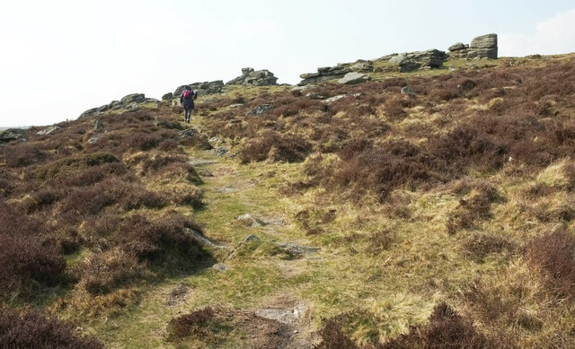
Visitors to Challacombe Down can explore the numerous walking trails and footpaths that crisscross the area, providing breathtaking views of the surrounding countryside. The down is a popular destination for outdoor activities such as hiking, birdwatching, and picnicking.

The nearby village of Challacombe offers amenities for visitors, including a traditional pub and quaint shops. The area is also well-connected, with easy access to major roads and public transportation, making it an ideal destination for day trips or longer stays.

Overall, Challacombe Down is a captivating natural landscape that showcases the beauty and diversity of the Devon countryside. Whether for its wildlife, archaeology, or scenic vistas, the downs offer a unique and enjoyable experience for anyone seeking a connection with nature and history.

If you have any feedback on the listing, please let us know in the comments section below.

Challacombe Down Images

Images are sourced within 2km of 50.601563/-3.8537231 or Grid Reference SX6879. Thanks to Geograph Open Source API. All images are credited.

Birch Tor Granite jointed and weathered rocks on the moorland above Bennett's Cross.
<span class="nowrap"><a title="www.dartmoor.gov.uk" rel="nofollow ugc noopener" href="http://www.dartmoor.gov.uk">Link</a><img style="margin-left:2px;" alt="External link" title="External link - shift click to open in new window" src="https://s1.geograph.org.uk/img/external.png" width="10" height="10"/></span>
Birch Tor
Granite jointed and weathered rocks on the moorland above Bennett's Cross. LinkExternal link
Grimspound Wooden footpath sign pointing from the small roadside car park towards the remains of a Bronze Age settlement, today named Grimspound.
<span class="nowrap"><a title="www.dartmoor.gov.uk" rel="nofollow ugc noopener" href="http://www.dartmoor.gov.uk">Link</a><img style="margin-left:2px;" alt="External link" title="External link - shift click to open in new window" src="https://s1.geograph.org.uk/img/external.png" width="10" height="10"/></span>
Grimspound
Wooden footpath sign pointing from the small roadside car park towards the remains of a Bronze Age settlement, today named Grimspound. LinkExternal link
Hookney Tor Granite jointed and weathered rocks at Hookney Tor, 497m amsl.
<span class="nowrap"><a title="www.dartmoor.gov.uk" rel="nofollow ugc noopener" href="http://www.dartmoor.gov.uk">Link</a><img style="margin-left:2px;" alt="External link" title="External link - shift click to open in new window" src="https://s1.geograph.org.uk/img/external.png" width="10" height="10"/></span>
Hookney Tor
Granite jointed and weathered rocks at Hookney Tor, 497m amsl. LinkExternal link
Dartmoor - Firth Bridge View over a narrow road, winding across moorland with much bracken and heather.
<span class="nowrap"><a title="www.dartmoor.gov.uk" rel="nofollow ugc noopener" href="http://www.dartmoor.gov.uk">Link</a><img style="margin-left:2px;" alt="External link" title="External link - shift click to open in new window" src="https://s1.geograph.org.uk/img/external.png" width="10" height="10"/></span>
Dartmoor - Firth Bridge
View over a narrow road, winding across moorland with much bracken and heather. LinkExternal link
Moorland west of Grimspound The path leads to the prehistoric settlement.
Moorland west of Grimspound
The path leads to the prehistoric settlement.
Sheep near Grimspound With Grim's Lake on the right and the West Webburn valley behind.
Sheep near Grimspound
With Grim's Lake on the right and the West Webburn valley behind.
Path to Hookney Tor Looking right from <a href="https://www.geograph.org.uk/photo/6964773">SX6980 : Sheep near Grimspound</a>, as the path crosses Grim's Lake and climbs to the tor.
Path to Hookney Tor
Looking right from SX6980 : Sheep near Grimspound, as the path crosses Grim's Lake and climbs to the tor.
Perimeter wall, Grimspound "The enclosure, which is known as Grimspound, survives as a stone and earth wall measuring between 2.5m and 3.5m wide, standing up to 1.25m high, surrounding an internal ovoid area of 1.45ha, containing at least 24 stone hut circles, several lynchets and rubble banks." <span class="nowrap"><a title="https://historicengland.org.uk/listing/the-list/list-entry/1014667" rel="nofollow ugc noopener" href="https://historicengland.org.uk/listing/the-list/list-entry/1014667">Link</a><img style="margin-left:2px;" alt="External link" title="External link - shift click to open in new window" src="https://s1.geograph.org.uk/img/external.png" width="10" height="10"/></span>
Perimeter wall, Grimspound
"The enclosure, which is known as Grimspound, survives as a stone and earth wall measuring between 2.5m and 3.5m wide, standing up to 1.25m high, surrounding an internal ovoid area of 1.45ha, containing at least 24 stone hut circles, several lynchets and rubble banks." LinkExternal link
Path to Grimspound Descending from Hookney Tor. The layout of this Bronze Age settlement <span class="nowrap"><a title="https://historicengland.org.uk/listing/the-list/list-entry/1014667" rel="nofollow ugc noopener" href="https://historicengland.org.uk/listing/the-list/list-entry/1014667">Link</a><img style="margin-left:2px;" alt="External link" title="External link - shift click to open in new window" src="https://s1.geograph.org.uk/img/external.png" width="10" height="10"/></span> is clearly seen from this hillside. The hill opposite is Hameldown Tor.
Path to Grimspound
Descending from Hookney Tor. The layout of this Bronze Age settlement LinkExternal link is clearly seen from this hillside. The hill opposite is Hameldown Tor.
Approaching Hookney Tor From the direction of Grimspound.
Approaching Hookney Tor
From the direction of Grimspound.
Hookney Tor "Of the tors that reside between the watersheds of the West and East Webburn Rivers, it is perhaps Hookney Tor that is the most spectacular, boasting a dominant position above the bronze-age village of Grimspound" <span class="nowrap"><a title="https://www.torsofdartmoor.co.uk/tor-page.php?tor=hookney-tor" rel="nofollow ugc noopener" href="https://www.torsofdartmoor.co.uk/tor-page.php?tor=hookney-tor">Link</a><img style="margin-left:2px;" alt="External link" title="External link - shift click to open in new window" src="https://s1.geograph.org.uk/img/external.png" width="10" height="10"/></span> .
Hookney Tor
"Of the tors that reside between the watersheds of the West and East Webburn Rivers, it is perhaps Hookney Tor that is the most spectacular, boasting a dominant position above the bronze-age village of Grimspound" LinkExternal link .
Rockpile, Hookney Tor A closer view of one of the rockpiles shown in <a href="https://www.geograph.org.uk/photo/6970213">SX6981 : Hookney Tor</a>.
Rockpile, Hookney Tor
A closer view of one of the rockpiles shown in SX6981 : Hookney Tor.
Hookney Tor There are several separate parts to the tor; this was taken in a central spot.
Hookney Tor
There are several separate parts to the tor; this was taken in a central spot.
Hookney Tor A northern part of the tor.
Hookney Tor
A northern part of the tor.
Hookney Tor The other side of the rockpile shown in <a href="https://www.geograph.org.uk/photo/6970230">SX6981 : Rockpile, Hookney Tor</a>.
Hookney Tor
The other side of the rockpile shown in SX6981 : Rockpile, Hookney Tor.
Descending from Hookney Tor The path is heading for Firth Bridge.
Descending from Hookney Tor
The path is heading for Firth Bridge.
Hookney Tor The southwestern part of the tor.
Hookney Tor
The southwestern part of the tor.
Path to Grimspound Cutting across the slopes below Hookney Tor. Part of the Bronze Age settlement of Grimspound can be seen left of centre, beneath Hameldown Tor.
Path to Grimspound
Cutting across the slopes below Hookney Tor. Part of the Bronze Age settlement of Grimspound can be seen left of centre, beneath Hameldown Tor.
Show me another place!

Challacombe Down is located at Grid Ref: SX6879 (Lat: 50.601563, Lng: -3.8537231)

Administrative County: Devon

District: Teignbridge

Police Authority: Devon and Cornwall

What 3 Words

///builders.resonates.request. Near Chagford, Devon

Nearby Locations

Challacombe Down

Related Wikis

Birch Tor and Vitifer mine

Birch Tor and Vitifer mine was a tin mine on Dartmoor, Devon, England. Located in the valley of the Redwater Brook, to the east of the B3212 Moretonhampstead...
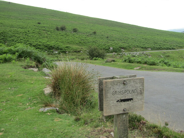
Grimspound

Grimspound is a late Bronze Age settlement, situated on Dartmoor in Devon, England. It consists of a set of 24 hut circles surrounded by a low stone wall...

Hookney Tor

Hookney Tor is a tor, situated on Dartmoor in Devon, England. It lies on the Two Moors Way and remains of Headland Warren farm and Vitifer Mine are also...

Warren House Inn

The Warren House Inn is a remote and isolated public house in the heart of Dartmoor, Devon, England. It is the highest pub in southern England at 1,425...

Nearby Amenities

Located within 500m of 50.601563,-3.8537231
Challacombe Cottages
Place: isolated_dwelling
Source: Bing
Lat/Long: 50.6016753/-3.8472363
Challacombe Down
Place: locality
Source: Bing
Lat/Long: 50.6035258/-3.851133
Challacombe
Place: hamlet
Source: Bing
Lat/Long: 50.6003625/-3.8474302
Bench
Lat/Long: 50.5999342/-3.8476541
Welcome to Challacombe Farm
Information: board
Tourism: information
Lat/Long: 50.6036871/-3.8585211
Buddles
Historic: ruins
Lat/Long: 50.6038608/-3.8590164
Engine Mountings
Historic: ruins
Lat/Long: 50.6041072/-3.8590139
Barrier: gap
Lat/Long: 50.5994965/-3.8496321
The data included in this document is from www.openstreetmap.org. The data is made available under ODbL.

Have you been to Challacombe Down?

Leave your review of Challacombe Down below (or comments, questions and feedback).