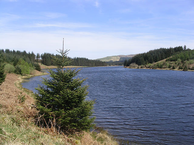
Fingland Moss

Downs, Moorland in Kirkcudbrightshire

Scotland

Fingland Moss

Below Auchenstroan Craig A logging road off the B729.
Below Auchenstroan Craig Credit: Richard Webb

Fingland Moss is a vast expanse of downs and moorland located in Kirkcudbrightshire, Scotland. Covering an area of approximately 1,000 hectares, it is one of the largest remaining areas of lowland raised bog in the country. The moss is situated on a gently undulating landscape, with rolling hills and scattered woodlands surrounding it.

The moss is characterized by its unique ecosystem, which supports a wide variety of plant and animal species. The bog itself is dominated by a dense carpet of sphagnum moss, interspersed with heather and cotton grass. These plants thrive in the acidic and waterlogged conditions that are typical of peatlands.

Fingland Moss is also home to a diverse range of bird species, including some rare and endangered species. The bog provides an important breeding ground for birds such as curlews, lapwings, and red grouse. It also attracts wintering birds such as whooper swans and golden plovers.

The moss is managed by the Scottish Wildlife Trust, which works to preserve and enhance its unique habitat. As such, there are several walking trails and observation points throughout the area, allowing visitors to explore and appreciate the natural beauty of Fingland Moss. The wildlife trust also conducts regular conservation work, including tree planting and water level management, to maintain the biodiversity of the bog.

Overall, Fingland Moss is a remarkable natural site that offers a glimpse into the unique and fragile ecosystem of lowland raised bogs. It is a haven for wildlife and a place of tranquility and beauty, attracting nature enthusiasts and visitors alike.

If you have any feedback on the listing, please let us know in the comments section below.

Fingland Moss Images

Images are sourced within 2km of 55.195394/-4.0630961 or Grid Reference NX6890. Thanks to Geograph Open Source API. All images are credited.

Below Auchenstroan Craig A logging road off the B729.
Below Auchenstroan Craig
A logging road off the B729.
Road to Trostan
Road to Trostan
Yellow road, College Glen The road can be quiet for ages, nothing passed after 17:00 this evening, but during the day it carries a lot of logging lorries.
Yellow road, College Glen
The road can be quiet for ages, nothing passed after 17:00 this evening, but during the day it carries a lot of logging lorries.
A stretch of the B729 road that runs from Moniaive to Kendoon Loch Looking south-westward.
A stretch of the B729 road that runs from Moniaive to Kendoon Loch
Looking south-westward.
Forestry, Auchenstroan View towards Auchenstroan Craig from beside the B729
Forestry, Auchenstroan
View towards Auchenstroan Craig from beside the B729
Road entrance, Auchenstroan A short logging road.
Road entrance, Auchenstroan
A short logging road.
B729 Climbing to a pass through the usual conifer plantations.
B729
Climbing to a pass through the usual conifer plantations.
B729 near Auchenstroan
Entrance to an area of new plantings
Forest Track near Ewe Craig
Road to Moniaive near Stroanshalloch Hill
Forest on Stroanshalloch Hill
Road to Carsphairn near Stroanshalloch Hill
Carroch Lane The term "lane" is often synonymous with "burn" in this part of Scotland.
Carroch Lane
The term "lane" is often synonymous with "burn" in this part of Scotland.
Cows on the road, near Fingland
Carroch A remote farm, seen from the B729 Kendoon to Moniaive road. Carroch Fell <a href="https://www.geograph.org.uk/gridref/NX6792">NX6792</a> in the distance.
Carroch
A remote farm, seen from the B729 Kendoon to Moniaive road. Carroch Fell NX6792 in the distance.
Moors near Fingland Lochlee Hill <a href="https://www.geograph.org.uk/gridref/NX6789">NX6789</a> in the distance.
Moors near Fingland
Lochlee Hill NX6789 in the distance.
Yet another windfarm on the way! Site entrance to Wether Hill windfarm Entrance to the site of Wether Hill windfarm, located to the north of the summit of the B729 Kendoon to Moniaive road in Galloway. When this photo was taken in October 2006, there was a continuous stream of cement lorries and other heavy traffic to the site along the adjoining road. This 18-turbine windfarm was opened the following year (2007).
Yet another windfarm on the way! Site entrance to Wether Hill windfarm
Entrance to the site of Wether Hill windfarm, located to the north of the summit of the B729 Kendoon to Moniaive road in Galloway. When this photo was taken in October 2006, there was a continuous stream of cement lorries and other heavy traffic to the site along the adjoining road. This 18-turbine windfarm was opened the following year (2007).
Show me another place!

Fingland Moss is located at Grid Ref: NX6890 (Lat: 55.195394, Lng: -4.0630961)

Unitary Authority: Dumfries and Galloway

Police Authority: Dumfries and Galloway

What 3 Words

///producing.proofs.thud. Near Thornhill, Dumfries & Galloway

Related Wikis

Carsphairn and Scaur Hills

The Carsphairn and Scaur Hills are the western and eastern hills respectively of a hill range in the Southern Uplands of Scotland. Ordnance Survey maps...

Craigdarroch

"Craigdarroch, An Accessory to Murder" is an expansion set for the board game Kill Doctor Lucky Craigdarroch is a house near Moniaive, Dumfries and Galloway...

Lochinvar

Lochinvar (or Lan Var) is a loch in the civil parish of Dalry in the historic county of Kirkcudbrightshire, Dumfries and Galloway Scotland. It is located...

Loch Howie

Loch Howie is a small, narrow, upland freshwater loch on the north side of Blackcraig Hill, approximately 18 miles (29 km) west of Dumfries, Scotland....

Nearby Amenities

Located within 500m of 55.195394,-4.0630961
Barrier: cattle_grid
Source: survey
Lat/Long: 55.1961883/-4.0578616
The data included in this document is from www.openstreetmap.org. The data is made available under ODbL.

Have you been to Fingland Moss?

Leave your review of Fingland Moss below (or comments, questions and feedback).