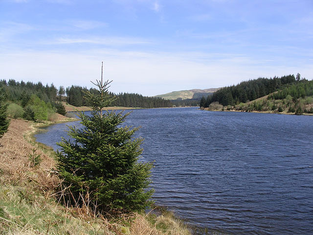
Bennieloan
Hill, Mountain in Kirkcudbrightshire
Scotland
Bennieloan

Bennieloan is a prominent hill located in the region of Kirkcudbrightshire, in the southwestern part of Scotland. Situated near the village of Carsluith, it forms part of the Galloway Hills range. With a summit elevation of approximately 386 meters (1,266 feet), Bennieloan offers stunning panoramic views of the surrounding countryside and the nearby coast.
The hill is known for its rugged and rocky terrain, making it a popular destination for outdoor enthusiasts, hikers, and nature lovers. Its slopes are covered in heather and grasses, providing a beautiful backdrop for photography and wildlife observation. The area is home to various species of birds, including red grouse and peregrine falcons.
Bennieloan is easily accessible from the nearby village, with well-marked trails leading to the summit. The ascent can be challenging at times, particularly in adverse weather conditions, so it is important for visitors to come prepared with appropriate clothing and footwear.
Aside from its natural beauty, Bennieloan also boasts historical significance. The hill is believed to have been a site of ancient settlements, with remnants of stone walls and structures still visible today. These artifacts provide insight into the area's rich history and cultural heritage.
Overall, Bennieloan offers a rewarding experience for those seeking outdoor adventure, breathtaking views, and a glimpse into the past.
If you have any feedback on the listing, please let us know in the comments section below.
Bennieloan Images
Images are sourced within 2km of 55.192584/-4.0607826 or Grid Reference NX6890. Thanks to Geograph Open Source API. All images are credited.


Bennieloan is located at Grid Ref: NX6890 (Lat: 55.192584, Lng: -4.0607826)
Unitary Authority: Dumfries and Galloway
Police Authority: Dumfries and Galloway
What 3 Words
///burden.nozzles.bluffing. Near Thornhill, Dumfries & Galloway
Nearby Locations
Related Wikis
Carsphairn and Scaur Hills
The Carsphairn and Scaur Hills are the western and eastern hills respectively of a hill range in the Southern Uplands of Scotland. Ordnance Survey maps...
Craigdarroch
"Craigdarroch, An Accessory to Murder" is an expansion set for the board game Kill Doctor Lucky Craigdarroch is a house near Moniaive, Dumfries and Galloway...
Lochinvar
Lochinvar (or Lan Var) is a loch in the civil parish of Dalry in the historic county of Kirkcudbrightshire, Dumfries and Galloway Scotland. It is located...
Loch Howie
Loch Howie is a small, narrow, upland freshwater loch on the north side of Blackcraig Hill, approximately 18 miles (29 km) west of Dumfries, Scotland....
Loch Skae
Loch Skae is a small, upland freshwater loch to the north of Blackcraig Hill, approximately 18 miles (29 km) west of Dumfries, Scotland, 0.5 mi (0.80 km...
Moniaive
Moniaive ( 'monny-IVE'; Scottish Gaelic: Am Moine Naomh, "The Holy Moor") is a village in the Parish of Glencairn, in Dumfries and Galloway, southwest...
Moniaive railway station
Moniaive railway station is the closed station terminus of the Cairn Valley Light Railway (CVR) branch, from Dumfries. It served the rural area of Moniaive...
Nearby Amenities
Located within 500m of 55.192584,-4.0607826Have you been to Bennieloan?
Leave your review of Bennieloan below (or comments, questions and feedback).


