Strife Ground

Downs, Moorland in Kirkcudbrightshire

Scotland

Strife Ground

Low Barcaple
Low Barcaple Credit: Kirsty Smith

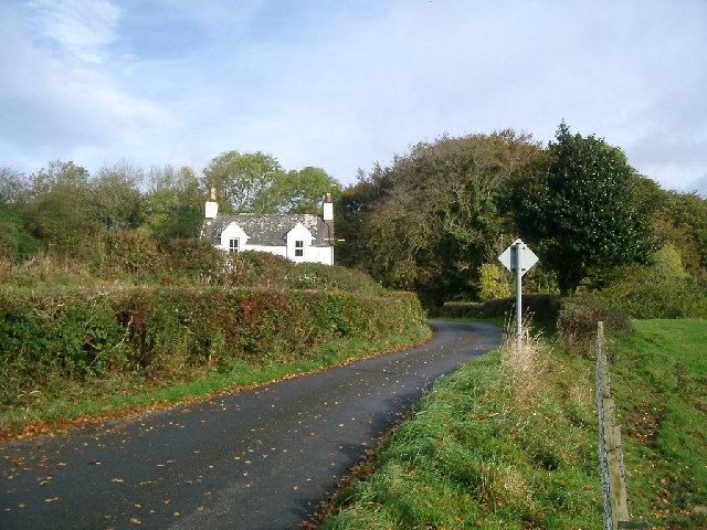
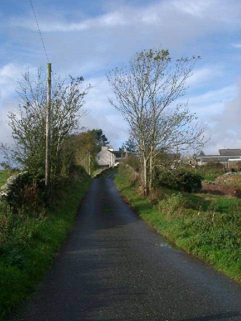
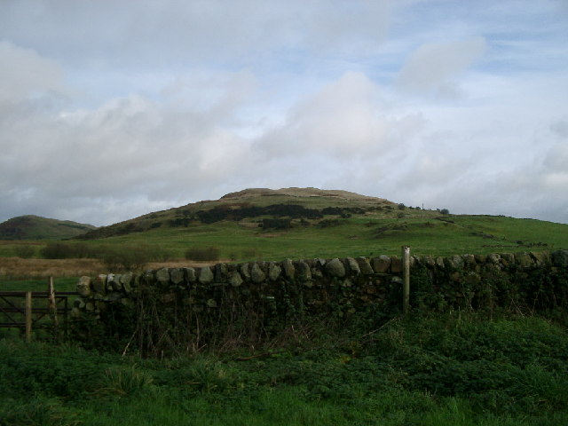
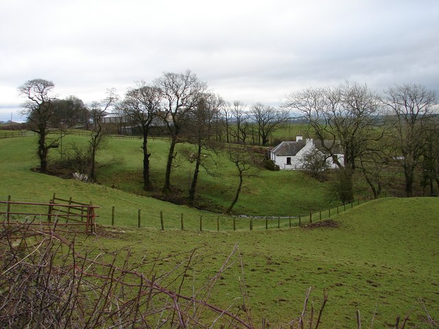
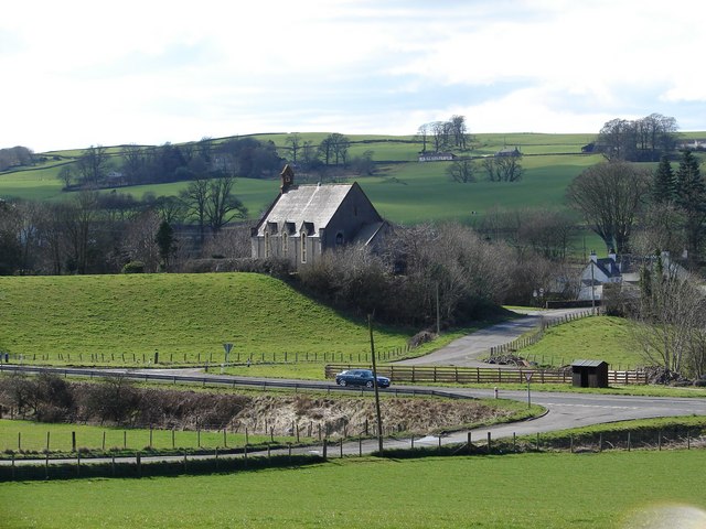
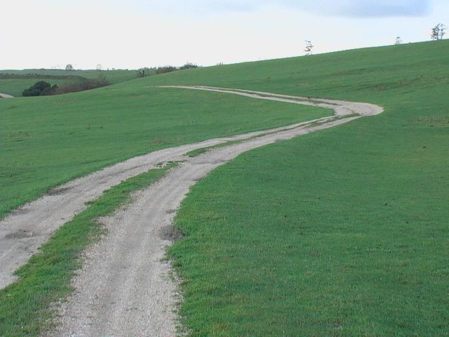
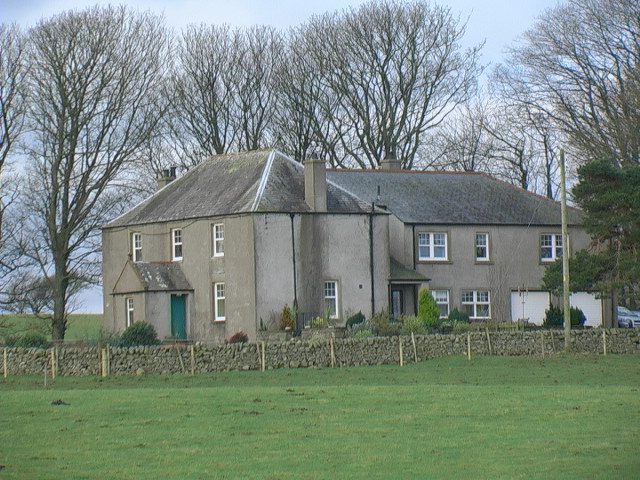
Strife Ground, located in Kirkcudbrightshire, is a picturesque landscape known for its vast downs and moorland. Covering an area of approximately 500 acres, this area is a haven for nature enthusiasts and those seeking serene surroundings. The name "Strife Ground" derives from its historical association with conflicts that occurred in the region during ancient times.

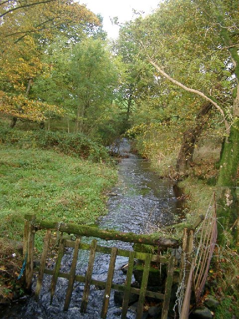
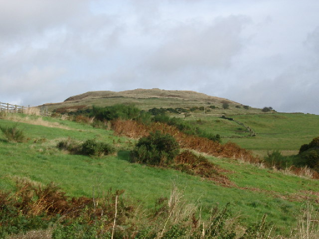
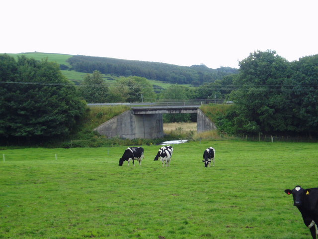
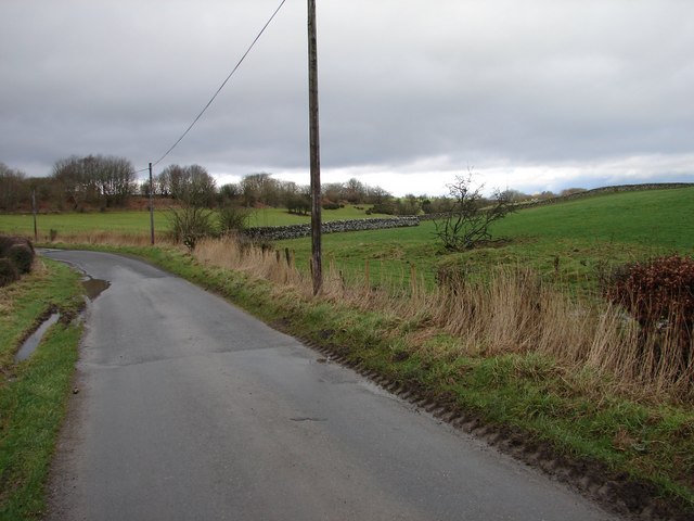
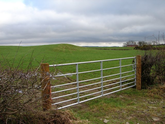
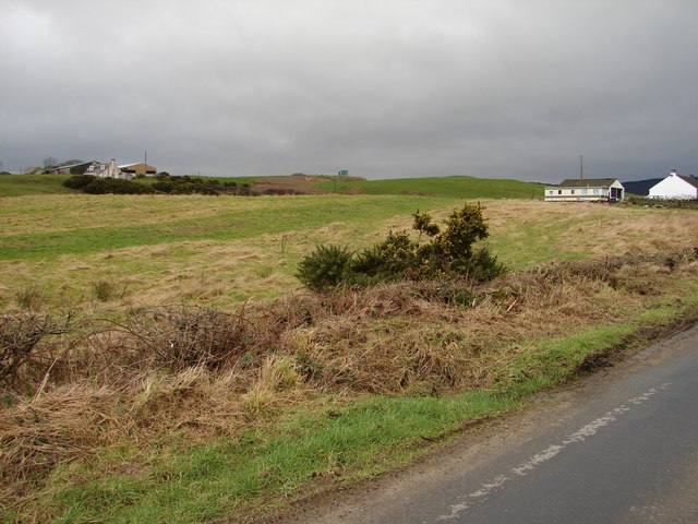
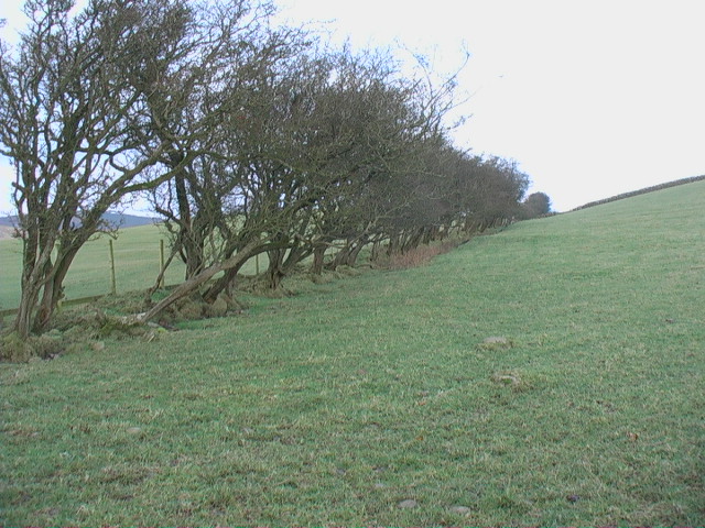
The downs of Strife Ground offer breathtaking panoramic views, with rolling hills and undulating terrain that stretch as far as the eye can see. These downs are characterized by their lush greenery, dotted with vibrant wildflowers during the warmer months. The soft ground of the downs provides an ideal habitat for a variety of plant species, including heather and gorse, which thrive in this unique environment.

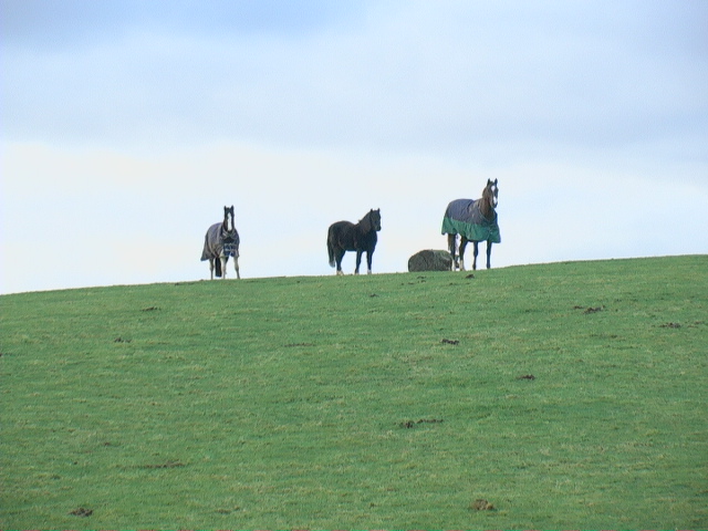
Adjacent to the downs, the moorland of Strife Ground showcases a different landscape altogether. Here, visitors can immerse themselves in the rugged beauty of the Scottish countryside. The moorland is characterized by its open expanses, covered in a patchwork of heather and grasses. The area is home to an array of wildlife, including red deer, grouse, and various bird species.

Strife Ground offers visitors an opportunity to explore nature at its finest. The tranquil surroundings provide a perfect setting for outdoor activities such as hiking, birdwatching, and photography. Whether one is seeking solitude or adventure, Strife Ground in Kirkcudbrightshire is a destination that caters to all nature lovers, making it a must-visit location in the region.

If you have any feedback on the listing, please let us know in the comments section below.

Strife Ground Images

Images are sourced within 2km of 54.886363/-4.0832373 or Grid Reference NX6656. Thanks to Geograph Open Source API. All images are credited.

Low Barcaple
Low Barcaple
Upstream, Spout Burn and Larks Plantation
Mark house from road steadings on left
Mark house from road
steadings on left
Looking towards Meikle Culcaigrie Hill Meikle Culcaigrie Hill from under the sheepfold near Trostrie. Sheepfold is on the left. Put this photo against the hill in the foreground.
Looking towards Meikle Culcaigrie Hill
Meikle Culcaigrie Hill from under the sheepfold near Trostrie. Sheepfold is on the left. Put this photo against the hill in the foreground.
Meikle Culcaigrie from Glencap Bridge Think that must be Pharoah's Throne at the left hand side.
Meikle Culcaigrie from Glencap Bridge
Think that must be Pharoah's Throne at the left hand side.
Weir on the Old Mill Burn Glinting in the spring sunshine.
Weir on the Old Mill Burn
Glinting in the spring sunshine.
The Old Bridge of Tarff Pictured from where the military road crossed the river by the High Bridge of Tarff, this hump-backed bridge was built in the 18th century.
The Old Bridge of Tarff
Pictured from where the military road crossed the river by the High Bridge of Tarff, this hump-backed bridge was built in the 18th century.
Beeches by the lane near Barcaple.
A75 Road Bridge over the Tarff Water. This is the latest bridge to carry the Gretna-Stranraer Road over the Tarff Water and least attractive. The previous two having much more character.
A75 Road Bridge over the Tarff Water.
This is the latest bridge to carry the Gretna-Stranraer Road over the Tarff Water and least attractive. The previous two having much more character.
Glengap Road, Twynholm View NNW from the Glengap Road (Redfield) toward the coppices of Mains of Twynholm.
Glengap Road, Twynholm
View NNW from the Glengap Road (Redfield) toward the coppices of Mains of Twynholm.
Redfield View from the Glengap Road SE across the fields toward Redfield house.
Redfield
View from the Glengap Road SE across the fields toward Redfield house.
Muirhead, Twynholm View from the Twynholm-Glengap road of Muirhead farm and cottages. In between on the hill is Muirhead reservoir.
Muirhead, Twynholm
View from the Twynholm-Glengap road of Muirhead farm and cottages. In between on the hill is Muirhead reservoir.
Lochhill, Ringford View across Spout Burn to Lochhill Cottage and Lochhill Farm.
Lochhill, Ringford
View across Spout Burn to Lochhill Cottage and Lochhill Farm.
Valleyfield Church The former Tongland & Twynholm Free Church (1843) stands in the hamlet of Valleyfield in Tarff Valley, today by-passed by the A75 trunk road.
Valleyfield Church
The former Tongland & Twynholm Free Church (1843) stands in the hamlet of Valleyfield in Tarff Valley, today by-passed by the A75 trunk road.
Farm track to Auchengassel The surfacing material was broken shell giving a rustic look to the track.
Farm track to Auchengassel
The surfacing material was broken shell giving a rustic look to the track.
Irelandton farmhouse
Untrimmed mature hedgerow Not only does the thorn hedge appear never to have been trimmed - it would not keep in much stock in this condition - but it also shows the direction of the prevailing wind.
Untrimmed mature hedgerow
Not only does the thorn hedge appear never to have been trimmed - it would not keep in much stock in this condition - but it also shows the direction of the prevailing wind.
Horses grazing on open ground
Show me another place!

Strife Ground is located at Grid Ref: NX6656 (Lat: 54.886363, Lng: -4.0832373)

Unitary Authority: Dumfries and Galloway

Police Authority: Dumfries and Galloway

What 3 Words

///beans.petulant.worked. Near Kirkcudbright, Dumfries & Galloway

Related Wikis

Tarff railway station

Tarff railway station served the village of Ringford, Dumfries and Galloway, Scotland from 1864 to 1965 on the Kirkcudbright Railway. == History == The...

Twynholm

Twynholm () is a village in Scotland. It is located 2+1⁄4 miles (3.6 km) north-northwest of Kirkcudbright and 4+1⁄2 miles (7.2 km) east of Gatehouse of...

Ringford

Ringford is a village in the historical county of Kirkcudbrightshire in Dumfries and Galloway located at grid reference NX689578 beside the Tarff Water...

Tongland

Tongland is a small village about 2 miles (3 km) north of Kirkcudbright, in the historic county of Kirkcudbrightshire in Dumfries and Galloway, Scotland...

Tongland Abbey

Tungland or Tongland Abbey was a Premonstratensian monastic community located in Tongland in the historical county of Kirkcudbrightshire in Dumfries and...

Broughton House

Broughton House is an 18th-century town house standing on the High Street of Kirkcudbright, Scotland. It was the home of Scots impressionist artist E....

Kirkcudbright Railway

The Kirkcudbright Railway was a railway branch line linking Kirkcudbright to the Castle Douglas and Dumfries Railway at Castle Douglas. It opened in 1864...

MacLellan's Castle

MacLellan's Castle in the town of Kirkcudbright, in Galloway, Scotland, was built in the late 16th century. It stands in the centre of Kirkcudbright...

Nearby Amenities

Located within 500m of 54.886363,-4.0832373
Power: pole
Lat/Long: 54.8831837/-4.0818968
Power: pole
Lat/Long: 54.8869664/-4.0907306
Power: pole
Lat/Long: 54.8844746/-4.0853806
Power: pole
Lat/Long: 54.8848915/-4.0852977
Power: pole
Lat/Long: 54.8855425/-4.0851743
Power: pole
Lat/Long: 54.8855445/-4.0873433
Power: pole
Lat/Long: 54.8867109/-4.0900005
Power: pole
Lat/Long: 54.886208/-4.0885632
Power: pole
Lat/Long: 54.8860427/-4.0899247
Power: pole
Lat/Long: 54.8859661/-4.0905185
Power: pole
Lat/Long: 54.8849942/-4.0863339
Power: pole
Lat/Long: 54.8840255/-4.0841687
Power: pole
Lat/Long: 54.8842284/-4.0847161
Power: pole
Lat/Long: 54.8836102/-4.0830479
Power: pole
Lat/Long: 54.8824639/-4.080472
Power: pole
Lat/Long: 54.8822831/-4.0812066
Power: pole
Lat/Long: 54.8828787/-4.0812972
The data included in this document is from www.openstreetmap.org. The data is made available under ODbL.

Have you been to Strife Ground?

Leave your review of Strife Ground below (or comments, questions and feedback).