Leary Moors

Downs, Moorland in Devon North Devon

England

Leary Moors

Huxtable Farm
Huxtable Farm Credit: Roger Cornfoot

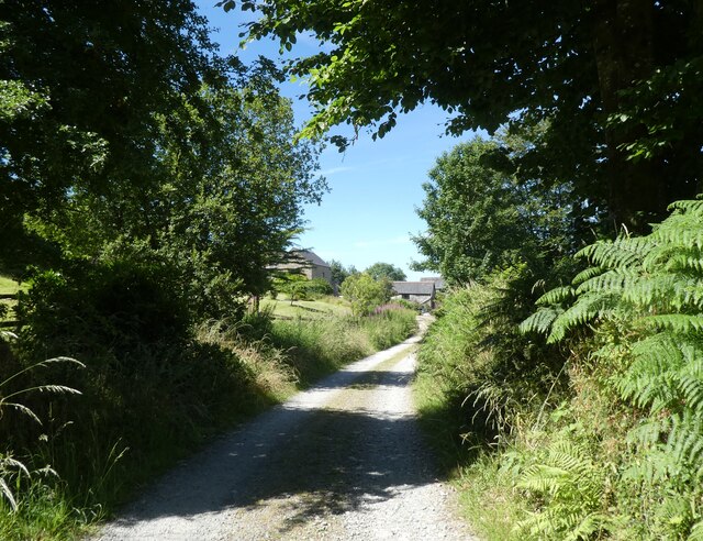
Leary Moors, located in Devon, England, is a stunning expanse of moorland that stretches across a vast area of approximately 5,000 acres. Situated in the heart of the Dartmoor National Park, it offers visitors a unique and tranquil experience in a rugged and picturesque landscape.

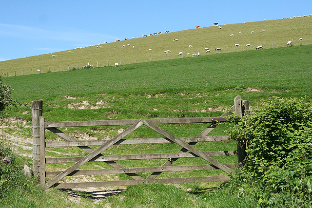
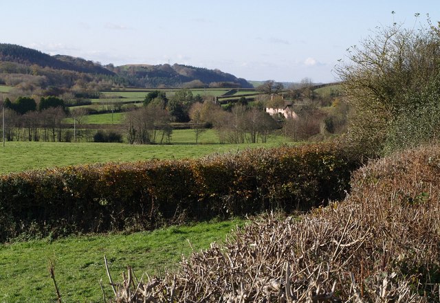
Characterized by its rolling hills, open grasslands, and scattered granite tors, Leary Moors showcases the natural beauty and diversity of the region. The moorland features a variety of vegetation, including heather, gorse, and bracken, which create a vibrant and colorful tapestry throughout the year.

The area is home to a rich array of wildlife, making it a haven for nature enthusiasts. Visitors may spot wild ponies grazing peacefully, along with an abundance of bird species, such as skylarks, buzzards, and stonechats. Additionally, Leary Moors is known for its rare flora, including the vibrant yellow gorse flowers that bloom in spring.

The moorland offers numerous opportunities for outdoor activities, attracting hikers, walkers, and cyclists from far and wide. There are several well-marked trails that crisscross the area, providing access to its most scenic spots and panoramic views. These paths cater to all levels of ability, from leisurely strolls to challenging hikes up the tors.

Leary Moors is also steeped in history, with evidence of prehistoric settlements and ancient burial sites scattered across the landscape. One notable landmark is the Grimspound, an impressive Bronze Age settlement that has been remarkably preserved.

Overall, Leary Moors in Devon is a captivating destination for those seeking a serene and breathtaking experience amidst the natural wonders of Dartmoor National Park.

If you have any feedback on the listing, please let us know in the comments section below.

Leary Moors Images

Images are sourced within 2km of 51.0475/-3.9158019 or Grid Reference SS6529. Thanks to Geograph Open Source API. All images are credited.

Huxtable Farm
Huxtable Farm
Huxtable Lane
Huxtable Lane
West Buckland: Buckingham’s Leary A farm with 250 Friesians in December 2003. In 1890 there was water-power here; one pier of an aqueduct is all that remains of this installation, by the lane beyond the farmhouse. The cottage to the right of the original farm carries an 1858 datestone
West Buckland: Buckingham’s Leary
A farm with 250 Friesians in December 2003. In 1890 there was water-power here; one pier of an aqueduct is all that remains of this installation, by the lane beyond the farmhouse. The cottage to the right of the original farm carries an 1858 datestone
St Paul's church, Filleigh
Cannons at the high point of Castle Hill Gardens Unsure whether the cannons are replicas or purely ornamental. <span class="nowrap"><a title="http://www.gardens-guide.com/gardenpages/_0512.htm" rel="nofollow ugc noopener" href="http://www.gardens-guide.com/gardenpages/_0512.htm">Link</a><img style="margin-left:2px;" alt="External link" title="External link - shift click to open in new window" src="https://s1.geograph.org.uk/img/external.png" width="10" height="10"/></span> gives more information about the gardens.
Cannons at the high point of Castle Hill Gardens
Unsure whether the cannons are replicas or purely ornamental. LinkExternal link gives more information about the gardens.
Castle Hill House The seat of the Fortescue family - the current countess of Arran. Castle Hill is to the left of the picture at GR SS 663 287.
Castle Hill House
The seat of the Fortescue family - the current countess of Arran. Castle Hill is to the left of the picture at GR SS 663 287.
An ornamental building in Castle Hill Gardens Taken through trees from the hill on the opposite side of the wooded valley.
An ornamental building in Castle Hill Gardens
Taken through trees from the hill on the opposite side of the wooded valley.
The lavender walk at Castle Hill Gardens
Statue of a satyr at Castle Hill Gardens
Filleigh Bridge Cottages to the north of the Filleigh Bridge taken from the south.
Filleigh Bridge
Cottages to the north of the Filleigh Bridge taken from the south.
Filleigh: wheat field Looking east-south-east
Filleigh: wheat field
Looking east-south-east
Filleigh: telephone box By the South Molton-Swimbridge road, looking north east
Filleigh: telephone box
By the South Molton-Swimbridge road, looking north east
Filleigh: near West Heddon Looking north-north-west towards the farm
Filleigh: near West Heddon
Looking north-north-west towards the farm
Filleigh: grass harvest Looking east near West Heddon farm with grass being transported for silage
Filleigh: grass harvest
Looking east near West Heddon farm with grass being transported for silage
Filleigh: Heddon A Royal Mail van passes. Looking south
Filleigh: Heddon
A Royal Mail van passes. Looking south
Filleigh: below High Down At Heddon. Looking south-south-west
Filleigh: below High Down
At Heddon. Looking south-south-west
West Buckland: by Leary Barton Looking north-north-west opposite the entrance to Leary Barton
West Buckland: by Leary Barton
Looking north-north-west opposite the entrance to Leary Barton
Gould's Leary Scattered along the lane between Filleigh Bridge and Riverton are numerous farmhouses bearing the name "Leary" and preceded by the surname of a person who once lived there. Gould's Leary is just across the lane from May's Leary. Close by to the left, but hidden, is the A371 link road to Barnstaple. The hills on the left, High Down and Great Hill are in adjoining squares.
Gould's Leary
Scattered along the lane between Filleigh Bridge and Riverton are numerous farmhouses bearing the name "Leary" and preceded by the surname of a person who once lived there. Gould's Leary is just across the lane from May's Leary. Close by to the left, but hidden, is the A371 link road to Barnstaple. The hills on the left, High Down and Great Hill are in adjoining squares.
Show me another place!

Leary Moors is located at Grid Ref: SS6529 (Lat: 51.0475, Lng: -3.9158019)

Administrative County: Devon

District: North Devon

Police Authority: Devon and Cornwall

What 3 Words

///incisions.shadowed.stack. Near South Molton, Devon

Related Wikis

Filleigh

Filleigh is a small village, civil parish and former manor in North Devon, on the southern edge of Exmoor, 3.5 miles (5.6 km) west of South Molton. The...

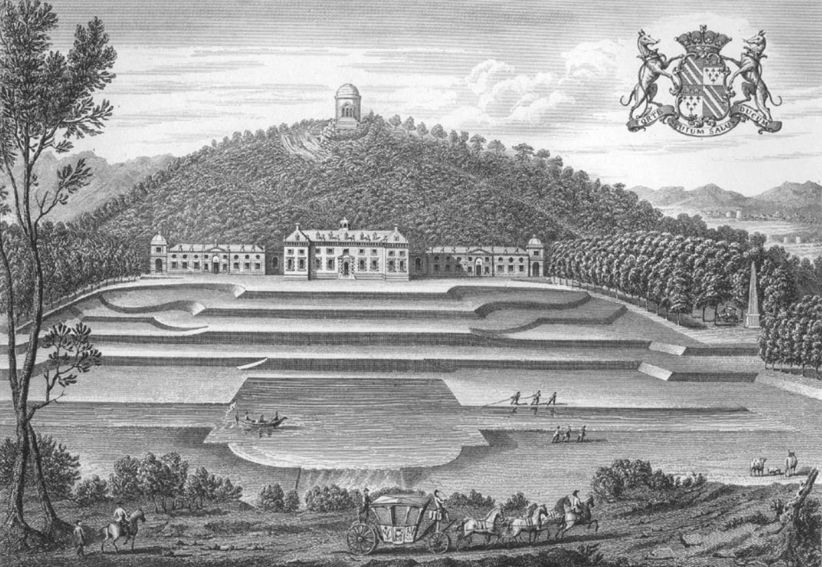
Castle Hill, Filleigh

Castle Hill in the parish of Filleigh in North Devon, is an early Neo-Palladian country house situated 3 miles (5 kilometres) north-west of South Molton...

West Buckland, Devon

West Buckland is a small village and former manor, now in the parish of East and West Buckland, in the North Devon district, in the county of Devon, England...

East Buckland

East Buckland is a small village and former civil parish, now in the parish of East and West Buckland, in the North Devon district of Devon, England, next...

Nearby Amenities

Located within 500m of 51.0475,-3.9158019
Parking
Access: yes
Fee: no
Parking: layby
Lat/Long: 51.0488246/-3.9101007
Power: pole
Source: bing
Lat/Long: 51.0518758/-3.9153573
Power: pole
Source: bing
Lat/Long: 51.0464724/-3.9179134
Power: pole
Source: bing
Lat/Long: 51.0499823/-3.9158481
Power: pole
Source: bing
Lat/Long: 51.0491628/-3.9160681
Power: pole
Source: bing
Lat/Long: 51.0476519/-3.9164677
Power: pole
Source: bing
Lat/Long: 51.0456385/-3.92077
Power: pole
Source: bing
Lat/Long: 51.0461124/-3.9202926
Power: pole
Source: bing
Lat/Long: 51.0462996/-3.9190641
Power: pole
Source: bing
Lat/Long: 51.0466621/-3.9167225
Power: pole
Source: bing
Lat/Long: 51.0499839/-3.9105186
Power: pole
Source: bing
Lat/Long: 51.0501475/-3.9116129
Power: pole
Source: bing
Lat/Long: 51.0503734/-3.9131069
Power: pole
Source: bing
Lat/Long: 51.0506011/-3.914609
Power: pole
Source: bing
Lat/Long: 51.0508017/-3.9156228
Power: pole
Source: bing
Lat/Long: 51.0510749/-3.9169988
Power: pole
Source: bing
Lat/Long: 51.0513328/-3.9183131
The data included in this document is from www.openstreetmap.org. The data is made available under ODbL.

Have you been to Leary Moors?

Leave your review of Leary Moors below (or comments, questions and feedback).