Kingston Plain

Downs, Moorland in Devon South Hams

England

Kingston Plain

Harvested field near Kingston Red trailers can be seen over the hedge in the d-adjacent field - see <a href="https://www.geograph.org.uk/photo/6829431">SX6348 : Tractors near Kingston</a> for one of them.
Harvested field near Kingston Credit: Derek Harper

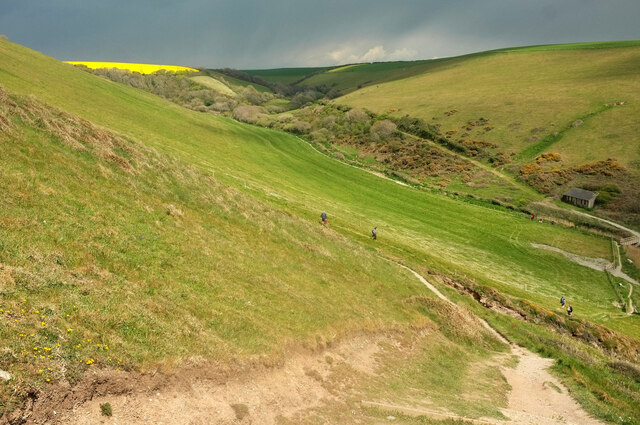
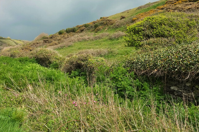
Kingston Plain is a picturesque area located in the county of Devon, England. Situated amidst the stunning Downs and Moorland, it offers visitors a tranquil escape into nature. With its rolling hills, lush greenery, and breathtaking panoramic views, Kingston Plain is a haven for outdoor enthusiasts and nature lovers.

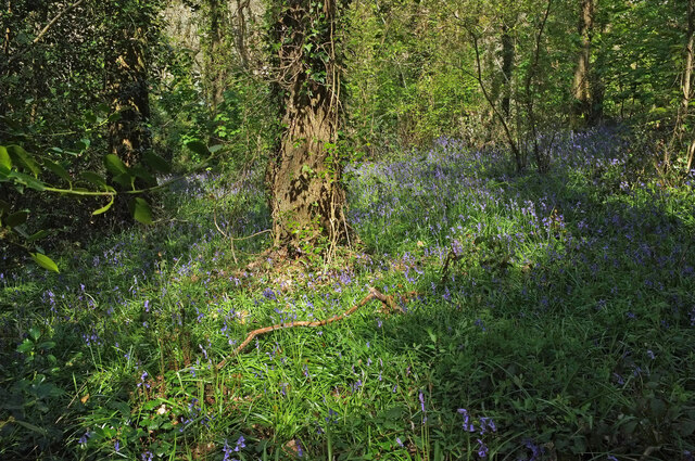
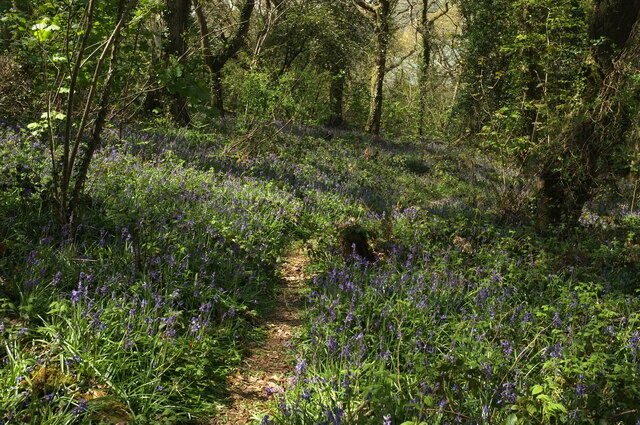
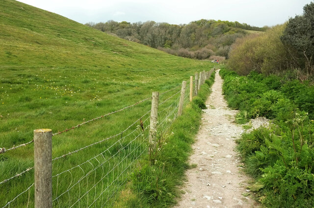
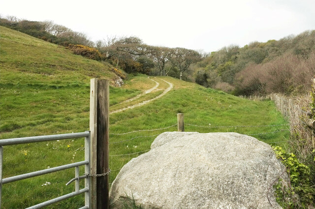
The area is characterized by its vast open spaces, making it perfect for activities such as hiking, walking, and cycling. The Downs provide ample opportunities for exploration, with well-marked trails that lead visitors through the beautiful countryside. The Moorland, on the other hand, offers a more rugged terrain, dotted with heather and gorse, creating a unique and captivating landscape.

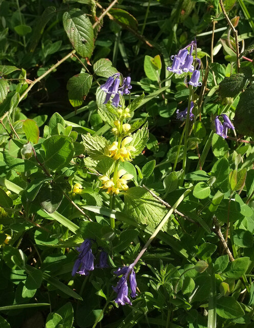
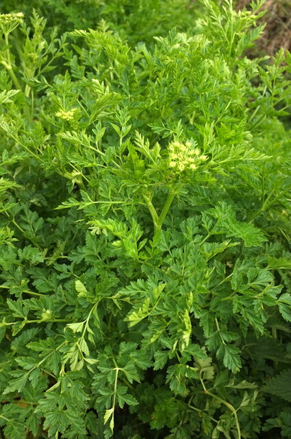
Wildlife enthusiasts will be delighted by the diverse range of flora and fauna found in Kingston Plain. The region is home to a variety of bird species, including skylarks, kestrels, and buzzards, making it a birdwatcher's paradise. Additionally, the area is known for its abundant populations of deer, providing the opportunity for wildlife spotting.

For those seeking a bit of history and culture, Kingston Plain is also dotted with ancient archaeological sites. Stone circles and burial mounds can be found throughout the area, offering a glimpse into the region's rich past.

Overall, Kingston Plain, Devon (Downs, Moorland) is a captivating destination that offers visitors a chance to immerse themselves in the beauty of nature. Whether it's exploring the rolling hills, observing the local wildlife, or uncovering the area's ancient history, Kingston Plain has something to offer every visitor.

If you have any feedback on the listing, please let us know in the comments section below.

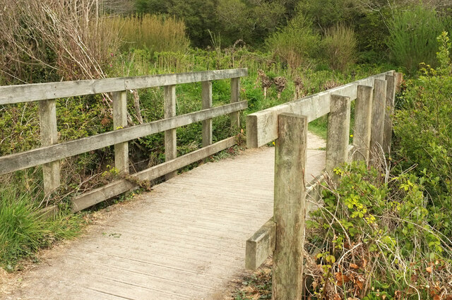
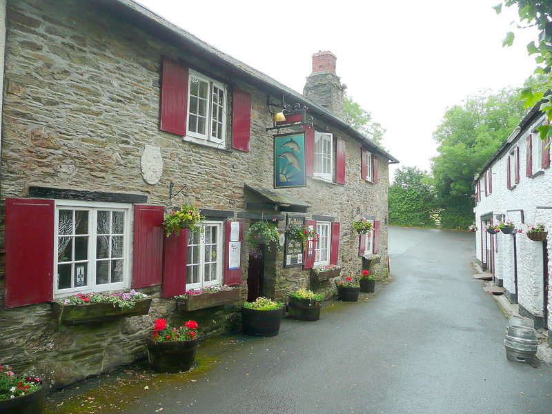
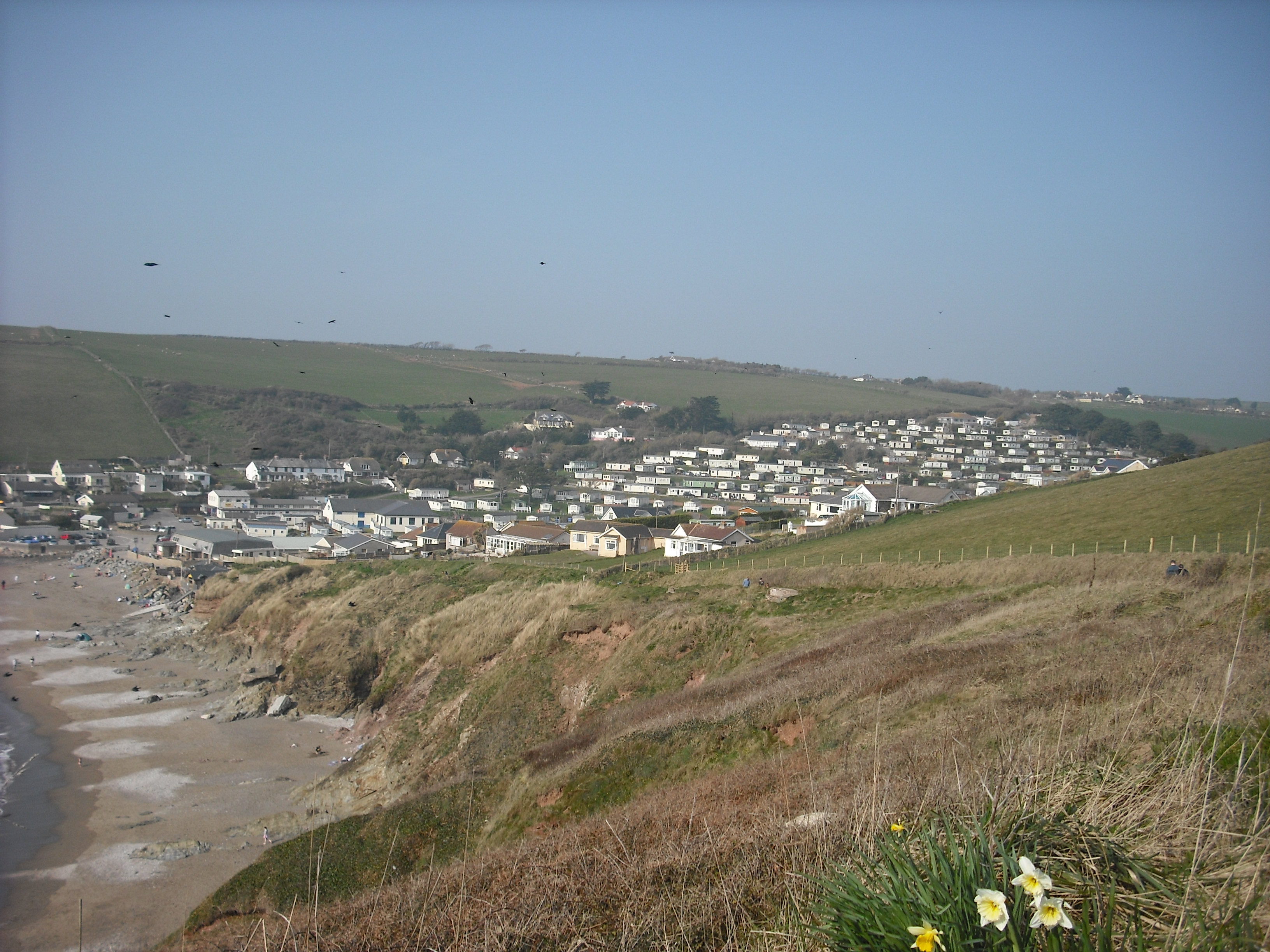
Kingston Plain Images

Images are sourced within 2km of 50.314936/-3.9113482 or Grid Reference SX6447. Thanks to Geograph Open Source API. All images are credited.

Harvested field near Kingston Red trailers can be seen over the hedge in the d-adjacent field - see <a href="https://www.geograph.org.uk/photo/6829431">SX6348 : Tractors near Kingston</a> for one of them.
Harvested field near Kingston
Red trailers can be seen over the hedge in the d-adjacent field - see SX6348 : Tractors near Kingston for one of them.
Footpath, Furzedown Wood Kingston footpath 3 winds between bluebells.
Footpath, Furzedown Wood
Kingston footpath 3 winds between bluebells.
Bluebells, Furzedown Wood Kingston footpath 3 drops through the bluebell wood.
Bluebells, Furzedown Wood
Kingston footpath 3 drops through the bluebell wood.
Bluebells, Furzedown Wood From the path shown in <a href="https://www.geograph.org.uk/photo/6829692">SX6247 : Footpath, Furzedown Wood</a>.
Bluebells, Furzedown Wood
From the path shown in SX6247 : Footpath, Furzedown Wood.
Footpath, Furzedown Wood Kingston footpath 3 reaches the southern edge of the wood after a climb.
Footpath, Furzedown Wood
Kingston footpath 3 reaches the southern edge of the wood after a climb.
Footpath, Furzedown Wood Kingston footpath 3 curves downhill through bluebells.
Footpath, Furzedown Wood
Kingston footpath 3 curves downhill through bluebells.
Bluebells, Wrinkle Wood Together with the neighbouring Furzedown Wood, a fine display of Hyacinthoides non-scripta.
Bluebells, Wrinkle Wood
Together with the neighbouring Furzedown Wood, a fine display of Hyacinthoides non-scripta.
Bluebells, Wrinkle Wood Looking right from <a href="https://www.geograph.org.uk/photo/6996392">SX6247 : Bluebells, Wrinkle Wood</a>.
Bluebells, Wrinkle Wood
Looking right from SX6247 : Bluebells, Wrinkle Wood.
Bluebells, Wrinkle Wood Looking across the sloping hillside.
Bluebells, Wrinkle Wood
Looking across the sloping hillside.
Footpath, Wrinkle Wood Kingston footpath 3 takes a diagonal route down the bluebell-swathed hillside.
Footpath, Wrinkle Wood
Kingston footpath 3 takes a diagonal route down the bluebell-swathed hillside.
Bluebells, Wrinkle Wood Looking right from the path shown in <a href="https://www.geograph.org.uk/photo/6996412">SX6247 : Footpath, Wrinkle Wood</a>.
Bluebells, Wrinkle Wood
Looking right from the path shown in SX6247 : Footpath, Wrinkle Wood.
Flowers, Wrinkle Wood A specimen of yellow archangel tucked away amidst the bluebells.
Flowers, Wrinkle Wood
A specimen of yellow archangel tucked away amidst the bluebells.
Westcombe from the coast path Taken on the precipitous descent down Kingston footpath 8 from Hoist Point, looking up the valley, which is also Wiscombe, as it's Wiscombe Lane that climbs up it towards Kingston. But below me is Westcombe Beach.
Westcombe from the coast path
Taken on the precipitous descent down Kingston footpath 8 from Hoist Point, looking up the valley, which is also Wiscombe, as it's Wiscombe Lane that climbs up it towards Kingston. But below me is Westcombe Beach.
Wiscombe Hedges and bushes on the lower valley side in the area shown in <a href="https://www.geograph.org.uk/photo/6997564">SX6345 : Westcombe from the coast path</a>.
Wiscombe
Hedges and bushes on the lower valley side in the area shown in SX6345 : Westcombe from the coast path.
Hemlock water dropwort, Wiscombe I could be mistaken, but this looks like Conium maculatum, possibly Britain's most poisonous plant, and very common in late spring in and around South Devon watercourses.
Hemlock water dropwort, Wiscombe
I could be mistaken, but this looks like Conium maculatum, possibly Britain's most poisonous plant, and very common in late spring in and around South Devon watercourses.
Footpath, Wiscombe Shown in <a href="https://www.geograph.org.uk/photo/1511844">SX6346 : Path up Westcombe</a>, where I have described it as a permissive path. It is now a fully-fledged public footpath, Kingston Footpath 10.
Footpath, Wiscombe
Shown in SX6346 : Path up Westcombe, where I have described it as a permissive path. It is now a fully-fledged public footpath, Kingston Footpath 10.
Track, Wiscombe A private track seen from Kingston Footpath 10. The track follows a western branch if the valley towards Scobbiscombe Farm; the public footpath keeps to the main Wiscombe valley.
Track, Wiscombe
A private track seen from Kingston Footpath 10. The track follows a western branch if the valley towards Scobbiscombe Farm; the public footpath keeps to the main Wiscombe valley.
Footbridge, Wiscombe Kingston Footpath 10 crosses the stream down Wiscombe. This looks right from <a href="https://www.geograph.org.uk/photo/6998149">SX6346 : Track, Wiscombe</a>. In the background is <a href="https://www.geograph.org.uk/photo/6825304">SX6346 : Willow plantation near Butts Brake</a>.
Footbridge, Wiscombe
Kingston Footpath 10 crosses the stream down Wiscombe. This looks right from SX6346 : Track, Wiscombe. In the background is SX6346 : Willow plantation near Butts Brake.
Show me another place!

Kingston Plain is located at Grid Ref: SX6447 (Lat: 50.314936, Lng: -3.9113482)

Administrative County: Devon

District: South Hams

Police Authority: Devon and Cornwall

What 3 Words

///globe.clutches.saucepan. Near Modbury, Devon

Nearby Locations

Kingston Plain

Related Wikis

Kingston, Devon

Kingston is civil parish and small scattered village in the South Hams, Devon, England. It is three miles south west of Modbury and about a mile from the...

Ringmore

Ringmore is a village and civil parish in the South Hams district, on the coast of Devon, England. The population taken at the 2011 census was 208. �...

River Erme

The Erme is a river in south Devon, England. From its source on Dartmoor it flows in a generally southerly direction past some of the best-preserved archaeological...

Challaborough

Challaborough is a village and popular surfing beach in the District of South Hams on the south coast of Devon, England. The village is in the parish of...

Nearby Amenities

Located within 500m of 50.314936,-3.9113482
Four Cross
Place: locality
Source: OS OpenData StreetView
Lat/Long: 50.3182633/-3.9136341
Kingston
Is In: Devon, England, UK
Place: village
Lat/Long: 50.3156431/-3.9141715
Place Of Worship
Source: OS OpenData StreetView
Lat/Long: 50.315123/-3.9148668
Fire Station
Source: OS_OpenData_StreetView
Lat/Long: 50.3145469/-3.9163704
Barrier: stile
Lat/Long: 50.3117398/-3.9135319
Barrier: stile
Lat/Long: 50.3118758/-3.9095408
Generator Method: photovoltaic
Generator Output Electricity: yes
Generator Source: solar
Generator Type: solar_photovoltaic_panel
Location: roof
Power: generator
Lat/Long: 50.3168335/-3.9128508
Generator Method: photovoltaic
Generator Output Electricity: yes
Generator Source: solar
Generator Type: solar_photovoltaic_panel
Location: roof
Power: generator
Lat/Long: 50.3144117/-3.9152929
Generator Method: photovoltaic
Generator Output Electricity: yes
Generator Source: solar
Generator Type: solar_photovoltaic_panel
Location: roof
Power: generator
Lat/Long: 50.3148793/-3.9141892
Generator Method: photovoltaic
Generator Output Electricity: yes
Generator Source: solar
Generator Type: solar_photovoltaic_panel
Location: roof
Power: generator
Lat/Long: 50.3149281/-3.9147176
Generator Method: photovoltaic
Generator Output Electricity: yes
Generator Source: solar
Generator Type: solar_photovoltaic_panel
Location: roof
Power: generator
Lat/Long: 50.3157905/-3.9155692
Generator Method: photovoltaic
Generator Output Electricity: yes
Generator Source: solar
Generator Type: solar_photovoltaic_panel
Location: roof
Power: generator
Lat/Long: 50.3155464/-3.9157663
Generator Method: photovoltaic
Generator Output Electricity: yes
Generator Source: solar
Generator Type: solar_photovoltaic_panel
Location: roof
Power: generator
Lat/Long: 50.315531/-3.9158508
Generator Method: photovoltaic
Generator Output Electricity: yes
Generator Source: solar
Generator Type: solar_photovoltaic_panel
Location: roof
Power: generator
Lat/Long: 50.3143543/-3.9162652
Generator Method: photovoltaic
Generator Output Electricity: yes
Generator Source: solar
Generator Type: solar_photovoltaic_panel
Location: roof
Power: generator
Lat/Long: 50.3140828/-3.9174588
Generator Method: photovoltaic
Generator Output Electricity: yes
Generator Source: solar
Generator Type: solar_photovoltaic_panel
Location: roof
Power: generator
Lat/Long: 50.3125387/-3.9165589
Generator Method: photovoltaic
Generator Output Electricity: yes
Generator Source: solar
Generator Type: solar_photovoltaic_panel
Location: roof
Power: generator
Lat/Long: 50.3124548/-3.9168271
Generator Method: photovoltaic
Generator Output Electricity: yes
Generator Source: solar
Generator Type: solar_photovoltaic_panel
Location: roof
Power: generator
Lat/Long: 50.3142875/-3.9159662
Post Box
Brand: Royal Mail
Brand Wikidata: Q638098
Brand Wikipedia: en:Royal Mail
Collection Times: Mo-Fr 12:00; Sa 10:30; Su off
Operator: Royal Mail
Operator Wikidata: Q638098
Post Box Design: type_b
Post Box Mounting: building
Post Box Type: wall
Ref: TQ7 67
Royal Cypher: GR
Royal Cypher Wikidata: Q33102273
Source: survey;streetlevel imagery;aerial imagery
Lat/Long: 50.3149322/-3.9150584
The data included in this document is from www.openstreetmap.org. The data is made available under ODbL.

Have you been to Kingston Plain?

Leave your review of Kingston Plain below (or comments, questions and feedback).