Coed-y-foel

Downs, Moorland in Merionethshire

Wales

Coed-y-foel

Approaching Bwlch y Rhiwgyr The ridge path drops to cross Bwlch y Rhiwgyr, an old drovers road, and ascends to the next top seen here in the background - Mynydd Egryn.

Walking north to south, the ridge path has been on the western seaward side of the ridge wall for miles but, if continuing on to Mynydd Egryn, at Bwlch y Rhiwgyr you should switch to the eastern side: there are no stiles or gaps in the cross walls on the western side.
Approaching Bwlch y Rhiwgyr Credit: Vivien and Geoff Crowder

Coed-y-foel is a stunning area located in Merionethshire, Wales. It is renowned for its breathtaking downs and moorland landscapes, attracting nature enthusiasts and outdoor adventurers alike. The name Coed-y-foel translates to "hillside wood" in English, accurately describing the area's diverse flora and fauna.

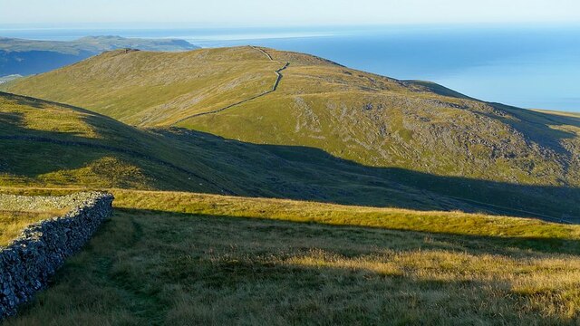
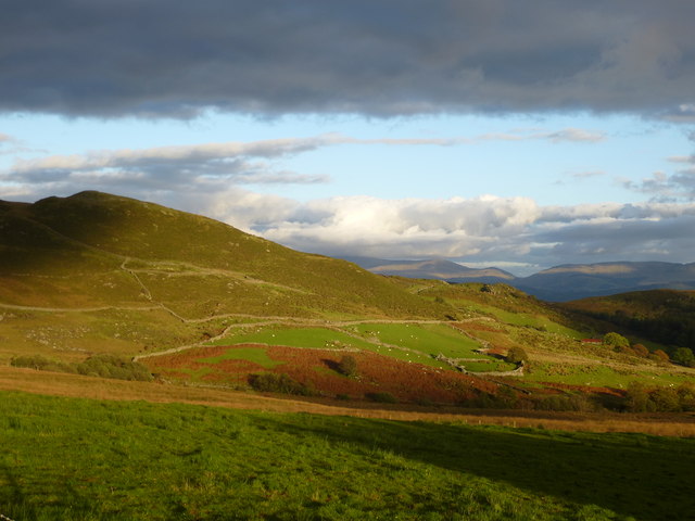
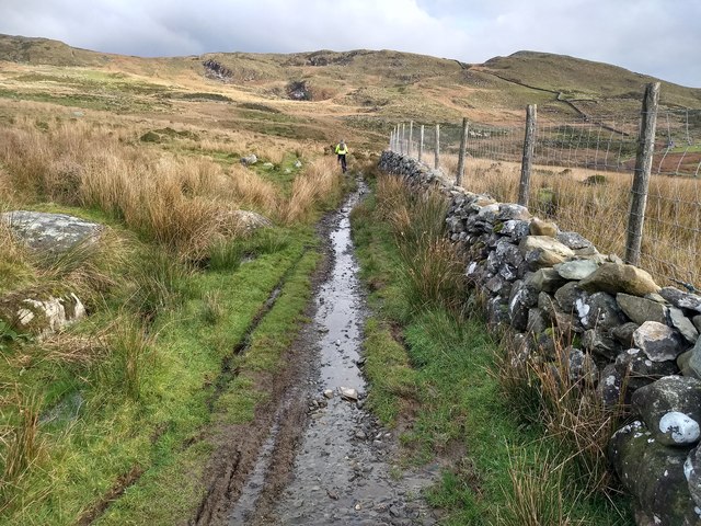
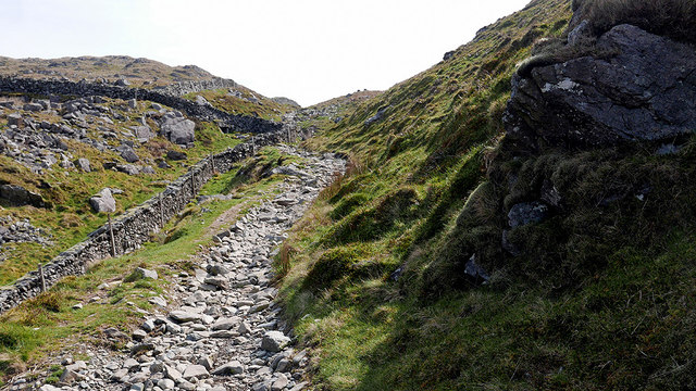
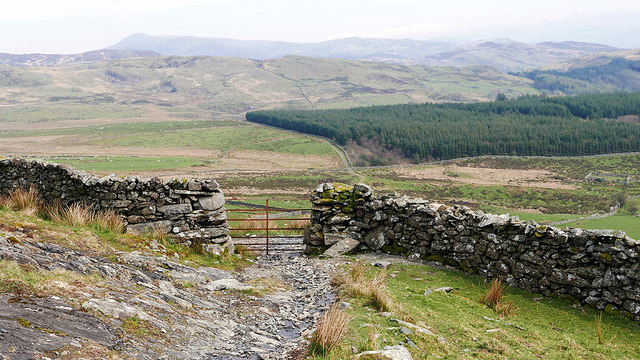
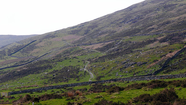
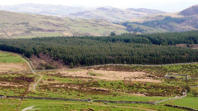
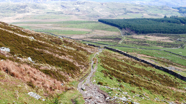
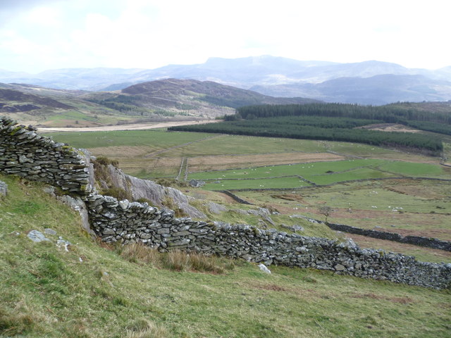
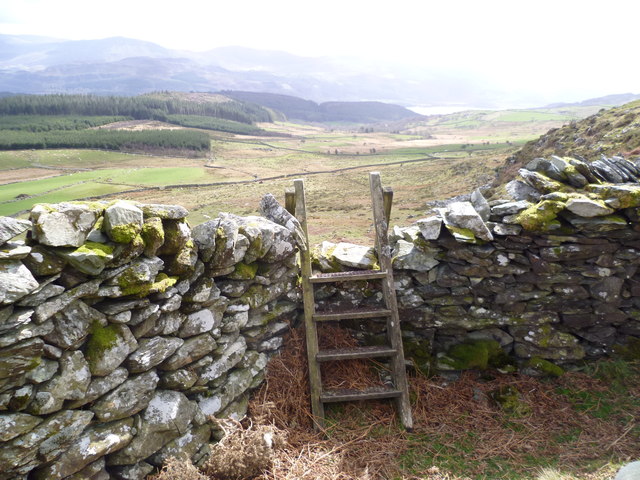
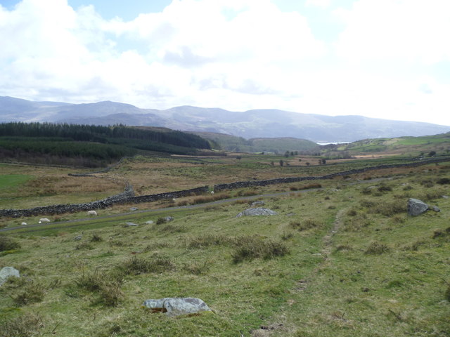
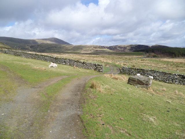
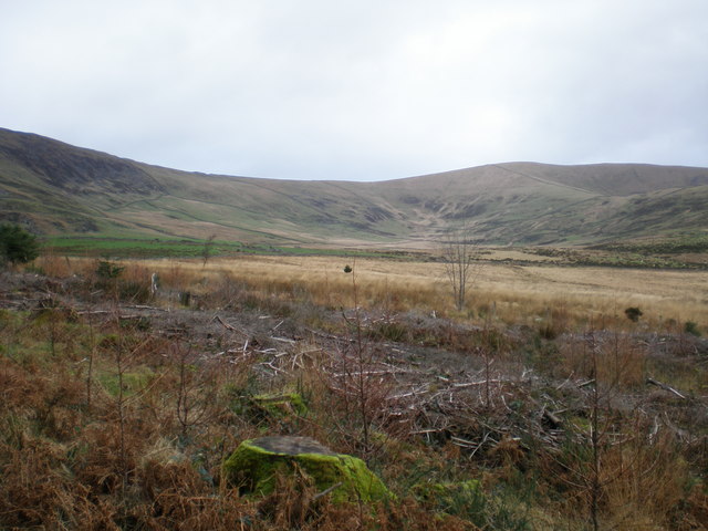
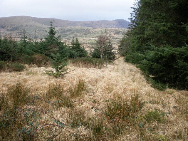
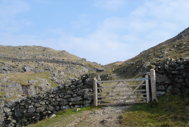
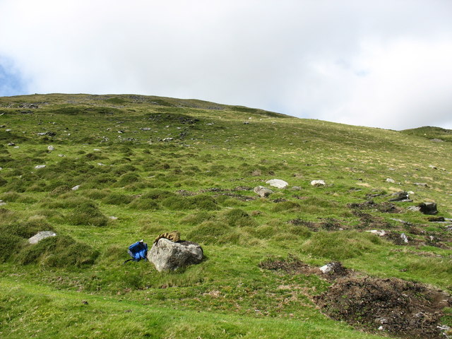
The downs of Coed-y-foel offer panoramic views of the surrounding countryside, with rolling hills stretching as far as the eye can see. Visitors can enjoy leisurely walks or hikes along the well-maintained trails, taking in the fresh air and peaceful ambiance. The moorland, characterized by expansive open spaces and heather-covered hills, provides a unique and enchanting experience for nature lovers.

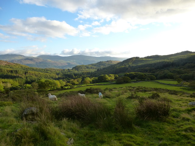
Coed-y-foel is home to a rich variety of wildlife, including rare bird species, foxes, and rabbits. The diverse ecosystems found here attract numerous birdwatchers and photographers throughout the year. The area is also known for its abundance of wildflowers, which create a vibrant tapestry of colors during the spring and summer months.

In addition to its natural beauty, Coed-y-foel offers a range of recreational activities. Outdoor enthusiasts can partake in cycling, horseback riding, and even camping, with designated areas available for overnight stays. The area is well-served by nearby amenities, including quaint cafes and charming accommodation options.

Overall, Coed-y-foel in Merionethshire is a captivating destination for those seeking tranquility and a connection with nature. Its downs and moorland landscapes, combined with its wealth of wildlife and outdoor activities, make it an idyllic retreat for visitors of all ages.

If you have any feedback on the listing, please let us know in the comments section below.

Coed-y-foel Images

Images are sourced within 2km of 52.749633/-4.0233903 or Grid Reference SH6318. Thanks to Geograph Open Source API. All images are credited.

Approaching Bwlch y Rhiwgyr The ridge path drops to cross Bwlch y Rhiwgyr, an old drovers road, and ascends to the next top seen here in the background - Mynydd Egryn.

Walking north to south, the ridge path has been on the western seaward side of the ridge wall for miles but, if continuing on to Mynydd Egryn, at Bwlch y Rhiwgyr you should switch to the eastern side: there are no stiles or gaps in the cross walls on the western side.
Approaching Bwlch y Rhiwgyr
The ridge path drops to cross Bwlch y Rhiwgyr, an old drovers road, and ascends to the next top seen here in the background - Mynydd Egryn. Walking north to south, the ridge path has been on the western seaward side of the ridge wall for miles but, if continuing on to Mynydd Egryn, at Bwlch y Rhiwgyr you should switch to the eastern side: there are no stiles or gaps in the cross walls on the western side.
Landscape near Caegwian Looking east from the path to Barmouth.
Landscape near Caegwian
Looking east from the path to Barmouth.
Landscape near Caegwian Looking south from the path to Barmouth.

Parts of the Cadair Idris mountain range can be seen in the distance.
Landscape near Caegwian
Looking south from the path to Barmouth. Parts of the Cadair Idris mountain range can be seen in the distance.
Rocky and wet This route is favoured by off-road motorbike users, which destroys the track surface.
Rocky and wet
This route is favoured by off-road motorbike users, which destroys the track surface.
Ascending in Bwlch y Rhiwgyr The summit of the pass reaches about 1500' ASL.
Ascending in Bwlch y Rhiwgyr
The summit of the pass reaches about 1500' ASL.
Gate on the path descending from Bwlch y Rhiwgyr Forestry on Cerrig y Cledd is seen ahead.
Gate on the path descending from Bwlch y Rhiwgyr
Forestry on Cerrig y Cledd is seen ahead.
The path ascending towards Bwlch y Rhiwgyr A couple of motorcyclists can just be seen climbing the path. It's rough in places - I wonder if they got to the top?
The path ascending towards Bwlch y Rhiwgyr
A couple of motorcyclists can just be seen climbing the path. It's rough in places - I wonder if they got to the top?
Motorcyclists on the trail A friendly bunch some of whom seemed to be having their first experience of rough riding. There were several spills!
Motorcyclists on the trail
A friendly bunch some of whom seemed to be having their first experience of rough riding. There were several spills!
Cerrig y Cledd From the path above Golodd.
Cerrig y Cledd
From the path above Golodd.
Descending from Bwlch y Rhiwgyr On the slopes of Craig y Grut.
Descending from Bwlch y Rhiwgyr
On the slopes of Craig y Grut.
Upland outlook Typical upland scene in this area.
Upland outlook
Typical upland scene in this area.
Ladder stile Lovely spot.
Ladder stile
Lovely spot.
Upland scene You have to love country like this.
Upland scene
You have to love country like this.
Upland scene Sheep pasture.
Upland scene
Sheep pasture.
Land North of Cae Gwian. Looking towards Craig y Grut and Braich.
Land North of Cae Gwian.
Looking towards Craig y Grut and Braich.
Grassy area near Cerrig y Cledd. The ridge of Braich can be seen climbing right to left with Craig Aderyn at the top right.
The very faint (near horizontal) line across Braich at the top left is the old London - Harlech coach track.
Grassy area near Cerrig y Cledd.
The ridge of Braich can be seen climbing right to left with Craig Aderyn at the top right. The very faint (near horizontal) line across Braich at the top left is the old London - Harlech coach track.
A Mountain Pass This is the track through Bwlch y Rhiwgyr over into the Mawddach Valley.
A Mountain Pass
This is the track through Bwlch y Rhiwgyr over into the Mawddach Valley.
Hillside above Rhos-caerau
Show me another place!

Coed-y-foel is located at Grid Ref: SH6318 (Lat: 52.749633, Lng: -4.0233903)

Unitary Authority: Gwynedd

Police Authority: North Wales

What 3 Words

///quieter.chiefs.bloom. Near Barmouth, Gwynedd

Related Wikis

Tyn-y-Coed Farmhouse

Tyn-y-Coed Farmhouse is a grade II Listed Building in Caerdeon, Barmouth, Gwynedd. This Georgian farm house was built in 1756 and later extended and altered...

St Philip's Church, Caerdeon

St Philip's Church, Caerdeon, near Barmouth, in Gwynedd, North Wales, is a redundant church and a Grade I listed building. The church was built in 1862...

Plas Mynach

Plas Mynach is a large country house in Barmouth, Gwynedd, Wales. It is designated by Cadw as a Grade II* listed building, and stands in a prominent position...

St Tudwal's Church, Barmouth

St Tudwal's Church is a Roman Catholic parish church in Barmouth, Gwynedd. It is situated on the King Edward Road leading from Barmouth to Llanaber. It...

Nearby Amenities

Located within 500m of 52.749633,-4.0233903
Sylfaen
Landuse: farm
Note Retag: CS #48756035
Lat/Long: 52.7465046/-4.0276358
Cerrig Arthur Stone Circle
Archaeological Site: megalith
Historic: archaeological_site
Historic Civilization: neolithic
Name Cy: Maen y Cleddau
Lat/Long: 52.7500728/-4.0287022
Power: pole
Lat/Long: 52.7496675/-4.0170526
Power: pole
Lat/Long: 52.7495138/-4.0178558
Power: pole
Lat/Long: 52.7502794/-4.0182785
Power: pole
Lat/Long: 52.7506839/-4.0189158
Power: pole
Lat/Long: 52.7512847/-4.0195428
Power: pole
Lat/Long: 52.7484169/-4.0168073
Track
Designation: public_footpath
Foot: designated
Prow Ref: Barmouth No 39
Lat/Long: 52.7492925/-4.0217115
The data included in this document is from www.openstreetmap.org. The data is made available under ODbL.

Have you been to Coed-y-foel?

Leave your review of Coed-y-foel below (or comments, questions and feedback).