Largoes Moor
Downs, Moorland in Kirkcudbrightshire
Scotland
Largoes Moor
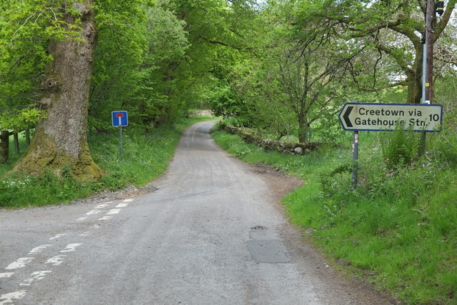
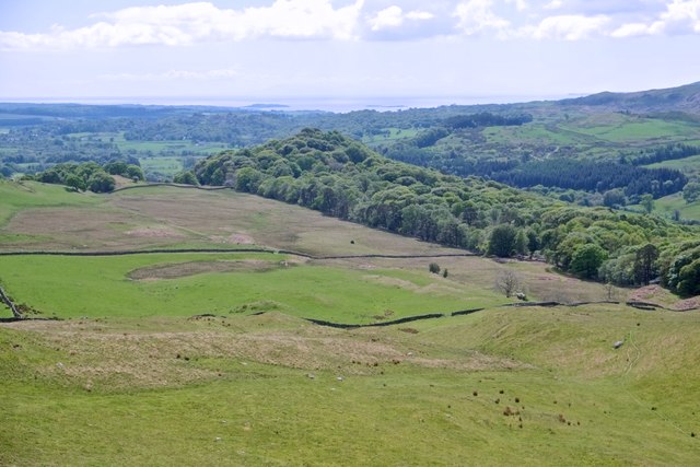
Largoes Moor, located in Kirkcudbrightshire, Scotland, is a picturesque expanse of downs and moorland that spans over a vast area of approximately 2,000 acres. Situated in the southern part of the country, it is renowned for its natural beauty and diverse wildlife, attracting nature enthusiasts and hikers from far and wide.
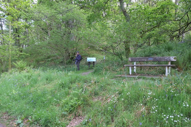
The moorland landscape of Largoes Moor is characterized by rolling hills, heather-covered expanses, and scattered patches of woodland. The terrain offers breathtaking views, with the Galloway Hills providing a stunning backdrop to the east. The area is crisscrossed by numerous walking trails and paths, allowing visitors to explore and immerse themselves in the tranquil surroundings.
Largoes Moor is home to a rich variety of flora and fauna. The heather-clad hillsides are adorned with vibrant colors during the blooming season, while native grasses and wildflowers dot the landscape. The moorland is also a haven for wildlife, with numerous bird species, including curlews, skylarks, and buzzards, making it their home. Rare species such as the hen harrier and short-eared owl can also be spotted on occasion.
Visitors to Largoes Moor can enjoy a range of outdoor activities, including hiking, birdwatching, and photography. The moorland provides a serene escape from the bustle of everyday life, offering a chance to reconnect with nature and appreciate the beauty of the Scottish countryside. Whether it's a leisurely stroll or a more challenging hike, Largoes Moor promises a memorable experience for all who venture into its captivating landscape.
If you have any feedback on the listing, please let us know in the comments section below.
Largoes Moor Images
Images are sourced within 2km of 54.916754/-4.171938 or Grid Reference NX6060. Thanks to Geograph Open Source API. All images are credited.


Largoes Moor is located at Grid Ref: NX6060 (Lat: 54.916754, Lng: -4.171938)
Unitary Authority: Dumfries and Galloway
Police Authority: Dumfries and Galloway
What 3 Words
///anchorman.ulterior.retrain. Near Kirkcudbright, Dumfries & Galloway
Nearby Locations
Related Wikis
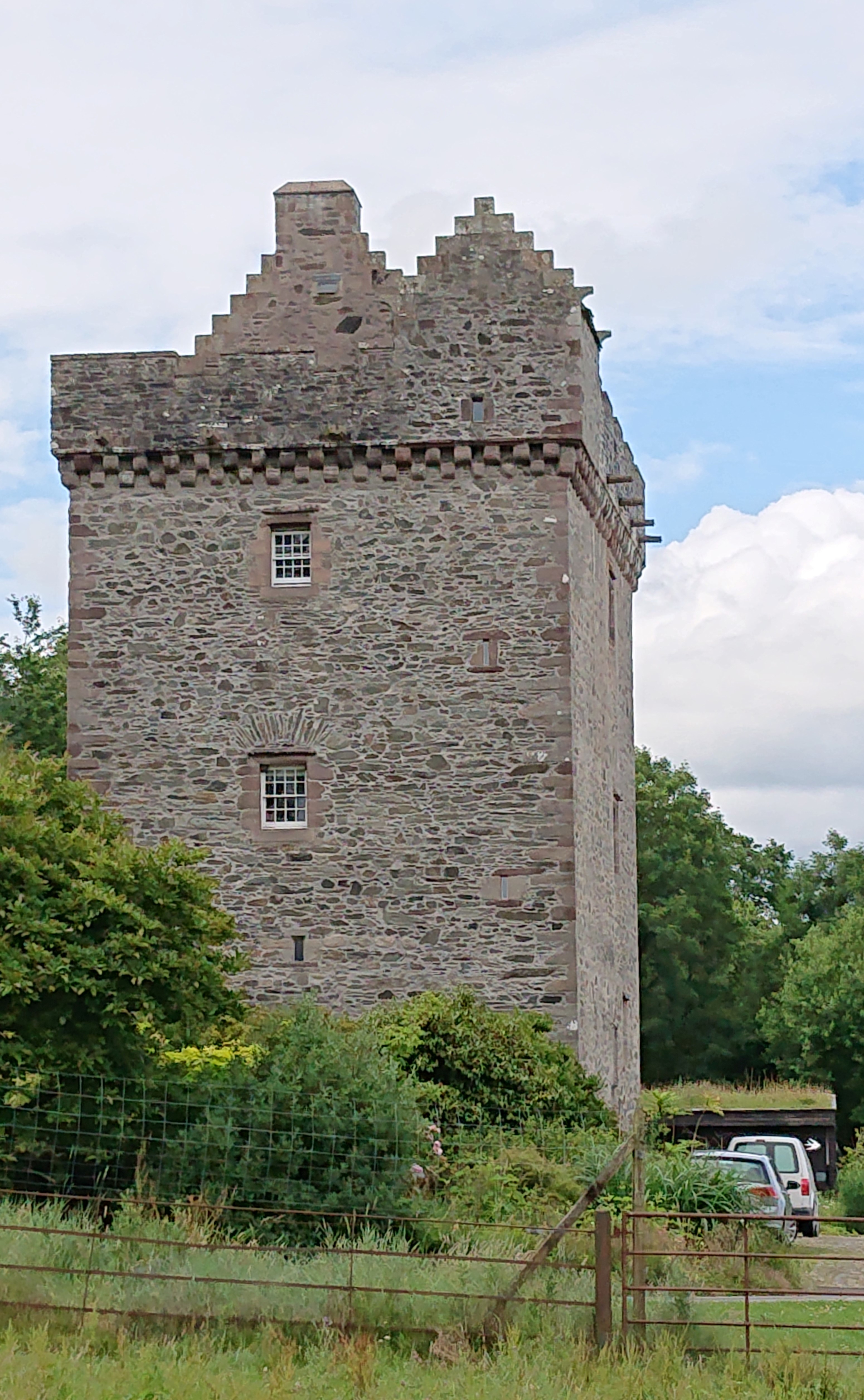
Rusco Tower
Rusco Tower, sometimes called Rusco Castle, is a tower house near Gatehouse of Fleet in Dumfries and Galloway, Scotland. Built around 1500 for Mariota...

Gatehouse of Fleet
Gatehouse of Fleet (Scots: Gatehoose o Fleet Scottish Gaelic: Taigh an Rathaid) is a town half in the civil parish of Girthon and half in the parish of...

Gatehouse of Fleet Town Hall
Gatehouse of Fleet Town Hall is a former municipal building in the High Street in Gatehouse of Fleet, Dumfries and Galloway, Scotland. The structure, which...

Trusty's Hill
Trusty's Hill is a small vitrified hillfort about a mile to the west of the present-day town of Gatehouse of Fleet, in the parish of Anwoth in the Stewartry...
Anwoth Old Church
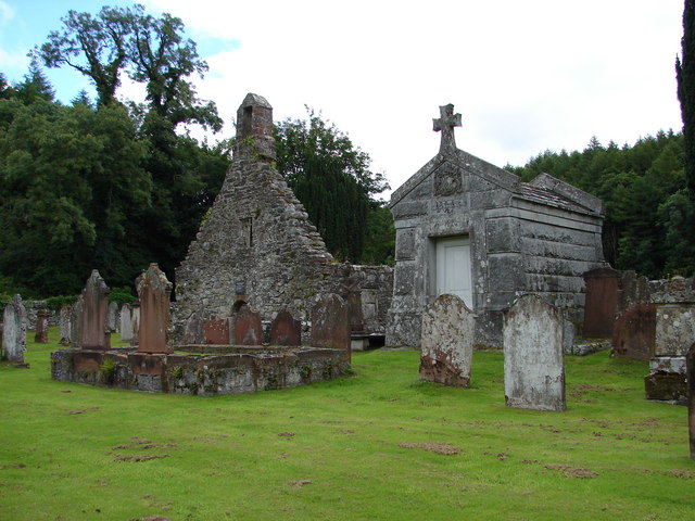
Anwoth Old Church is a ruined church building which was built in 1626 to serve the parish of Anwoth in Dumfries and Galloway, Scotland. It is roofless...
Rutherford's Monument
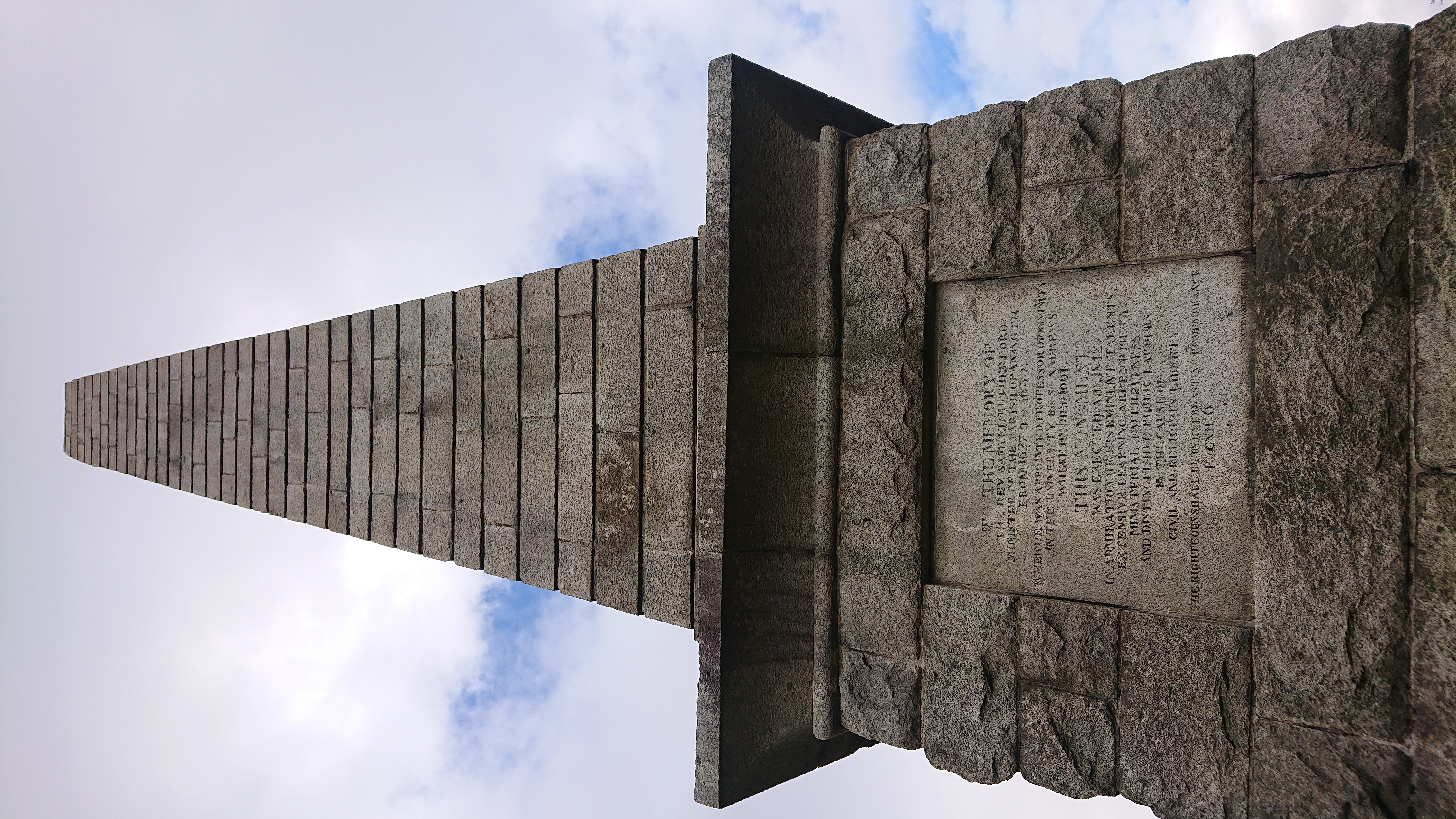
Rutherford's Monument is a commemorative monument between Anwoth and Gatehouse of Fleet in Dumfries and Galloway, Scotland. It is dedicated to the 17th...

Anwoth
Anwoth is a settlement near the Solway Firth in the historic county of Kirkcudbrightshire, southwest Scotland, within a parish of the same name in the...

Anwoth Parish Church
Anwoth Parish Church was built in 1826 to serve the parish of Anwoth in Dumfries and Galloway, Scotland. Designed by Walter Newall, it replaced Anwoth...
Nearby Amenities
Located within 500m of 54.916754,-4.171938Have you been to Largoes Moor?
Leave your review of Largoes Moor below (or comments, questions and feedback).