Yellow Moss

Downs, Moorland in Ayrshire

Scotland

Yellow Moss

South Boig Farm Viewed from Connel Park, looking in the Cumnock direction.
South Boig Farm Credit: Mary and Angus Hogg

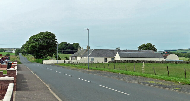
Yellow Moss, Ayrshire, located in southwestern Scotland, is a captivating region known for its picturesque downs and moorland landscapes. Stretching across an area of approximately 100 square miles, this stunning natural area offers a diverse range of flora and fauna, making it a haven for nature enthusiasts and hikers alike.

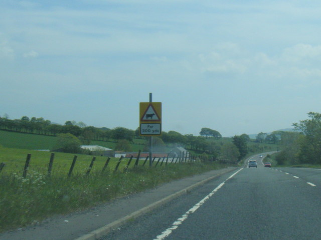
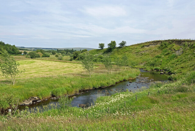
The downs of Yellow Moss are characterized by gently rolling hills covered in lush green grasses and scattered wildflowers. These expansive grasslands provide a serene and tranquil atmosphere, perfect for leisurely walks or picnics amidst nature. The downs are also home to a variety of bird species, including skylarks and meadow pipits, creating a delightful soundscape for visitors.

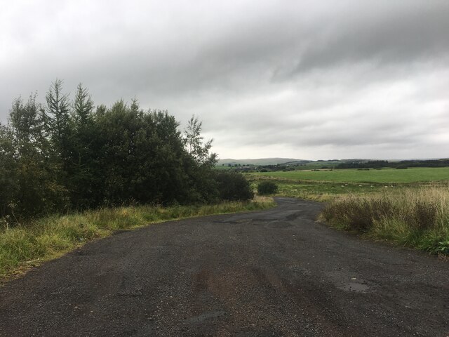
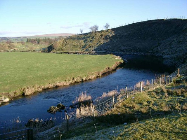
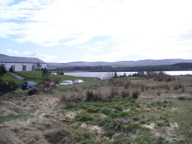
The moorland in Yellow Moss presents a contrasting landscape with its rugged and wild terrain. This heathland is covered in dense vegetation, including heather, gorse, and bracken, which adds an enchanting touch of purple and gold hues to the landscape. The moorland is also dotted with small lochs and peat bogs, creating an otherworldly atmosphere.

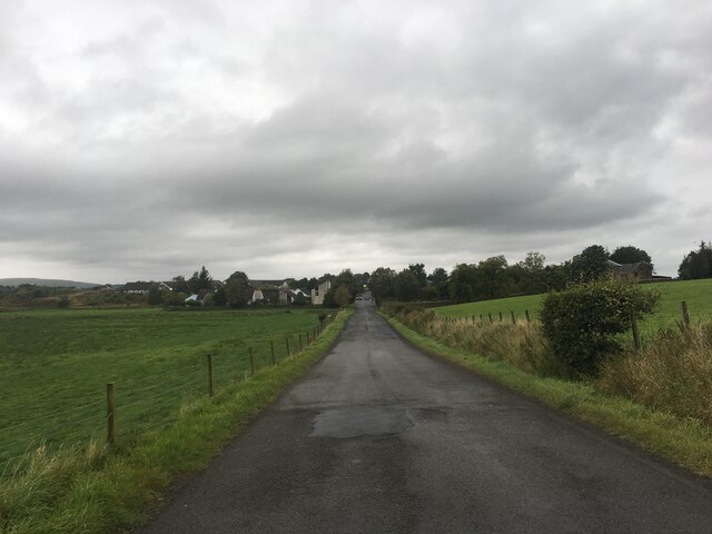
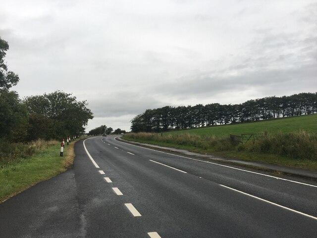
The region boasts several walking trails and paths, allowing visitors to explore the beauty of Yellow Moss at their own pace. These trails offer stunning panoramic views of the surrounding countryside, with glimpses of the nearby Ayrshire hills and distant coastal cliffs.

Yellow Moss, Ayrshire, is a true gem in Scotland's natural heritage. Its downs and moorland provide a diverse and captivating landscape, offering visitors a chance to immerse themselves in the beauty of nature while enjoying the tranquility and serenity it provides.

If you have any feedback on the listing, please let us know in the comments section below.
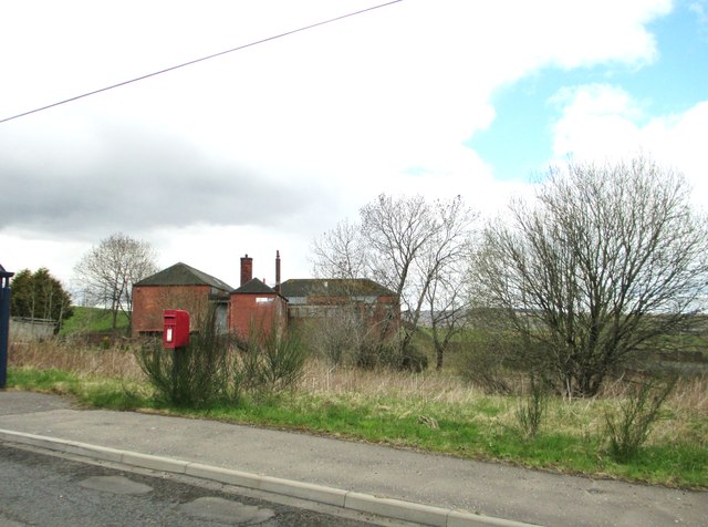
Yellow Moss Images

Images are sourced within 2km of 55.401498/-4.1988663 or Grid Reference NS6014. Thanks to Geograph Open Source API. All images are credited.

South Boig Farm Viewed from Connel Park, looking in the Cumnock direction.
South Boig Farm
Viewed from Connel Park, looking in the Cumnock direction.
Coal from Knockshinnoch Washery 1997 A scanned slide from May 1997 shows the class 60 locomotive EWS 60002 hauling a load of coal from the old washery at Connel Park to join the main line on the west side of New Cumnock. It’s all part of history and memory now. See also <a href="https://www.geograph.org.uk/photo/7239867">NS5913 : At Boig Road Level Crossing</a>
Coal from Knockshinnoch Washery 1997
A scanned slide from May 1997 shows the class 60 locomotive EWS 60002 hauling a load of coal from the old washery at Connel Park to join the main line on the west side of New Cumnock. It’s all part of history and memory now. See also NS5913 : At Boig Road Level Crossing
Minor road near Mansfield
No through road near Pathhead
Bus stops on the B741 The road, on the left, is Glen Park.
Bus stops on the B741
The road, on the left, is Glen Park.
Post box on the B741 I am told that the buildings were once part of a colliery.
Post box on the B741
I am told that the buildings were once part of a colliery.
A76 nearing Lochill Farm
Approaching Nith Bridge The road connects Cumnock with Connel Park and New Cumnock.
Approaching Nith Bridge
The road connects Cumnock with Connel Park and New Cumnock.
Meadowsweet by the Nith A bonny swathe of meadowsweet flowering beside the Nith near Meikle Creoch.
Meadowsweet by the Nith
A bonny swathe of meadowsweet flowering beside the Nith near Meikle Creoch.
River Nith view Looking towards the land called Mote Knowe.
River Nith view
Looking towards the land called Mote Knowe.
At Boig Road Level Crossing The railway line was laid to serve the open-cast mining developments of the late 20th century. All traffic stopped when the open-cast industry collapsed. <a href="https://www.geograph.org.uk/photo/7239864">NS6014 : Coal from Knockshinnoch Washery 1997</a> shows rail traffic that was typical of the period on a nearby line.
At Boig Road Level Crossing
The railway line was laid to serve the open-cast mining developments of the late 20th century. All traffic stopped when the open-cast industry collapsed. NS6014 : Coal from Knockshinnoch Washery 1997 shows rail traffic that was typical of the period on a nearby line.
Boig Road Level Crossing The railway line was laid to serve the open-cast mining developments of the late 20th century. The track has lain idle since the collapse of the open-cast industry after a very short life-span. For a glimpse of past activity on a nearby line, see <a href="https://www.geograph.org.uk/photo/7239864">NS6014 : Coal from Knockshinnoch Washery 1997</a>
Boig Road Level Crossing
The railway line was laid to serve the open-cast mining developments of the late 20th century. The track has lain idle since the collapse of the open-cast industry after a very short life-span. For a glimpse of past activity on a nearby line, see NS6014 : Coal from Knockshinnoch Washery 1997
A76 towards Kilmarnock
Entrance to Righead Open-Cast Coal Site Ayrshire used to have a number of deep mines, but they are all now gone.  Instead, Ayrshire coal extraction is expanding using open-cast techniques.
Entrance to Righead Open-Cast Coal Site
Ayrshire used to have a number of deep mines, but they are all now gone. Instead, Ayrshire coal extraction is expanding using open-cast techniques.
Entrance to Meikle Creoch farm This farm has diversified and also runs the Nith Holiday Cottages - the River Nith is nearby.
Entrance to Meikle Creoch farm
This farm has diversified and also runs the Nith Holiday Cottages - the River Nith is nearby.
The River Nith at Meikle Creoch Heavy frost still on the north facing slopes on this brilliant winter's day.
The River Nith at Meikle Creoch
Heavy frost still on the north facing slopes on this brilliant winter's day.
Level crossing at Woodend This area is criss-crossed by railway lines used for removing the coal after open-cast extraction.
Level crossing at Woodend
This area is criss-crossed by railway lines used for removing the coal after open-cast extraction.
Creoch Loch and the Kilmarnock Dumfries railway line The railway line can just be seen, bisecting the photo from left to right.
Creoch Loch and the Kilmarnock Dumfries railway line
The railway line can just be seen, bisecting the photo from left to right.
Show me another place!

Yellow Moss is located at Grid Ref: NS6014 (Lat: 55.401498, Lng: -4.1988663)

Unitary Authority: East Ayrshire

Police Authority: Ayrshire

What 3 Words

///reframe.ideal.simulator. Near New Cumnock, East Ayrshire

Related Wikis

Connel Burn

Connel Burn is a river in East Ayrshire, Scotland which rises at Enoch Hill in the Southern Uplands and flows northwards through Laglaf and Connel Park...

Loch o' th' Lowes (New Cumnock)

Loch o' th' Lowes (NS 60183 14581), Lochside or Meikle Creoch Loch is a freshwater loch in the Parish of New Cumnock in the East Ayrshire Council Area...

Glenafton Athletic F.C.

Glenafton Athletic Football Club is a Scottish football club, based in New Cumnock, Ayrshire. Members of the Scottish Junior Football Association, they...

New Cumnock railway station

New Cumnock railway station is a railway station serving the town of New Cumnock, East Ayrshire, Scotland. The station is managed by ScotRail and is on...

New Cumnock Town Hall

New Cumnock Town Hall is a municipal building in Castle, New Cumnock, East Ayrshire, Scotland. The structure, which is used as a community events venue...

New Cumnock

New Cumnock is a town in East Ayrshire, Scotland. It expanded during the coal-mining era from the late 18th century, and mining remained its key industry...

River Afton

The River Afton (or Afton Water) is a small river in Ayrshire, Scotland, which flows north from Alwhat Hill in the Carsphairn and Scaur Hills, through...

Mansfield, East Ayrshire

Mansfield is a village in East Ayrshire in Scotland. It is north of New Cumnock from which it is separated by the River Nith and the adjacent village of...

Nearby Amenities

Located within 500m of 55.401498,-4.1988663
Greenburn Junction
Railway: junction
Source: OS_OpenData_StreetView
Lat/Long: 55.3972516/-4.2005089
Railway: level_crossing
Lat/Long: 55.3989183/-4.1999013
Power: pole
Lat/Long: 55.3994129/-4.2056025
Power: pole
Lat/Long: 55.399531/-4.204191
Power: pole
Lat/Long: 55.3996556/-4.2027433
Power: pole
Lat/Long: 55.3997841/-4.2013092
Power: pole
Lat/Long: 55.3998933/-4.1999724
Power: pole
Lat/Long: 55.3999125/-4.1984795
Power: pole
Lat/Long: 55.3999164/-4.1970318
Power: pole
Lat/Long: 55.4001219/-4.1956949
Power: pole
Lat/Long: 55.4003313/-4.1943219
Power: pole
Lat/Long: 55.4005368/-4.1929783
Power: pole
Lat/Long: 55.4007474/-4.1915939
Power: pole
Lat/Long: 55.4007243/-4.199995
Power: pole
Lat/Long: 55.4015065/-4.2000493
Power: pole
Lat/Long: 55.4023221/-4.2001737
Power: pole
Lat/Long: 55.4031595/-4.2003139
Power: pole
Lat/Long: 55.4040021/-4.2004203
Power: pole
Lat/Long: 55.4046455/-4.2012436
Power: pole
Lat/Long: 55.4053108/-4.2021213
The data included in this document is from www.openstreetmap.org. The data is made available under ODbL.

Have you been to Yellow Moss?

Leave your review of Yellow Moss below (or comments, questions and feedback).