Fardel Moor

Downs, Moorland in Devon South Hams

England

Fardel Moor

A38 at the Westlake Turnoff The A38 is a major A-class trunk route. When first designated in 1922, it ran from Derby to Plymouth but it was later extended at both ends so that it now runs for 292 miles from Mansfield in Nottinghamshire to Bodmin in Cornwall.

Prior to the opening of the M5 motorway in the 1960s and 1970s, the A38 formed the main "holiday route" from the Midlands to Somerset, Devon and Cornwall and the south-western section was notorious at holiday times for the congestion. Nowadays, for most of the southern section, the A38 is a fairly quiet road shadowing the M5 extremely closely; often running alongside the motorway as a single carriageway road. The section between Exeter and Plymouth is, however, a busy dual carriageway which serves as the southern extension of the M5 and is known as “the Devon Expressway”.

More information at <span class="nowrap"><a title="http://en.wikipedia.org/wiki/A38_road" rel="nofollow ugc noopener" href="http://en.wikipedia.org/wiki/A38_road">Link</a><img style="margin-left:2px;" alt="External link" title="External link - shift click to open in new window" src="https://s1.geograph.org.uk/img/external.png" width="10" height="10"/></span>  (Wikipedia) and <span class="nowrap"><a title="http://www.sabre-roads.org.uk/wiki/index.php?title=A38" rel="nofollow ugc noopener" href="http://www.sabre-roads.org.uk/wiki/index.php?title=A38">Link</a><img style="margin-left:2px;" alt="External link" title="External link - shift click to open in new window" src="https://s1.geograph.org.uk/img/external.png" width="10" height="10"/></span>  (SABRE).
A38 at the Westlake Turnoff Credit: David Dixon

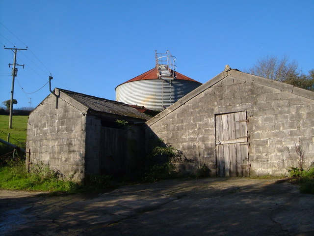
Fardel Moor, located in Devon, England, is a picturesque area known for its scenic beauty and diverse natural habitats. Covering an expansive area of downs and moorland, it offers a unique and rewarding experience for nature enthusiasts and hikers alike.

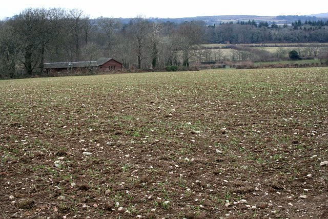
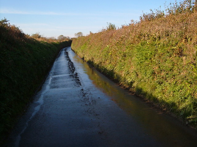
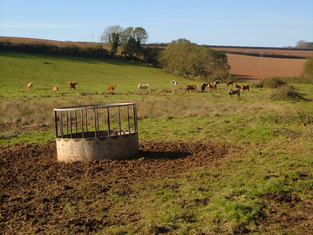
The moorland of Fardel Moor is characterized by its wide open spaces, rolling hills, and heather-covered landscapes, creating a stunning backdrop for visitors to explore. The area is home to a rich variety of flora and fauna, with heather, gorse, and bracken dominating the vegetation. It provides a haven for many bird species, including the rare and elusive Dartford warbler, as well as buzzards, kestrels, and skylarks.

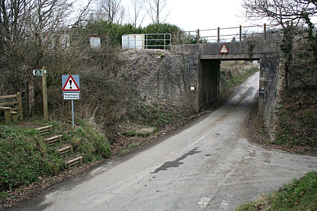
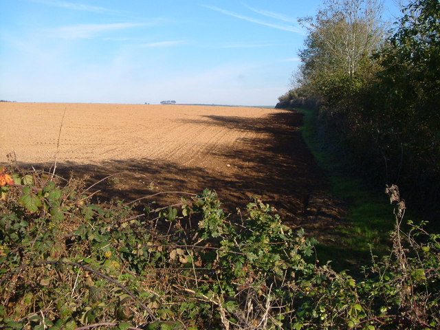
The downs of Fardel Moor offer breathtaking views of the surrounding countryside, with sweeping panoramas stretching out as far as the eye can see. The area is crisscrossed with footpaths and bridleways, making it an ideal destination for walkers and horse riders. Visitors can enjoy leisurely strolls, challenging hikes, or even venture on horseback to fully immerse themselves in the beauty of the landscape.

Fardel Moor is also of historical significance, with evidence of human occupation dating back centuries. The remains of ancient settlements, burial mounds, and stone circles can still be found scattered across the moor, providing a glimpse into the area's past.

Overall, Fardel Moor in Devon offers a captivating blend of natural beauty, wildlife, and historical intrigue, making it an idyllic destination for those seeking tranquility and a connection to the land.

If you have any feedback on the listing, please let us know in the comments section below.

Fardel Moor Images

Images are sourced within 2km of 50.396012/-3.9667387 or Grid Reference SX6056. Thanks to Geograph Open Source API. All images are credited.

A38 at the Westlake Turnoff The A38 is a major A-class trunk route. When first designated in 1922, it ran from Derby to Plymouth but it was later extended at both ends so that it now runs for 292 miles from Mansfield in Nottinghamshire to Bodmin in Cornwall.

Prior to the opening of the M5 motorway in the 1960s and 1970s, the A38 formed the main "holiday route" from the Midlands to Somerset, Devon and Cornwall and the south-western section was notorious at holiday times for the congestion. Nowadays, for most of the southern section, the A38 is a fairly quiet road shadowing the M5 extremely closely; often running alongside the motorway as a single carriageway road. The section between Exeter and Plymouth is, however, a busy dual carriageway which serves as the southern extension of the M5 and is known as “the Devon Expressway”.

More information at <span class="nowrap"><a title="http://en.wikipedia.org/wiki/A38_road" rel="nofollow ugc noopener" href="http://en.wikipedia.org/wiki/A38_road">Link</a><img style="margin-left:2px;" alt="External link" title="External link - shift click to open in new window" src="https://s1.geograph.org.uk/img/external.png" width="10" height="10"/></span>  (Wikipedia) and <span class="nowrap"><a title="http://www.sabre-roads.org.uk/wiki/index.php?title=A38" rel="nofollow ugc noopener" href="http://www.sabre-roads.org.uk/wiki/index.php?title=A38">Link</a><img style="margin-left:2px;" alt="External link" title="External link - shift click to open in new window" src="https://s1.geograph.org.uk/img/external.png" width="10" height="10"/></span>  (SABRE).
A38 at the Westlake Turnoff
The A38 is a major A-class trunk route. When first designated in 1922, it ran from Derby to Plymouth but it was later extended at both ends so that it now runs for 292 miles from Mansfield in Nottinghamshire to Bodmin in Cornwall. Prior to the opening of the M5 motorway in the 1960s and 1970s, the A38 formed the main "holiday route" from the Midlands to Somerset, Devon and Cornwall and the south-western section was notorious at holiday times for the congestion. Nowadays, for most of the southern section, the A38 is a fairly quiet road shadowing the M5 extremely closely; often running alongside the motorway as a single carriageway road. The section between Exeter and Plymouth is, however, a busy dual carriageway which serves as the southern extension of the M5 and is known as “the Devon Expressway”. More information at LinkExternal link (Wikipedia) and LinkExternal link (SABRE).
Devon Expressway, Lee Mill The A38 is a major A-class trunk route. When first designated in 1922, it ran from Derby to Plymouth but it was later extended at both ends so that it now runs for 292 miles from Mansfield in Nottinghamshire to Bodmin in Cornwall.

Prior to the opening of the M5 motorway in the 1960s and 1970s, the A38 formed the main "holiday route" from the Midlands to Somerset, Devon and Cornwall and the south-western section was notorious at holiday times for the congestion. Nowadays, for most of the southern section, the A38 is a fairly quiet road shadowing the M5 extremely closely; often running alongside the motorway as a single carriageway road. The section between Exeter and Plymouth is, however, a busy dual carriageway which serves as the southern extension of the M5 and is known as “the Devon Expressway”.

More information at <span class="nowrap"><a title="http://en.wikipedia.org/wiki/A38_road" rel="nofollow ugc noopener" href="http://en.wikipedia.org/wiki/A38_road">Link</a><img style="margin-left:2px;" alt="External link" title="External link - shift click to open in new window" src="https://s1.geograph.org.uk/img/external.png" width="10" height="10"/></span>  (Wikipedia) and <span class="nowrap"><a title="http://www.sabre-roads.org.uk/wiki/index.php?title=A38" rel="nofollow ugc noopener" href="http://www.sabre-roads.org.uk/wiki/index.php?title=A38">Link</a><img style="margin-left:2px;" alt="External link" title="External link - shift click to open in new window" src="https://s1.geograph.org.uk/img/external.png" width="10" height="10"/></span>  (SABRE).
Devon Expressway, Lee Mill
The A38 is a major A-class trunk route. When first designated in 1922, it ran from Derby to Plymouth but it was later extended at both ends so that it now runs for 292 miles from Mansfield in Nottinghamshire to Bodmin in Cornwall. Prior to the opening of the M5 motorway in the 1960s and 1970s, the A38 formed the main "holiday route" from the Midlands to Somerset, Devon and Cornwall and the south-western section was notorious at holiday times for the congestion. Nowadays, for most of the southern section, the A38 is a fairly quiet road shadowing the M5 extremely closely; often running alongside the motorway as a single carriageway road. The section between Exeter and Plymouth is, however, a busy dual carriageway which serves as the southern extension of the M5 and is known as “the Devon Expressway”. More information at LinkExternal link (Wikipedia) and LinkExternal link (SABRE).
A38 Devon Expressway near Lee Mill The A38 is a major A-class trunk route. When first designated in 1922, it ran from Derby to Plymouth but it was later extended at both ends so that it now runs for 292 miles from Mansfield in Nottinghamshire to Bodmin in Cornwall.

Prior to the opening of the M5 motorway in the 1960s and 1970s, the A38 formed the main "holiday route" from the Midlands to Somerset, Devon and Cornwall and the south-western section was notorious at holiday times for the congestion. Nowadays, for most of the southern section, the A38 is a fairly quiet road shadowing the M5 extremely closely; often running alongside the motorway as a single carriageway road. The section between Exeter and Plymouth is, however, a busy dual carriageway which serves as the southern extension of the M5 and is known as “the Devon Expressway”.

More information at <span class="nowrap"><a title="http://en.wikipedia.org/wiki/A38_road" rel="nofollow ugc noopener" href="http://en.wikipedia.org/wiki/A38_road">Link</a><img style="margin-left:2px;" alt="External link" title="External link - shift click to open in new window" src="https://s1.geograph.org.uk/img/external.png" width="10" height="10"/></span>  (Wikipedia) and <span class="nowrap"><a title="http://www.sabre-roads.org.uk/wiki/index.php?title=A38" rel="nofollow ugc noopener" href="http://www.sabre-roads.org.uk/wiki/index.php?title=A38">Link</a><img style="margin-left:2px;" alt="External link" title="External link - shift click to open in new window" src="https://s1.geograph.org.uk/img/external.png" width="10" height="10"/></span>  (SABRE).
A38 Devon Expressway near Lee Mill
The A38 is a major A-class trunk route. When first designated in 1922, it ran from Derby to Plymouth but it was later extended at both ends so that it now runs for 292 miles from Mansfield in Nottinghamshire to Bodmin in Cornwall. Prior to the opening of the M5 motorway in the 1960s and 1970s, the A38 formed the main "holiday route" from the Midlands to Somerset, Devon and Cornwall and the south-western section was notorious at holiday times for the congestion. Nowadays, for most of the southern section, the A38 is a fairly quiet road shadowing the M5 extremely closely; often running alongside the motorway as a single carriageway road. The section between Exeter and Plymouth is, however, a busy dual carriageway which serves as the southern extension of the M5 and is known as “the Devon Expressway”. More information at LinkExternal link (Wikipedia) and LinkExternal link (SABRE).
Snowy Cornwood Road Making for rather slippery driving and walking conditions.
Snowy Cornwood Road
Making for rather slippery driving and walking conditions.
Little Chef, Smithaleigh The Little Chef at Smithaleigh, Devon, just off the A38 Plymouth bound carriageway.
Little Chef, Smithaleigh
The Little Chef at Smithaleigh, Devon, just off the A38 Plymouth bound carriageway.
Challonsleigh Farm Waste Recycling Centre The entrance to Challonsleigh Farm Waste Recycling Centre and Transfer Station at Smithaleigh, Devon. The cars on the left of the picture behind the crash barrier are travelling on the A38 towards Ivybridge.
Challonsleigh Farm Waste Recycling Centre
The entrance to Challonsleigh Farm Waste Recycling Centre and Transfer Station at Smithaleigh, Devon. The cars on the left of the picture behind the crash barrier are travelling on the A38 towards Ivybridge.
Newly Planted Field Looking towards Shipland Cottage.  The Ordnance Survey 1:25,000 map shows this field as woodland!
Newly Planted Field
Looking towards Shipland Cottage. The Ordnance Survey 1:25,000 map shows this field as woodland!
Under the Railway Line The bridge over this minor road carries the mainline railway.  The warning sign says the road is liable to flooding.
Under the Railway Line
The bridge over this minor road carries the mainline railway. The warning sign says the road is liable to flooding.
Slade viaduct Like several viaducts on this line, the trestle-less piers of Brunel's 1849 viaduct (pictured here <span class="nowrap"><a title="http://digbig.com/4gneq" rel="nofollow ugc noopener" href="http://digbig.com/4gneq">Link</a><img style="margin-left:2px;" alt="External link" title="External link - shift click to open in new window" src="https://s1.geograph.org.uk/img/external.png" width="10" height="10"/></span> ) stand alongside the 1893 replacement. Taken looking east (and up), from bridleway at the edge of wood and Piall valley.
Slade viaduct
Like several viaducts on this line, the trestle-less piers of Brunel's 1849 viaduct (pictured here LinkExternal link ) stand alongside the 1893 replacement. Taken looking east (and up), from bridleway at the edge of wood and Piall valley.
Piall river from Stert Bridge This tributary of the Yealm may be small, but its valley required the construction of <a href="https://www.geograph.org.uk/photo/130563">SX5958 : Slade viaduct</a> just a few hundred metres upstream.
Piall river from Stert Bridge
This tributary of the Yealm may be small, but its valley required the construction of SX5958 : Slade viaduct just a few hundred metres upstream.
Flooded lane near Stert Bridge Unforeseen hazard at the point where Sparkwell Bridleway 27 leaves the lane between Little Stert and Sparkwell.
Flooded lane near Stert Bridge
Unforeseen hazard at the point where Sparkwell Bridleway 27 leaves the lane between Little Stert and Sparkwell.
Grazealders The valley beyond the farmhouse is of Ridgecot Lake, a tributary of the Yealm. The field is shown as woodland on the 1:25000 sheet - but not on other scales.
Grazealders
The valley beyond the farmhouse is of Ridgecot Lake, a tributary of the Yealm. The field is shown as woodland on the 1:25000 sheet - but not on other scales.
Langage Farm ice cream factory Home of one of the superior ice creams. An interesting comparison: the old thatched farmhouse behind the friendly cow, and the building in the background where, presumably, the ice cream is manufactured. On the other hand, which premises are more likely to produce a reliably hazard-free product?
Langage Farm ice cream factory
Home of one of the superior ice creams. An interesting comparison: the old thatched farmhouse behind the friendly cow, and the building in the background where, presumably, the ice cream is manufactured. On the other hand, which premises are more likely to produce a reliably hazard-free product?
Wet lane to Mount Pleasant Seen from its junction with the lane from Smithaleigh to Yolland Farm.
Wet lane to Mount Pleasant
Seen from its junction with the lane from Smithaleigh to Yolland Farm.
Farm buildings at Hitchcombe Silo and breeze block barns at the end of the public lane near Lee Mill.
Farm buildings at Hitchcombe
Silo and breeze block barns at the end of the public lane near Lee Mill.
Confused bullocks near Hitchcombe The footpath from Hitchcombe to Yolland Farm runs along the edge of their field.
Confused bullocks near Hitchcombe
The footpath from Hitchcombe to Yolland Farm runs along the edge of their field.
Ploughed field north of Lee Mill Shadows encroaching on a field seen across a bramble and oak hedge, from the passing footpath.
Ploughed field north of Lee Mill
Shadows encroaching on a field seen across a bramble and oak hedge, from the passing footpath.
Blachford Viaduct from path near Grazealders A view across several squares from the public footpath from Hitchcombe to Furzedown. The cottage beyond the wooden stable is Frog Cottage. Beyond the viaduct is hanger Down on the edge of Dartmoor.
Blachford Viaduct from path near Grazealders
A view across several squares from the public footpath from Hitchcombe to Furzedown. The cottage beyond the wooden stable is Frog Cottage. Beyond the viaduct is hanger Down on the edge of Dartmoor.
Show me another place!

Fardel Moor is located at Grid Ref: SX6056 (Lat: 50.396012, Lng: -3.9667387)

Administrative County: Devon

District: South Hams

Police Authority: Devon and Cornwall

What 3 Words

///grazed.bongo.hikes. Near Ivybridge, Devon

Related Wikis

Fardel Manor

Fardel is a historic manor in the parish of Cornwood, in the South Hams district of Devon. It was successively the seat of the Raleigh and Hele families...

Ivybridge Priory

Ivybridge Priory or St. Austin's Priory was a monastic house in Devon, England. From 1932 it was a priory of the Order of Augustinian Recollects. They...

South West Devon (UK Parliament constituency)

South West Devon is a constituency represented in the House of Commons of the UK Parliament since 1997 by Sir Gary Streeter, a Conservative. == Boundaries... ==

Yondertown

Yondertown is a mining hamlet located in an Area of Great Landscape Value on the edge of Dartmoor National Park in the English county of Devon. The community...

Nearby Amenities

Located within 500m of 50.396012,-3.9667387
Lucas Wood
Place: hamlet
Source: Local knowledge
Lat/Long: 50.3970913/-3.9712915
Generator Method: photovoltaic
Generator Output Electricity: yes
Generator Source: solar
Generator Type: solar_photovoltaic_panel
Location: roof
Power: generator
Lat/Long: 50.3974146/-3.9695875
Post Box
Brand: Royal Mail
Brand Wikidata: Q638098
Brand Wikipedia: en:Royal Mail
Collection Times: Mo-Sa 09:15; Su off
Operator: Royal Mail
Operator Wikidata: Q638098
Post Box Mounting: pier
Post Box Type: lamp
Ref: PL21 846
Royal Cypher: EIIR
Royal Cypher Wikidata: Q33102113
Source: survey;streetlevel imagery;aerial imagery
Lat/Long: 50.3971967/-3.9716511
The data included in this document is from www.openstreetmap.org. The data is made available under ODbL.

Have you been to Fardel Moor?

Leave your review of Fardel Moor below (or comments, questions and feedback).