Avon Moss

Downs, Moorland in Ayrshire

Scotland

Avon Moss

Powmeadow Burn A small meandering burn that flows into the Avon Water.
Powmeadow Burn Credit: Alan O'Dowd

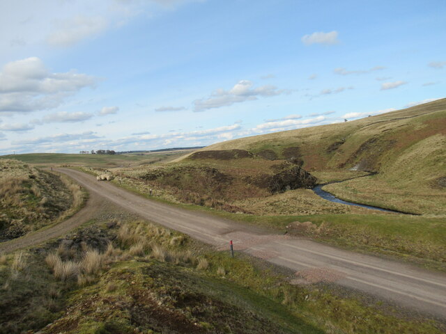
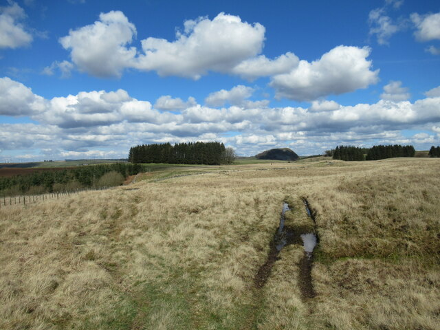
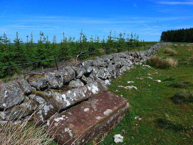
Avon Moss, located in Ayrshire, Scotland, is an enchanting area characterized by its diverse landscape, encompassing downs and moorland. Stretching across approximately 200 acres, it offers a captivating blend of natural beauty and wildlife, making it a popular destination for nature lovers and outdoor enthusiasts.

The downs of Avon Moss are characterized by their gently rolling hills and expansive grasslands. These open spaces provide breathtaking panoramic views of the surrounding countryside, with sheep and cattle frequently grazing in the area. The downs are a haven for birdwatchers, with a variety of species such as lapwings, curlews, and red grouse commonly spotted.

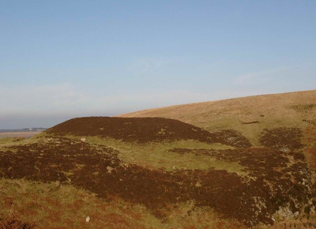
The moorland section of Avon Moss offers a stark contrast to the downs, with its rugged terrain and heather-covered hills. This captivating landscape is home to many indigenous plant species, including bilberries and cotton grass. Visitors can also encounter a range of wildlife, such as red deer, mountain hares, and various bird species, including golden eagles and merlins.

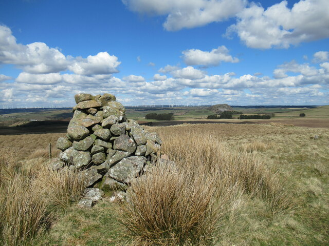
Avon Moss is not only a picturesque location but also holds historical significance. The area is dotted with ancient archaeological sites, including cairns and standing stones, which provide a glimpse into the region's past.

With its diverse landscapes, abundant wildlife, and historical sites, Avon Moss is a captivating destination that offers something for everyone. Whether it's exploring the downs, traversing the moorland, or immersing oneself in the rich history, visitors are sure to be captivated by the beauty and tranquility of this enchanting area in Ayrshire.

If you have any feedback on the listing, please let us know in the comments section below.

Avon Moss Images

Images are sourced within 2km of 55.579728/-4.2172312 or Grid Reference NS6034. Thanks to Geograph Open Source API. All images are credited.

Powmeadow Burn A small meandering burn that flows into the Avon Water.
Powmeadow Burn
A small meandering burn that flows into the Avon Water.
Ford at confluence of the Powmeadow Burn and the Avon Water The Avon Water is a tributary of the Clyde, eventually joining the larger river near Hamilton.
Ford at confluence of the Powmeadow Burn and the Avon Water
The Avon Water is a tributary of the Clyde, eventually joining the larger river near Hamilton.
The upper reaches of the Avon Water The Avon Water eventually flows into the Clyde near Hamilton, but at this stage is just a burn winding through a small deep valley.
The upper reaches of the Avon Water
The Avon Water eventually flows into the Clyde near Hamilton, but at this stage is just a burn winding through a small deep valley.
Junction of tracks near Main Castle The main track here is an access track for the Bankend Rig Wind Farm. The Avon Water can be seen meandering through the valley.
Junction of tracks near Main Castle
The main track here is an access track for the Bankend Rig Wind Farm. The Avon Water can be seen meandering through the valley.
Wheel ruts, King's Muir A rutted track, boggy in places, crosses King's Muir north of Watstone Hill. The rocky lump of Loudoun Hill can be seen on the horizon.
Wheel ruts, King's Muir
A rutted track, boggy in places, crosses King's Muir north of Watstone Hill. The rocky lump of Loudoun Hill can be seen on the horizon.
Cairn on Watstone Hill A view from the cairn across King's Muir to the volcanic plug of Loudoun Hill. Some of the turbines of the vast Whitelee Wind Farm can be seen in the distance.
Cairn on Watstone Hill
A view from the cairn across King's Muir to the volcanic plug of Loudoun Hill. Some of the turbines of the vast Whitelee Wind Farm can be seen in the distance.
Fenceline below Mule Hill The fenceline can be followed across sometimes boggy moorland towards the gentle rise of Mule Hill.
Fenceline below Mule Hill
The fenceline can be followed across sometimes boggy moorland towards the gentle rise of Mule Hill.
King's Moss Loudoun Hill in the distance.
King's Moss
Loudoun Hill in the distance.
Remains of a shed By the Distinkhorn track.  It looks as though the roof has been blown off and is now some five metres from the remains of the walls.
Remains of a shed
By the Distinkhorn track. It looks as though the roof has been blown off and is now some five metres from the remains of the walls.
Carved stones by the track to Watstone Hill A pile of three rectangular stones lying by a wall. There are some markings on one of the stones, but they are very difficult to make out.

Compare with <a href="https://www.geograph.org.uk/photo/114011">NS5935 : Carved stones by the track to Watstone Hill</a> taken in 2006;  the trees showing then have been felled and are now replanted.
Carved stones by the track to Watstone Hill
A pile of three rectangular stones lying by a wall. There are some markings on one of the stones, but they are very difficult to make out. Compare with NS5935 : Carved stones by the track to Watstone Hill taken in 2006; the trees showing then have been felled and are now replanted.
The track towards Distinkhorn And it's not very distinct!  Obviously little used, this track is scarcely visible from time to time, especially where it crosses very boggy ground (which is frequently!).
The track towards Distinkhorn
And it's not very distinct! Obviously little used, this track is scarcely visible from time to time, especially where it crosses very boggy ground (which is frequently!).
Carved stones by the track to Watstone Hill A pile of three rectangular stones lying by a wall.  There are some markings on one of the stones, but they are very difficult to make out.
Carved stones by the track to Watstone Hill
A pile of three rectangular stones lying by a wall. There are some markings on one of the stones, but they are very difficult to make out.
Shooting butt on the slopes of Watstone Hill Looking west
Shooting butt on the slopes of Watstone Hill
Looking west
The cairn on Watstone Hill
Small hut above the Pomefield burn
Triple fence on the northern slopes of Distinkhorn Three fences here - a very new one, an older, rather frail one, and, in the middle, the rotting stobs of the original fence
Triple fence on the northern slopes of Distinkhorn
Three fences here - a very new one, an older, rather frail one, and, in the middle, the rotting stobs of the original fence
Steep valley of the Powmeadow burn
Earthworks at Main Castle, by the Avon Water
Show me another place!

Avon Moss is located at Grid Ref: NS6034 (Lat: 55.579728, Lng: -4.2172312)

Unitary Authority: East Ayrshire

Police Authority: Ayrshire

What 3 Words

///lines.touched.unloading. Near Darvel, East Ayrshire

Nearby Locations

Avon Moss

Related Wikis

Loudounhill railway station

Loudounhill (NS 60268 37191) was a railway station on the Darvel and Strathaven Railway serving a rural area that included the landmark of Loudoun Hill...

Battle of Loudoun Hill

The Battle of Loudoun Hill was fought on 10 May 1307, between a Scots force led by King Robert the Bruce and the English commanded by Aymer de Valence...

Loch Gate

Loch Gate (NS 62389 37170), previously known as Loch Gait, was a freshwater loch, partly in the East Ayrshire Council Area and partly in South Lanarkshire...
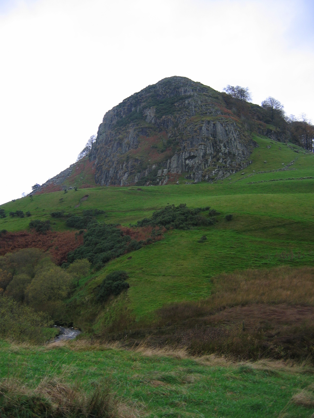
Loudoun Hill

Loudoun Hill (Scottish Gaelic: Beinn Lùghdain; also commonly Loudounhill) is a volcanic plug in East Ayrshire, Scotland. It is located near the head of...

Have you been to Avon Moss?

Leave your review of Avon Moss below (or comments, questions and feedback).