Blairskaith Muir

Downs, Moorland in Stirlingshire

Scotland

Blairskaith Muir

Path down from Clochcore Wood From the reservoir heading towards the Celtic FC training facility.
Path down from Clochcore Wood Credit: Stephen Sweeney

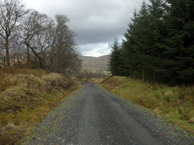
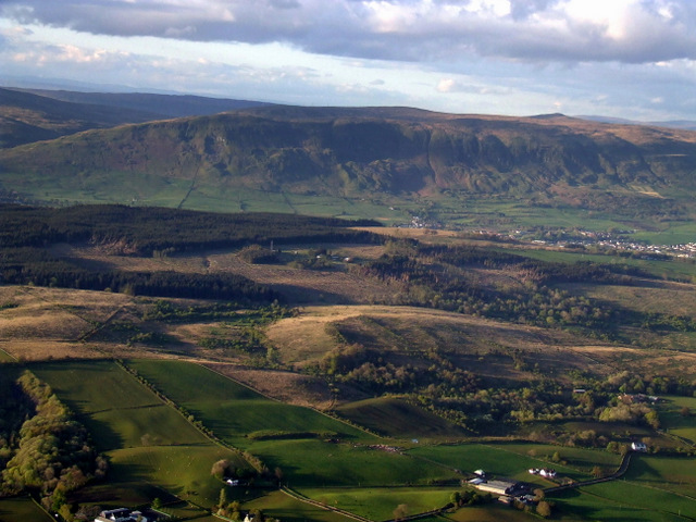
Blairskaith Muir is a vast expanse of moorland located in Stirlingshire, Scotland. Covering an area of approximately 2,000 acres, it is situated in the western part of the county, near the village of Kippen. The muir is characterized by its rolling hills, open plains, and diverse plant and animal life.

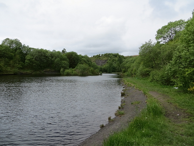
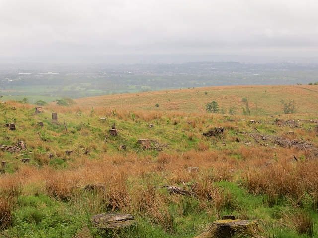
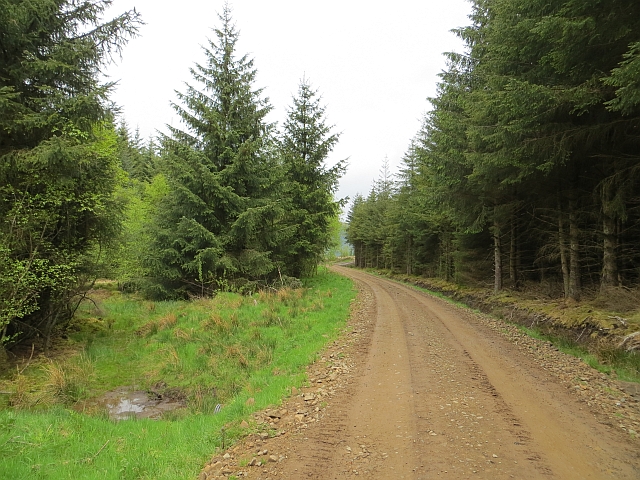
The terrain of Blairskaith Muir is predominantly heathland, with patches of rough grasses and occasional boggy areas. The landscape is dotted with small lochs and ponds, providing habitats for various bird species, including curlews, lapwings, and red grouse. The muir is also home to a variety of mammals, such as red deer, hares, and rabbits.

The muir has a rich history, with evidence of human activity dating back thousands of years. Archaeological remains, including Bronze Age burial cairns and Iron Age forts, can be found within its boundaries. Furthermore, the area was once used for peat cutting and grazing, contributing to its unique ecological composition.

Blairskaith Muir is a popular destination for outdoor enthusiasts, offering opportunities for walking, birdwatching, and photography. The muir is crisscrossed by a network of paths and trails, allowing visitors to explore its natural beauty and experience the tranquility of the Scottish countryside.

Overall, Blairskaith Muir is a remarkable example of the moorland landscape in Stirlingshire, boasting a diverse array of flora and fauna and providing a haven for wildlife and outdoor enthusiasts alike.

If you have any feedback on the listing, please let us know in the comments section below.

Blairskaith Muir Images

Images are sourced within 2km of 55.960154/-4.2561174 or Grid Reference NS5976. Thanks to Geograph Open Source API. All images are credited.

Path down from Clochcore Wood From the reservoir heading towards the Celtic FC training facility.
Path down from Clochcore Wood
From the reservoir heading towards the Celtic FC training facility.
The Campsie Fells from the air The farms in the foreground are Easter Blairskaith and Castlehill on Tower Road. Viewed from a Glasgow bound flight from Luton.
The Campsie Fells from the air
The farms in the foreground are Easter Blairskaith and Castlehill on Tower Road. Viewed from a Glasgow bound flight from Luton.
Lennox Forest The trees at the roadside have been trimmed back during forest operations
Lennox Forest
The trees at the roadside have been trimmed back during forest operations
Damp  pasture, Barraston
Damp pasture, Barraston
Quarry, Barraston Mapped as a clay quarry but older maps suggest that limestone and coal was extracted here as well as fire clay. Now flooded.
Quarry, Barraston
Mapped as a clay quarry but older maps suggest that limestone and coal was extracted here as well as fire clay. Now flooded.
Path sign, Newlands Various paths meet in Lennox Forest.
Path sign, Newlands
Various paths meet in Lennox Forest.
Logging road, Lennox Forest Long established southern edge of the forestry block given the foliage on the side of the trees. I expect this to be felled within a few years.
Logging road, Lennox Forest
Long established southern edge of the forestry block given the foliage on the side of the trees. I expect this to be felled within a few years.
Clearfell, Lennox Forest Views to the south have been opened up.
Clearfell, Lennox Forest
Views to the south have been opened up.
Newly graded road Recently maintained logging road in Lennox Forest. This is just north of Mounthullie which is the highest point of the moorland between the Kelvin and Lennoxtown.
Newly graded road
Recently maintained logging road in Lennox Forest. This is just north of Mounthullie which is the highest point of the moorland between the Kelvin and Lennoxtown.
Felled area, Lennox Forest At a road junction near the summit of Mounthoulie.
Felled area, Lennox Forest
At a road junction near the summit of Mounthoulie.
Logging road, Lennox Forest With a felled area to the north allowing views over to the Campsies.
Logging road, Lennox Forest
With a felled area to the north allowing views over to the Campsies.
Felled area, Lennox Forest
Lennox Forest
Lennox Forest
Abandoned Quarry near Barraston Farm A warning sign indicates that the water in the now flooded quarry is very deep.
Abandoned Quarry near Barraston Farm
A warning sign indicates that the water in the now flooded quarry is very deep.
Hillhead Farm Viewed from near to Back o' Hill.
Hillhead Farm
Viewed from near to Back o' Hill.
Barraston Quarry Flooded and disused.
Barraston Quarry
Flooded and disused.
Hillhead Farm Most of the farm is in the square to the south with just a part in this one.
Hillhead Farm
Most of the farm is in the square to the south with just a part in this one.
Clearing in Lennox Forest An open space in amongst the conifers. Very good for insects, including damselflies.
Clearing in Lennox Forest
An open space in amongst the conifers. Very good for insects, including damselflies.
Show me another place!

Blairskaith Muir is located at Grid Ref: NS5976 (Lat: 55.960154, Lng: -4.2561174)

Unitary Authority: East Dunbartonshire

Police Authority: Greater Glasgow

What 3 Words

///jaws.rebel.instead. Near Torrance, East Dunbartonshire

Related Wikis

Baldernock

Baldernock (; Gaelic: Baile D' Earnaig) meaning 'settlement of St Earnaig' (Iain Mac an Táilleir, Sabhall Mór Ostaig) is a small parish in East Dunbartonshire...

Lennox Castle

Lennox Castle is an abandoned castle in Lennoxtown, East Dunbartonshire, Scotland, approximately 12 miles (19 kilometres) north of Glasgow. It is infamous...

Barnellan

Barnellan is a small hamlet in East Dunbartonshire, Scotland, situated in the civil parish of Baldernock. It consists of a few houses and a farm, the latter...

Lennoxtown training centre

Lennoxtown Training Centre is Celtic F.C.'s training centre, located at Lennoxtown, East Dunbartonshire in Scotland. The complex houses the club's training...

Nearby Amenities

Located within 500m of 55.960154,-4.2561174
Man Made: survey_point
Lat/Long: 55.9631336/-4.2512784
Tourism: viewpoint
Lat/Long: 55.9631464/-4.2512624
The data included in this document is from www.openstreetmap.org. The data is made available under ODbL.

Have you been to Blairskaith Muir?

Leave your review of Blairskaith Muir below (or comments, questions and feedback).