Stafford Moor

Downs, Moorland in Devon Torridge

England

Stafford Moor

Tarka Trail: Footbridge near Ham Farm On the Tarka Trail between Iddesleigh and Dolton
Tarka Trail: Footbridge near Ham Farm Credit: Grant Sherman

Stafford Moor is a picturesque area located in Devon, England, known for its stunning downs and vast moorland. Situated in the heart of the county, it offers visitors a tranquil and idyllic setting to explore and appreciate the natural beauty of the region.

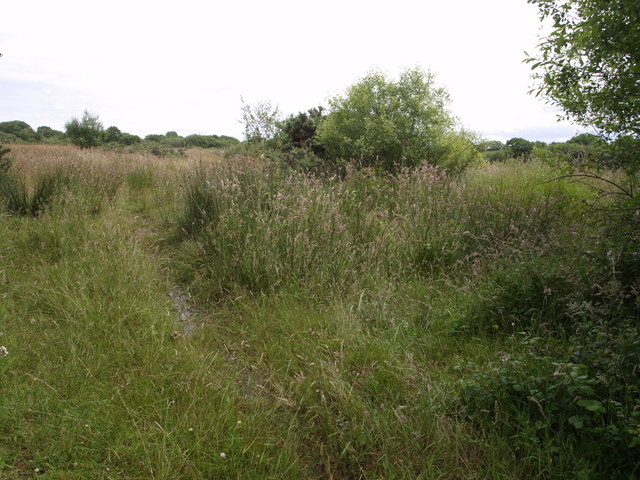
The downs of Stafford Moor showcase rolling hills and lush green landscapes, providing a captivating sight for nature enthusiasts and hikers. The area boasts an abundance of diverse flora and fauna, making it a haven for wildlife. Visitors can spot various bird species, including buzzards and skylarks, as well as occasional sightings of deer and other small mammals.

The moorland of Stafford Moor is equally captivating, with its expansive open spaces and heather-covered hills. It provides a unique and uninterrupted vista, allowing visitors to immerse themselves in the rugged beauty of the region. The moorland is also home to several rare and protected species, further adding to its ecological significance.

In addition to its natural wonders, Stafford Moor offers a range of outdoor activities. Walking and hiking trails crisscross the area, providing an opportunity to explore its diverse terrain. The moorland also offers excellent conditions for horse riding and cycling, with designated paths and routes available for enthusiasts.

For those seeking a peaceful retreat or a chance to reconnect with nature, Stafford Moor in Devon is an ideal destination. With its breathtaking downs, pristine moorland, and a range of outdoor activities, it promises an unforgettable experience for visitors of all ages.

If you have any feedback on the listing, please let us know in the comments section below.

Stafford Moor Images

Images are sourced within 2km of 50.884275/-4.0023467 or Grid Reference SS5911. Thanks to Geograph Open Source API. All images are credited.

Tarka Trail: Footbridge near Ham Farm On the Tarka Trail between Iddesleigh and Dolton
Tarka Trail: Footbridge near Ham Farm
On the Tarka Trail between Iddesleigh and Dolton
Farmland around Wood Farm Wood Farm is on high ground to the east of Dolton
Farmland around Wood Farm
Wood Farm is on high ground to the east of Dolton
Parsonage Farm The wooded valley drains west to join the Torridge. The farm is seen from a tiny lane from Cherubeer to Dolton. The cattle, who often rise to their feet on these occasions, are reluctant, in view of the unsettled weather.
Parsonage Farm
The wooded valley drains west to join the Torridge. The farm is seen from a tiny lane from Cherubeer to Dolton. The cattle, who often rise to their feet on these occasions, are reluctant, in view of the unsettled weather.
Venton Moor Venton Moor is an area of unimproved lowland grassland, typical of this part of Devon. This section is seen from the lane between Mudhouse Cross and Loosedon Cross
Venton Moor
Venton Moor is an area of unimproved lowland grassland, typical of this part of Devon. This section is seen from the lane between Mudhouse Cross and Loosedon Cross
Dowland Moor Dowland Moor is a substantial area of woodland occupying more than half of this square. This stand of birches is near the northeast entrance, seen from the lane between Mudhouse Cross and Loosedon Cross.
Dowland Moor
Dowland Moor is a substantial area of woodland occupying more than half of this square. This stand of birches is near the northeast entrance, seen from the lane between Mudhouse Cross and Loosedon Cross.
Furzepark Cross A lane junction at a corner of Furzepark Wood southeast of Dolton. The lane in the foreground is arriving from Dolton; straight ahead is to Upcott and Iddesleigh. Right is for Downland, and left for Winkleigh.
Furzepark Cross
A lane junction at a corner of Furzepark Wood southeast of Dolton. The lane in the foreground is arriving from Dolton; straight ahead is to Upcott and Iddesleigh. Right is for Downland, and left for Winkleigh.
Field beside Stafford Road Taken from Dolton Footpath 5, which runs, fenced, along the right hand side of this field.
Field beside Stafford Road
Taken from Dolton Footpath 5, which runs, fenced, along the right hand side of this field.
Tarka Trail: North-East of Staple Cross Looking north-east on the Tarka Trail at Staple Cross east of Dowland.
Tarka Trail: North-East of Staple Cross
Looking north-east on the Tarka Trail at Staple Cross east of Dowland.
Hollocombe Moor
Hollocombe Moor
Loosedon Cross The signpost on a triangle of grass gives most of the information, although the lane in the background also leads to Barwick.
Loosedon Cross
The signpost on a triangle of grass gives most of the information, although the lane in the background also leads to Barwick.
Farm road to Durdon Looking along the entrance lane to the farm at Durdon, from its junction with the A3124.
Farm road to Durdon
Looking along the entrance lane to the farm at Durdon, from its junction with the A3124.
Valley near Heath Hill A tributary of the Hollocombe Water occupies this valley, seen from the A3124 opposite Whitehouse Lane.
Valley near Heath Hill
A tributary of the Hollocombe Water occupies this valley, seen from the A3124 opposite Whitehouse Lane.
Loosedon Cross The plot on which the sign stands has been used for dumping topsoil, and the upright is partly buried.  Since <a href="https://www.geograph.org.uk/photo/465953">SS5909 : Loosedon Cross</a> was taken, one of the arms has disappeared
Loosedon Cross
The plot on which the sign stands has been used for dumping topsoil, and the upright is partly buried. Since SS5909 : Loosedon Cross was taken, one of the arms has disappeared
Road to Dolton from Loosedon Cross The southern edge of the woods of Dowland Moor is in the background
Road to Dolton from Loosedon Cross
The southern edge of the woods of Dowland Moor is in the background
Winter trees at Loosedon Cross The road leads north from the crossroads towards Beaford.  It looks as if the original track was wider and these trees have grown in the part which was not metalled.
Winter trees at Loosedon Cross
The road leads north from the crossroads towards Beaford. It looks as if the original track was wider and these trees have grown in the part which was not metalled.
In the woods of Dowland Moor
Track to Goosedown This leads to the farm on Durdon Moor
Track to Goosedown
This leads to the farm on Durdon Moor
Field west of Venton Moor The trees form the edge of Venton Moor woodland
Field west of Venton Moor
The trees form the edge of Venton Moor woodland
Show me another place!

Stafford Moor is located at Grid Ref: SS5911 (Lat: 50.884275, Lng: -4.0023467)

Administrative County: Devon

District: Torridge

Police Authority: Devon and Cornwall

What 3 Words

///types.torso.chess. Near Winkleigh, Devon

Related Wikis

Stafford, Dolton

Stafford (anciently Stowford) is an historic manor in the parish of Dolton in Devon, England. The present manor house known as Stafford Barton is a grade...

Dolton, Devon

Dolton is a small village and civil parish in the Torridge district of Devon, south-west England, surrounded, clockwise from the north, by Beaford, Ashreigney...

Dowland, Devon

Dowland is a civil parish in Devon, situated near Winkleigh. It is also the name of a hamlet in the parish. == References ==

RAF Winkleigh

Royal Air Force Winkleigh, or more simply RAF Winkleigh, is a former Royal Air Force satellite station located near to Winkleigh, Devon and south of Barnstaple...

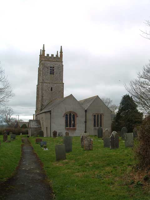
Church of St James, Iddesleigh

St James' Church, Iddesleigh, is a church in the small village of Iddesleigh, Devon, England. It dates back to the 13th century, although most of the...

Ashreigney

Ashreigney is a village and civil parish in the Torridge district of Devon, England, about 15 miles (24 km) south of the town of Barnstaple. According...

Iddesleigh

Iddesleigh is a village and civil parish in the county of Devon, England. The settlement has ancient origins and is listed in the Domesday Book. The village...

Beaford

Beaford is a village and civil parish in the Torridge district of Devon, England. The village is about five miles south-east of Great Torrington, on the...

Have you been to Stafford Moor?

Leave your review of Stafford Moor below (or comments, questions and feedback).