Airds Moss

Downs, Moorland in Ayrshire

Scotland

Airds Moss

Cronberry No.2 Pit Bing A view of Cronberry No.2 pit bing from the north.  The fenced off
area in the foreground is very wet and very swampy.
This photo was taken on the 13th July 2022.
Cronberry No.2 Pit Bing Credit: Rab McMurdo

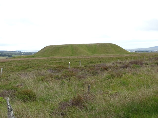
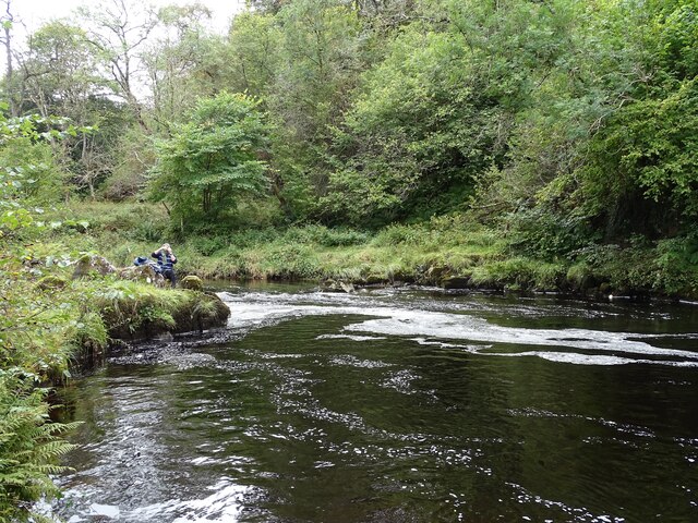
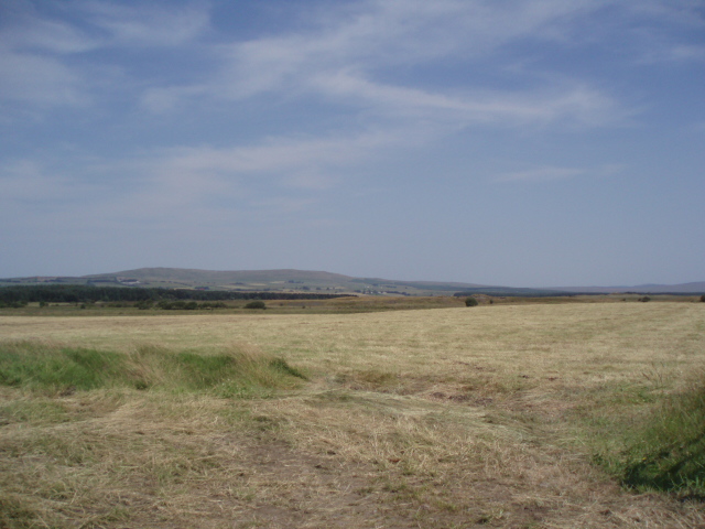
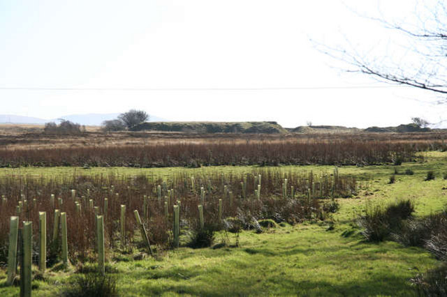
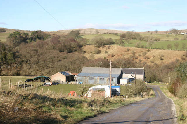
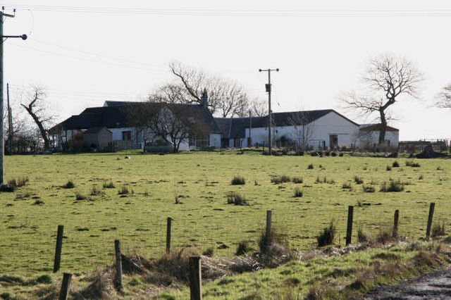
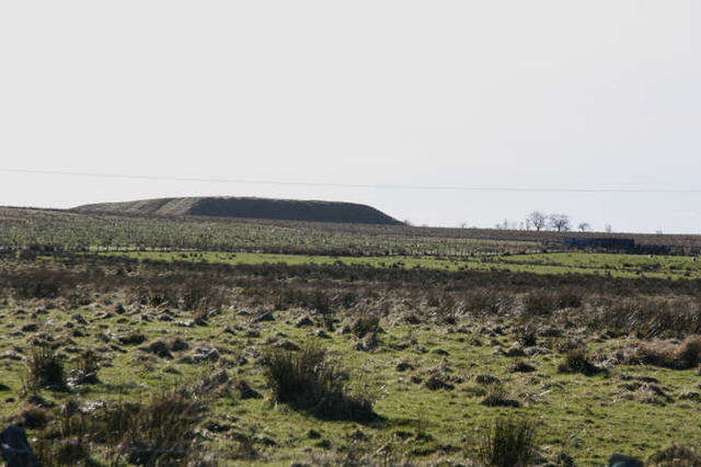
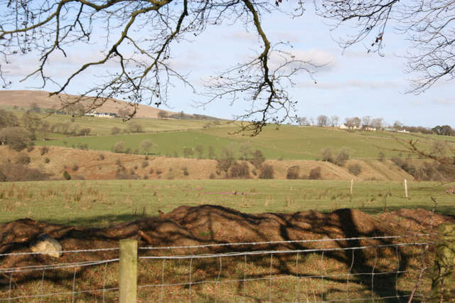
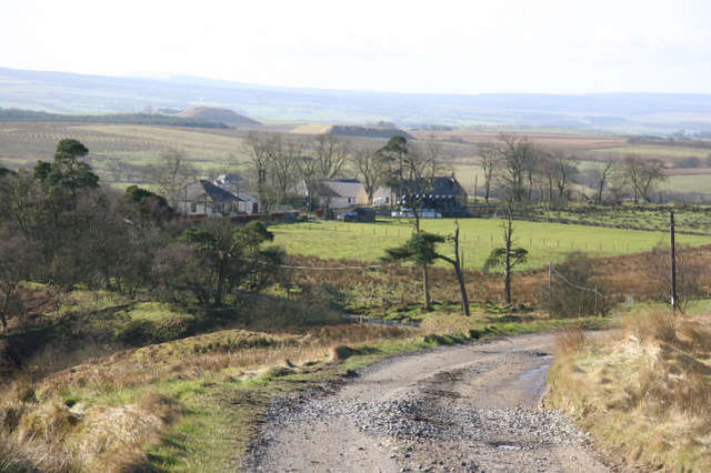
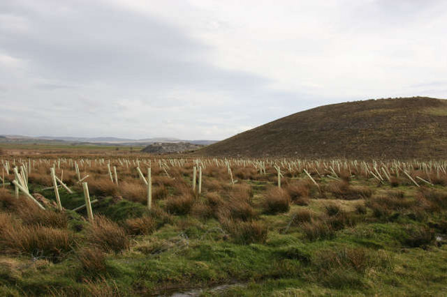
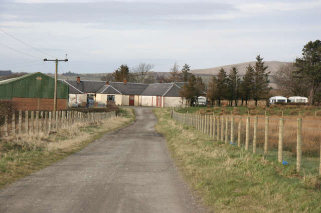
Airds Moss is a vast expanse of moorland located in Ayrshire, Scotland. Spanning over 1,000 acres, it is a significant natural habitat for various plant and animal species. The moss is situated near the village of Muirkirk and is surrounded by rolling hills and farmland.

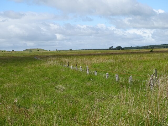
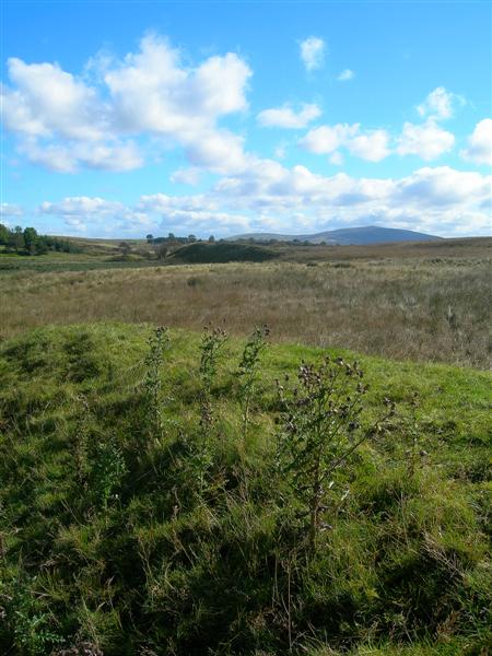
The landscape of Airds Moss is characterized by its flat terrain, dotted with numerous pools and marshes. It is predominantly covered in heather, grasses, and mosses, which lend the area its distinct moorland appearance. The moss is also home to an assortment of plant life, including cotton grass, bog myrtle, and sphagnum moss.

The region's wildlife thrives within Airds Moss, with several bird species making it their home. Visitors may spot birds such as lapwings, curlews, and skylarks soaring above the moorland. In addition to the avian inhabitants, various mammals, including hares, foxes, and rabbits, can be found within the moss.

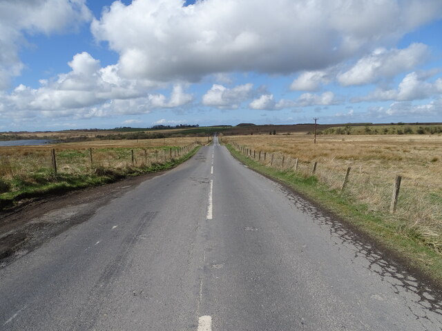
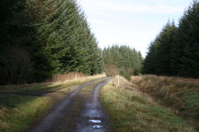
Airds Moss is a popular destination for outdoor enthusiasts, offering ample opportunities for walking, birdwatching, and photography. The moss is crisscrossed by footpaths and trails that allow visitors to explore its diverse flora and fauna. However, caution is advised due to the presence of bogs and marshes, which can be hazardous if not approached carefully.

This picturesque and ecologically rich landscape makes Airds Moss a valuable natural resource, contributing to the biodiversity and beauty of Ayrshire. It serves as a reminder of Scotland's wild and untamed countryside, attracting nature lovers and adventurers alike.

If you have any feedback on the listing, please let us know in the comments section below.

Airds Moss Images

Images are sourced within 2km of 55.496349/-4.2300527 or Grid Reference NS5924. Thanks to Geograph Open Source API. All images are credited.

Cronberry No.2 Pit Bing A view of Cronberry No.2 pit bing from the north.  The fenced off
area in the foreground is very wet and very swampy.
This photo was taken on the 13th July 2022.
Cronberry No.2 Pit Bing
A view of Cronberry No.2 pit bing from the north. The fenced off area in the foreground is very wet and very swampy. This photo was taken on the 13th July 2022.
Cronberry to Commondyke A view looking along the road towards the slag-bing road-end and the Common farm, from near the White Gates at Cronberry.
Cronberry to Commondyke
A view looking along the road towards the slag-bing road-end and the Common farm, from near the White Gates at Cronberry.
Sinking Fence-line Airds Moss is slowly swallowing this wire fence!
This photo was taken on the 13th July 2022.
Sinking Fence-line
Airds Moss is slowly swallowing this wire fence! This photo was taken on the 13th July 2022.
Wild Strawberries on the Slag-Bing A carpet of wild strawberries growing over the waste on the slag-bing.
This photo was taken on the 13th July 2022.
Wild Strawberries on the Slag-Bing
A carpet of wild strawberries growing over the waste on the slag-bing. This photo was taken on the 13th July 2022.
Security Device This security machine speaks with an Irish accent!
Photo taken on the 13th July 2022.
Security Device
This security machine speaks with an Irish accent! Photo taken on the 13th July 2022.
Dead Man's Hole The Dead Man's Hole on the Water Ayr.
Dead Man's Hole
The Dead Man's Hole on the Water Ayr.
Airds Moss There are former mine workings are here
Airds Moss
There are former mine workings are here
Afforestation An area of "lost mining settlements", old coal pits and disused waste bings, now being planted by Scottish Woodland. Opencast mining has started on the other side of Airds Moss in the Roundshaw and Darnconnor Farm areas.
Afforestation
An area of "lost mining settlements", old coal pits and disused waste bings, now being planted by Scottish Woodland. Opencast mining has started on the other side of Airds Moss in the Roundshaw and Darnconnor Farm areas.
Nether Heilar The "polytunnel" like structures at the entrance to the farm are to provide protection for sheep during the lambing season. From midden evidence, there  also appears to be an interest in other livestock, possibly beef cattle.
Nether Heilar
The "polytunnel" like structures at the entrance to the farm are to provide protection for sheep during the lambing season. From midden evidence, there also appears to be an interest in other livestock, possibly beef cattle.
Mid-Heilar A small collection of farm buildings and a dwelling house located above the floodplain of the R.Ayr. The floodplain starts to widen here after the gorge section which extends downstream for about 2km from Upper Heilar.
Mid-Heilar
A small collection of farm buildings and a dwelling house located above the floodplain of the R.Ayr. The floodplain starts to widen here after the gorge section which extends downstream for about 2km from Upper Heilar.
Track to Upper Heilar Access to this track is restricted by a metal barrier at the entrance. A mature coniferous plantation extends on both sides of the track leading to Upper Heilar. There is access to the R. Ayr for members of Sorn Angling Club.
Track to Upper Heilar
Access to this track is restricted by a metal barrier at the entrance. A mature coniferous plantation extends on both sides of the track leading to Upper Heilar. There is access to the R. Ayr for members of Sorn Angling Club.
Templandshaw A farm track lined on both sides by a mature coniferous plantation provides access to this quite isolated farm on Airds Moss. There is some improved grassland around the farm buildings. The surface soil has been derived from glacial till which makes it wet and heavy to work with. Not too far from the farm,there is coal present in the underlying rocks which has been recently worked by opencast methods.
Templandshaw
A farm track lined on both sides by a mature coniferous plantation provides access to this quite isolated farm on Airds Moss. There is some improved grassland around the farm buildings. The surface soil has been derived from glacial till which makes it wet and heavy to work with. Not too far from the farm,there is coal present in the underlying rocks which has been recently worked by opencast methods.
Glendale Woodland This is a recent woodland project on the northern edge of Airds Moss. The land here is wet and boggy by nature which makes it less attractive for farming activities although sheep are run on parts of Airds Moss.
Glendale Woodland
This is a recent woodland project on the northern edge of Airds Moss. The land here is wet and boggy by nature which makes it less attractive for farming activities although sheep are run on parts of Airds Moss.
Disused Bing An area scarred by past coal mining activity. The fields in front of this bing are being planted with new trees as part of the Scottish Woodland planting projects in this area.
Disused Bing
An area scarred by past coal mining activity. The fields in front of this bing are being planted with new trees as part of the Scottish Woodland planting projects in this area.
Paired River Terraces The branches of the tree point to the deeply incised valley of the R.Ayr. The flat grassy area just beyond the fence in the foreground and the similar grassy area on the opposite side of the valley are both part of the same former floodplain of the R. Ayr and are called river terraces. The glacial till which had been deposited in the valley during the glacial period, has been eroded by the outpouring of meltwater down the valley as the ice melted at the end of the glacial era. The R.Ayr to-day is a misfit stream flowing in a valley which could not have been created by the present river. Because the river terraces are virtual mirror images, they are referred to as 'paired terraces'. 
The 2 farms located on the gently sloping land in the distance, are Burntshield and Merkland.
Paired River Terraces
The branches of the tree point to the deeply incised valley of the R.Ayr. The flat grassy area just beyond the fence in the foreground and the similar grassy area on the opposite side of the valley are both part of the same former floodplain of the R. Ayr and are called river terraces. The glacial till which had been deposited in the valley during the glacial period, has been eroded by the outpouring of meltwater down the valley as the ice melted at the end of the glacial era. The R.Ayr to-day is a misfit stream flowing in a valley which could not have been created by the present river. Because the river terraces are virtual mirror images, they are referred to as 'paired terraces'. The 2 farms located on the gently sloping land in the distance, are Burntshield and Merkland.
Merkland The farm lies off the B743 overlooking the valley of the R.Ayr (see photo No. 344655). Land use in this area is mainly grassland farming providing grazing for both sheep and beef cattle.
In the distance can be seen the bings associated with past coal mining activity near Cronberry on the edge of Airds Moss.
Merkland
The farm lies off the B743 overlooking the valley of the R.Ayr (see photo No. 344655). Land use in this area is mainly grassland farming providing grazing for both sheep and beef cattle. In the distance can be seen the bings associated with past coal mining activity near Cronberry on the edge of Airds Moss.
Recent Opencast Remains As the coal is removed by opencast methods from a number of areas on Airds Moss, part of the land reinstatement programme is to plant several varieties of deciduous trees. 
In the distance can be seen the fireclay pit which has around two years supply of clay at the present rate of extraction. The mound of overburden to the right will then be used to improve the area shown in Photo No.366318.
Recent Opencast Remains
As the coal is removed by opencast methods from a number of areas on Airds Moss, part of the land reinstatement programme is to plant several varieties of deciduous trees. In the distance can be seen the fireclay pit which has around two years supply of clay at the present rate of extraction. The mound of overburden to the right will then be used to improve the area shown in Photo No.366318.
Darnconner Farm All that now remains of what was a much larger mining village of the same name. To the right of the caravans is a dwelling house which used to be the manse, while behind the farm buildings on the right there used to be the schoolmaster's house.
The main interest on the farm to-day is livestock - sheep and some beef cattle.
Darnconner Farm
All that now remains of what was a much larger mining village of the same name. To the right of the caravans is a dwelling house which used to be the manse, while behind the farm buildings on the right there used to be the schoolmaster's house. The main interest on the farm to-day is livestock - sheep and some beef cattle.
Show me another place!

Airds Moss is located at Grid Ref: NS5924 (Lat: 55.496349, Lng: -4.2300527)

Unitary Authority: East Ayrshire

Police Authority: Ayrshire

What 3 Words

///again.glimmers.passion. Near Logan, East Ayrshire

Nearby Locations

Airds Moss

Related Wikis

Airds Moss

Airds Moss is a large area of moor in East Ayrshire, the site is a protected area because of the extensive blanket bogs. In 1680 it was the location of...

Medieval turf building in Cronberry

Excavations in Cronberry, East Ayrshire, Scotland by Headland Archaeology revealed a medieval turf building and a nearby enclosure of unknown date. The...

Lugar railway station

Lugar railway station was a railway station serving the Lugar Ironworks, East Ayrshire, Scotland. The station was originally part of the Glasgow, Paisley...

Cronberry railway station

Cronberry railway station was a railway station serving the hamlet of Cronberry, East Ayrshire, Scotland. The station was originally part of the Glasgow...

Nearby Amenities

Located within 500m of 55.496349,-4.2300527
Power: pole
Lat/Long: 55.5005901/-4.2282638
Power: pole
Lat/Long: 55.5002634/-4.2270807
Power: pole
Lat/Long: 55.4999648/-4.2259656
Power: pole
Lat/Long: 55.499683/-4.224916
The data included in this document is from www.openstreetmap.org. The data is made available under ODbL.

Have you been to Airds Moss?

Leave your review of Airds Moss below (or comments, questions and feedback).