Blairskaith Muir
Hill, Mountain in Stirlingshire
Scotland
Blairskaith Muir
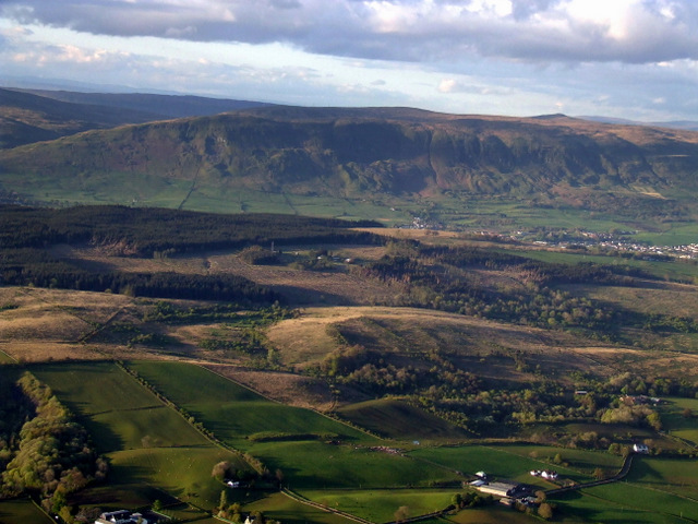
Blairskaith Muir is a prominent hill located in Stirlingshire, Scotland. It is situated approximately 4 miles northeast of the town of Stirling and is part of the Ochil Hills range. Blairskaith Muir stands at an elevation of 413 meters (1,355 feet) above sea level, making it a notable landmark in the area.
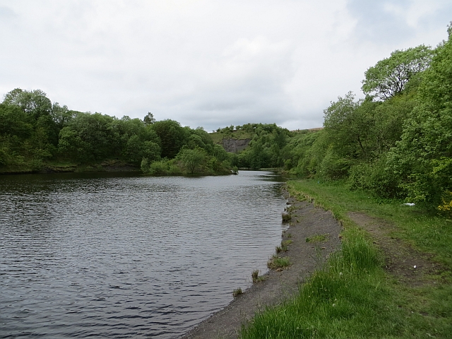
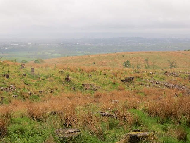
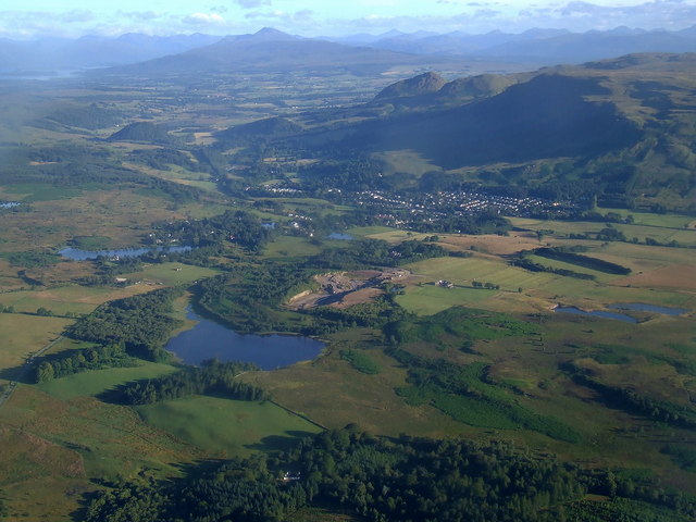
The hill is characterized by its gently sloping terrain and is mostly covered with heather and grasses, typical of the Scottish moorland landscape. It offers stunning panoramic views of the surrounding countryside, including the nearby Ochil Hills, the Forth Valley, and the city of Stirling.
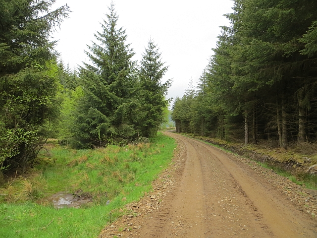
Blairskaith Muir is a popular destination for outdoor enthusiasts and nature lovers. Several walking and hiking trails traverse the hill, providing opportunities for visitors to explore and appreciate the natural beauty of the area. The hill is also known for its diverse wildlife, including various bird species, rabbits, and occasionally deer.
Historically, Blairskaith Muir has been used for farming and grazing purposes, and remnants of old stone walls and enclosures can still be seen on its slopes. The hill has also played a role in local folklore and legends, adding to its cultural significance.
Overall, Blairskaith Muir is a picturesque hill that offers breathtaking views and a tranquil escape for those seeking to immerse themselves in the natural beauty of Stirlingshire's landscape.
If you have any feedback on the listing, please let us know in the comments section below.
Blairskaith Muir Images
Images are sourced within 2km of 55.963127/-4.2512914 or Grid Reference NS5976. Thanks to Geograph Open Source API. All images are credited.


Blairskaith Muir is located at Grid Ref: NS5976 (Lat: 55.963127, Lng: -4.2512914)
Unitary Authority: East Dunbartonshire
Police Authority: Greater Glasgow
What 3 Words
///daydreams.tipping.scrapping. Near Lennoxtown, East Dunbartonshire
Nearby Locations
Related Wikis

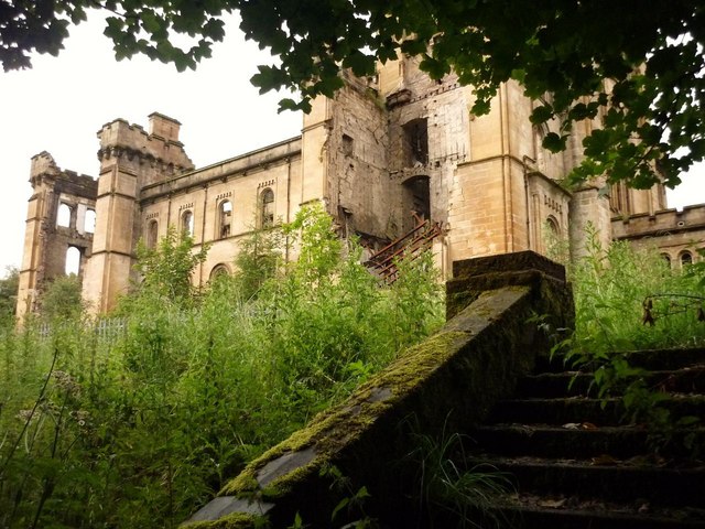
Lennox Castle
Lennox Castle is an abdandoned castle in Lennoxtown, East Dunbartonshire, Scotland, approximately 12 miles (19 kilometres) north of Glasgow. It is infamous...

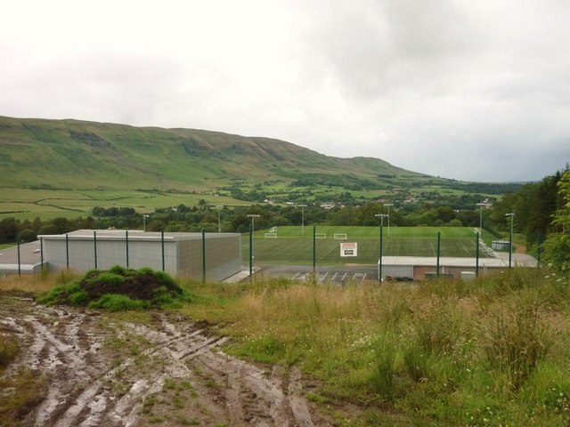
Lennoxtown training centre
Lennoxtown Training Centre is Celtic F.C.'s training centre, located at Lennoxtown, East Dunbartonshire in Scotland. The complex houses the club's training...

Finglen Burn
The Finglen Burn is a burn in Scotland that runs from north east of the Earl's Seat (the highest point on the Campsie Fells) to just north of Campsie Village...

Baldernock
Baldernock (; Gaelic: Baile D' Earnaig) meaning 'settlement of St Earnaig' (Iain Mac an Táilleir, Sabhall Mór Ostaig) is a small parish in East Dunbartonshire...
Haughhead
Haughhead is a hamlet two miles from Lennoxtown in East Dunbartonshire, Scotland. It was historically part of Stirlingshire until 1975, when it became...

Campsie Glen railway station
Campsie Glen railway station served the village of Clachan of Campsie, East Dunbartonshire, Scotland from 1867 to 1951 on the Blane Valley Railway; the...

East Dunbartonshire (UK Parliament constituency)
East Dunbartonshire is a county constituency of the House of Commons of the Parliament of the United Kingdom (Westminster). It elects one Member of Parliament...
Loch Ardinning
Loch Ardinning (Scottish Gaelic: Loch Àird Dùnain) is a body of freshwater in the district of Stirling in Scotland, lying to the south of the village of...
Nearby Amenities
Located within 500m of 55.963127,-4.2512914Have you been to Blairskaith Muir?
Leave your review of Blairskaith Muir below (or comments, questions and feedback).