Blairderry Moss

Downs, Moorland in Wigtownshire

Scotland

Blairderry Moss

Road to Blairderry
Road to Blairderry Credit: David Baird

Blairderry Moss is a picturesque area located in Wigtownshire, Scotland. Nestled amidst the stunning landscape of downs and moorland, this region offers visitors a unique and tranquil experience.

Covering a vast expanse, Blairderry Moss is characterized by its rich biodiversity and natural beauty. The area is primarily composed of peatland, providing a home to various species of plants and animals. The moss is adorned with a carpet of vibrant heather, which bursts into hues of purple during the summer months. This creates a breathtaking scene that attracts nature enthusiasts and photographers from far and wide.

The moss is also abundant in wildlife, including rare bird species such as hen harriers and short-eared owls. The open landscape allows for fantastic birdwatching opportunities, with visitors often catching glimpses of these majestic creatures soaring through the skies.

The moss is a haven for outdoor enthusiasts, offering numerous walking and hiking trails that allow visitors to explore its untouched beauty. The terrain varies from gentle slopes to more challenging uphill climbs, ensuring there is something for every level of fitness.

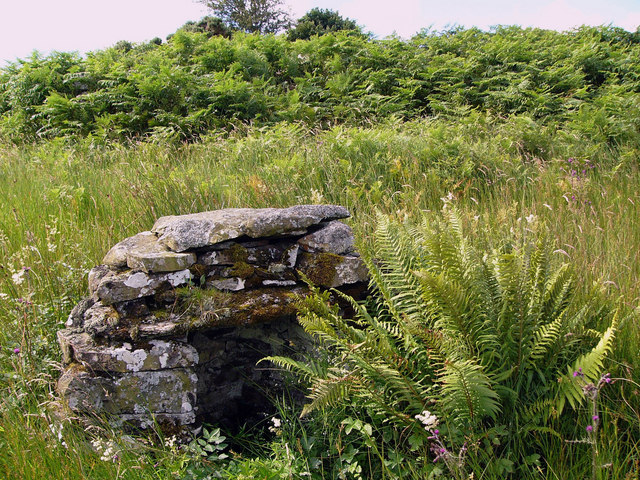
Additionally, Blairderry Moss is steeped in history, with evidence of ancient settlements and archaeological sites dating back thousands of years. It is a place where visitors can connect with the past and imagine the lives of those who once called this area home.

In conclusion, Blairderry Moss in Wigtownshire is a remarkable destination for anyone seeking to immerse themselves in the natural splendor of downs and moorland. Its diverse flora and fauna, coupled with its rich history, make it a must-visit location for nature lovers and history enthusiasts alike.

If you have any feedback on the listing, please let us know in the comments section below.

Blairderry Moss Images

Images are sourced within 2km of 54.915631/-4.7143935 or Grid Reference NX2661. Thanks to Geograph Open Source API. All images are credited.

Road to Blairderry
Road to Blairderry
Airyligg Ford Disused ford across the Water of Tarf. The barn on the other side is Markbroom. Airyligg = Airidh luig - the sheiling of the hollow.
Airyligg Ford
Disused ford across the Water of Tarf. The barn on the other side is Markbroom. Airyligg = Airidh luig - the sheiling of the hollow.
Black Drumgalder Forestry plantation on this hill, the origin of whose name remains obscure.
Black Drumgalder
Forestry plantation on this hill, the origin of whose name remains obscure.
The road to the Grennan The road runs over the shoulder of Filbane Hill (Fal Ban - white enclosure) to Grennan Farm and then onwards to Carscreugh.
The road to the Grennan
The road runs over the shoulder of Filbane Hill (Fal Ban - white enclosure) to Grennan Farm and then onwards to Carscreugh.
Bluebells on roadside bank
Barn at Markbroom Mark indicates a march, or boundary between farms, or sometimes parishes. The shed appears to be used for feeding cattle and for sheep shearing.
Barn at Markbroom
Mark indicates a march, or boundary between farms, or sometimes parishes. The shed appears to be used for feeding cattle and for sheep shearing.
Airyligg Farm Airyligg (airidh luig) - the sheiling of the hollow. Now abandoned.
Airyligg Farm
Airyligg (airidh luig) - the sheiling of the hollow. Now abandoned.
Well at Airyligg Ford This little well sits about 15 yards from the river edge. It doesn't appear on the  1:25000 OS map.
Well at Airyligg Ford
This little well sits about 15 yards from the river edge. It doesn't appear on the 1:25000 OS map.
Old railway goods van, Airyligg Farm An old railway goods wagon used as a shed, and now slowly rotting away.
Old railway goods van, Airyligg Farm
An old railway goods wagon used as a shed, and now slowly rotting away.
Markbroom Looking across moorland to the barn at Markbroom. The Knock of Luce can be seen on the horizon at the left of the picture.
Markbroom
Looking across moorland to the barn at Markbroom. The Knock of Luce can be seen on the horizon at the left of the picture.
Blairderry Farm from the slopes of Barwhil Looking to Blairderry (Blar doire - the field of the oak wood) over an area of clearfell from Barwhil (Barr chuill - hill of the hazels)
Blairderry Farm from the slopes of Barwhil
Looking to Blairderry (Blar doire - the field of the oak wood) over an area of clearfell from Barwhil (Barr chuill - hill of the hazels)
Looking to Shanvolley Hill A clump of trees growing in the middle of moorland often marks the site of an old house or farm, and the remains of old walls suggests that there were at one time buildings here, but if so the name is now lost. Shanvolley Hill is the next ridge across the moor, the name meaning an old byre or cattleshed.
Looking to Shanvolley Hill
A clump of trees growing in the middle of moorland often marks the site of an old house or farm, and the remains of old walls suggests that there were at one time buildings here, but if so the name is now lost. Shanvolley Hill is the next ridge across the moor, the name meaning an old byre or cattleshed.
Fireweed Fireweed (willow-herb) flourishes in areas of clearfell.
Fireweed
Fireweed (willow-herb) flourishes in areas of clearfell.
The Tarf Water from Barwhil
Bog oil An oily iridescence is often seen on the surface of stagnant pools in peat bogs. I had thought it was due to vegetable oils released by decaying plant matter but have recently read that it is due to iron salts floating on the surface.
Bog oil
An oily iridescence is often seen on the surface of stagnant pools in peat bogs. I had thought it was due to vegetable oils released by decaying plant matter but have recently read that it is due to iron salts floating on the surface.
Barlae Bridge The bridge carries the A75 over the Water of Tarf. Barlae comes from the gaelic barr laegh - the calves' hill.
Barlae Bridge
The bridge carries the A75 over the Water of Tarf. Barlae comes from the gaelic barr laegh - the calves' hill.
Show me another place!

Blairderry Moss is located at Grid Ref: NX2661 (Lat: 54.915631, Lng: -4.7143935)

Unitary Authority: Dumfries and Galloway

Police Authority: Dumfries and Galloway

What 3 Words

///pampering.journey.infinite. Near Newton Stewart, Dumfries & Galloway

Related Wikis

Barhapple Loch

Barhapple Loch is a small semicircular freshwater loch located in Wigtownshire, Dumfries and Galloway in Scotland. Barhapple Loch is principally known...

Tarf Water, Wigtownshire

The Tarf Water is a river in the former county of Wigtownshire in south-west Scotland. It rises on the Ayrshire border (55.0048°N 4.7815°W / 55.0048;...

Kirkcowan railway station

Kirkcowan railway station served the village of Kirkcowan, Dumfries and Galloway, Scotland from 1861 to 1965 on the Portpatrick and Wigtownshire Joint...

Kirkcowan

Kirkcowan is an area about 15 miles in length, and from nearly two to nearly seven miles in breadth, comprising 30,580 acres, of which 7000 are arable...

Nearby Amenities

Located within 500m of 54.915631,-4.7143935
Blairderry Moss
Place: locality
Source: NLS Bartholomew half inch.
Lat/Long: 54.9168856/-4.7147454
The data included in this document is from www.openstreetmap.org. The data is made available under ODbL.

Have you been to Blairderry Moss?

Leave your review of Blairderry Moss below (or comments, questions and feedback).