Blairderry Moss

Hill, Mountain in Wigtownshire

Scotland

Blairderry Moss

Road to Blairderry
Road to Blairderry Credit: David Baird

Blairderry Moss is a prominent hill located in Wigtownshire, a historic county in the southwest of Scotland. It is part of the larger Galloway Hills range and stands at an elevation of approximately 567 meters (1,860 feet) above sea level. The hill offers stunning panoramic views of the surrounding countryside, making it a popular destination for hikers and nature enthusiasts.

Blairderry Moss is characterized by its rugged terrain and heather-covered slopes. The hill is composed mainly of granite and is home to a diverse range of flora and fauna. The surrounding area is scattered with small lochs and peat bogs, adding to its natural beauty.

Hiking trails lead to the summit of Blairderry Moss, providing visitors with the opportunity to enjoy the breathtaking vistas and observe the local wildlife. Birdwatchers may spot species such as red grouse, golden eagles, and peregrine falcons soaring above the hill. The moorland surrounding the hill is also inhabited by various mammals, including red deer and mountain hares.

Blairderry Moss is easily accessible, with several footpaths and parking areas nearby. The hill is located in close proximity to the town of Wigtown, renowned for its annual book festival and its rich literary heritage. Visitors to Blairderry Moss can combine their outdoor adventure with a visit to Wigtown, exploring its charming streets and bookshops.

Overall, Blairderry Moss in Wigtownshire offers a captivating natural landscape, providing an ideal setting for outdoor activities and a peaceful retreat for those seeking tranquility amidst Scotland's scenic beauty.

If you have any feedback on the listing, please let us know in the comments section below.

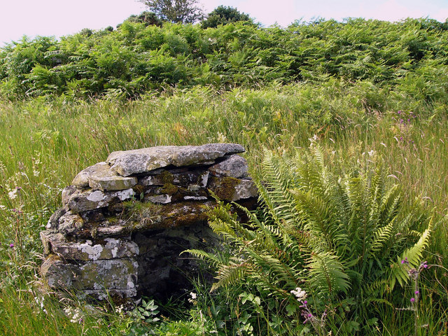
Blairderry Moss Images

Images are sourced within 2km of 54.91424/-4.7082763 or Grid Reference NX2661. Thanks to Geograph Open Source API. All images are credited.

Road to Blairderry
Road to Blairderry
Airyligg Ford Disused ford across the Water of Tarf. The barn on the other side is Markbroom. Airyligg = Airidh luig - the sheiling of the hollow.
Airyligg Ford
Disused ford across the Water of Tarf. The barn on the other side is Markbroom. Airyligg = Airidh luig - the sheiling of the hollow.
Bluebells on roadside bank
Barn at Markbroom Mark indicates a march, or boundary between farms, or sometimes parishes. The shed appears to be used for feeding cattle and for sheep shearing.
Barn at Markbroom
Mark indicates a march, or boundary between farms, or sometimes parishes. The shed appears to be used for feeding cattle and for sheep shearing.
Airyligg Farm Airyligg (airidh luig) - the sheiling of the hollow. Now abandoned.
Airyligg Farm
Airyligg (airidh luig) - the sheiling of the hollow. Now abandoned.
Well at Airyligg Ford This little well sits about 15 yards from the river edge. It doesn't appear on the  1:25000 OS map.
Well at Airyligg Ford
This little well sits about 15 yards from the river edge. It doesn't appear on the 1:25000 OS map.
Old railway goods van, Airyligg Farm An old railway goods wagon used as a shed, and now slowly rotting away.
Old railway goods van, Airyligg Farm
An old railway goods wagon used as a shed, and now slowly rotting away.
Markbroom Looking across moorland to the barn at Markbroom. The Knock of Luce can be seen on the horizon at the left of the picture.
Markbroom
Looking across moorland to the barn at Markbroom. The Knock of Luce can be seen on the horizon at the left of the picture.
Blairderry Farm from the slopes of Barwhil Looking to Blairderry (Blar doire - the field of the oak wood) over an area of clearfell from Barwhil (Barr chuill - hill of the hazels)
Blairderry Farm from the slopes of Barwhil
Looking to Blairderry (Blar doire - the field of the oak wood) over an area of clearfell from Barwhil (Barr chuill - hill of the hazels)
Looking to Shanvolley Hill A clump of trees growing in the middle of moorland often marks the site of an old house or farm, and the remains of old walls suggests that there were at one time buildings here, but if so the name is now lost. Shanvolley Hill is the next ridge across the moor, the name meaning an old byre or cattleshed.
Looking to Shanvolley Hill
A clump of trees growing in the middle of moorland often marks the site of an old house or farm, and the remains of old walls suggests that there were at one time buildings here, but if so the name is now lost. Shanvolley Hill is the next ridge across the moor, the name meaning an old byre or cattleshed.
Fireweed Fireweed (willow-herb) flourishes in areas of clearfell.
Fireweed
Fireweed (willow-herb) flourishes in areas of clearfell.
The Tarf Water from Barwhil
Bog oil An oily iridescence is often seen on the surface of stagnant pools in peat bogs. I had thought it was due to vegetable oils released by decaying plant matter but have recently read that it is due to iron salts floating on the surface.
Bog oil
An oily iridescence is often seen on the surface of stagnant pools in peat bogs. I had thought it was due to vegetable oils released by decaying plant matter but have recently read that it is due to iron salts floating on the surface.
Barlae Bridge The bridge carries the A75 over the Water of Tarf. Barlae comes from the gaelic barr laegh - the calves' hill.
Barlae Bridge
The bridge carries the A75 over the Water of Tarf. Barlae comes from the gaelic barr laegh - the calves' hill.
Water of Tarf from Barlae Bridge Looking south.
Water of Tarf from Barlae Bridge
Looking south.
Water of Tarf from Barlae Bridge Looking north
Water of Tarf from Barlae Bridge
Looking north
Show me another place!

Blairderry Moss is located at Grid Ref: NX2661 (Lat: 54.91424, Lng: -4.7082763)

Unitary Authority: Dumfries and Galloway

Police Authority: Dumfries and Galloway

What 3 Words

///lifestyle.prestige.extremes. Near Newton Stewart, Dumfries & Galloway

Related Wikis

Barhapple Loch

Barhapple Loch is a small semicircular freshwater loch located in Wigtownshire, Dumfries and Galloway in Scotland. Barhapple Loch is principally known...

Tarf Water, Wigtownshire

The Tarf Water is a river in the former county of Wigtownshire in south-west Scotland. It rises on the Ayrshire border (55.0048°N 4.7815°W / 55.0048;...

Kirkcowan railway station

Kirkcowan railway station served the village of Kirkcowan, Dumfries and Galloway, Scotland from 1861 to 1965 on the Portpatrick and Wigtownshire Joint...

Kirkcowan

Kirkcowan is an area about 15 miles in length, and from nearly two to nearly seven miles in breadth, comprising 30,580 acres, of which 7000 are arable...

Nearby Amenities

Located within 500m of 54.91424,-4.7082763
The data included in this document is from www.openstreetmap.org. The data is made available under ODbL.

Have you been to Blairderry Moss?

Leave your review of Blairderry Moss below (or comments, questions and feedback).