Rankin Park

Downs, Moorland in Renfrewshire

Scotland

Rankin Park

Branchton railway station A night view of the single platform station, which is on the Wemyss Bay line from Glasgow Central.
Branchton railway station Credit: Thomas Nugent

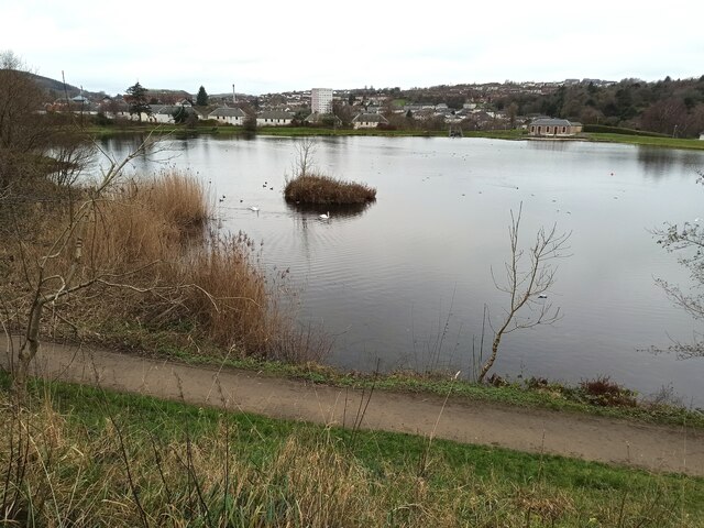
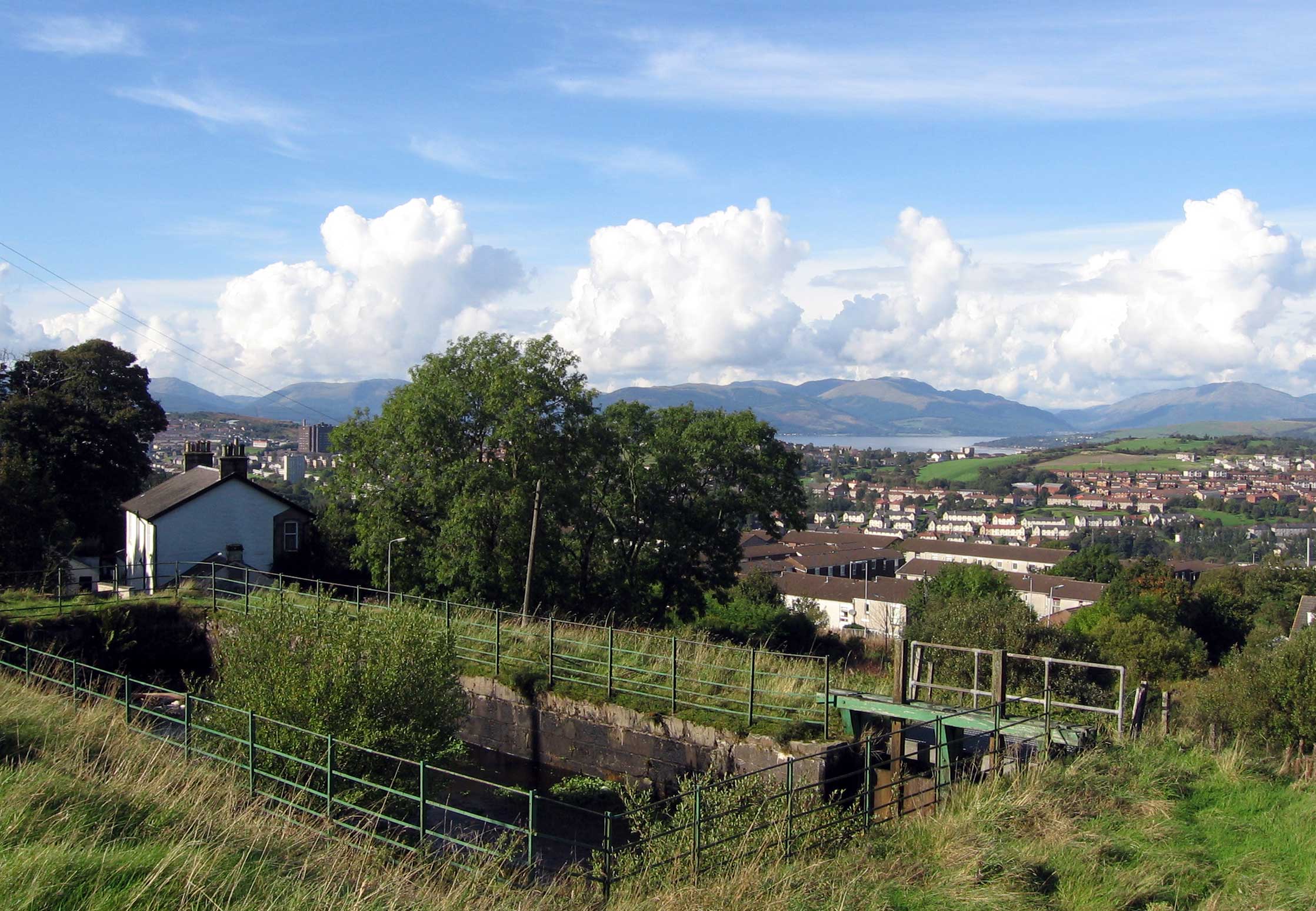
Rankin Park is a picturesque and expansive green space located in Renfrewshire, Scotland. Spread across downs and moorland, the park offers a diverse and captivating natural landscape that attracts both locals and visitors alike. Covering an area of approximately 100 hectares, it provides ample space for recreational activities and a tranquil environment for relaxation.

The downs in Rankin Park boast gently rolling hills covered in lush green grass, making it an ideal spot for picnics and outdoor games. The open expanse offers breathtaking panoramic views of the surrounding countryside, creating a serene and idyllic setting for nature enthusiasts. The downs are also home to a variety of flora and fauna, including wildflowers, birds, and small mammals, providing ample opportunities for wildlife spotting.

Adjacent to the downs, the moorland area of Rankin Park offers a different landscape altogether. Here, visitors can explore heather-covered hillsides and meandering walking trails that wind through the rugged terrain. The moorland is a haven for hikers and nature lovers, with its diverse plant life and stunning vistas presenting a unique and captivating experience.

Facilities within Rankin Park include well-maintained paths for walking and cycling, picnic areas with benches, and ample parking space. The park is also equipped with public toilets and designated areas for barbecues and outdoor events, making it a popular destination for families and groups.

Overall, Rankin Park in Renfrewshire is a natural gem, offering a harmonious blend of downs and moorland that provides a diverse range of recreational opportunities for all to enjoy.

If you have any feedback on the listing, please let us know in the comments section below.
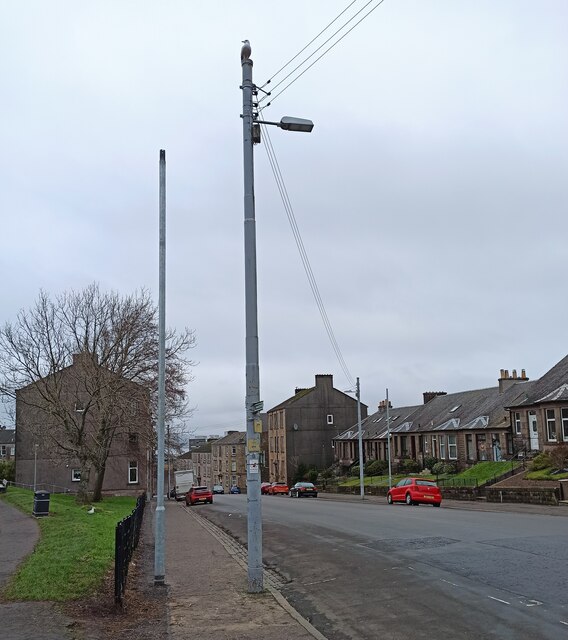
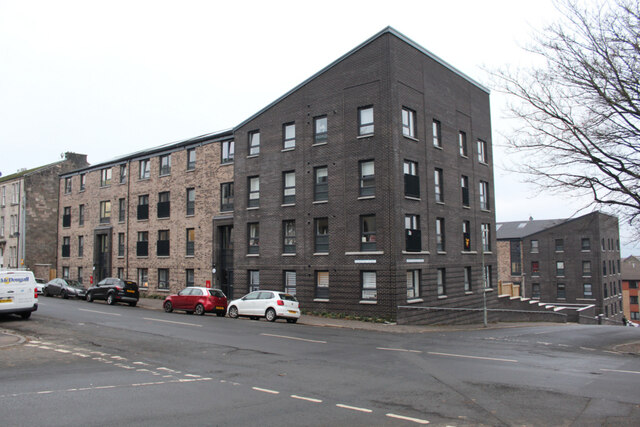
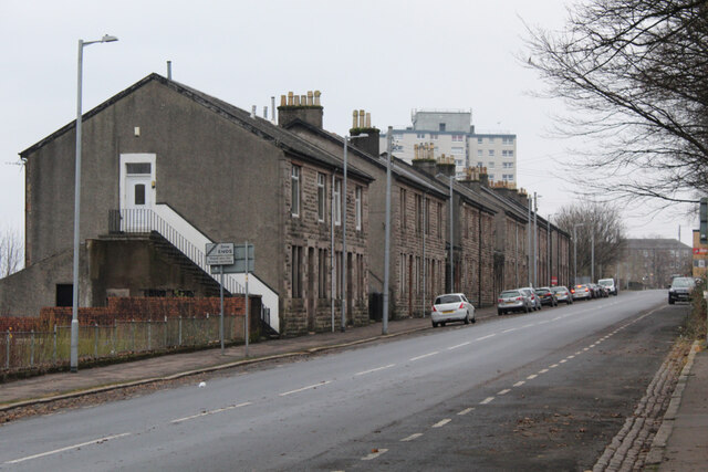
Rankin Park Images

Images are sourced within 2km of 55.940624/-4.7867974 or Grid Reference NS2675. Thanks to Geograph Open Source API. All images are credited.

Branchton railway station A night view of the single platform station, which is on the Wemyss Bay line from Glasgow Central.
Branchton railway station
A night view of the single platform station, which is on the Wemyss Bay line from Glasgow Central.
Branchton railway station A night view of the single platform station, which is on the Wemyss Bay line from Glasgow Central.
Branchton railway station
A night view of the single platform station, which is on the Wemyss Bay line from Glasgow Central.
Branchton railway station A night view of the single platform station, which is on the Wemyss Bay line from Glasgow Central. Taken from the A78 Inverkip Road footbridge.
Branchton railway station
A night view of the single platform station, which is on the Wemyss Bay line from Glasgow Central. Taken from the A78 Inverkip Road footbridge.
Branchton railway station A night view of the single platform station, which is on the Wemyss Bay line from Glasgow Central. The station building stood in the area in the foreground. The footbridge crosses the A78 Inverkip Road.
Branchton railway station
A night view of the single platform station, which is on the Wemyss Bay line from Glasgow Central. The station building stood in the area in the foreground. The footbridge crosses the A78 Inverkip Road.
Branchton railway station A night view of the single platform station, which is on the Wemyss Bay line from Glasgow Central. Note the tactile paving strip on the platform.
Branchton railway station
A night view of the single platform station, which is on the Wemyss Bay line from Glasgow Central. Note the tactile paving strip on the platform.
Drumfrochar railway station Looking east along the single platform from the Peat Road entrance.
Drumfrochar railway station
Looking east along the single platform from the Peat Road entrance.
Greenock Health & Care Centre The new health centre on Wellington Street, on the site of the former Wellington Academy. Opened in 2021 to replace the old health centre on nearby Duncan Street.
Greenock Health & Care Centre
The new health centre on Wellington Street, on the site of the former Wellington Academy. Opened in 2021 to replace the old health centre on nearby Duncan Street.
Greenock  Health  & Care Centre  car park Serving the new (2021) health centre on Wellington Street, which is in the background.
Greenock Health & Care Centre car park
Serving the new (2021) health centre on Wellington Street, which is in the background.
Railway line in central Greenock  The Gourock branch of the Inverclyde Line runs through three tunnels between  Greenock Central station and the terminus at Gourock. This short stretch of exposed track is at King Street, with Greenock telephone exchange prominent.
Railway line in central Greenock
The Gourock branch of the Inverclyde Line runs through three tunnels between Greenock Central station and the terminus at Gourock. This short stretch of exposed track is at King Street, with Greenock telephone exchange prominent.
The Oak Mall The Crown  Street  entrance to the mall, with the A78 High Street above.
The Oak Mall
The Crown Street entrance to the mall, with the A78 High Street above.
Smartcard reader at Drumfrochar railway station One of two similar readers at the station which reads smartcards which are preloaded with journeys. This one is at the Peat Road entrance, the other is at the Lemmon Street entrance.
Smartcard reader at Drumfrochar railway station
One of two similar readers at the station which reads smartcards which are preloaded with journeys. This one is at the Peat Road entrance, the other is at the Lemmon Street entrance.
Smartcard reader at Drumfrochar railway station  One of two similar readers at the station which reads smartcards which are preloaded with journeys. This one is at the Peat Road entrance, the other is at the Lemmon Street entrance.
Smartcard reader at Drumfrochar railway station
One of two similar readers at the station which reads smartcards which are preloaded with journeys. This one is at the Peat Road entrance, the other is at the Lemmon Street entrance.
Cowdeknowes Reservoir  One of two small reservoirs off Murdieston Street.
Cowdeknowes Reservoir
One of two small reservoirs off Murdieston Street.
New lampposts on Murdieston Street  New lampposts are being installed to replace the old ones and their overhead wires.
New lampposts on Murdieston Street
New lampposts are being installed to replace the old ones and their overhead wires.
Cemetery, Greenock
Cemetery, Greenock
Site of Highlanders Academy The school closed in 2012 and the building was demolished in 2017.

See the building here <a href="https://www.geograph.org.uk/photo/595527">NS2775 : Highlanders' Academy</a>.
Site of Highlanders Academy
The school closed in 2012 and the building was demolished in 2017. See the building here NS2775 : Highlanders' Academy.
Dempster Street Stone-built terraced houses on the north side of the street, with Whinhill Court towerblock in the distance.
Dempster Street
Stone-built terraced houses on the north side of the street, with Whinhill Court towerblock in the distance.
Show me another place!

Rankin Park is located at Grid Ref: NS2675 (Lat: 55.940624, Lng: -4.7867974)

Unitary Authority: Inverclyde

Police Authority: Renfrewshire and Inverclyde

What 3 Words

///ample.aspect.cross. Near Greenock, Inverclyde

Related Wikis

HM Prison Greenock

HMP Greenock is a prison located in Greenock, Scotland, serving designated courts in western Scotland by holding male prisoners on remand, and short-term...

Overton, Greenock

Overton is an area in the suburbs of Greenock, Inverclyde. Overton offers excellent views across the River Clyde and suburban Greenock. The area is the...

Greenock rail crash

On 25 June 1994, the 22:45 from Wemyss Bay to Glasgow, in Scotland, derailed and smashed into a bridge after hitting concrete blocks placed deliberately...

Ravenscraig Hospital

Ravenscraig Hospital was a mental health facility in Inverkip Road, Greenock, Scotland. It was managed by NHS Greater Glasgow and Clyde. == History... ==

Nearby Amenities

Located within 500m of 55.940624,-4.7867974
Traffic Signals
Lat/Long: 55.9410036/-4.7875033
Parking
Source: Bing
Lat/Long: 55.9418026/-4.7853397
Noexit: yes
Lat/Long: 55.941674/-4.7926516
Morrisons Daily
Addr Housename: Barrs Cottage
Brand: Morrisons Daily
Brand Wikidata: Q99752411
Operator: McColl's
Operator Wikidata: Q16997477
Shop: convenience
Website: https://my.morrisons.com/storefinder/61508/morrisons-daily-greenock-inverkip-road
Lat/Long: 55.9428202/-4.7860178
Turning Circle
Source: Bing
Lat/Long: 55.9442141/-4.7883268
Access: private
Entrance: service
Source: Bing
Lat/Long: 55.9428151/-4.783019
Pennyfern
Place: suburb
Lat/Long: 55.9384088/-4.7888633
Gateside
Place: suburb
Lat/Long: 55.9428763/-4.7917686
Noexit: yes
Lat/Long: 55.9413949/-4.792141
Generator Method: photovoltaic
Generator Output Electricity: yes
Generator Source: solar
Generator Type: solar_photovoltaic_panel
Power: generator
Lat/Long: 55.9421771/-4.7829928
Oh My Days
Shop: dessert
Lat/Long: 55.942629/-4.785897
Fast Food
Sizzlers
Addr City: Greenock
Addr Housenumber: 78
Addr Postcode: PA16 9AP
Addr Street: Inverkip Road
Fhrs Id: 530
Lat/Long: 55.9426911/-4.7859253
Fast Food
Bar's Cottage Fish & Chips
Cuisine: fish_and_chips
Lat/Long: 55.942748/-4.7859478
Bus Stop
Bus: yes
Public Transport: platform
Shelter: yes
Lat/Long: 55.9402514/-4.7927117
Bus Stop
Bus: yes
Public Transport: platform
Shelter: yes
Lat/Long: 55.940419/-4.7918025
Bus Stop
Bus: yes
Public Transport: platform
Shelter: yes
Lat/Long: 55.9423224/-4.7853218
Bus Stop
Bus: yes
Public Transport: platform
Shelter: yes
Lat/Long: 55.943196/-4.7859725
Bus Stop
Rankin Court
Bus: yes
Public Transport: platform
Lat/Long: 55.9443506/-4.7823316
Bus Stop
Rankin Court
Bus: yes
Public Transport: platform
Lat/Long: 55.9442406/-4.7821139
Bus Stop
Florence Street
Bus: yes
Naptan AtcoCode: 6130202
Naptan NaptanCode: 46823873
Public Transport: platform
Lat/Long: 55.9431344/-4.7860674
Bus Stop
Greenock Library
Bus: yes
Public Transport: platform
Lat/Long: 55.9419499/-4.785348
Bus Stop
Inverkip Road (opp 174)
Bus: yes
Public Transport: platform
Lat/Long: 55.9402227/-4.7926187
Bus Stop
Inverkip Road (at 162)
Bus: yes
Public Transport: platform
Lat/Long: 55.9404969/-4.7918127
The data included in this document is from www.openstreetmap.org. The data is made available under ODbL.

Have you been to Rankin Park?

Leave your review of Rankin Park below (or comments, questions and feedback).