Artfield Fell

Downs, Moorland in Wigtownshire

Scotland

Artfield Fell

A windfarm at Artfield Fell, East of New Luce Photo taken from the New Luce to barrhill road near to Quarter Farm, New Luce.
A windfarm at Artfield Fell, East of New Luce Credit: Colin McDonald

Artfield Fell is a scenic area located in Wigtownshire, Scotland. Situated amidst the Downs and Moorland, it offers breathtaking views and a diverse range of natural landscapes. Spanning over a vast expanse, Artfield Fell is a haven for nature enthusiasts and visitors seeking tranquility.

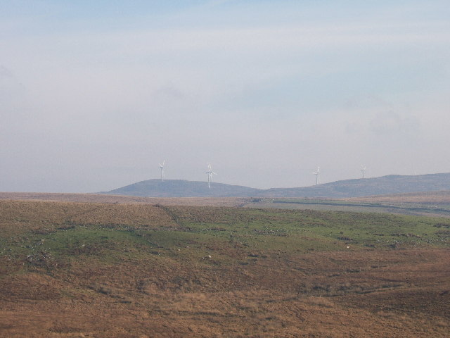
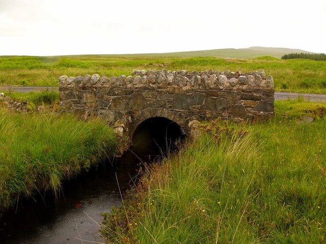
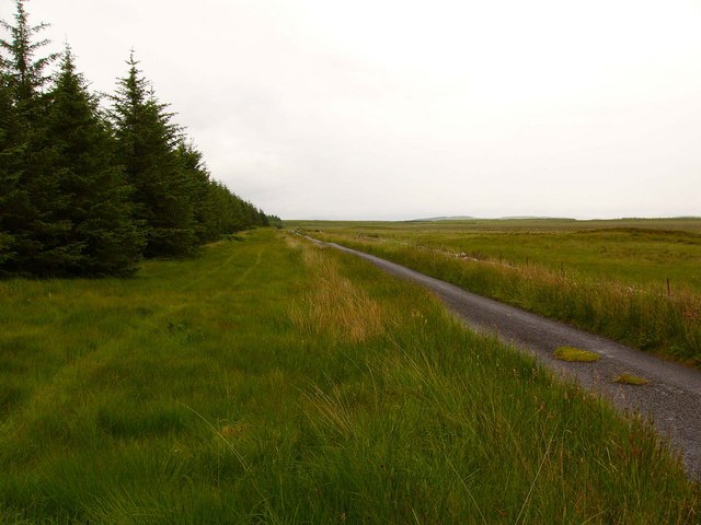
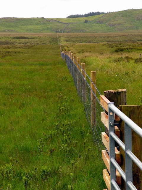
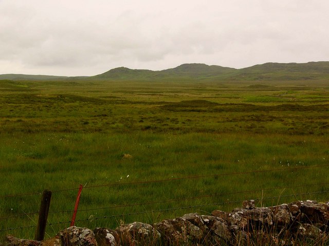
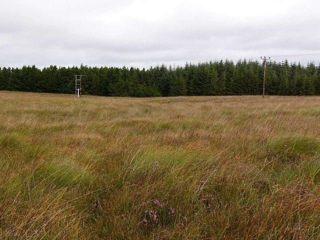
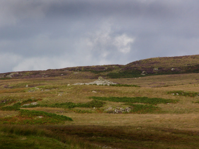
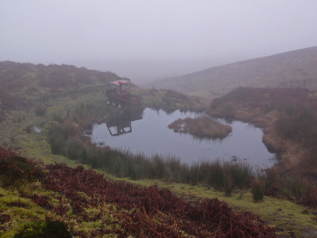
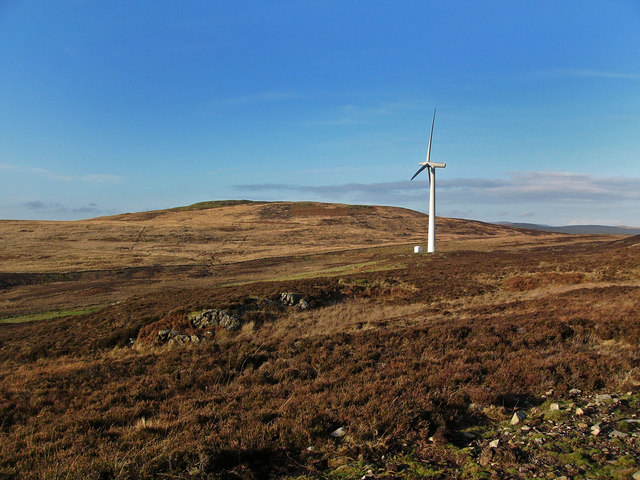
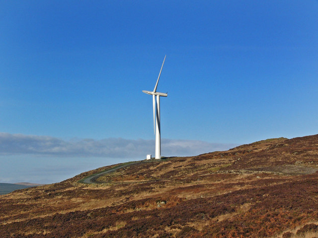
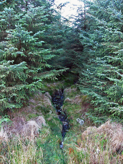
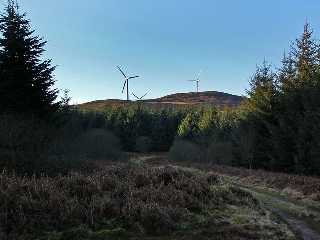
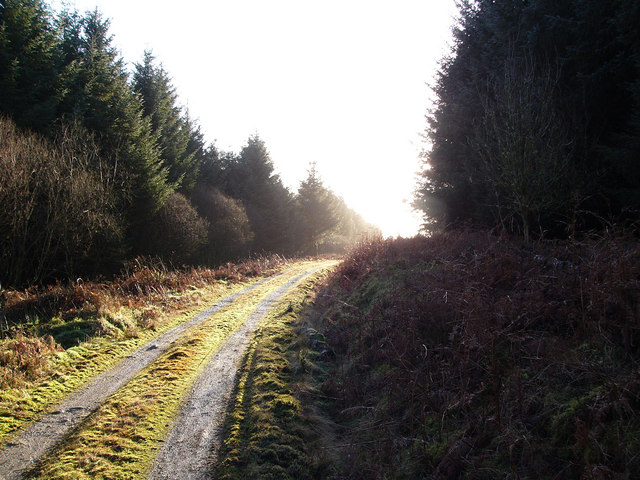
The area is characterized by its rolling hills, expansive moorlands, and picturesque valleys. The Downs, with their gentle slopes, provide a perfect setting for leisurely walks and picnics, offering panoramic views of the surrounding countryside. The Moorland, on the other hand, presents a rugged terrain with heather-covered hills and peat bogs, creating a unique and wild atmosphere.

Wildlife is abundant in Artfield Fell, with various species of birds, mammals, and plant life calling this area home. Birdwatchers can spot a variety of species, including red grouse, curlews, and golden plovers. The moorland is also home to small mammals like rabbits and hares, while deer can occasionally be spotted grazing in the distance.

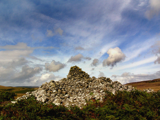
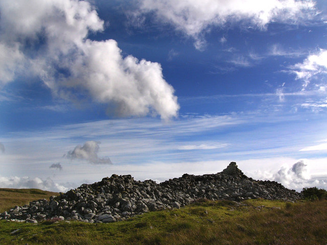
For those interested in history, Artfield Fell has its own stories to tell. The area is dotted with ancient archaeological sites, including burial mounds and stone circles, providing a glimpse into the region's past.

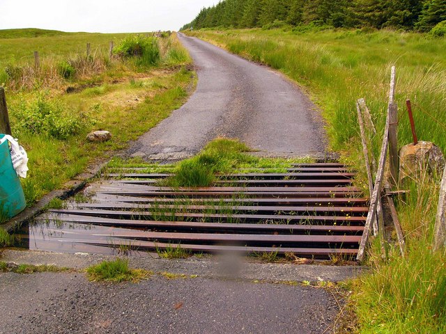
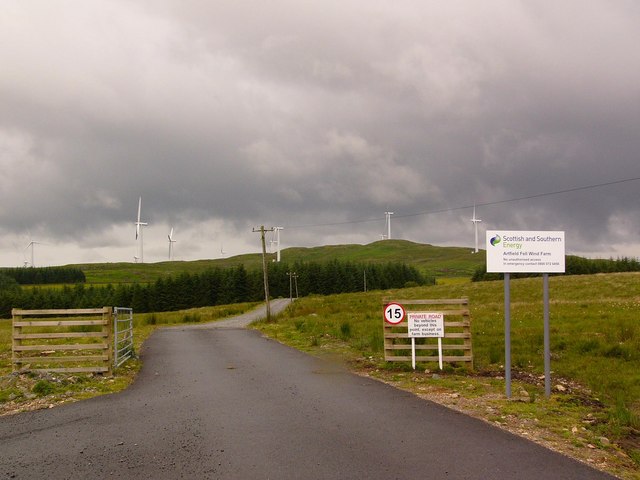
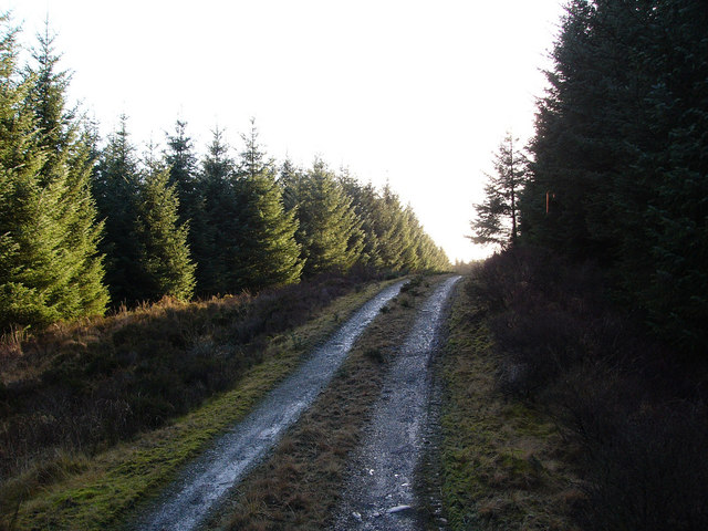
Artfield Fell is easily accessible, with well-maintained walking paths and trails offering visitors the opportunity to explore the area at their own pace. Whether it's a gentle stroll through the Downs or an adventurous hike across the moorland, Artfield Fell promises an unforgettable experience for nature lovers and outdoor enthusiasts alike.

If you have any feedback on the listing, please let us know in the comments section below.

Artfield Fell Images

Images are sourced within 2km of 54.963825/-4.7646266 or Grid Reference NX2366. Thanks to Geograph Open Source API. All images are credited.

A windfarm at Artfield Fell, East of New Luce Photo taken from the New Luce to barrhill road near to Quarter Farm, New Luce.
A windfarm at Artfield Fell, East of New Luce
Photo taken from the New Luce to barrhill road near to Quarter Farm, New Luce.
Moorland bridge.
Moorland bridge.
Moorland road
Moorland road
Cattle grid near Artfield A pretty dodgy cattle grid which looks about ready to collapse!
Cattle grid near Artfield
A pretty dodgy cattle grid which looks about ready to collapse!
Moorland fence
Moorland fence
The road to Artfield Fell wind farm.
Moorland The hills on the horizon are, from the left, Bennan of Garvilland, Bught Fell and Larig Fell.
Moorland
The hills on the horizon are, from the left, Bennan of Garvilland, Bught Fell and Larig Fell.
Power line This new power line was built to connect the windfarm on Artfield Fell to the national grid. It runs to the substation at Glenluce.
Power line
This new power line was built to connect the windfarm on Artfield Fell to the national grid. It runs to the substation at Glenluce.
Cairn Na Gath Carn na gcat - the cairn of the wild cat. This is a neolithic chambered long cairn.  At the south end there are the remains of huts or enclosures, probably of relatively recent date. There is no visible evidence of a burial chamber.
Cairn Na Gath
Carn na gcat - the cairn of the wild cat. This is a neolithic chambered long cairn. At the south end there are the remains of huts or enclosures, probably of relatively recent date. There is no visible evidence of a burial chamber.
Cairn na Gath Carn na gcat - the cairn of the wild cat. This is a  chambered long cairn dating to the neolithic.  At the south end there are the remains of huts or enclosures, probably of relatively recent date. There is no visible evidence of a burial chamber.
Cairn na Gath
Carn na gcat - the cairn of the wild cat. This is a chambered long cairn dating to the neolithic. At the south end there are the remains of huts or enclosures, probably of relatively recent date. There is no visible evidence of a burial chamber.
Cairn na Gath Carn na gcat - the cairn of the wild cat. This is a neolithic chambered long cairn.  At the south end there are the remains of huts or enclosures, probably of relatively recent date. There is no visible evidence of a burial chamber.
Cairn na Gath
Carn na gcat - the cairn of the wild cat. This is a neolithic chambered long cairn. At the south end there are the remains of huts or enclosures, probably of relatively recent date. There is no visible evidence of a burial chamber.
Pond and abandoned ATV on Artfield Fell Artfield Fell is the site of a windfarm, but on what was a very foggy day the wind turbines were virtually invisible in the mist, so instead I opted for this photo of an artificial pond and abandoned derelict all-terrain vehicle as a first geograph for the square.
Pond and abandoned ATV on Artfield Fell
Artfield Fell is the site of a windfarm, but on what was a very foggy day the wind turbines were virtually invisible in the mist, so instead I opted for this photo of an artificial pond and abandoned derelict all-terrain vehicle as a first geograph for the square.
Wind turbine on Artfield Fell Looking towards Balmurrie Fell. The windfarm on Artfield Fell has 15 turbines and when working at peak efficiency can generate 19.5 MW.
Wind turbine on Artfield Fell
Looking towards Balmurrie Fell. The windfarm on Artfield Fell has 15 turbines and when working at peak efficiency can generate 19.5 MW.
Wind turbine on Artfield Fell 1.3MW turbine standing 43 metres tall to the hub, with a rotor diameter of 62 metres, giving an overall height of 74 metres. Total capacity of windfarm at peak generation = 19.5MW. I admit to having mixed feelings about wind turbines. While they are undoubtedly elegant, their size is grossly out of scale with the rest of the landscape.
Wind turbine on Artfield Fell
1.3MW turbine standing 43 metres tall to the hub, with a rotor diameter of 62 metres, giving an overall height of 74 metres. Total capacity of windfarm at peak generation = 19.5MW. I admit to having mixed feelings about wind turbines. While they are undoubtedly elegant, their size is grossly out of scale with the rest of the landscape.
Burn in the forest A small unnamed burn drains from the forest and eventually runs into the Tarf.
Burn in the forest
A small unnamed burn drains from the forest and eventually runs into the Tarf.
Forestry road A road. Surrounded by forestry.
Forestry road
A road. Surrounded by forestry.
Forestry road and wind turbines The turbines are part of the windfarm on Artfield Fell.
Forestry road and wind turbines
The turbines are part of the windfarm on Artfield Fell.
Forestry road
Forestry road
Show me another place!

Artfield Fell is located at Grid Ref: NX2366 (Lat: 54.963825, Lng: -4.7646266)

Unitary Authority: Dumfries and Galloway

Police Authority: Dumfries and Galloway

What 3 Words

///captions.water.elaborate. Near Cairnryan, Dumfries & Galloway

Nearby Locations

Artfield Fell Green Top

Related Wikis

Tarf Water, Wigtownshire

The Tarf Water is a river in the former county of Wigtownshire in south-west Scotland. It rises on the Ayrshire border (55.0048°N 4.7815°W / 55.0048;...

New Luce

New Luce (Scottish Gaelic: Baile Ùr Ghlinn Lus) is a civil parish in Dumfries and Galloway, south-west Scotland. It lies in the traditional county of Wigtownshire...

New Luce railway station

New Luce railway station served the village of New Luce, Dumfries and Galloway, Scotland from 1887 to 1965 on the Girvan and Portpatrick Junction Railway...

Mid Gleniron

Mid Gleniron is a prehistoric site in Dumfries and Galloway used in the Neolithic and Bronze Age. The site is a scheduled ancient monument that comprises...

Glenwhilly railway station

Glenwhilly railway station served the area of Glenwhilly, Dumfries and Galloway, Scotland from 1887 to 1965 on the Girvan and Portpatrick Junction Railway...

Barhapple Loch

Barhapple Loch is a small semicircular freshwater loch located in Wigtownshire, Dumfries and Galloway in Scotland. Barhapple Loch is principally known...

Glenluce Abbey

Glenluce Abbey, near to Glenluce, Scotland, was a Cistercian monastery called also Abbey of Luce or Vallis Lucis and founded around 1190 by Rolland or...

Kilgallioch

Kilgallioch Wind Farm is a 96 turbine wind farm in South Ayrshire, Scotland with a total capacity of up to 239 megawatts (MW). Consent granted by the Scottish...

Nearby Amenities

Located within 500m of 54.963825,-4.7646266
Artfield Fell
Generator Method: wind_turbine
Generator Source: wind
Generator Type: horizontal_axis
Power: generator
Lat/Long: 54.9657542/-4.764206
Artfield Fell
Generator Method: wind_turbine
Generator Source: wind
Generator Type: horizontal_axis
Power: generator
Lat/Long: 54.963333/-4.76634
Artfield Fell
Generator Method: wind_turbine
Generator Source: wind
Generator Type: horizontal_axis
Power: generator
Lat/Long: 54.9594215/-4.7631857
Artfield Fell
Generator Method: wind_turbine
Generator Source: wind
Generator Type: horizontal_axis
Power: generator
Lat/Long: 54.9606594/-4.767091
Artfield Fell
Generator Method: wind_turbine
Generator Source: wind
Generator Type: horizontal_axis
Power: generator
Lat/Long: 54.9620641/-4.7621128
Artfield Fell
Generator Method: wind_turbine
Generator Source: wind
Generator Type: horizontal_axis
Power: generator
Lat/Long: 54.9651684/-4.7697088
Artfield Fell
Generator Method: wind_turbine
Generator Source: wind
Generator Type: horizontal_axis
Power: generator
Lat/Long: 54.96741/-4.7662863
Artfield Fell
Generator Method: wind_turbine
Generator Source: wind
Generator Type: horizontal_axis
Power: generator
Lat/Long: 54.9629634/-4.7706851
Green Top
Ele: 244
Natural: peak
Lat/Long: 54.96295/-4.7639381
The data included in this document is from www.openstreetmap.org. The data is made available under ODbL.

Have you been to Artfield Fell?

Leave your review of Artfield Fell below (or comments, questions and feedback).