Killiechonate Forest

Downs, Moorland in Inverness-shire

Scotland

Killiechonate Forest

Sgùrr Choinnich Mòr The western hill of the Grey Corries ridge seen from the southeast. The big crag on the left is Aonach Beag.
Sgùrr Choinnich Mòr Credit: Richard Webb

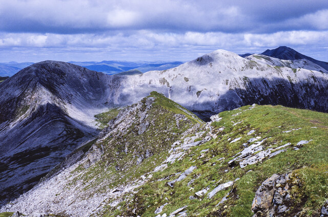
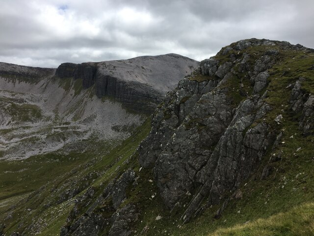
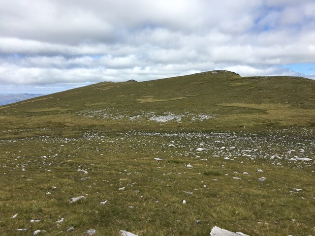
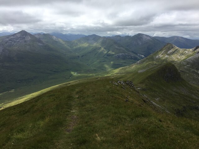
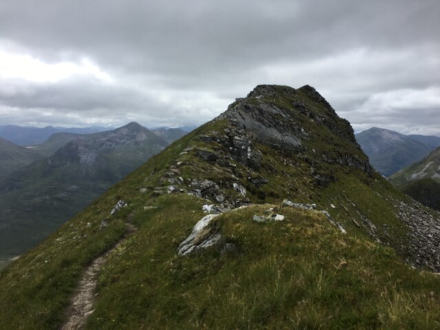
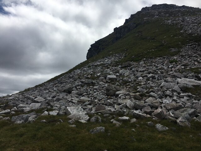
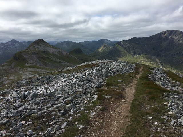
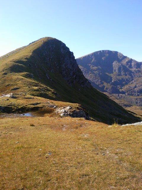
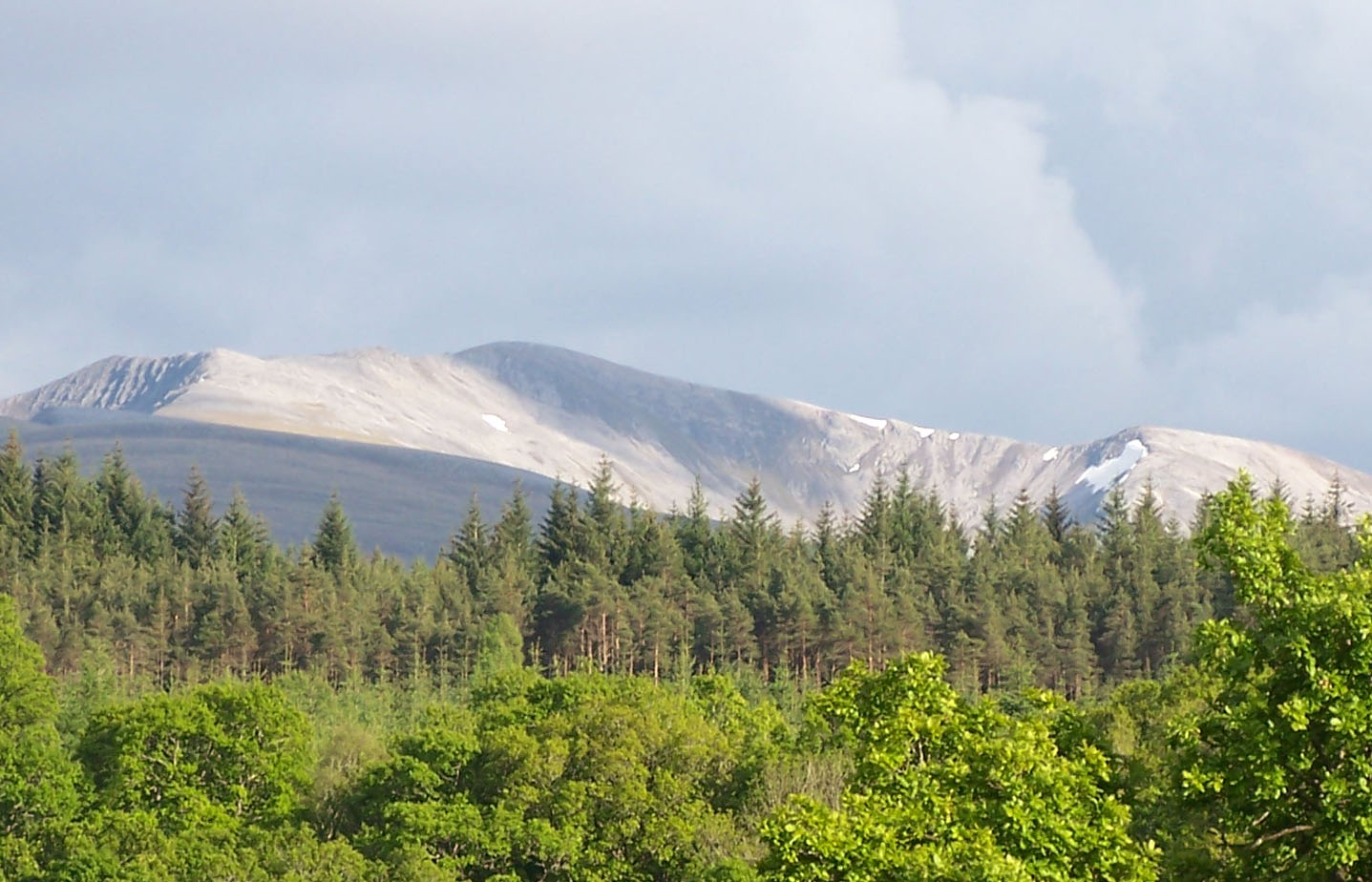
Killiechonate Forest is a stunning natural area located in Inverness-shire, Scotland. Covering an expansive area of downs and moorland, the forest is a haven for outdoor enthusiasts and nature lovers alike.

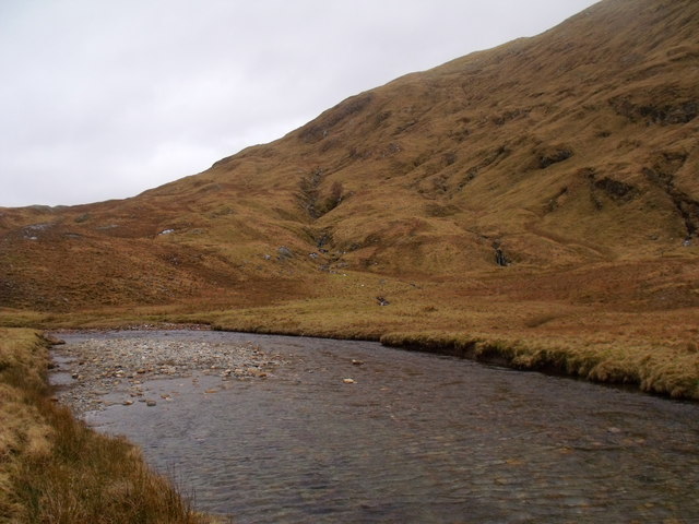
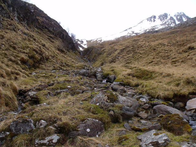
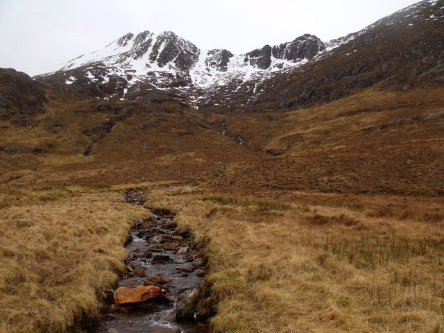
The landscape of Killiechonate Forest is characterized by rolling hills, heather-covered moorland, and dense woodlands. The forest is home to a variety of wildlife, including red deer, pine martens, and a wide range of bird species. Visitors to the forest can enjoy peaceful walks through the woodland trails, offering picturesque views of the surrounding countryside.

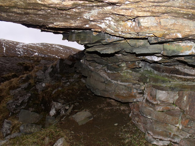
In addition to its natural beauty, Killiechonate Forest also has a rich history. The area is dotted with ancient ruins and archaeological sites, providing a glimpse into the past of this historic region.

For those looking to explore the great outdoors, Killiechonate Forest offers a range of activities, including hiking, mountain biking, and wildlife watching. With its diverse landscape and rich biodiversity, Killiechonate Forest is a must-visit destination for anyone seeking a true Scottish wilderness experience.

If you have any feedback on the listing, please let us know in the comments section below.

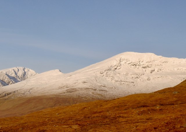
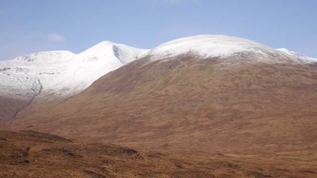
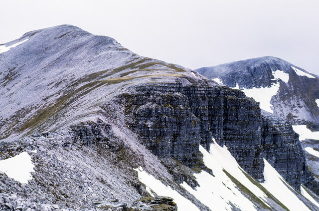
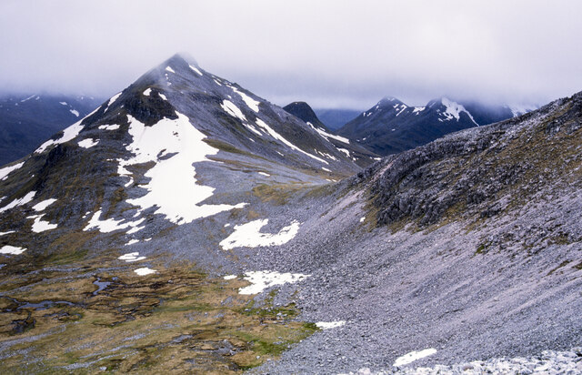
Killiechonate Forest Images

Images are sourced within 2km of 56.812147/-4.9097227 or Grid Reference NN2272. Thanks to Geograph Open Source API. All images are credited.

Sgùrr Choinnich Mòr The western hill of the Grey Corries ridge seen from the southeast. The big crag on the left is Aonach Beag.
Sgùrr Choinnich Mòr
The western hill of the Grey Corries ridge seen from the southeast. The big crag on the left is Aonach Beag.
Stob Coire an Laoigh The pointed summit of one of the Grey Corries hills, seen from the pass between Kinlochleven and Lùibuilt.
Stob Coire an Laoigh
The pointed summit of one of the Grey Corries hills, seen from the pass between Kinlochleven and Lùibuilt.
Rock buttresses along ridge of Stob Coire an Laoigh The peak at the left side of the image is Stob Coire an Laoigh. Its east-north-east ridge connects it with Caisteil, an intermediate top of the Grey Corries group of mountains from where the image was made. The ridge almost terminates at the large crag at the centre of the image but continues to Caisteil by making a turn to the east. A mountain walker can be seen along that section of ridge.
Rock buttresses along ridge of Stob Coire an Laoigh
The peak at the left side of the image is Stob Coire an Laoigh. Its east-north-east ridge connects it with Caisteil, an intermediate top of the Grey Corries group of mountains from where the image was made. The ridge almost terminates at the large crag at the centre of the image but continues to Caisteil by making a turn to the east. A mountain walker can be seen along that section of ridge.
Bealach Coire Easain The Bealach Coire Easain as seen from another bealach, that between two Grey Corries peaks, Stob Coire Easain and Stob Coire an Laoigh.
Sgùrr Choinnich Mòr is the obvious conical peak rising from the bealach.
Bealach Coire Easain
The Bealach Coire Easain as seen from another bealach, that between two Grey Corries peaks, Stob Coire Easain and Stob Coire an Laoigh. Sgùrr Choinnich Mòr is the obvious conical peak rising from the bealach.
Ridge north-east from summit of Sgùrr Choinnich Mòr The ridge continues to the Grey Corries range of mountains, descending before rising to Stob Coire Easain then crossing Stob Coire an Laoigh, the near-white peak in the image.
Ridge north-east from summit of Sgùrr Choinnich Mòr
The ridge continues to the Grey Corries range of mountains, descending before rising to Stob Coire Easain then crossing Stob Coire an Laoigh, the near-white peak in the image.
Craggy eastern slope of Beinn na Socaich
Beinn na Socaich
Beinn na Socaich
Looking south west from the summit of Sgurr Choinnich Mor
View to the summit of Sgurr Choinnich Mor
Steep slope of Sgurr Choinnich Mor
From the top of Stob Coire Easain towards Sgurr Choinnich Mor
View from Caisteal towards Stob Coire an Laoigh
Summit of Sgurr Choinnich Mor Photo taken at the bealach between Sgurr Choinnich beag and Sgurr Choinnich Mor.
Summit of Sgurr Choinnich Mor
Photo taken at the bealach between Sgurr Choinnich beag and Sgurr Choinnich Mor.
Summit of Sgurr Choinnich Beag Photo taken at the wee lochan on the bealach between Sgurr Choinnich beag and Sgurr Choinnich Mor. The eastern flanks of Aonach Beag can be seen in the background.
Summit of Sgurr Choinnich Beag
Photo taken at the wee lochan on the bealach between Sgurr Choinnich beag and Sgurr Choinnich Mor. The eastern flanks of Aonach Beag can be seen in the background.
A broad reach of Allt a' Coire Eoin in Killiechonate Forest
Ridge and high ground above Allt Coire na Eoin in Killiechonate Forest
Allt Coire an Fhir Duibh in Killiechonate Forest
Rock undercut in Killiechonate Forest Igneous rock overlies weaker,possibly sedimentary, rock to create this cut above Allt Coire an Eoin. There was sign of use by sheep as a shelter.
Rock undercut in Killiechonate Forest
Igneous rock overlies weaker,possibly sedimentary, rock to create this cut above Allt Coire an Eoin. There was sign of use by sheep as a shelter.
Show me another place!

Killiechonate Forest is located at Grid Ref: NN2272 (Lat: 56.812147, Lng: -4.9097227)

Unitary Authority: Highland

Police Authority: Highlands and Islands

What 3 Words

///earliest.oblige.lectured. Near Fort William, Highland

Nearby Locations

Killiechonate Forest

Related Wikis

Stob Coire an Laoigh

Stob Coire an Laoigh (Scottish Gaelic: Peak of the corrie of the calf) is a Scottish mountain in The Grey Corries Range, 15 kilometres north east of Kinlochleven...

Grey Corries

The Grey Corries are a range of mountains in the West Highlands of Scotland. The range includes several of Scotland's highest peaks including a number...

Aonach Beag

Aonach Beag is a mountain in the Scottish Highlands. It is located about 3 km east of Ben Nevis on the north side of Glen Nevis, near the town of Fort...

Aonach Mòr

Aonach Mòr is a mountain in the Scottish Highlands. It is located about two miles (three kilometres) northeast of Ben Nevis on the south side of Glen Spean...

Have you been to Killiechonate Forest?

Leave your review of Killiechonate Forest below (or comments, questions and feedback).