Milford Common

Downs, Moorland in Devon Torridge

England

Milford Common

Docton Mill
Docton Mill Credit: thejackrustles

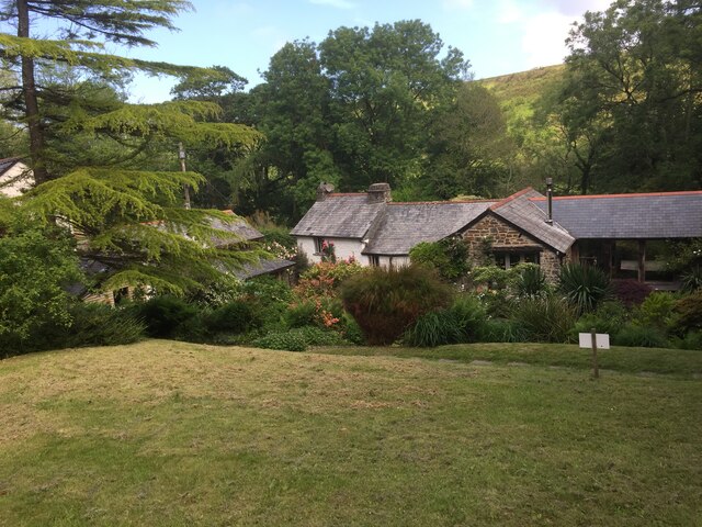
Milford Common is a picturesque area located in Devon, England. It is a vast expanse of natural beauty, characterized by its rolling hills, expansive downs, and captivating moorland. The common is situated in the southern part of Devon, near the town of Milford, and covers an area of approximately 500 acres.

The common is known for its diverse range of flora and fauna, making it a haven for nature enthusiasts. It is home to a variety of plant species, including heather, gorse, and wildflowers, which create a colorful and vibrant landscape throughout the year. The rich biodiversity attracts a wide array of wildlife, such as birds, small mammals, and even the occasional deer.

Visitors to Milford Common can enjoy leisurely walks or hikes along the numerous trails that crisscross the area. The rolling hills offer breathtaking views of the surrounding countryside, while the open downs provide ample space for outdoor activities like picnicking and kite flying. The moorland, with its vast expanses of open space, is perfect for those seeking solitude and tranquility.

Milford Common also holds historical significance, with evidence of human habitation dating back to the Bronze Age. Archaeological sites, such as ancient burial mounds and stone circles, can still be found scattered across the common, providing a glimpse into its rich past.

Overall, Milford Common is a natural gem in Devon, offering a peaceful and scenic escape for both locals and visitors alike. Whether it's exploring the diverse flora and fauna, soaking in the panoramic views, or immersing oneself in the area's history, Milford Common has something for everyone to enjoy.

If you have any feedback on the listing, please let us know in the comments section below.

Milford Common Images

Images are sourced within 2km of 50.974188/-4.5293955 or Grid Reference SS2222. Thanks to Geograph Open Source API. All images are credited.

Docton Mill
Docton Mill
Spekes Mill Mouth The Mill has long gone but the waterfall remains a dramatic feature. A brilliant rock climb ("Pressure Drop") takes the smooth wall on the right - slightly out of the picture.
Spekes Mill Mouth
The Mill has long gone but the waterfall remains a dramatic feature. A brilliant rock climb ("Pressure Drop") takes the smooth wall on the right - slightly out of the picture.
Hartland: Docton Mill leat above Lymebridge The leat is on the left of the image; the stream on the right. Docton Mill gardens - downstream - are open to the public
Hartland: Docton Mill leat above Lymebridge
The leat is on the left of the image; the stream on the right. Docton Mill gardens - downstream - are open to the public
View North from Nabor Point Majestic Atlantic cliffs.
View North from Nabor Point
Majestic Atlantic cliffs.
South West Coastpath near Sandhole Cliff The Coastpath follows the road for a short stretch. This is the view South with the cliffs of Embury Beacon visible middle left.
South West Coastpath near Sandhole Cliff
The Coastpath follows the road for a short stretch. This is the view South with the cliffs of Embury Beacon visible middle left.
Mansley Cliff Taken on the South West Coastpath near Elmscott.
Mansley Cliff
Taken on the South West Coastpath near Elmscott.
Milford Common and Swansford Hill Taken on the South West Coastpath. The Coastpath continues down the valley to the right. There is an alternate 'cliff top' path over Swansford Hill.
Milford Common and Swansford Hill
Taken on the South West Coastpath. The Coastpath continues down the valley to the right. There is an alternate 'cliff top' path over Swansford Hill.
Speke's Mill Mouth from Swansford Hill With St Catherine's Tor in the background.
Speke's Mill Mouth from Swansford Hill
With St Catherine's Tor in the background.
RAF Air Sea Rescue helicopter at Speke's Mill Mouth These spiffing fellows watched over me as I descended the 'cliff top' path on Swansford Hill. I think these chaps are based at RAF Chivenor.
RAF Air Sea Rescue helicopter at Speke's Mill Mouth
These spiffing fellows watched over me as I descended the 'cliff top' path on Swansford Hill. I think these chaps are based at RAF Chivenor.
Speke's Mill Mouth waterfall Compare this picture with the one from June !
Speke's Mill Mouth waterfall
Compare this picture with the one from June !
St Catherine's Tor from Speke's Mill Mouth
St Catherine's Tor
St Catherine's Tor
Speke's mill
Speke's mill
Speke's Mill
Speke's Mill
Speke's mill
Speke's mill
Speke's Mill Waterfall, Devon The location is worth a visit for anybody that is able to walk a short distance and ascend a short climb from the parking area at Hartland Quay.
Speke's Mill Waterfall, Devon
The location is worth a visit for anybody that is able to walk a short distance and ascend a short climb from the parking area at Hartland Quay.
Coastline at Speke's Mill Mouth View from the coast path looking north to St Catherine's Tor on a windy day.
Coastline at Speke's Mill Mouth
View from the coast path looking north to St Catherine's Tor on a windy day.
Milford Water  valley Milford Water, destined to end spectacularly at Speke's Mill Mouth, flows (towards the camera) along a valley lined with wood and scrub. Taken from Hartland Footpath 51 beside Speke's House.
Milford Water valley
Milford Water, destined to end spectacularly at Speke's Mill Mouth, flows (towards the camera) along a valley lined with wood and scrub. Taken from Hartland Footpath 51 beside Speke's House.
Show me another place!

Milford Common is located at Grid Ref: SS2222 (Lat: 50.974188, Lng: -4.5293955)

Administrative County: Devon

District: Torridge

Police Authority: Devon and Cornwall

What 3 Words

///unwound.invite.hindered. Near Flexbury, Cornwall

Related Wikis

RFA Green Ranger

RFA Green Ranger was a Ranger-class fleet support tanker of the Royal Fleet Auxiliary. On 24 September 1946, Green Ranger was struck by a torpedo in Portland...
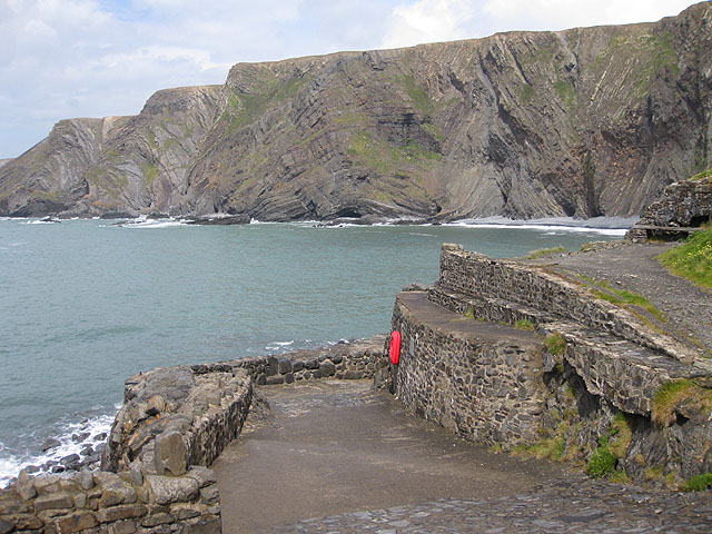
Hartland Quay

Hartland Quay is located on the Atlantic coast of Devon, England, south of Hartland Point and north of Bude, Cornwall. It experiences some of the roughest...

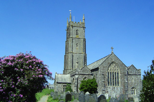
St Nectan's Church, Hartland

The Church of St Nectan is the parish church of Hartland, Devon, England. Sometimes referred to as the "Cathedral of North Devon", it is located in the...
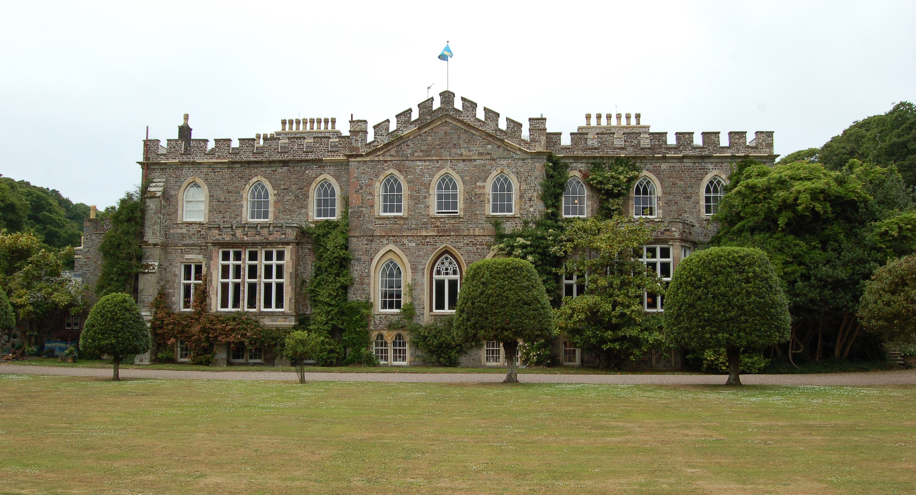
Hartland Abbey

Hartland Abbey is a former abbey and current family home to the Stucley family. It is located in Hartland, Devon. The current owner is Sir Hugh George...

Ballhill

Ballhill is a village in Devon, England.

Tosberry

Tosberry (alternate spelling Tosbury) is a hamlet in the parish of Hartland, Devon, England, United Kingdom. It is situated 2.6 miles South of Hartland...

Embury Beacon

Embury Beacon is the site of an Iron Age promontory fort on the west of the Hartland Peninsula, north of Bude and west of Clovelly, in north Devon. The...

Hartland, Devon

The village of Hartland, whose parish incorporates the hamlet of Stoke to the west and the village of Meddon in the south, is the most north-westerly settlement...

Nearby Amenities

Located within 500m of 50.974188,-4.5293955
Source: PGS
Lat/Long: 50.9705139/-4.5329739
Barrier: kissing_gate
Lat/Long: 50.9734765/-4.530837
Barrier: kissing_gate
Lat/Long: 50.9771082/-4.5315802
Ford: yes
Lat/Long: 50.9775051/-4.5306551
Bench
Backrest: no
Survey Date: 2024-03-23
Lat/Long: 50.973709/-4.5309747
The data included in this document is from www.openstreetmap.org. The data is made available under ODbL.

Have you been to Milford Common?

Leave your review of Milford Common below (or comments, questions and feedback).