Ardstinchar Brae

Downs, Moorland in Ayrshire

Scotland

Ardstinchar Brae

Ballantrae Spit Shingle spit at the mouth of River Stinchar with Downan Hill to South
Ballantrae Spit Credit: Mary and Angus Hogg

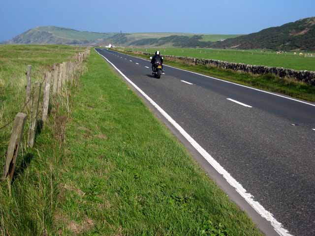
Ardstinchar Brae is a prominent geographical feature located in Ayrshire, Scotland. It is characterized by its rolling hills, vast moorland, and breathtaking downs. Situated in the southwestern part of the country, Ardstinchar Brae offers visitors a unique and diverse landscape to explore.

The brae, or hill, is part of the larger Galloway Hills, which stretch across the border between Ayrshire and Dumfries and Galloway. These hills are known for their rugged beauty and provide stunning panoramic views of the surrounding countryside. Ardstinchar Brae itself rises to an elevation of approximately 500 meters (1,640 feet) above sea level, making it one of the highest points in the region.

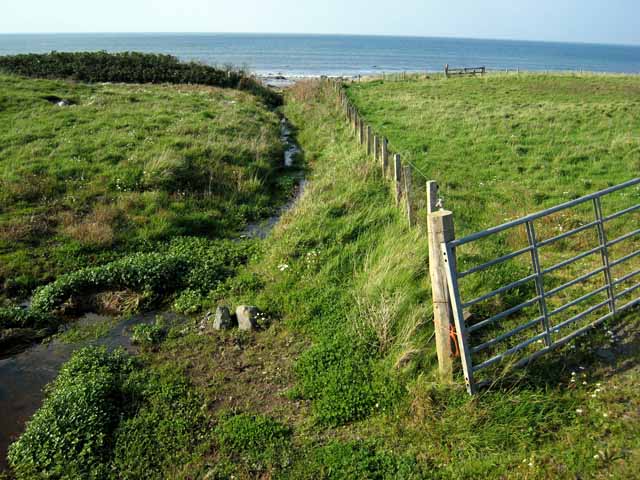
The area is predominantly covered in heather moorland, which creates a striking contrast to the green valleys and farmland below. This moorland is an important habitat for various wildlife species, including red grouse, curlews, and mountain hares. It is also home to several rare plant species, such as the blaeberry and the bog cotton.

Ardstinchar Brae is a popular destination for outdoor enthusiasts, offering opportunities for hiking, walking, and wildlife spotting. There are numerous trails that wind their way through the hills, providing visitors with a chance to immerse themselves in the natural beauty of the area. Additionally, the downs offer excellent vantage points for birdwatching or simply taking in the stunning vistas.

Overall, Ardstinchar Brae in Ayrshire is a captivating and diverse landscape that showcases the natural beauty of Scotland. Its hills, moorland, and downs provide a haven for wildlife and offer visitors a chance to experience the unspoiled wilderness of this picturesque region.

If you have any feedback on the listing, please let us know in the comments section below.

Ardstinchar Brae Images

Images are sourced within 2km of 55.099011/-4.9996841 or Grid Reference NX0882. Thanks to Geograph Open Source API. All images are credited.

Ballantrae Spit Shingle spit at the mouth of River Stinchar with Downan Hill to South
Ballantrae Spit
Shingle spit at the mouth of River Stinchar with Downan Hill to South
The lane to Downam, near Ballantrae
Kinnegar Beach Shingle beach and enclosed lagoon on the south side of the mouth of the River Stinchar. In the summer, this is an important breeding site for little terns.
Kinnegar Beach
Shingle beach and enclosed lagoon on the south side of the mouth of the River Stinchar. In the summer, this is an important breeding site for little terns.
Offshore rocks at Ballantrae A small outcrop of tidal rocks outside Ballantrae Harbour just falls into this square. The square also includes a small portion of shingle beach further south.
Offshore rocks at Ballantrae
A small outcrop of tidal rocks outside Ballantrae Harbour just falls into this square. The square also includes a small portion of shingle beach further south.
Bungalows at Garleffin
Getting ready for firework night, Ballantrae Beach A bonfire in construction on the shingle beach at Ballantrae.
Getting ready for firework night, Ballantrae Beach
A bonfire in construction on the shingle beach at Ballantrae.
Breakwater at Ballantrae This breakwater provides some shelter, but hardly qualifies as a harbour.
Breakwater at Ballantrae
This breakwater provides some shelter, but hardly qualifies as a harbour.
A77 north of Ballantrae This busy main road which carries the traffic from Central Scotland down to the Irish ferries at Cairnryan and Stranraer is a bit of a racetrack here where it crosses the raised beach just to the north of Ballantrae. Unfortunately, the position of this road next to the coast means that the whole fine 18 km length of coastline between Ballantrae and Girvan is effectively inaccessible to walkers and cyclists.
A77 north of Ballantrae
This busy main road which carries the traffic from Central Scotland down to the Irish ferries at Cairnryan and Stranraer is a bit of a racetrack here where it crosses the raised beach just to the north of Ballantrae. Unfortunately, the position of this road next to the coast means that the whole fine 18 km length of coastline between Ballantrae and Girvan is effectively inaccessible to walkers and cyclists.
A77 south of Ballantrae This busy main road carries the bulk of traffic from central Scotland to the Irish ferries at Cairnryan and Stranraer.
A77 south of Ballantrae
This busy main road carries the bulk of traffic from central Scotland to the Irish ferries at Cairnryan and Stranraer.
South Lodge, Laggan House A 2 km driveway runs up the Stinchar valley from here to Laggan House.
South Lodge, Laggan House
A 2 km driveway runs up the Stinchar valley from here to Laggan House.
Rocky shore at Ballantrae A few scraps of tidal rock on the seaward side of the breakwater at Ballantrae falls into this square.                                                                       Bennane Head <a href="https://www.geograph.org.uk/gridref/NX0986">NX0986</a> in the distance on the far side of Ballantrae Bay.
Rocky shore at Ballantrae
A few scraps of tidal rock on the seaward side of the breakwater at Ballantrae falls into this square. Bennane Head NX0986 in the distance on the far side of Ballantrae Bay.
Kinnegar, Garleffin
Kinnegar, Garleffin
Stream north of Ballantrae A narrow strip, one field wide and traversed by this stream, separates the A77 from the beach just north of Ballantrae.
Stream north of Ballantrae
A narrow strip, one field wide and traversed by this stream, separates the A77 from the beach just north of Ballantrae.
Laggan At the lower end of the Stinchar valley.
Laggan
At the lower end of the Stinchar valley.
Road out The hill in the distance has a wee cairn on top, road heads back to Ballantrae
Road out
The hill in the distance has a wee cairn on top, road heads back to Ballantrae
Glenapp Castle Ballantrae Winter view of castle once home of the Inchcape family and now an award winning hotel owned by the Mc Millan family
Glenapp Castle Ballantrae
Winter view of castle once home of the Inchcape family and now an award winning hotel owned by the Mc Millan family
The mail must get through view of Glenapp Castle drive
The mail must get through
view of Glenapp Castle drive
Former Ballantrae Coup For many years locals used the quarry as a dump until the Council became more involved now it is closed and a tiny skip is placed in the village about every 3 weeks.
Former Ballantrae Coup
For many years locals used the quarry as a dump until the Council became more involved now it is closed and a tiny skip is placed in the village about every 3 weeks.
Show me another place!

Ardstinchar Brae is located at Grid Ref: NX0882 (Lat: 55.099011, Lng: -4.9996841)

Unitary Authority: South Ayrshire

Police Authority: Ayrshire

What 3 Words

///rattled.collision.yoga. Near Cairnryan, Dumfries & Galloway

Related Wikis

Related Videos

Ballantrae Holiday Cottages

Ballantrae Holiday Cottages have six luxury self-catering holiday cottages for between two and seven people on the south-west ...

Hiking with kids!

Little walk around Glenapp State.

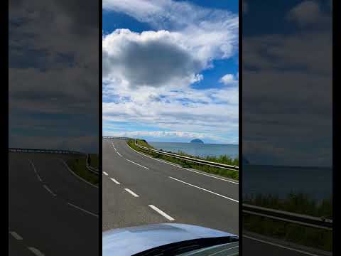
❤️A scenic coastal road❤️ #scenic #coastal #travel #sea

This place is way to Stranraer. To be honest, all the road from Girvan to Stranraer is stunning, if you are a natural lover you would ...

Glenapp Castle - Ayrshire, Scotland

Visit Glenapp Castle's website: https://goo.gl/yfrmSY Glenapp Castle is a fairytale castle hidden on the beautiful Ayrshire coast in ...

Nearby Amenities

Located within 500m of 55.099011,-4.9996841
Ballantrae
Name En: Ballantrae
Name Gd: Baile na Tràgha
Place: village
Source: OS_OpenData_StreetView
Wikidata: Q3997904
Wikipedia: en:Ballantrae
Lat/Long: 55.1014603/-5.0044737
Barrier: bollard
Lat/Long: 55.0982997/-5.0003082
Post Box
Brand: Royal Mail
Brand Wikidata: Q638098
Operator: Royal Mail
Operator Wikidata: Q638098
Post Box Mounting: pier
Post Box Type: lamp
Source: survey
Lat/Long: 55.1007781/-5.0046767
Fuel
Highland
Lat/Long: 55.1004426/-5.0042642
Power: pole
Lat/Long: 55.1020982/-5.0037923
Power: pole
Lat/Long: 55.1020552/-5.0025478
Power: pole
Lat/Long: 55.102046/-5.001892
Power: pole
Lat/Long: 55.1020191/-5.0010927
Power: pole
Lat/Long: 55.1029621/-5.000107
Power: pole
Lat/Long: 55.102224/-5.0007051
Power: pole
Lat/Long: 55.1014874/-5.0013167
Power: pole
Lat/Long: 55.1015074/-5.0008607
Power: pole
Lat/Long: 55.1020506/-4.9998897
Power: pole
Lat/Long: 55.1025831/-4.9989456
Power: pole
Lat/Long: 55.1030695/-4.9978808
Power: pole
Lat/Long: 55.1026813/-4.9965262
Power: pole
Lat/Long: 55.1023544/-4.9954051
Bus Stop
Bus: yes
Public Transport: platform
Lat/Long: 55.1005636/-5.0046583
Scotmid
Brand: Scotmid
Brand Wikidata: Q7435719
Brand Wikipedia: en:Scotmid
Shop: convenience
Lat/Long: 55.100668/-5.0047361
Post Office
Ballantrae Post Office
Addr Postcode: KA26 0NB
Branch: Ballantrae
Brand: Post Office
Brand Wikidata: Q1783168
Check Date: 2020-02-20
Contact Website: https://www.postoffice.co.uk/branch-finder/1928430/ballantrae
Ref Pol Id: 6301
Lat/Long: 55.1007038/-5.0048676
Generator Method: photovoltaic
Generator Output Electricity: yes
Generator Source: solar
Generator Type: solar_photovoltaic_panel
Power: generator
Lat/Long: 55.0990298/-5.0042567
Generator Method: photovoltaic
Generator Output Electricity: yes
Generator Source: solar
Generator Type: solar_photovoltaic_panel
Power: generator
Lat/Long: 55.0989726/-5.0039178
Generator Method: photovoltaic
Generator Output Electricity: yes
Generator Source: solar
Generator Type: solar_photovoltaic_panel
Power: generator
Lat/Long: 55.0988809/-5.0037345
Power: pole
Lat/Long: 55.0950879/-4.9980585
Power: pole
Lat/Long: 55.0955414/-4.9983783
Charging Station
Lat/Long: 55.0993888/-5.0071323
The data included in this document is from www.openstreetmap.org. The data is made available under ODbL.

Have you been to Ardstinchar Brae?

Leave your review of Ardstinchar Brae below (or comments, questions and feedback).