Upper Bar

Beach in Ayrshire

Scotland

Upper Bar

Ballantrae Spit Shingle spit at the mouth of River Stinchar with Downan Hill to South
Ballantrae Spit Credit: Mary and Angus Hogg

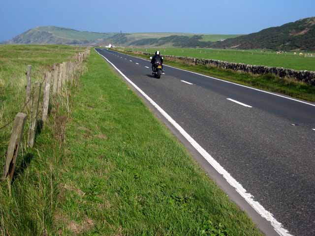
Upper Bar is a stunning beach located in Ayrshire, Scotland. Situated on the west coast, it offers visitors breathtaking views of the Ayrshire coastline and the vast expanse of the Firth of Clyde. With its golden sand and crystal-clear waters, Upper Bar is a popular destination for beachgoers and nature enthusiasts alike.

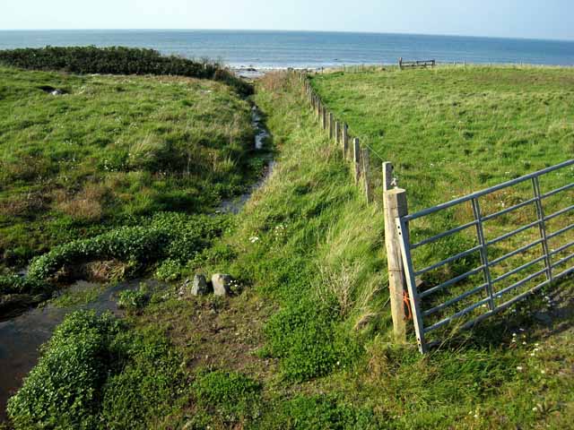
The beach stretches for approximately 2 miles and is backed by sand dunes, providing a picturesque backdrop for long walks and picnics. The dunes also serve as a natural habitat for a variety of plant and animal species, making it a haven for wildlife enthusiasts.

The beach is easily accessible, with ample parking available nearby. There are also facilities such as toilets and a café, ensuring visitors have a comfortable and enjoyable experience. Lifeguards patrol the area during peak times, ensuring the safety of swimmers and water sports enthusiasts.

Upper Bar is a perfect spot for a range of activities, including swimming, sunbathing, and beach games. The clear waters also make it an ideal location for snorkeling and diving, allowing visitors to explore the marine life that inhabits the area.

The beach is known for its clean and well-maintained environment, as efforts are made to preserve its natural beauty. Visitors are encouraged to respect the beach and its surroundings, taking their litter with them and leaving the area as they found it.

Overall, Upper Bar in Ayrshire is a must-visit destination for anyone seeking a peaceful and picturesque beach experience in Scotland.

If you have any feedback on the listing, please let us know in the comments section below.

Upper Bar Images

Images are sourced within 2km of 55.099394/-5.0092767 or Grid Reference NX0882. Thanks to Geograph Open Source API. All images are credited.

Ballantrae Spit Shingle spit at the mouth of River Stinchar with Downan Hill to South
Ballantrae Spit
Shingle spit at the mouth of River Stinchar with Downan Hill to South
The lane to Downam, near Ballantrae
Kinnegar Beach Shingle beach and enclosed lagoon on the south side of the mouth of the River Stinchar. In the summer, this is an important breeding site for little terns.
Kinnegar Beach
Shingle beach and enclosed lagoon on the south side of the mouth of the River Stinchar. In the summer, this is an important breeding site for little terns.
Offshore rocks at Ballantrae A small outcrop of tidal rocks outside Ballantrae Harbour just falls into this square. The square also includes a small portion of shingle beach further south.
Offshore rocks at Ballantrae
A small outcrop of tidal rocks outside Ballantrae Harbour just falls into this square. The square also includes a small portion of shingle beach further south.
Bungalows at Garleffin
Getting ready for firework night, Ballantrae Beach A bonfire in construction on the shingle beach at Ballantrae.
Getting ready for firework night, Ballantrae Beach
A bonfire in construction on the shingle beach at Ballantrae.
Breakwater at Ballantrae This breakwater provides some shelter, but hardly qualifies as a harbour.
Breakwater at Ballantrae
This breakwater provides some shelter, but hardly qualifies as a harbour.
A77 north of Ballantrae This busy main road which carries the traffic from Central Scotland down to the Irish ferries at Cairnryan and Stranraer is a bit of a racetrack here where it crosses the raised beach just to the north of Ballantrae. Unfortunately, the position of this road next to the coast means that the whole fine 18 km length of coastline between Ballantrae and Girvan is effectively inaccessible to walkers and cyclists.
A77 north of Ballantrae
This busy main road which carries the traffic from Central Scotland down to the Irish ferries at Cairnryan and Stranraer is a bit of a racetrack here where it crosses the raised beach just to the north of Ballantrae. Unfortunately, the position of this road next to the coast means that the whole fine 18 km length of coastline between Ballantrae and Girvan is effectively inaccessible to walkers and cyclists.
A77 south of Ballantrae This busy main road carries the bulk of traffic from central Scotland to the Irish ferries at Cairnryan and Stranraer.
A77 south of Ballantrae
This busy main road carries the bulk of traffic from central Scotland to the Irish ferries at Cairnryan and Stranraer.
South Lodge, Laggan House A 2 km driveway runs up the Stinchar valley from here to Laggan House.
South Lodge, Laggan House
A 2 km driveway runs up the Stinchar valley from here to Laggan House.
Rocky shore at Ballantrae A few scraps of tidal rock on the seaward side of the breakwater at Ballantrae falls into this square.                                                                       Bennane Head <a href="https://www.geograph.org.uk/gridref/NX0986">NX0986</a> in the distance on the far side of Ballantrae Bay.
Rocky shore at Ballantrae
A few scraps of tidal rock on the seaward side of the breakwater at Ballantrae falls into this square. Bennane Head NX0986 in the distance on the far side of Ballantrae Bay.
Kinnegar, Garleffin
Kinnegar, Garleffin
Stream north of Ballantrae A narrow strip, one field wide and traversed by this stream, separates the A77 from the beach just north of Ballantrae.
Stream north of Ballantrae
A narrow strip, one field wide and traversed by this stream, separates the A77 from the beach just north of Ballantrae.
Laggan At the lower end of the Stinchar valley.
Laggan
At the lower end of the Stinchar valley.
Road out The hill in the distance has a wee cairn on top, road heads back to Ballantrae
Road out
The hill in the distance has a wee cairn on top, road heads back to Ballantrae
The mail must get through view of Glenapp Castle drive
The mail must get through
view of Glenapp Castle drive
Former Ballantrae Coup For many years locals used the quarry as a dump until the Council became more involved now it is closed and a tiny skip is placed in the village about every 3 weeks.
Former Ballantrae Coup
For many years locals used the quarry as a dump until the Council became more involved now it is closed and a tiny skip is placed in the village about every 3 weeks.
What a waste! Gates at former village coup. Nearest one is now at Lendalfoot. The landfill site there takes several lorry loads from Northern Ireland each day.
What a waste!
Gates at former village coup. Nearest one is now at Lendalfoot. The landfill site there takes several lorry loads from Northern Ireland each day.
Show me another place!

Upper Bar is located at Grid Ref: NX0882 (Lat: 55.099394, Lng: -5.0092767)

Unitary Authority: South Ayrshire

Police Authority: Ayrshire

What 3 Words

///invoices.pickle.switch. Near Cairnryan, Dumfries & Galloway

Related Wikis

Ballantrae

Ballantrae is a community in Carrick, South Ayrshire, Scotland. The name probably comes from the Scottish Gaelic Baile na Tràgha, meaning the "town by...

River Stinchar

The River Stinchar ( STIN-shər) is a river in South Ayrshire, Scotland. It flows south west from the Galloway Forest Park to enter the Firth of Clyde at...

Ballantrae Windmill

The Ballantrae Windmill, on Mill Hill was a late 17th or early 18th century vaulted tower windmill, the ruins of which are located above the old raised...

Glenapp Castle

Glenapp Castle, formerly the family seat of the Earl of Inchcape, is now a luxury hotel and restaurant located about 1+1⁄2 miles (2.5 kilometres) southeast...

Heronsford

Heronsford is a village located in South Ayrshire, South-West Scotland. == About == Heronsford is a hamlet located near Ballantrae that sits along the...

Bennane Head

Bennane Head is a tapering piece of land formed of hard rock projecting into the Firth of Clyde, Scotland, at the northern end of Ballantrae Bay, 17 kilometres...

Colmonell

Colmonell (Scottish Gaelic: Cill Cholmain Eala) (meaning the church of St. Colman of Lainn Eala - in Lynally, County Offaly, Ireland) is a small village...

Dumbarton Collegiate Church

The Collegiate Church of St Mary, Dumbarton, Scotland, was founded in about 1453 by Isabella, Countess of Lennox and Duchess of Albany. During the medieval...

Nearby Amenities

Located within 500m of 55.099394,-5.0092767
Source: PGS
Lat/Long: 55.0971192/-5.0105348
Source: PGS
Lat/Long: 55.0967274/-5.0107263
Source: PGS
Lat/Long: 55.0964498/-5.0106458
Source: PGS
Lat/Long: 55.0960198/-5.0103153
Source: PGS
Lat/Long: 55.0954822/-5.0103295
Created By: dmgroom_coastlines
Source: PGS
Lat/Long: 55.095129/-5.009729
Source: Landsat photo
Lat/Long: 55.0986773/-5.0098741
Source: Landsat photo
Lat/Long: 55.1014892/-5.0090982
Source: Landsat photo
Lat/Long: 55.1035668/-5.0092666
Ballantrae
Name En: Ballantrae
Name Gd: Baile na Tràgha
Place: village
Source: OS_OpenData_StreetView
Wikidata: Q3997904
Wikipedia: en:Ballantrae
Lat/Long: 55.1014603/-5.0044737
Post Box
Brand: Royal Mail
Brand Wikidata: Q638098
Operator: Royal Mail
Operator Wikidata: Q638098
Post Box Mounting: pier
Post Box Type: lamp
Source: survey
Lat/Long: 55.1007781/-5.0046767
Fuel
Highland
Lat/Long: 55.1004426/-5.0042642
Power: pole
Lat/Long: 55.1020982/-5.0037923
Bus Stop
Bus: yes
Public Transport: platform
Lat/Long: 55.1005636/-5.0046583
Scotmid
Brand: Scotmid
Brand Wikidata: Q7435719
Brand Wikipedia: en:Scotmid
Shop: convenience
Website: https://scotmid.coop/store/ballantrae/
Lat/Long: 55.100668/-5.0047361
Post Office
Ballantrae Post Office
Addr Postcode: KA26 0NB
Branch: Ballantrae
Brand: Post Office
Brand Wikidata: Q1783168
Check Date: 2020-02-20
Contact Website: https://www.postoffice.co.uk/branch-finder/1928430/ballantrae
Ref Pol Id: 6301
Lat/Long: 55.1007038/-5.0048676
Generator Method: photovoltaic
Generator Output Electricity: yes
Generator Source: solar
Generator Type: solar_photovoltaic_panel
Power: generator
Lat/Long: 55.0990298/-5.0042567
Generator Method: photovoltaic
Generator Output Electricity: yes
Generator Source: solar
Generator Type: solar_photovoltaic_panel
Power: generator
Lat/Long: 55.0989726/-5.0039178
Generator Method: photovoltaic
Generator Output Electricity: yes
Generator Source: solar
Generator Type: solar_photovoltaic_panel
Power: generator
Lat/Long: 55.0988809/-5.0037345
BRICC Thrift Shop
Opening Hours: Mo-Fr 10:00-12:00,14:00-16:00; Sa-Su 14:00-16:00
Phone: +441465 831380
Second Hand: yes
Shop: second_hand
Lat/Long: 55.1027166/-5.0052326
Charging Station
Lat/Long: 55.0993888/-5.0071323
The data included in this document is from www.openstreetmap.org. The data is made available under ODbL.

Have you been to Upper Bar?

Leave your review of Upper Bar below (or comments, questions and feedback).