West Monar Forest

Downs, Moorland in Ross-shire

Scotland

West Monar Forest

Nice Bridge on the North side of Loch Monar
Nice Bridge on the North side of Loch Monar Credit: Alan Hodgson

West Monar Forest is a picturesque natural landscape located in Ross-shire, Scotland. Covering an expansive area of downs and moorland, it showcases the stunning beauty of the Scottish Highlands. The forest is situated in the western part of Monar Estate, approximately 20 miles southwest of the town of Drumnadrochit.

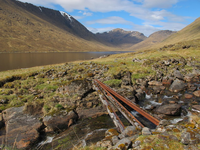
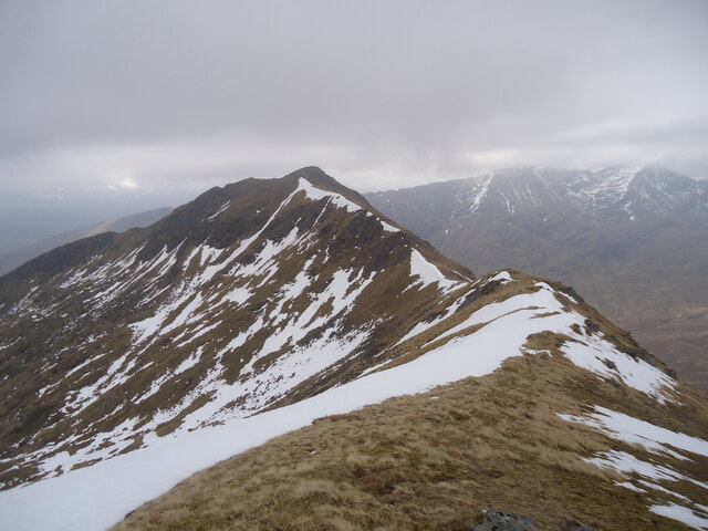
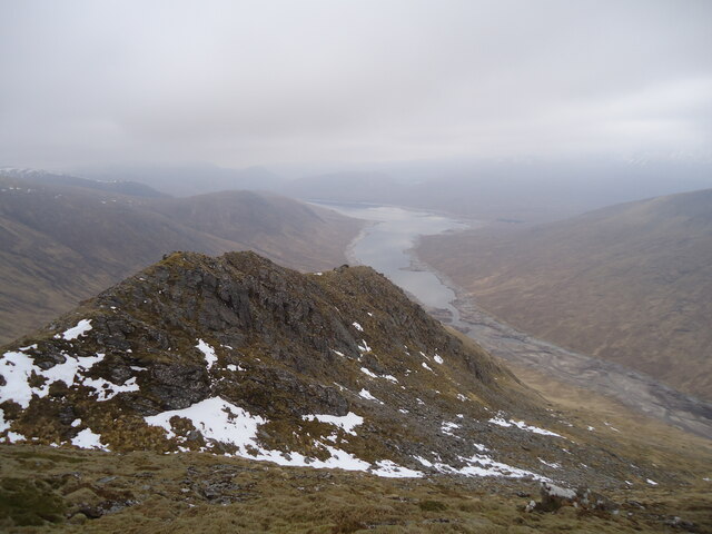
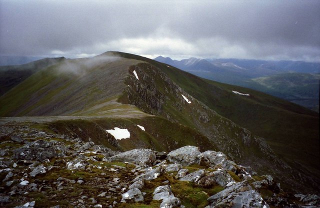
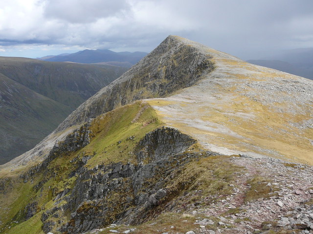
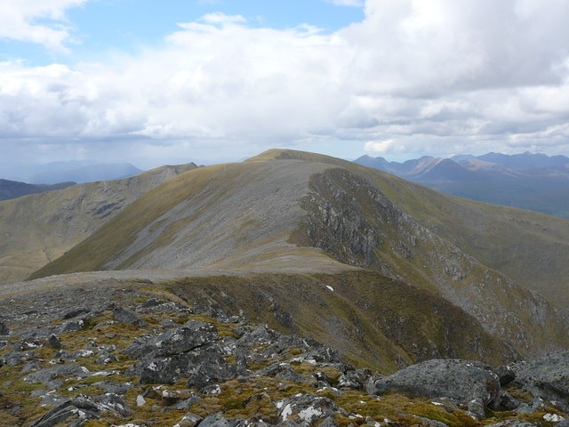
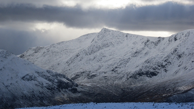
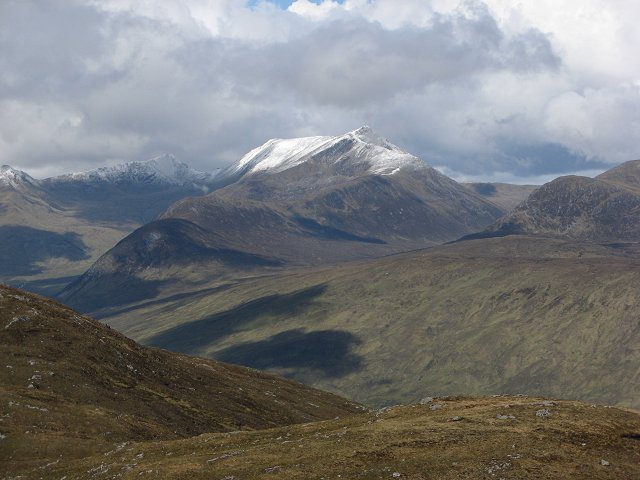
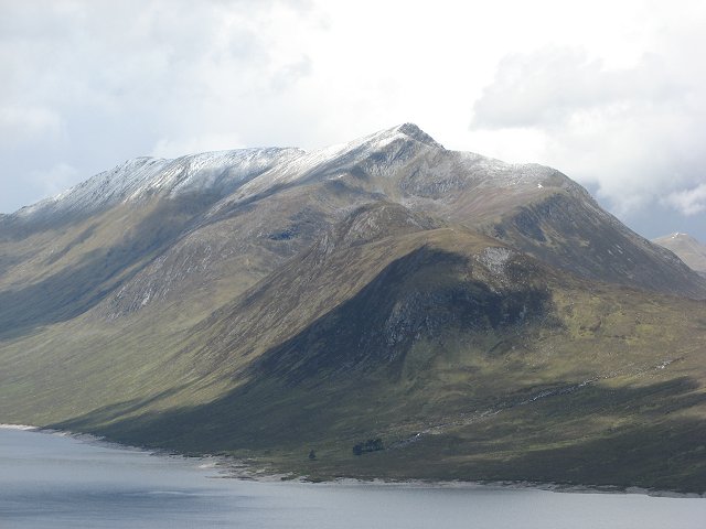
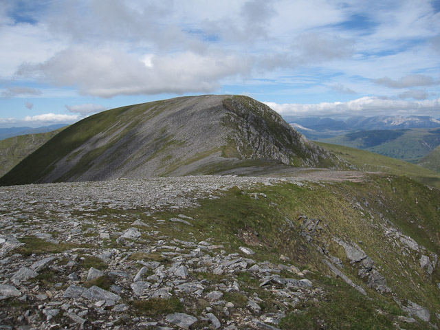
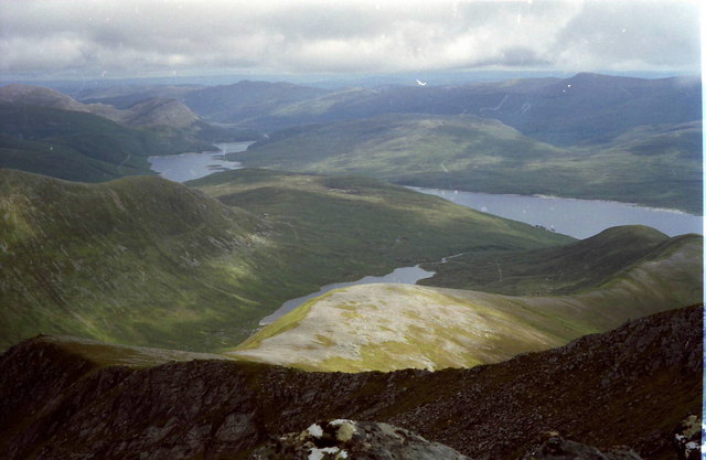
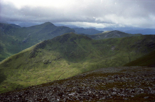
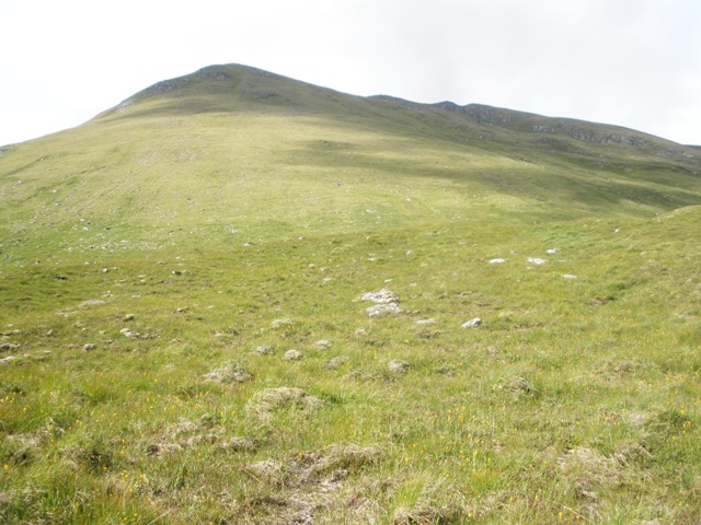
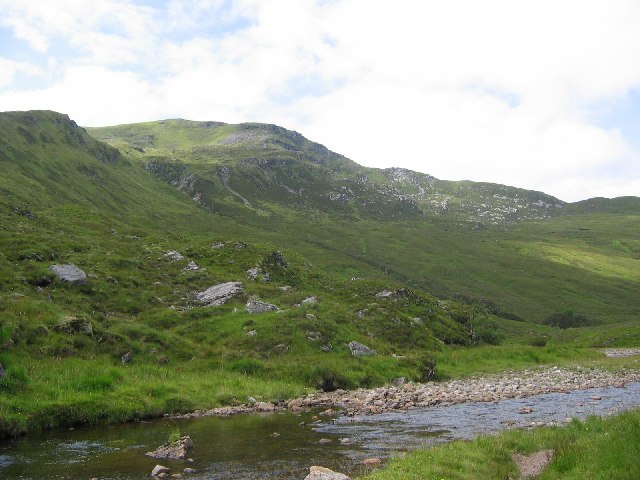
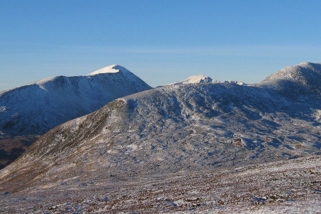
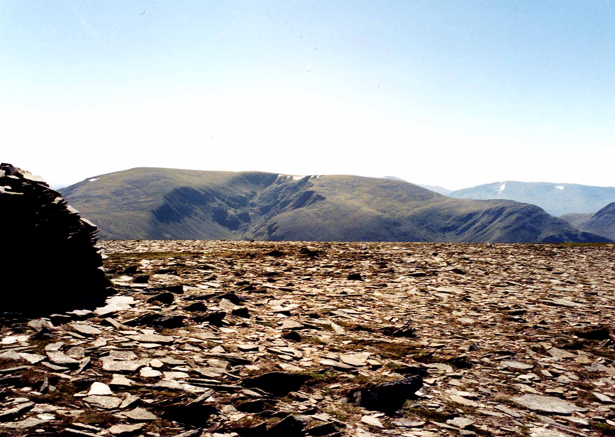
The terrain of West Monar Forest is characterized by rolling hills, heather-covered moorlands, and scattered woodlands. The downs offer breathtaking panoramic views of the surrounding mountains and lochs, including Loch Monar and Loch Na Leitreach. The landscape is adorned with vibrant colors throughout the year, with purple heather in the summer and golden hues of grass in the autumn.

The forest is home to a diverse range of flora and fauna. Visitors can spot various bird species, including golden eagles, ospreys, and peregrine falcons, soaring through the skies. Red deer and roe deer can often be seen grazing on the moorlands, while pine martens and red squirrels inhabit the woodlands.

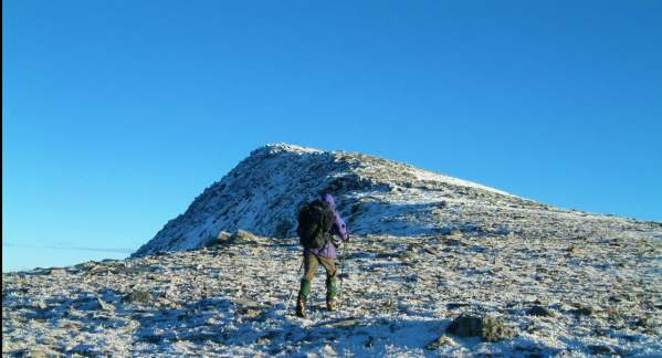
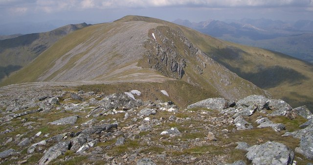
Hiking and walking trails crisscross the forest, allowing visitors to explore its natural wonders at their own pace. The popular Affric Kintail Way passes through a section of West Monar Forest, offering breathtaking views and opportunities for wildlife observation.

The tranquility and untouched beauty of West Monar Forest make it an ideal destination for nature lovers, photographers, and outdoor enthusiasts seeking a peaceful retreat in the heart of the Scottish Highlands. It provides an opportunity to immerse oneself in the raw, natural splendor of the area and experience the serenity of this remote corner of Ross-shire.

If you have any feedback on the listing, please let us know in the comments section below.

West Monar Forest Images

Images are sourced within 2km of 57.443362/-5.1874099 or Grid Reference NH0843. Thanks to Geograph Open Source API. All images are credited.

Nice Bridge on the North side of Loch Monar
Approaching Sgurr na Conbhaire Sgurr na Conbhaire is a 902m hill, south of Munro Sgurr Choinnich along this gentle ridge, and overlooking the west end of Loch Monar.

In the distance  (and cloud!) on the right is Lurg Mhor, one of the remoter Munros.
Approaching Sgurr na Conbhaire
Sgurr na Conbhaire is a 902m hill, south of Munro Sgurr Choinnich along this gentle ridge, and overlooking the west end of Loch Monar. In the distance (and cloud!) on the right is Lurg Mhor, one of the remoter Munros.
Sgurr Choinnich Sgurr Choinnich is a 999m Munro south of Glen Carron. It is seen here from the summit of Sgurr na Conbhaire. The route between them is straightforward.
Sgurr Choinnich
Sgurr Choinnich is a 999m Munro south of Glen Carron. It is seen here from the summit of Sgurr na Conbhaire. The route between them is straightforward.
The south-east ridge of Sgurr na Conbhaire, from the summit Looking towards the upper (western) end of Loch Monar, which seems quite low for early spring.
The south-east ridge of Sgurr na Conbhaire, from the summit
Looking towards the upper (western) end of Loch Monar, which seems quite low for early spring.
View west from Bidean an Eòinn Deirg Towards Sgùrr a' Chaorachain.
View west from Bidean an Eòinn Deirg
Towards Sgùrr a' Chaorachain.
View along ridge to Bidean an Eoin Deirg
View west along the ridge from the summit of Bidean an Eoin Dearg
Bidean an Eòin  Deirg A landmark peak in a remote area between Gleann Fhiodhaig and Strathmore. The eastern ridge is actually quite easy and has the merit of finishing with a scramble to the foot of the summit cairn.
Bidean an Eòin Deirg
A landmark peak in a remote area between Gleann Fhiodhaig and Strathmore. The eastern ridge is actually quite easy and has the merit of finishing with a scramble to the foot of the summit cairn.
Bidean an Eòin Dearg
Bidean an Eòin Deirg A Strathmore icon, well it would be if anyone still lived in the glen.  A graceful peak with a very fine ridge.
Bidean an Eòin Deirg
A Strathmore icon, well it would be if anyone still lived in the glen. A graceful peak with a very fine ridge.
Bidean an Eòin Deirg Bidean an Eòin Deirg dominates Loch Monar, and the flooded Strathmore. The clump of trees beneath the peak are just above the site of Strathmore Lodge, destroyed by the enlarged loch. An account of life here can be found in Iain R. Thompson's book Isolation Shepherd. 
<span class="nowrap"><a title="http://birlinn.birlinn.co.uk/book/details/Isolation-Shepherd-9781841586151/" rel="nofollow ugc noopener" href="http://birlinn.birlinn.co.uk/book/details/Isolation-Shepherd-9781841586151/">Link</a><img style="margin-left:2px;" alt="External link" title="External link - shift click to open in new window" src="https://s1.geograph.org.uk/img/external.png" width="10" height="10"/></span>
Bidean an Eòin Deirg
Bidean an Eòin Deirg dominates Loch Monar, and the flooded Strathmore. The clump of trees beneath the peak are just above the site of Strathmore Lodge, destroyed by the enlarged loch. An account of life here can be found in Iain R. Thompson's book Isolation Shepherd. LinkExternal link
Brocken Spectre from the Peak of the Red Bird Late afternoon on a day of heavy rain, the clouds briefly parted just as we arrived on Bidean an Eoin Deirg to reveal this phenomenon - a common sight to hillgoers. Looking north east towards Maoile Lunndaidh.
Not as a girl at my work said 'I've seen a Brock Inspector'!
<span class="nowrap"><a title="http://www.atoptics.co.uk/droplets/globrock.htm" rel="nofollow ugc noopener" href="http://www.atoptics.co.uk/droplets/globrock.htm">Link</a><img style="margin-left:2px;" alt="External link" title="External link - shift click to open in new window" src="https://s1.geograph.org.uk/img/external.png" width="10" height="10"/></span>
Brocken Spectre from the Peak of the Red Bird
Late afternoon on a day of heavy rain, the clouds briefly parted just as we arrived on Bidean an Eoin Deirg to reveal this phenomenon - a common sight to hillgoers. Looking north east towards Maoile Lunndaidh. Not as a girl at my work said 'I've seen a Brock Inspector'! LinkExternal link
Sgurr a'Chaorachain from Bidein an Eoin Dearg West from Bidein an Eoin Dearg
Sgurr a'Chaorachain from Bidein an Eoin Dearg
West from Bidein an Eoin Dearg
Ridge to Sgùrr a' Chaorachain From Bidean an Eòin Deirg. Luckily Bidean an Eòin Deirg is seven metres shorter than Sgùrr a' Chaorachain so is not classed as a Munro. This means that it is much less frequently climbed and there is no path along the ridge, giving the Ptarmigans some peace.
Ridge to Sgùrr a' Chaorachain
From Bidean an Eòin Deirg. Luckily Bidean an Eòin Deirg is seven metres shorter than Sgùrr a' Chaorachain so is not classed as a Munro. This means that it is much less frequently climbed and there is no path along the ridge, giving the Ptarmigans some peace.
The east ridge of Bidean an Eòinn Deirg From the summit.  The ridge continues as Meall a' Chreagain Duibh, in the sunlight, with Loch Mhuilich somewhat hidden behind it. In the far distance is the dam end of Loch Monar.
The east ridge of Bidean an Eòinn Deirg
From the summit. The ridge continues as Meall a' Chreagain Duibh, in the sunlight, with Loch Mhuilich somewhat hidden behind it. In the far distance is the dam end of Loch Monar.
The west ridge of Bidean an Eòinn Deirg With Sgurr na Conbhaire across the coire.  The prominent peak on the horizon is Bidein a'Choire Sheasgaich.
The west ridge of Bidean an Eòinn Deirg
With Sgurr na Conbhaire across the coire. The prominent peak on the horizon is Bidein a'Choire Sheasgaich.
Sgurr na Conbhaire Sgurr na Conbhaire from the side of Loch Monar
Sgurr na Conbhaire
Sgurr na Conbhaire from the side of Loch Monar
West Monar Forest West Monar Forest, north shore of Loch Monar. Bidean a Choire Sheasgaich is left of centre on the skyline. The water level is a couple of metres below normal/high water level.
West Monar Forest
West Monar Forest, north shore of Loch Monar. Bidean a Choire Sheasgaich is left of centre on the skyline. The water level is a couple of metres below normal/high water level.
Show me another place!

West Monar Forest is located at Grid Ref: NH0843 (Lat: 57.443362, Lng: -5.1874099)

Unitary Authority: Highland

Police Authority: Highlands and Islands

What 3 Words

///pocketed.washable.lovely. Near Achnasheen, Highland

Related Wikis

Have you been to West Monar Forest?

Leave your review of West Monar Forest below (or comments, questions and feedback).