St Brides Green

Downs, Moorland in Pembrokeshire

Wales

St Brides Green

Footpath from St Brides
Footpath from St Brides Credit: Alistair Hare

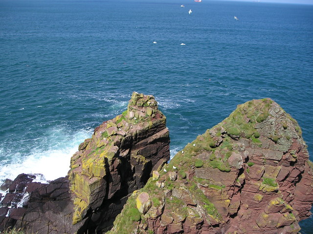
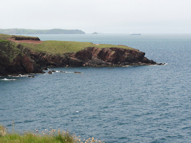
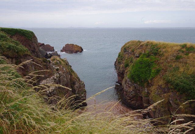
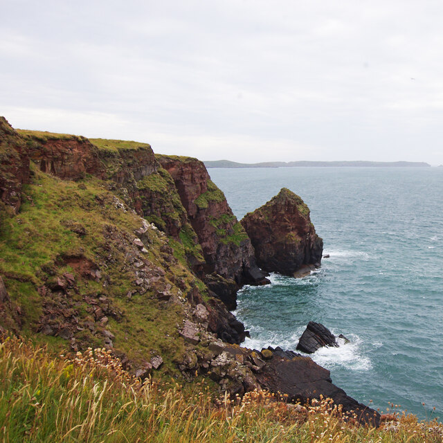
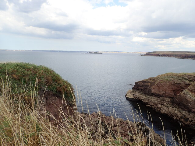
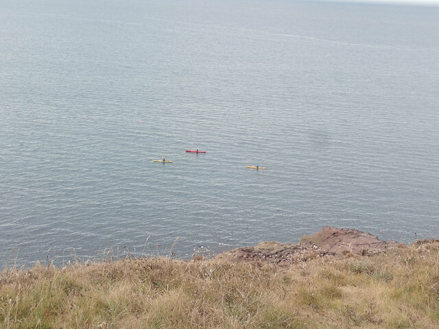
St Brides Green is a picturesque area located in the county of Pembrokeshire, Wales. Situated on the western coast of the country, it offers breathtaking views of the Atlantic Ocean and is surrounded by lush greenery, including downs and moorland.

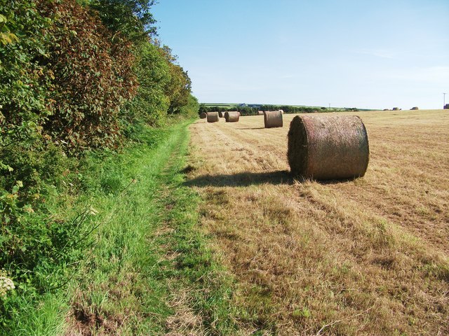
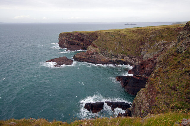
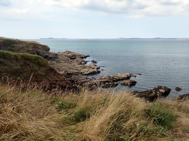
The downs of St Brides Green are characterized by their rolling hills and open grasslands. These areas provide a great opportunity for outdoor activities such as hiking, picnicking, and birdwatching. The gentle slopes and expansive spaces make it an ideal spot for families and nature enthusiasts to spend a day immersed in the beauty of the countryside.

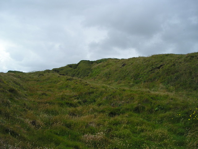
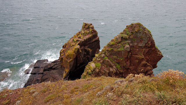
Moorland, on the other hand, is a more rugged and wild landscape that can be found in St Brides Green. Here, visitors can explore the untamed beauty of the moors, with their heather-covered hillsides and scattered rocky outcrops. The moorland offers a unique habitat for a variety of wildlife, including birds, small mammals, and reptiles.

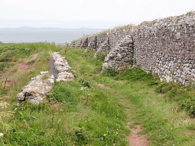
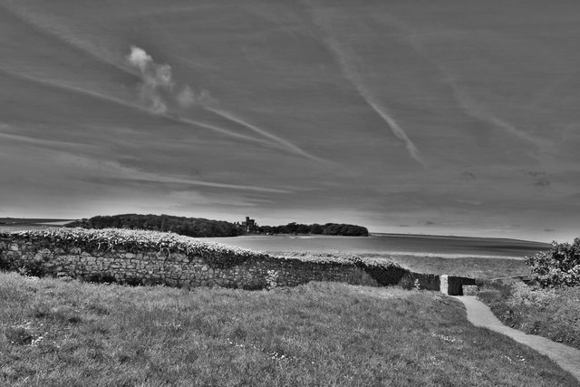
St Brides Green is also home to several historical sites and landmarks, adding to its charm and cultural significance. The area boasts ancient burial grounds and standing stones that provide a glimpse into the region's rich history.

Overall, St Brides Green in Pembrokeshire is a captivating destination that combines natural beauty, outdoor recreation, and cultural heritage. Whether it's enjoying the tranquility of the downs, exploring the ruggedness of the moorland, or discovering the area's historical sites, visitors are sure to be enchanted by all that St Brides Green has to offer.

If you have any feedback on the listing, please let us know in the comments section below.

St Brides Green Images

Images are sourced within 2km of 51.752371/-5.1830766 or Grid Reference SM8010. Thanks to Geograph Open Source API. All images are credited.

Footpath from St Brides
Fort near Nab Head Part of the embankments surrounding this coastal fortification.
Fort near Nab Head
Part of the embankments surrounding this coastal fortification.
Tower Point in summer
Footpath  to the coast path From Marloes village
Footpath to the coast path
From Marloes village
The Wall A high wall separates the fields from the cliff edge here, presumably this marked the edge of the estate surrounding the nearby St Bride's Castle.
The Wall
A high wall separates the fields from the cliff edge here, presumably this marked the edge of the estate surrounding the nearby St Bride's Castle.
The Nab Head Looking across the water to the red sandstone peninsula called The Nab Head.
The Nab Head
Looking across the water to the red sandstone peninsula called The Nab Head.
Mur Ystad Kensington Estate Wall Llwybr arfordir yn dilyn mur ffin Ystad Kensington.

Coastal path following the Kensington Estate boundary wall.
Mur Ystad Kensington Estate Wall
Llwybr arfordir yn dilyn mur ffin Ystad Kensington. Coastal path following the Kensington Estate boundary wall.
St Brides Castle The former country seat of the Kensington family the 19th century St Brides Castle with its castellated top and lofty towers is imposingly sited on the gently sloping hill behind the little beach. It was built in 1833 by Charles Philipps of Picton Castle and was considerably enlarged between 1905 and 1913, the Kensington family having bought it in 1888 and sold it in 1923. It served for over 30 years as a TB isolation hospital and later as an old people’s home before being converted into holiday apartments in the early 1990s
St Brides Castle
The former country seat of the Kensington family the 19th century St Brides Castle with its castellated top and lofty towers is imposingly sited on the gently sloping hill behind the little beach. It was built in 1833 by Charles Philipps of Picton Castle and was considerably enlarged between 1905 and 1913, the Kensington family having bought it in 1888 and sold it in 1923. It served for over 30 years as a TB isolation hospital and later as an old people’s home before being converted into holiday apartments in the early 1990s
View towards Castle Head
St Bride's Castle from the Coast Path Very large castellated house of 1833 built for William Charles Allen Philipps (1810-64) and enlarged in 1905-6 and 1913 for the 6th Baron Kensington. Grade II* listed
St Bride's Castle from the Coast Path
Very large castellated house of 1833 built for William Charles Allen Philipps (1810-64) and enlarged in 1905-6 and 1913 for the 6th Baron Kensington. Grade II* listed
Inlet near Castle Head
Shoreline, North side  of Tower Point
Shoreline, North side of Tower Point
Shoreline, North of Tower Point Looking north from Tower Point to The Nab Head.
Shoreline, North of Tower Point
Looking north from Tower Point to The Nab Head.
Tower Point
Tower Point
St Bride's Castle Seen from the Coast Path. Originally the baronial mansion of the Allen-Phillips family. In 1920 death duties forced the then owner, Lord Kensington, to sell off the estate and it came into the possession of the King Edward VII Welsh National Memorial Association. It became Kensington Hospital and then a convalescent home until its closure in 1978. Now it is part of Holiday Property Bond's portfolio with 50 apartments and cottages.
St Bride's Castle
Seen from the Coast Path. Originally the baronial mansion of the Allen-Phillips family. In 1920 death duties forced the then owner, Lord Kensington, to sell off the estate and it came into the possession of the King Edward VII Welsh National Memorial Association. It became Kensington Hospital and then a convalescent home until its closure in 1978. Now it is part of Holiday Property Bond's portfolio with 50 apartments and cottages.
Rocky coastline east of St Bride's
Inlet in St Bride's headland Looking out to sea, Stack Rocks in the distance
Inlet in St Bride's headland
Looking out to sea, Stack Rocks in the distance
Kayakers off Nab's Head in St Bride's Bay
Show me another place!

St Brides Green is located at Grid Ref: SM8010 (Lat: 51.752371, Lng: -5.1830766)

Unitary Authority: Pembrokeshire

Police Authority: Dyfed Powys

What 3 Words

///nutty.assets.geese. Near Dale, Pembrokeshire

Nearby Locations

The Moors St Brides Green

Related Wikis

St Brides

St Brides (Welsh: Sain Ffraid) is a parish and small coastal village in Pembrokeshire, Wales, at the south of St Brides Bay, about 1+1⁄2 miles (2.4 km...
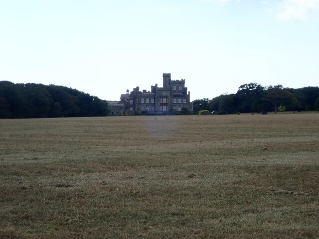
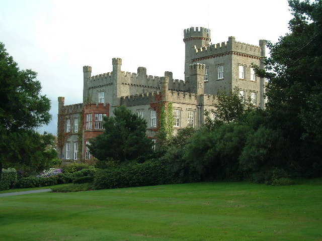
St Brides Castle

St Brides Castle is a 19th-century castellated baronial-style mansion in the parish of St Brides and the community of Marloes and St Brides, Pembrokeshire...

Marloes and St Brides

Marloes and St. Brides (Welsh: Marloes a Sain Ffraid) is a community in the West Wales county of Pembrokeshire. The main settlements are the villages of...

Marloes

Marloes is a village and parish in Pembrokeshire, Wales, on the Marloes Peninsula 7 miles (11 km) west of Milford Haven and forms the western tip of the...

RAF Talbenny

Royal Air Force Talbenny, or more simply RAF Talbenny, is a former Royal Air Force station located 5.6 miles (9.0 km) north west of Milford Haven, Pembrokeshire...

Marloes Mere

Marloes Mere is a Site of Special Scientific Interest (or SSSI) in Pembrokeshire, South Wales. It has been designated as a Site of Special Scientific Interest...
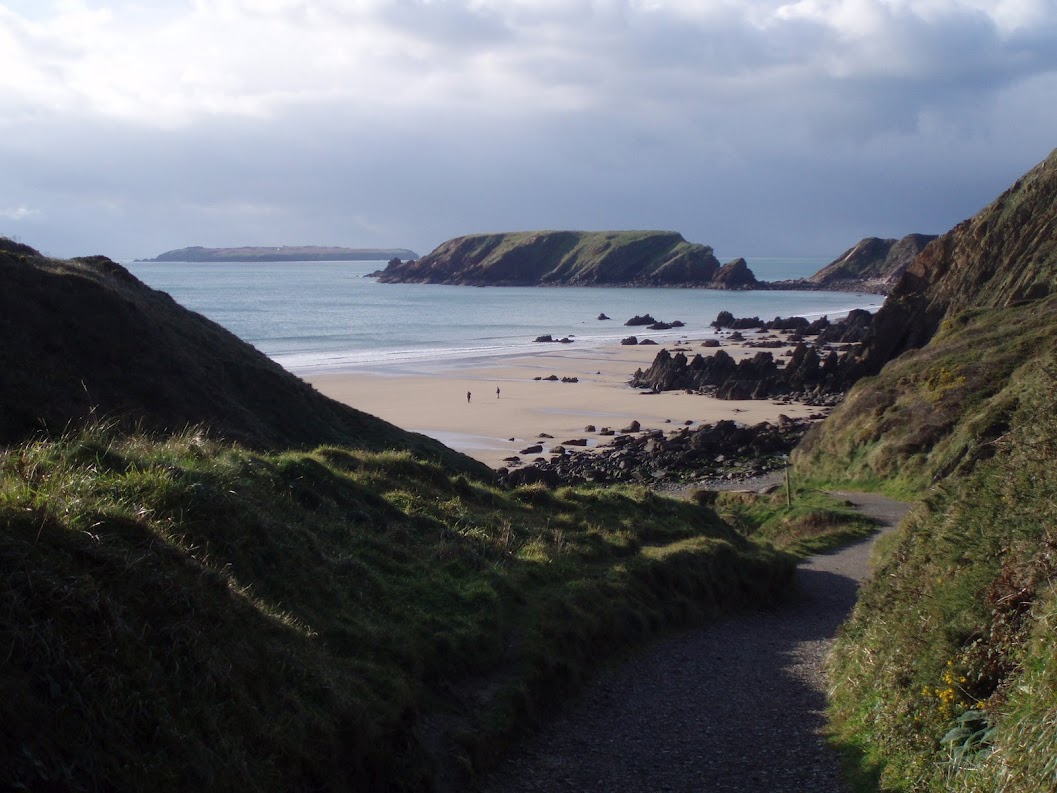
Marloes Sands

Marloes Sands (Welsh: Traeth Marloes) is an approx. 1.5 kilometres (0.93 mi) long remote sandy beach in Pembrokeshire, Wales, near the village of Marloes...

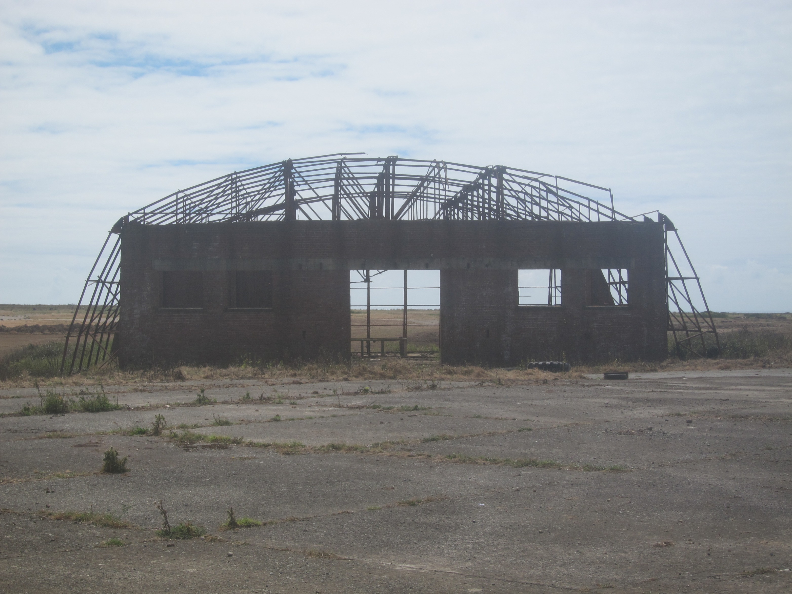
RNAS Dale (HMS Goldcrest)

Royal Naval Air Station Dale (RNAS Dale, also known as HMS Goldcrest) is a former Royal Naval Air Station, located 10 miles (16 km) South West of Haverfordwest...

Nearby Amenities

Located within 500m of 51.752371,-5.1830766
Saint Brides
Place: hamlet
Wikidata: Q7592714
Lat/Long: 51.7535493/-5.1850747
Place Of Worship
St Bridget
Religion: christian
Wikidata: Q29496806
Lat/Long: 51.7531125/-5.1849731
Tourism: picnic_site
Lat/Long: 51.7536077/-5.1859061
Toilets
Lat/Long: 51.7536239/-5.1849164
St Brides Campsite
Addr City: Haverfordwest
Addr Postcode: SA62 3AJ
Addr Street: St Brides Green
Internet Access: no
Tourism: camp_site
Website: https://www.scoutscymru.org.uk/resources/camp-site-list/south-west-wales-and-gower/st-brides
Lat/Long: 51.7528575/-5.1829398
Pump House
Tourism: attraction
Lat/Long: 51.7535045/-5.1842487
Defibrillator
Emergency: defibrillator
Indoor: no
Lat/Long: 51.7535828/-5.1846318
Power: pole
Lat/Long: 51.7500364/-5.18897
Power: pole
Lat/Long: 51.7505994/-5.1849735
Power: pole
Lat/Long: 51.7502607/-5.1820821
Power: pole
Lat/Long: 51.750719/-5.1794052
Power: pole
Lat/Long: 51.7515127/-5.1780856
Power: pole
Lat/Long: 51.7522997/-5.1768196
Power: pole
Lat/Long: 51.7507472/-5.186218
Material: wood
Power: pole
Lat/Long: 51.7528387/-5.1851633
Material: wood
Power: pole
Lat/Long: 51.7521629/-5.1862201
Power: pole
Lat/Long: 51.7514887/-5.1866519
Power: pole
Lat/Long: 51.7509698/-5.1869872
Power: pole
Lat/Long: 51.7504454/-5.1873163
Power: pole
Lat/Long: 51.7528055/-5.1759633
Power: pole
Lat/Long: 51.750079/-5.1804587
Power: pole
Lat/Long: 51.7504808/-5.1838464
Direction: S
Generator Method: photovoltaic
Generator Output Electricity: yes
Generator Solar Modules: 6
Generator Source: solar
Generator Type: solar_photovoltaic_panel
Location: roof
Power: generator
Lat/Long: 51.7530224/-5.1847744
Direction: 175
Generator Method: photovoltaic
Generator Output Electricity: yes
Generator Solar Modules: 7
Generator Source: solar
Generator Type: solar_photovoltaic_panel
Location: roof
Power: generator
Lat/Long: 51.7529798/-5.1849514
The data included in this document is from www.openstreetmap.org. The data is made available under ODbL.

Have you been to St Brides Green?

Leave your review of St Brides Green below (or comments, questions and feedback).