The Moors

Wood, Forest in Pembrokeshire

Wales

The Moors

Footpath from St Brides
Footpath from St Brides Credit: Alistair Hare

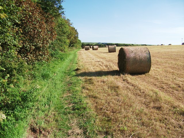
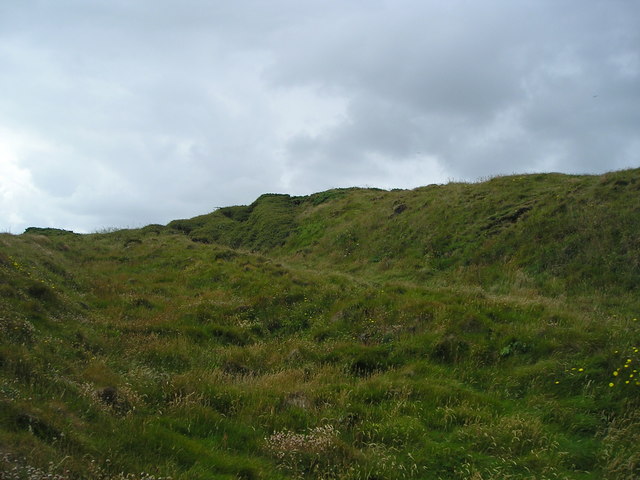
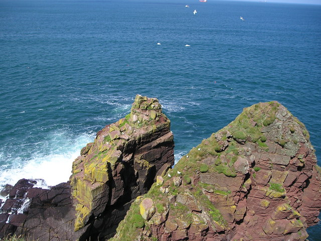
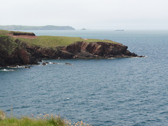
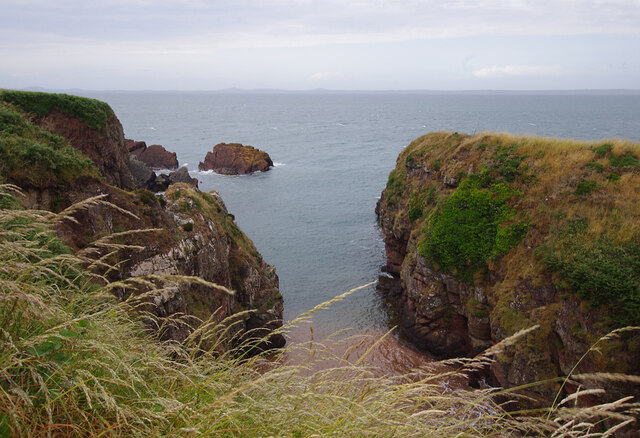
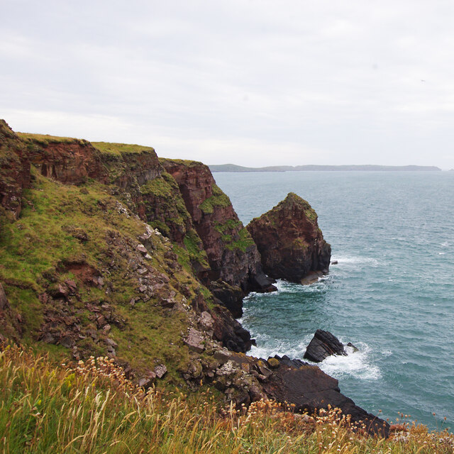
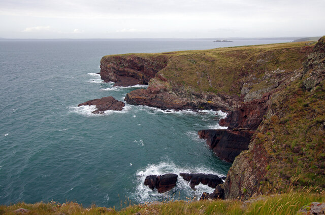
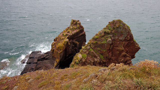
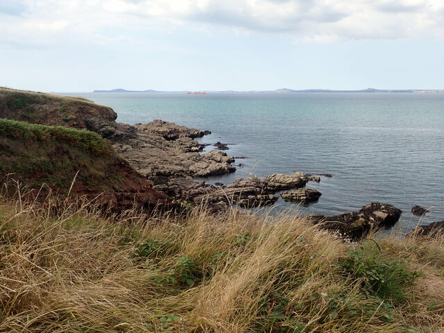
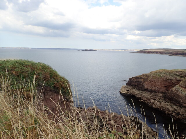
The Moors in Pembrokeshire, also known as the Wood or Forest, is a vast and enchanting natural landscape located in southwest Wales. Covering an area of over 600 square miles, The Moors is characterized by its rolling hills, dense woodlands, and expansive heathlands. The area is home to a diverse range of flora and fauna, including rare species such as red kites, otters, and wild ponies.

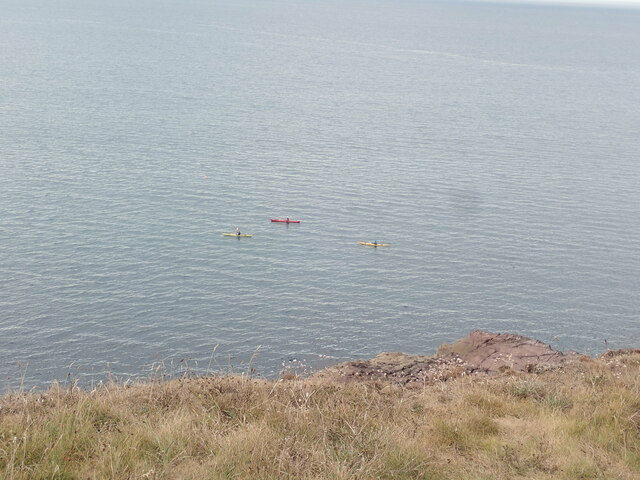
The Moors is a popular destination for outdoor enthusiasts, offering a variety of activities such as hiking, birdwatching, and mountain biking. The ancient woodlands provide a tranquil setting for leisurely walks, while the rugged terrain of the heathlands offers a more challenging experience for adventurous hikers.

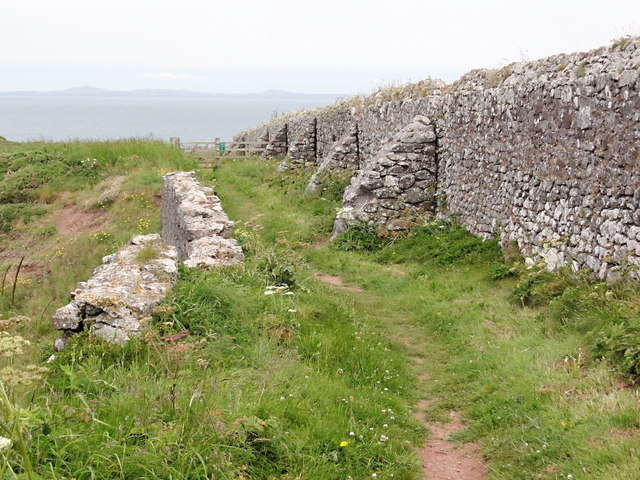
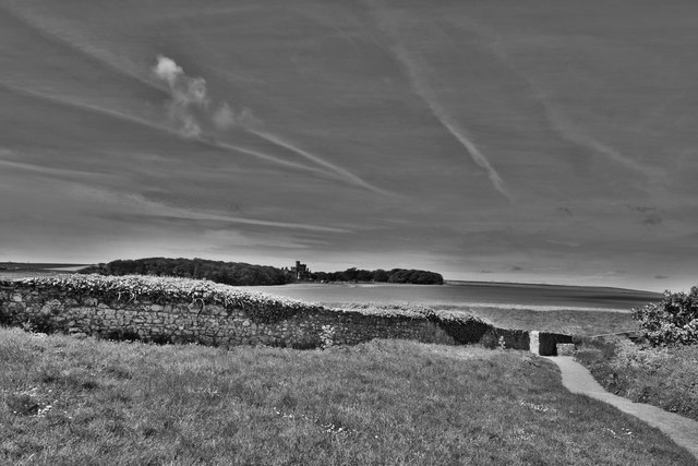
The Moors is also steeped in history, with archaeological sites dating back thousands of years scattered throughout the landscape. Visitors can explore ancient burial mounds, standing stones, and Iron Age hillforts, providing insight into the area's rich cultural heritage.

Overall, The Moors in Pembrokeshire is a stunning and diverse natural environment that offers something for everyone to enjoy.

If you have any feedback on the listing, please let us know in the comments section below.

The Moors Images

Images are sourced within 2km of 51.749415/-5.186926 or Grid Reference SM8010. Thanks to Geograph Open Source API. All images are credited.

Footpath from St Brides
Fort near Nab Head Part of the embankments surrounding this coastal fortification.
Fort near Nab Head
Part of the embankments surrounding this coastal fortification.
Tower Point in summer
Footpath  to the coast path From Marloes village
Footpath to the coast path
From Marloes village
The Wall A high wall separates the fields from the cliff edge here, presumably this marked the edge of the estate surrounding the nearby St Bride's Castle.
The Wall
A high wall separates the fields from the cliff edge here, presumably this marked the edge of the estate surrounding the nearby St Bride's Castle.
The Nab Head Looking across the water to the red sandstone peninsula called The Nab Head.
The Nab Head
Looking across the water to the red sandstone peninsula called The Nab Head.
Mur Ystad Kensington Estate Wall Llwybr arfordir yn dilyn mur ffin Ystad Kensington.

Coastal path following the Kensington Estate boundary wall.
Mur Ystad Kensington Estate Wall
Llwybr arfordir yn dilyn mur ffin Ystad Kensington. Coastal path following the Kensington Estate boundary wall.
St Brides Castle The former country seat of the Kensington family the 19th century St Brides Castle with its castellated top and lofty towers is imposingly sited on the gently sloping hill behind the little beach. It was built in 1833 by Charles Philipps of Picton Castle and was considerably enlarged between 1905 and 1913, the Kensington family having bought it in 1888 and sold it in 1923. It served for over 30 years as a TB isolation hospital and later as an old people’s home before being converted into holiday apartments in the early 1990s
St Brides Castle
The former country seat of the Kensington family the 19th century St Brides Castle with its castellated top and lofty towers is imposingly sited on the gently sloping hill behind the little beach. It was built in 1833 by Charles Philipps of Picton Castle and was considerably enlarged between 1905 and 1913, the Kensington family having bought it in 1888 and sold it in 1923. It served for over 30 years as a TB isolation hospital and later as an old people’s home before being converted into holiday apartments in the early 1990s
View towards Castle Head
St Bride's Castle from the Coast Path Very large castellated house of 1833 built for William Charles Allen Philipps (1810-64) and enlarged in 1905-6 and 1913 for the 6th Baron Kensington. Grade II* listed
St Bride's Castle from the Coast Path
Very large castellated house of 1833 built for William Charles Allen Philipps (1810-64) and enlarged in 1905-6 and 1913 for the 6th Baron Kensington. Grade II* listed
Inlet near Castle Head
Shoreline, North side  of Tower Point
Shoreline, North side of Tower Point
Shoreline, North of Tower Point Looking north from Tower Point to The Nab Head.
Shoreline, North of Tower Point
Looking north from Tower Point to The Nab Head.
Tower Point
Tower Point
St Bride's Castle Seen from the Coast Path. Originally the baronial mansion of the Allen-Phillips family. In 1920 death duties forced the then owner, Lord Kensington, to sell off the estate and it came into the possession of the King Edward VII Welsh National Memorial Association. It became Kensington Hospital and then a convalescent home until its closure in 1978. Now it is part of Holiday Property Bond's portfolio with 50 apartments and cottages.
St Bride's Castle
Seen from the Coast Path. Originally the baronial mansion of the Allen-Phillips family. In 1920 death duties forced the then owner, Lord Kensington, to sell off the estate and it came into the possession of the King Edward VII Welsh National Memorial Association. It became Kensington Hospital and then a convalescent home until its closure in 1978. Now it is part of Holiday Property Bond's portfolio with 50 apartments and cottages.
Rocky coastline east of St Bride's
Inlet in St Bride's headland Looking out to sea, Stack Rocks in the distance
Inlet in St Bride's headland
Looking out to sea, Stack Rocks in the distance
Kayakers off Nab's Head in St Bride's Bay
Show me another place!

The Moors is located at Grid Ref: SM8010 (Lat: 51.749415, Lng: -5.186926)

Unitary Authority: Pembrokeshire

Police Authority: Dyfed Powys

What 3 Words

///unsigned.reporters.fizzy. Near Dale, Pembrokeshire

Nearby Locations

St Brides Green The Moors

Related Wikis

St Brides

St Brides (Welsh: Sain Ffraid) is a parish and small coastal village in Pembrokeshire, Wales, at the south of St Brides Bay, about 1+1⁄2 miles (2.4 km...
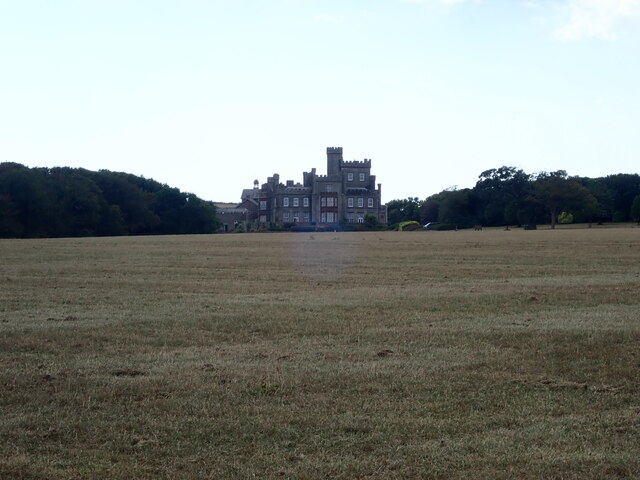
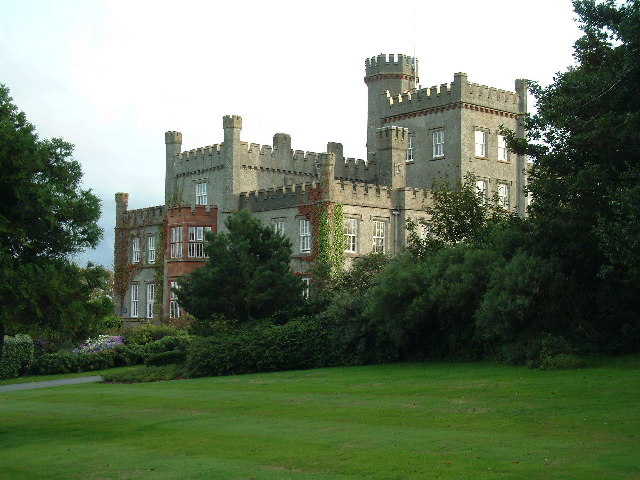
St Brides Castle

St Brides Castle is a 19th-century castellated baronial-style mansion in the parish of St Brides and the community of Marloes and St Brides, Pembrokeshire...

Marloes and St Brides

Marloes and St. Brides (Welsh: Marloes a Sain Ffraid) is a community in the West Wales county of Pembrokeshire. The main settlements are the villages of...

Marloes

Marloes is a village and parish in Pembrokeshire, Wales, on the Marloes Peninsula 7 miles (11 km) west of Milford Haven and forms the western tip of the...

Nearby Amenities

Located within 500m of 51.749415,-5.186926
Saint Brides
Place: hamlet
Wikidata: Q7592714
Lat/Long: 51.7535493/-5.1850747
Place Of Worship
St Bridget
Religion: christian
Wikidata: Q29496806
Lat/Long: 51.7531125/-5.1849731
Tourism: picnic_site
Lat/Long: 51.7536077/-5.1859061
Toilets
Lat/Long: 51.7536239/-5.1849164
St Brides Campsite
Addr City: Haverfordwest
Addr Postcode: SA62 3AJ
Addr Street: St Brides Green
Internet Access: no
Tourism: camp_site
Website: https://www.scoutscymru.org.uk/resources/camp-site-list/south-west-wales-and-gower/st-brides
Lat/Long: 51.7528575/-5.1829398
Pump House
Tourism: attraction
Lat/Long: 51.7535045/-5.1842487
Defibrillator
Emergency: defibrillator
Indoor: no
Lat/Long: 51.7535828/-5.1846318
Power: pole
Lat/Long: 51.7454681/-5.1903004
Power: pole
Lat/Long: 51.7460726/-5.1908583
Power: pole
Lat/Long: 51.7466073/-5.1914162
Power: pole
Lat/Long: 51.7472719/-5.1920978
Power: pole
Lat/Long: 51.7489687/-5.1931435
Power: pole
Lat/Long: 51.7492178/-5.1924676
Power: pole
Lat/Long: 51.7494337/-5.1913303
Power: pole
Lat/Long: 51.7500364/-5.18897
Power: pole
Lat/Long: 51.7505994/-5.1849735
Power: pole
Lat/Long: 51.7502607/-5.1820821
Power: pole
Lat/Long: 51.7507472/-5.186218
Material: wood
Power: pole
Lat/Long: 51.7528387/-5.1851633
Material: wood
Power: pole
Lat/Long: 51.7521629/-5.1862201
Power: pole
Lat/Long: 51.7514887/-5.1866519
Power: pole
Lat/Long: 51.7509698/-5.1869872
Power: pole
Lat/Long: 51.7504454/-5.1873163
Power: pole
Lat/Long: 51.750079/-5.1804587
Power: pole
Lat/Long: 51.7504808/-5.1838464
Power: pole
Lat/Long: 51.7495874/-5.1906672
Power: pole
Lat/Long: 51.7497244/-5.1936726
Power: pole
Lat/Long: 51.7480257/-5.1925609
Direction: S
Generator Method: photovoltaic
Generator Output Electricity: yes
Generator Solar Modules: 6
Generator Source: solar
Generator Type: solar_photovoltaic_panel
Location: roof
Power: generator
Lat/Long: 51.7530224/-5.1847744
Direction: 175
Generator Method: photovoltaic
Generator Output Electricity: yes
Generator Solar Modules: 7
Generator Source: solar
Generator Type: solar_photovoltaic_panel
Location: roof
Power: generator
Lat/Long: 51.7529798/-5.1849514
The data included in this document is from www.openstreetmap.org. The data is made available under ODbL.

Have you been to The Moors?

Leave your review of The Moors below (or comments, questions and feedback).