Dail Bhàite

Downs, Moorland in Argyllshire

Scotland

Dail Bhàite

Road, Glen Forsa Quite busy today with construction work and logging taking place.
Road, Glen Forsa Credit: Richard Webb

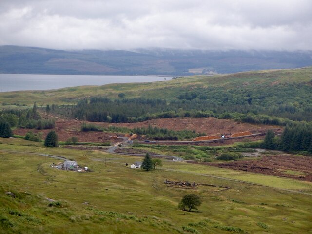
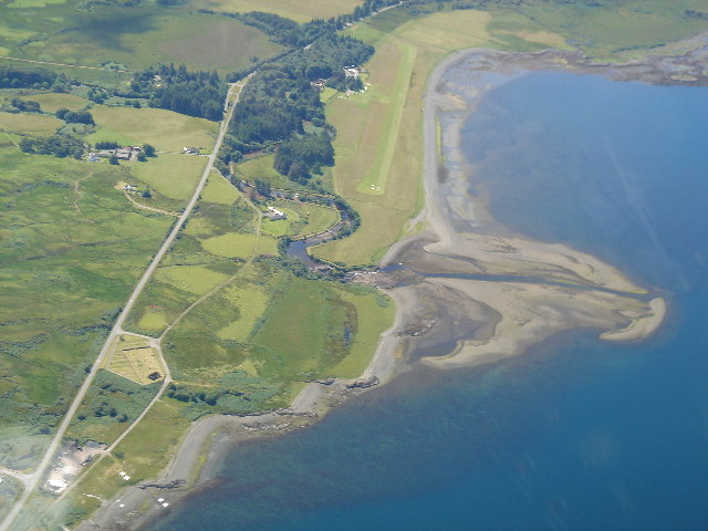
Dail Bhàite is a captivating area located in Argyllshire, Scotland. Nestled amidst the stunning landscape of the Highlands, it is renowned for its picturesque downs and moorland. Spanning over a vast expanse, Dail Bhàite offers a diverse range of natural wonders and breathtaking scenery.

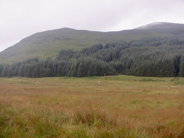
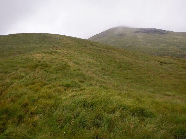
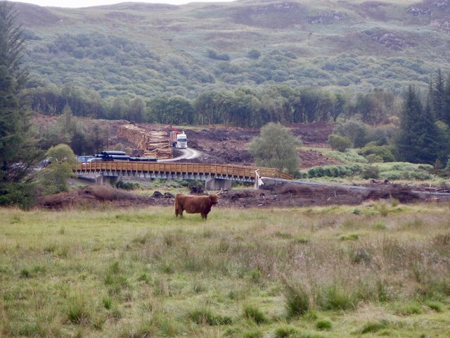
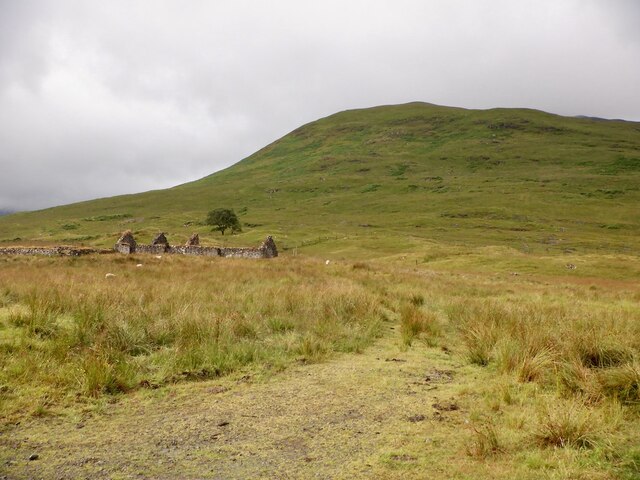
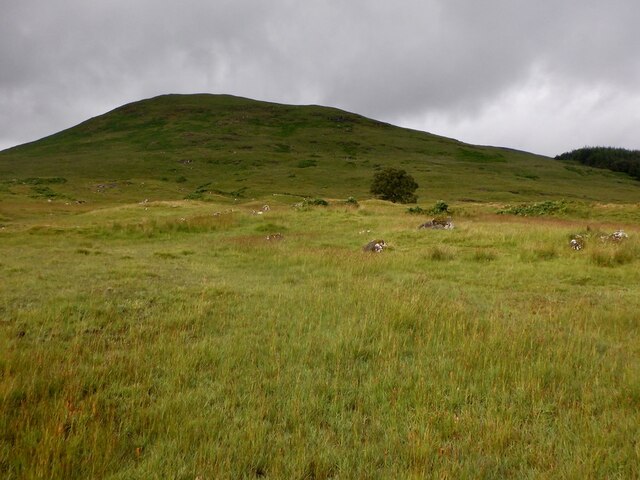
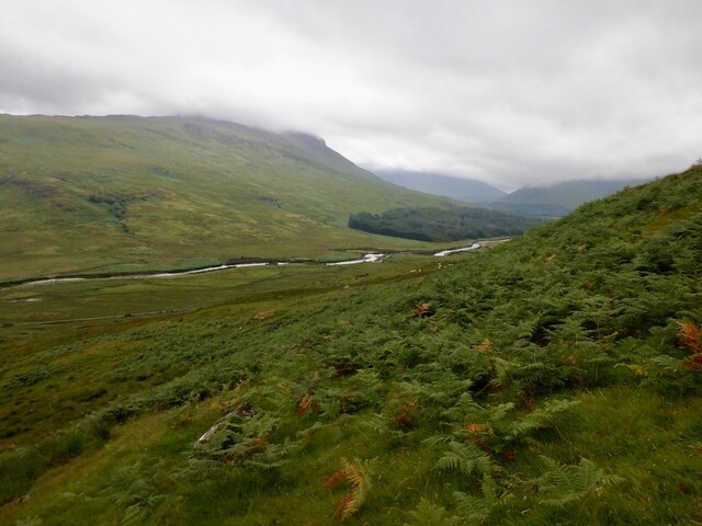
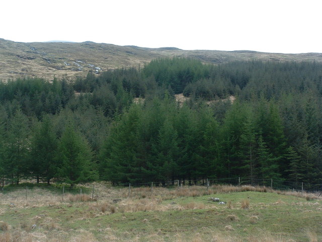
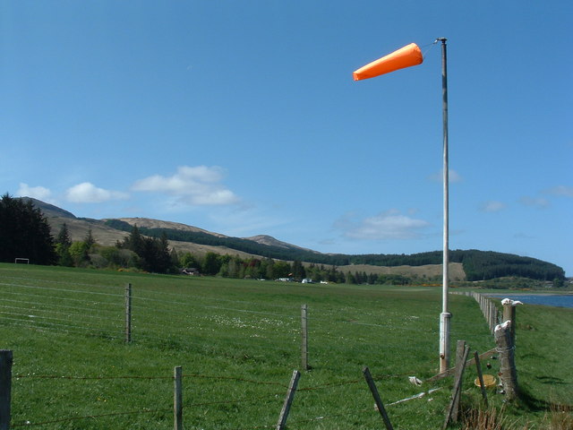
The downs of Dail Bhàite are characterized by their rolling hills, covered in a patchwork of lush green grass and heather. These gentle slopes provide a tranquil setting for nature enthusiasts to explore and appreciate the beauty of the surrounding area. The moorland, on the other hand, presents a more rugged and wild landscape, with its open expanses and dramatic vistas.

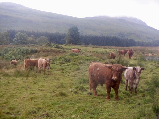
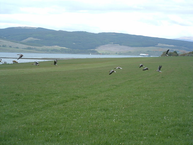
The region is home to a variety of flora and fauna, including heather, gorse, and wildflowers, which add vibrant colors to the landscape. Dail Bhàite is also known for its diverse bird population, with species such as golden eagles, red grouse, and curlews frequently spotted in the area.

Visitors to Dail Bhàite can indulge in a range of outdoor activities. Hiking and walking trails crisscross the countryside, offering opportunities to explore the downs and moorland while enjoying breathtaking views. The area is also popular for birdwatching, photography, and even camping, allowing visitors to immerse themselves in the natural beauty and tranquility of the surroundings.

Overall, Dail Bhàite in Argyllshire is a captivating destination for nature lovers and outdoor enthusiasts. Its downs and moorland provide a diverse and picturesque landscape, while its natural wonders and wildlife offer a unique and unforgettable experience for visitors.

If you have any feedback on the listing, please let us know in the comments section below.
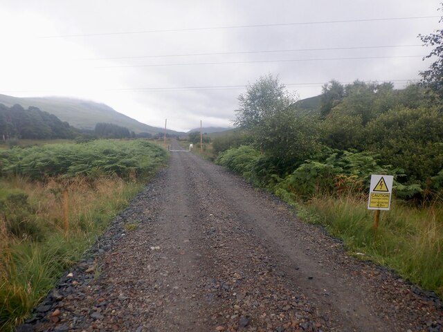
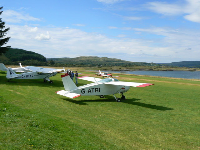
Dail Bhàite Images

Images are sourced within 2km of 56.513186/-5.9031477 or Grid Reference NM5942. Thanks to Geograph Open Source API. All images are credited.

Road, Glen Forsa Quite busy today with construction work and logging taking place.
Road, Glen Forsa
Quite busy today with construction work and logging taking place.
Woodland, Glen Forsa View towards Beinn nan Lus.
Woodland, Glen Forsa
View towards Beinn nan Lus.
Beinn nan Lus Easier going higher on the hill, above all the deep grass and tussocks lower down.
Beinn nan Lus
Easier going higher on the hill, above all the deep grass and tussocks lower down.
Cattle, Glen Forsa The bull is very young.  Unlike my last visit, the cows were all very well mannered.
Cattle, Glen Forsa
The bull is very young. Unlike my last visit, the cows were all very well mannered.
New forestry road and bridge, Glen Forsa There was also some construction work in progress further up the glen, as a cement mixer went up later in the morning.
New forestry road and bridge, Glen Forsa
There was also some construction work in progress further up the glen, as a cement mixer went up later in the morning.
Ruins, Killbeg Beneath Beinn nan Lus.
Ruins, Killbeg
Beneath Beinn nan Lus.
Beinn nan Lus, Glen Forsa
Glen Forsa A cement mixer had just gone up the glen. View from an ascent of Beinn nan Lus.
Glen Forsa
A cement mixer had just gone up the glen. View from an ascent of Beinn nan Lus.
Killbeg and forestry A new house is being built at Killbeg and there is now a forestry road across the Forsa.
Killbeg and forestry
A new house is being built at Killbeg and there is now a forestry road across the Forsa.
Glenforsa Airfield
Glenforsa Airfield
Dual carriageway The old road bridge on the left has been supplemented by the new bridge when the road was upgraded to 2 lane.
Dual carriageway
The old road bridge on the left has been supplemented by the new bridge when the road was upgraded to 2 lane.
Forested hillside
Forested hillside
Gooseflight 10 taking off from Glenforsa
Glenforsa Airfield View of the runway from the east end, the terminal"!" is centre screen. 
Note the dead sheep skulls on the fenceposts, presumably they bring good luck, to pilots but not sheep.
Glenforsa Airfield
View of the runway from the east end, the terminal"!" is centre screen. Note the dead sheep skulls on the fenceposts, presumably they bring good luck, to pilots but not sheep.
Glenforsa airfield Flight control and the waiting room at the grass runway airfield.
Glenforsa airfield
Flight control and the waiting room at the grass runway airfield.
Old House near Salen
Houses at Salen. The road is part of the old A849 Salen to Craignure road.
Houses at Salen.
The road is part of the old A849 Salen to Craignure road.
Aircraft parking A group of visiting light aircraft parked close to the hotel at Glenforsa Airfield on the island of Mull.
Aircraft parking
A group of visiting light aircraft parked close to the hotel at Glenforsa Airfield on the island of Mull.
Show me another place!

Dail Bhàite is located at Grid Ref: NM5942 (Lat: 56.513186, Lng: -5.9031477)

Unitary Authority: Argyll and Bute

Police Authority: Argyll and West Dunbartonshire

What 3 Words

///refer.tribe.middle. Near Salen, Argyll & Bute

Related Wikis

Great Mull Air Mystery

The Great Mull Air Mystery is the name given by the media to the disappearance of pilot Peter Gibbs on 24 December 1975 after he took an unscheduled solo...

Sound of Mull

The Sound of Mull is a sound between the Inner Hebridean island of Mull and mainland Scotland. It forms part of the Atlantic Ocean. The Sound of Mull Project...

Salen, Mull

Salen (Scottish Gaelic: An t-Sàilean) is a settlement on the Isle of Mull, Scotland. It is on the east coast of the island, on the Sound of Mull, approximately...

SS Rondo

SS Rondo was a steam cargo ship. She was built by Tampa Shipbuilding & Drydock Company of Florida for the British government under the name War Wonder...

Nearby Amenities

Located within 500m of 56.513186,-5.9031477
Power: pole
Lat/Long: 56.5129266/-5.9102851
Power: pole
Lat/Long: 56.5131723/-5.9090889
Power: pole
Lat/Long: 56.5134268/-5.9077746
Power: pole
Lat/Long: 56.5136932/-5.906471
Power: pole
Lat/Long: 56.5140188/-5.9048027
Power: pole
Lat/Long: 56.5129474/-5.9108216
Power: pole
Lat/Long: 56.5132848/-5.9091854
Power: pole
Lat/Long: 56.5135689/-5.9077317
Power: pole
Lat/Long: 56.513856/-5.9063047
Power: pole
Lat/Long: 56.5142467/-5.9044111
Power: pole
Lat/Long: 56.5146226/-5.9025067
Power: pole
Lat/Long: 56.5153891/-5.9013963
Power: pole
Lat/Long: 56.5159011/-5.9006721
Power: pole
Lat/Long: 56.514297/-5.9034294
Power: pole
Lat/Long: 56.5145382/-5.9023082
Power: pole
Lat/Long: 56.5150798/-5.9015143
Power: pole
Lat/Long: 56.5155726/-5.9008223
Power: pole
Lat/Long: 56.5158701/-5.900377
Power: pole
Lat/Long: 56.5166824/-5.899213
Power: pole
Lat/Long: 56.5169962/-5.8990976
Pennygown
Place: hamlet
Wikidata: Q108366903
Lat/Long: 56.5160733/-5.9034055
Power: pole
Lat/Long: 56.5162346/-5.9014688
Power: pole
Lat/Long: 56.5169422/-5.9014989
The data included in this document is from www.openstreetmap.org. The data is made available under ODbL.

Have you been to Dail Bhàite?

Leave your review of Dail Bhàite below (or comments, questions and feedback).