Muir of Aird

Downs, Moorland in Inverness-shire

Scotland

Muir of Aird
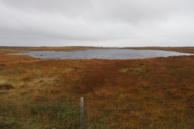
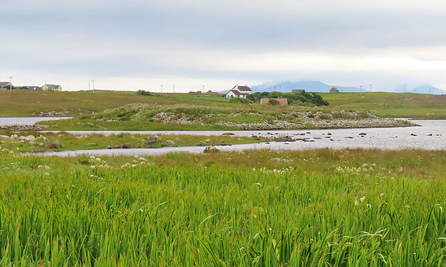
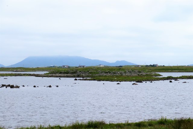
Unnamed loch on Benbecula
Unnamed loch on Benbecula Credit: Hugh Venables

The requested URL returned error: 429 Too Many Requests

If you have any feedback on the listing, please let us know in the comments section below.

Muir of Aird Images

Images are sourced within 2km of 57.463598/-7.3629976 or Grid Reference NF7854. Thanks to Geograph Open Source API. All images are credited.
Unnamed loch on Benbecula
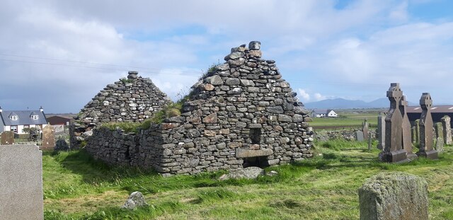
Ruin of St Mary's Chapel, Nunton <span class="nowrap"><a title="https://canmore.org.uk/site/9972/benbecula-nunton-ruin-of-st-marys-chapel" rel="nofollow ugc noopener" href="https://canmore.org.uk/site/9972/benbecula-nunton-ruin-of-st-marys-chapel">Link</a><img style="margin-left:2px;" alt="External link" title="External link - shift click to open in new window" src="https://s1.geograph.org.uk/img/external.png" width="10" height="10"/></span>
Ruin of St Mary's Chapel, Nunton
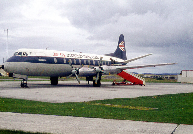
BEA Vickers Viscount at Benbecula Airfield
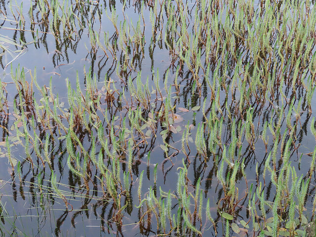
Marestail (Hippuris vulgaris) A plant that always grows in water, for once conveniently close enough to the land to be photographed.
Marestail (Hippuris vulgaris)
A plant that always grows in water, for once conveniently close enough to the land to be photographed.
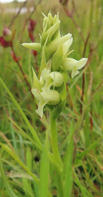
Irish Lady's-tresses (Spiranthes romanzoffiana) A member of the orchid family, with a very western distribution.
Irish Lady's-tresses (Spiranthes romanzoffiana)
A member of the orchid family, with a very western distribution.
Dùn Buidhe The 'yellow fort' is on a peninsula, almost an islet, in Loch Dùn Mhurchaidh.
Dùn Buidhe
The 'yellow fort' is on a peninsula, almost an islet, in Loch Dùn Mhurchaidh.
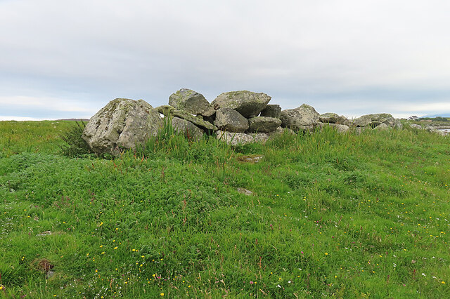
Boulder Dyke On a peninsula in Loch Dùn Mhurchaidh.
Boulder Dyke
On a peninsula in Loch Dùn Mhurchaidh.
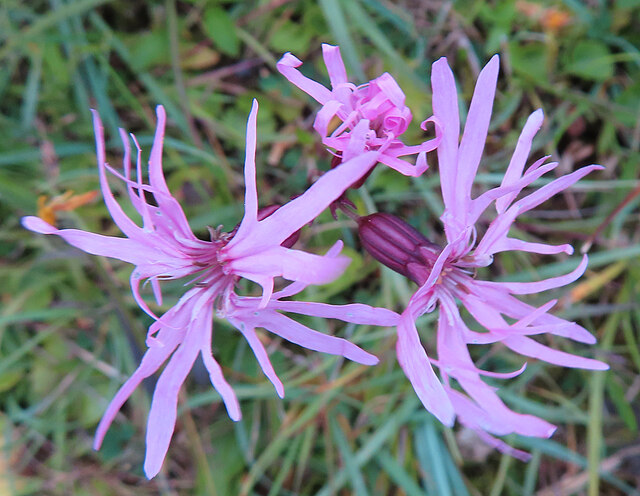
Ragged Robin (Silene flos-cuculi) Previously known as Lychnis flos-cuculi.
Ragged Robin (Silene flos-cuculi)
Previously known as Lychnis flos-cuculi.
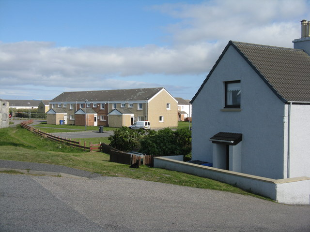
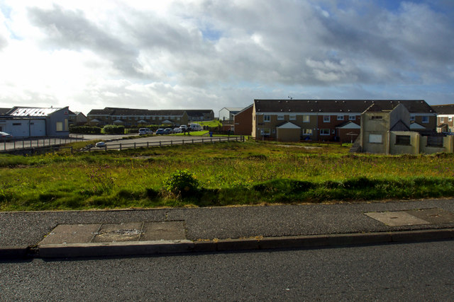
Houses at Baile a' Mhanaich/Balivanich On the western edge of the village.
Houses at Baile a' Mhanaich/Balivanich
On the western edge of the village.
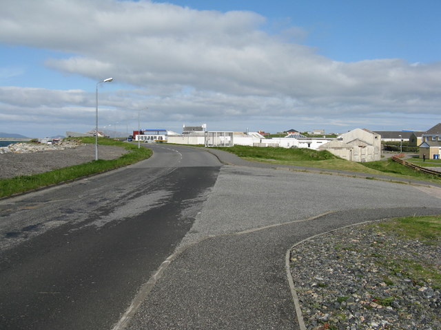
The B892 at Baile a' Mhanaich/Balivanich Looking east towards the main part of the village and airfield.
The B892 at Baile a' Mhanaich/Balivanich
Looking east towards the main part of the village and airfield.
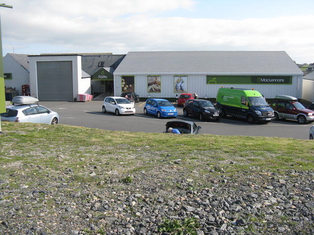
MacLennans at Baile a' Mhanaich/Balivanich A well-stocked store in Benbecula.
MacLennans at Baile a' Mhanaich/Balivanich
A well-stocked store in Benbecula.
Baile a' Mhanaich
Baile a' Mhanaich
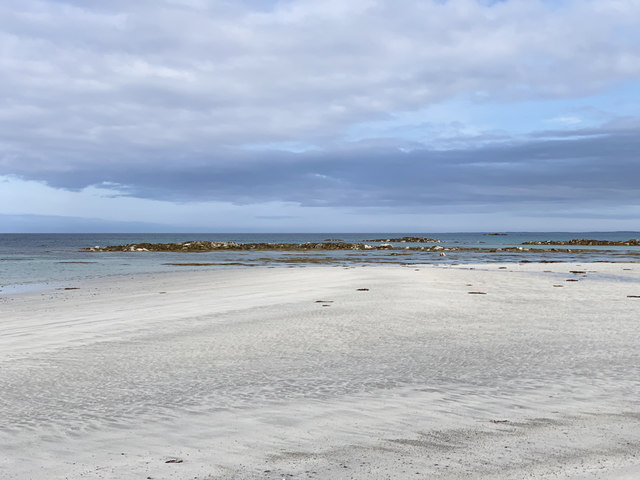
Beach at Baile a' Mhanaich Looking to the rocks of An Ceòthan.
Beach at Baile a' Mhanaich
Looking to the rocks of An Ceòthan.
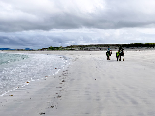
Beach at Baile a' Mhanaich Right beside Benbecula Airport. The runways are on top of the visible sand dunes on the right.
Beach at Baile a' Mhanaich
Right beside Benbecula Airport. The runways are on top of the visible sand dunes on the right.
Dun Buidhe The dun is situated on the further island, and although there's a lot of stones around it, one would be hard pressed to identify anything of a built nature.
Dun Buidhe
The dun is situated on the further island, and although there's a lot of stones around it, one would be hard pressed to identify anything of a built nature.
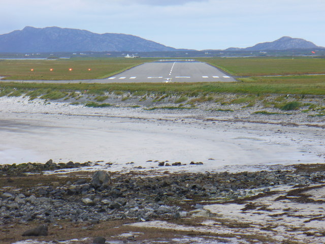
Runway at Benbecula Airport View from An Ceothan of a small sandy bay and the end of a runway at the civil / military Benbecula Airport. The mountains of North Uist are on the skyline.
<span class="nowrap"><a title="http://www.isle-of-benbecula.co.uk/" rel="nofollow ugc noopener" href="http://www.isle-of-benbecula.co.uk/">Link</a><img style="margin-left:2px;" alt="External link" title="External link - shift click to open in new window" src="https://s1.geograph.org.uk/img/external.png" width="10" height="10"/></span>
Runway at Benbecula Airport
View from An Ceothan of a small sandy bay and the end of a runway at the civil / military Benbecula Airport. The mountains of North Uist are on the skyline. LinkExternal link
Water Tower, Benbecula Airport Large shed beside the landmark, upturned cone-shaped, water tower at Balivanich, the southern end of Benbecula Airport.
<span class="nowrap"><a title="http://www.isle-of-benbecula.co.uk/" rel="nofollow ugc noopener" href="http://www.isle-of-benbecula.co.uk/">Link</a><img style="margin-left:2px;" alt="External link" title="External link - shift click to open in new window" src="https://s1.geograph.org.uk/img/external.png" width="10" height="10"/></span>
Water Tower, Benbecula Airport
Large shed beside the landmark, upturned cone-shaped, water tower at Balivanich, the southern end of Benbecula Airport. LinkExternal link
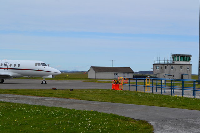
Control tower and apron, Benbecula Airport
Show me another place!

Muir of Aird is located at Grid Ref: NF7854 (Lat: 57.463598, Lng: -7.3629976)

Unitary Authority: Na h-Eileanan an Iar

Police Authority: Highlands and Islands

What 3 Words

///stylists.solo.mugs. Near Balivanich, Na h-Eileanan Siar

Related Wikis

Deep Sea Range

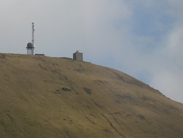
The Deep Sea Range is an RAF missile range in the Outer Hebrides. It has also been known as the Hebrides Guided Weapon Range and the South Uist Missile...

Balivanich

Balivanich (Scottish Gaelic: Baile a' Mhanaich [palə ˈvanɪç]) is a village on the island of Benbecula in the Outer Hebrides off the west coast of Scotland...

Uist and Barra Hospital

Ospadal Uibhist agus Bharraigh (Uist and Barra Hospital) is a community hospital in Benbecula which provides services on the islands of North Uist, South...

Benbecula Airport

Benbecula Airport (Scottish Gaelic: Port-adhair Bheinn na Faoghla) (IATA: BEB, ICAO: EGPL) is located on the island of Benbecula in the Outer Hebrides...

Nearby Amenities

Located within 500m of 57.463598,-7.3629976
Bus Stop
Muir of Aird Benbecula
Naptan AtcoCode: 6010731758
Naptan Bearing: SE
Naptan CommonName: Muir of Aird Benbecula
Naptan Indicator: Village
Naptan Landmark: Village
Naptan NaptanCode: 94723489
Naptan Street: Village
Naptan Verified: no
Source: naptan_import
Lat/Long: 57.4624492/-7.3589397
Sliabh na h-Àirde
Name En: Muir of Aird
Name Gd: Sliabh na h-Àirde
Place: hamlet
Lat/Long: 57.462825/-7.361266
Barrier: cattle_grid
Lat/Long: 57.4626969/-7.3617245
Passing Place
Lat/Long: 57.4639589/-7.3708924
Passing Place
Lat/Long: 57.4625783/-7.3600678
Power: pole
Lat/Long: 57.4616787/-7.3559639
Power: pole
Lat/Long: 57.4619114/-7.3571638
Power: pole
Lat/Long: 57.4621136/-7.3582778
Power: pole
Lat/Long: 57.4623139/-7.3593562
Power: pole
Lat/Long: 57.4624379/-7.3600596
Power: pole
Lat/Long: 57.4625652/-7.3607351
Power: pole
Lat/Long: 57.4627359/-7.3621008
Power: pole
Lat/Long: 57.4628722/-7.3634269
Power: pole
Lat/Long: 57.4629881/-7.3647066
Power: pole
Lat/Long: 57.4631035/-7.3659943
Power: pole
Lat/Long: 57.4632419/-7.3673485
Power: pole
Lat/Long: 57.4633587/-7.3685402
Power: pole
Lat/Long: 57.4634926/-7.3697861
Power: pole
Lat/Long: 57.4635933/-7.3708151
Power: pole
Lat/Long: 57.4669005/-7.3672047
Power: pole
Lat/Long: 57.4663327/-7.3664698
Power: pole
Lat/Long: 57.4658035/-7.365811
Power: pole
Lat/Long: 57.4652765/-7.365131
Power: pole
Lat/Long: 57.4647382/-7.3644637
Power: pole
Lat/Long: 57.4641566/-7.3637082
Power: pole
Lat/Long: 57.4639885/-7.3626906
Power: pole
Lat/Long: 57.4638445/-7.3618861
Power: pole
Lat/Long: 57.463648/-7.3607359
Power: pole
Lat/Long: 57.4634869/-7.3598179
Power: pole
Lat/Long: 57.4633299/-7.3586609
Power: pole
Lat/Long: 57.4631232/-7.3574657
Power: pole
Lat/Long: 57.4629052/-7.3562916
Power: pole
Lat/Long: 57.4626985/-7.3550627
Power: pole
Lat/Long: 57.4649035/-7.3624843
Power: pole
Lat/Long: 57.4644353/-7.3625884
Passing Place
Lat/Long: 57.4635895/-7.3680277
Passing Place
Lat/Long: 57.4632476/-7.3652498
Passing Place
Lat/Long: 57.4609071/-7.3565431
Barrier: cattle_grid
Lat/Long: 57.4640506/-7.3708499
Barrier: cattle_grid
Lat/Long: 57.4636319/-7.3679519
Barrier: cattle_grid
Lat/Long: 57.4635956/-7.3671444
Barrier: cattle_grid
Lat/Long: 57.4626288/-7.3598915
The data included in this document is from www.openstreetmap.org. The data is made available under ODbL.

Have you been to Muir of Aird?

Leave your review of Muir of Aird below (or comments, questions and feedback).